
New weather warning as winds batter state
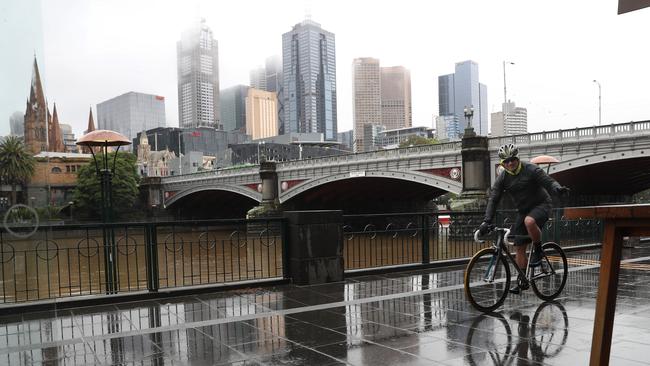
Wild and windy weather has continued to cause chaos across the state with residents reporting landslides in multiple Melbourne suburbs on Saturday.

Weather
Don't miss out on the headlines from Weather. Followed categories will be added to My News.
An emergency alert has been issued for parts of Victoria after a wet and windy night where a 130km/h wind gust was recorded.
The wild weather events continued on Saturday as people reported landslides in multiple Melbourne suburbs.
An SES spokesman said several landslides have occurred over roads at Mount Dandenong, Healesville, Diamond Creek and Toolangi.
More than 390 people have called SES for help in the 24 hours to 1pm on Saturday, of which 42 incidents are still active.
“Calls relate to trees down (249), building damage (71) and impacts of flooding (44),” he said.
Lilydale was among the hardest hit location, with the SES unit responding to 55 calls.
The Emerald Unit received 41, Healesville 22, Frankston 20 and Sorrento 19.
Earlier, the spokesman said their volunteers had a “very, very busy” night responding to more than 200 incidents, including a landslide on Mt Dandenong Tourist Rd after rocks and debris fell down.
“In the 24 hours to 7.45am, we had 247 calls for help,” he said.
“Our busiest units were Lilydale with 39 calls, Emerald with 23 and Frankston 25.”
He said call outs were mostly split between fallen trees, building damage and floods.
It comes after a night of wild weather, with Wilsons Promontory recording a wind gust of 130 km / h.
Port Phillip’s weather peaked with a gust of 81 km/h, while St Kilda harbour saw 77km/h and Frankston recorded 78km/h gusts.
BOM forecaster Chris Arvier said they saw some “pretty strong” wind totals throughout the city, while Mt Dandenong saw the heaviest rainfall in Victoria.
“The heaviest falls were around Mt Dandenong and the far eastern suburbs of Melbourne,” he said.
“The highest rainfall in the 24 hours to 9am this morning was 68mm at Warburton, 64mm at Ferny Creek – the sites not too far outside the eastern part of the city.
“There was a high totals through the city.”
He said there was wide spread rainfall between 25mm and 40mm throughout the eastern suburbs, whereas in the west it was between 15mm and 20mm.
🌧ï¸Heavy rain overnight in Victoria, with flooding occurring across several river catchments including the Yarra.
— Bureau of Meteorology, Victoria (@BOM_Vic) October 15, 2021
15 to 40mm fell across #Melbourne with highest falls in the east. 64mm at Ferny Ck the top.
Check website for full list of flood warnings: https://t.co/mcCkiKSVPLpic.twitter.com/AAtKhnIrCV
The weather will die down in Melbourne on Saturday, he added, but it will still be pretty miserable.
“So it’s still fairly windy with maximum gusts around 50km/h,” he said.
“So certainly it will feel quite windy and there will be showers.
“The conditions will be easing as we head into middle of the day and hopefully there will be a few patches of sunshine.”
Two more earthquake aftershocks were also recorded in Victoria on Saturday morning, more than 3 weeks after a 5.9 magnitude quake caught the state by surprise.
A magnitude 2.9 earthquake was detected at 5.04am in Rawson, followed by a 2.8 quake at 8.10am, GeoScience Australia has reported.
No damage has been reported so far, according to SES.
But storm-related call outs are expected to increase throughout the day as people wake up to more damage from overnight, but the weather isn’t going away yet either.
A moderate flood warning is still in place in Healesville for the Watts River, which is expected to peak sometime on Saturday morning if the forecasted rain falls.
It is currently steady at 1.52m.
The Bureau of Meteorology has warned strong, damaging winds are possible in several regions on Saturday morning as a low pressure system moves south east across the Bass Strait, but Melbourne has been spared.
Strong winds averaging 50 to 65km/h are forecast and damaging gusts of 90 to 100km/h are possible.
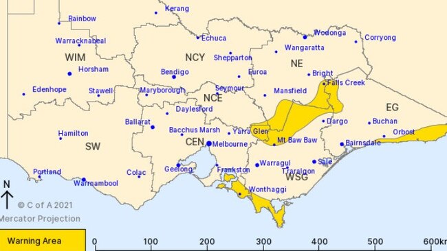
Parts of Central, East Gippsland, North East and West and South Gippsland lie in the warning zone, including Wonthaggi, Mallacoota, Mt Baw Baw, Falls Creek, Mt Hotham and Mt Buller.
A flood watch has been issued for multiple rivers across large parts of the state including the Yarra River, the Goulbourn River, the Yea River, the Acheron River, the Kiewa River, the Murray River, the Bunyip River, the Dandenong Creek, Mitchell River, Snowy River, Tambo River, Moorabool River, Barwon River, La Trobe River, South Gippsland River, Leigh River, the Otway Coast and Traralgon Creek.
VicTraffic has urged motorists to avoid Mt Dandenong Tourist Road between Montrose and Mount Dandenong following multiple reports of fallen trees blocking the road.
Emerald-Monbulk Rd has been shut for the same reason between Nobelius St and Stewart Rd.
In the Docklands, three lanes have been closed outbound on Footscray Road just before CityLink due to flooding.
As of 9.30am, rising water has also impacted the West Gate Freeway near Melbourne Rd in Spotswood, Melba Highway and Coldstream West Road in Yering, South Gippsland Highway in Clyde and Cranbourne Rd near Lancaster Ave in Narre Warren.
Motorists are urged to check VicTraffic for all closures.
The weather has also caused public transport delays in Melbourne’s north east, with a downed tree blocking train tracks.
A fallen tree was cleared from the Hurstbridge line between Clifton Hill and Heidelberg just before 9am, allowing train services to resume.
A Metro Trains alert said there would still be “minor delays” while they recover and buses were brought in to replace trains initially.

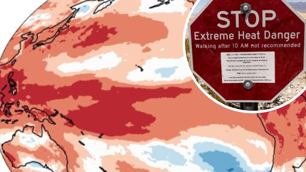
Mapped: Why 2024 could be our hottest year
Australia is suffering through a wet and chilly winter, but heat records are being broken all around the world - prompting new ideas about how we should be dealing with it.

Aussies freeze through coldest morning of the year
An extra blanket or two could be in order as Australians woke up to icy weather across the country. See how long the cold blast will last.