
90km/h winds to hit Melbourne after snowlike hail falls
Melbourne’s eastern suburbs and areas of regional Victoria are bracing for damaging winds as wild weather continues to lash parts of the state.

Victoria
Don't miss out on the headlines from Victoria. Followed categories will be added to My News.
An emergency alert has been issued for parts of Melbourne and regional Victoria as a low pressure system continues to bring wild weather.
The Bureau of Meteorology issued a Severe Weather Alert for damaging winds on Friday morning, with peak wind gusts of up to 90km/h forecast.
Strong winds are expected to hit on late Friday evening, averaging 50km/h to 70km/h.
Melbourne’s eastern Bayside suburbs, the Surf Coast, Mornington Peninsula, Frankston, Phillip Island and the Alpine areas lie in the warning area.
The State Emergency Service has urged people to avoid travel if possible, stay indoors and secure any loose items.

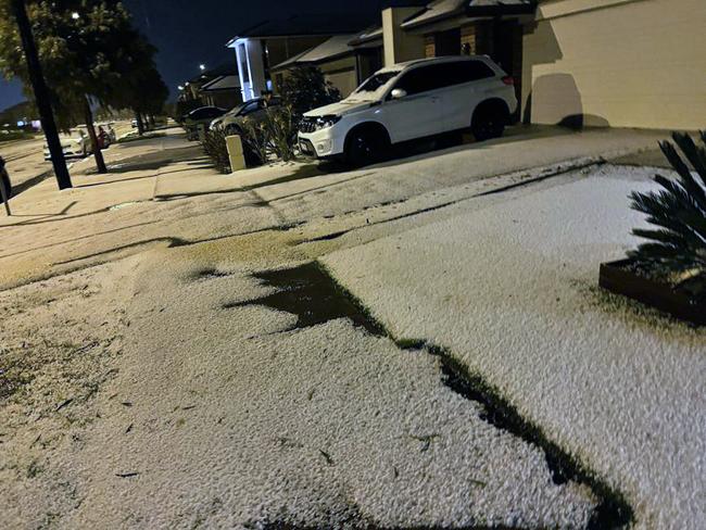
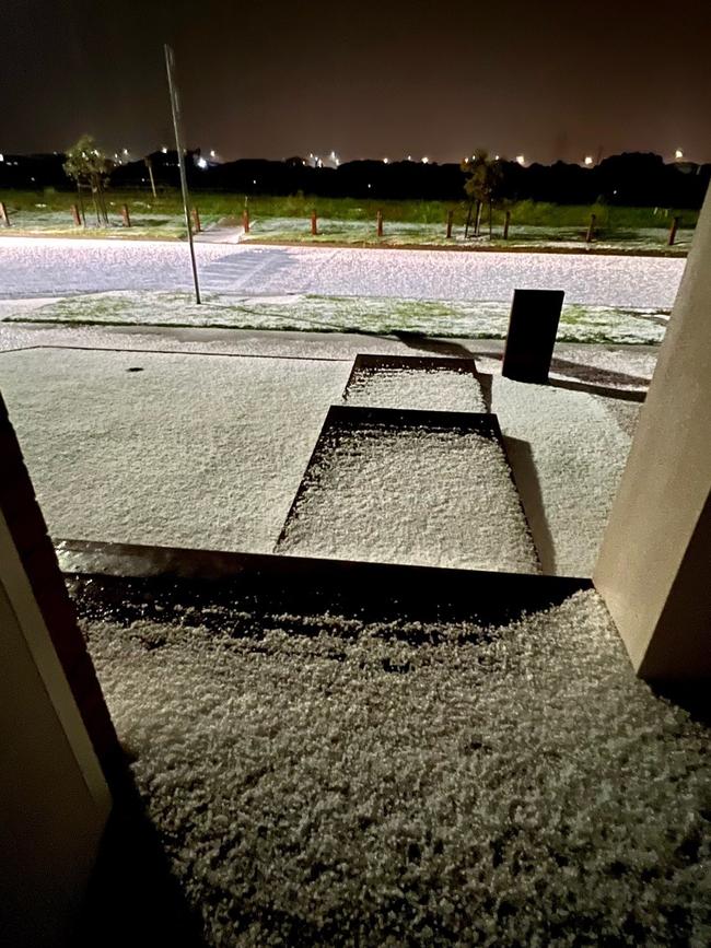
Wild weather lashed parts of Victoria on Thursday evening as a massive storm cell swept across Melbourne’s suburbs, blanketing streets in snowlike hail.
Bureau of Meteorology forecaster Hannah Marsh said more storms were on their way on Friday.
“We are expecting storms but we’re not expecting to be like yesterday particularly for Melbourne,” she said.
“The big thing for tonight will be it will get quite windy.
These are Mallee trees not Snow Gums!! Some of the worst hail I’ve seen, worst of it not super widespread but there will be a bit of damage where it did hit pic.twitter.com/HLxA7ofAda
— Andrew McMahen (@andrewmcmahen) October 14, 2021
“We will probably issue a severe weather warning at some stage this morning.
“There will be peak wind gusts around 90 km/h and that will cover the eastern suburbs of Melbourne, the Surf Coast and the Bass Coast.”
She said the storm should begin in the late evening and ease before dawn.
“In terms of rainfall, generally we’re looking at 5 to 15mm but there is potentially significant falls through Latrobe Valley again overnight,” she said.

“We’ve got an initial minor flooding for Traralgon Creek and we’ll monitor that as we head into the afternoon.
A minor flood warning was also issued for the Bunyip River and a flood watch was raised for parts of Gippsland, North East, Otways and Central Victoria.
Ms Marsh said the spectacular pictures of hails that stormed through social media were linked to a “complex low pressure system” that was “quite unstable”.


But she said the drier air mass means Melbourne was unlikely to see hail again today.
Residents in Fraser Rise - 35km northwest of Melbourne’s CBD - posted photos and videos of the aftermath on social media.
Lockdown-weary Melburnians took advantage of the rare event, tobogganing and skiing down suburban streets.

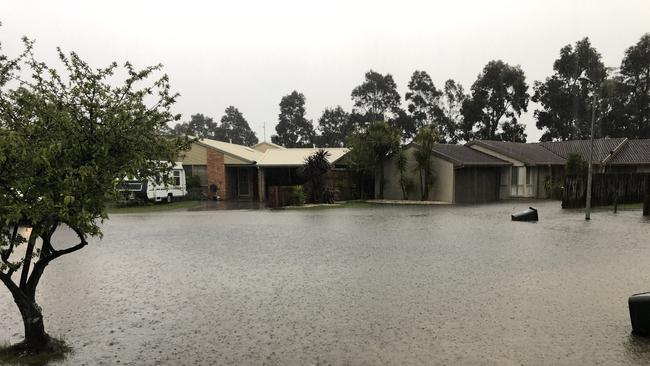
More than 30mm of rain was recorded in Traralgon, causing flash flooding, with the SES recording 51 calls for help after 5pm.
“We’ve had a significant number of calls relating to building damage, trees that have fallen onto rooftops and significant rescues after several cars have driven into flood water,” an SES spokesman said.
“SES and other emergency services have been deployed to rescue them.”
The SES also had reports a house in the area was struck by lightning, resulting in holes in the roof and a power outage.

Emergency services encouraged anyone affected by rising floodwaters to stay inside and be aware of changing conditions.
If floodwater comes inside a property, residents are encouraged to move to a higher point such as a kitchen bench or second storey.
“We urge people to never drive on flooded roads – it only takes 15cm to float a small car,” a SES spokesman said.
Weather warnings can be monitored online at the Bureau of Meteorology or VicEmergency website.

Horror family violence scourge set to spike over Easter
Victoria’s biggest family violence scourge on record is expected to spike over Easter, with police responding to one incident every five minutes last year.
150 years of family farming history sold at auction
A renowned family farming partnership have sold their 936ha four-farm aggregation in northern Victoria for millions.