Melbourne weather: Chilly Saturday awaits after wild and windy Friday
WILD weather delayed or grounded dozens of flights yesterday and sparked hundreds of calls for help, as parts of Victoria braces for another day of chilly conditions. Here’s what to expect today.

VIC News
Don't miss out on the headlines from VIC News. Followed categories will be added to My News.
WILD weather delayed or grounded dozens of flights yesterday and sparked hundreds of calls for help, as parts of Victoria braces for another day of chilly conditions.
Melbourne has been inundated with roughly half a month’s rainfall over the past 36 hours.
Mt Baw Baw received 70mm of rain since 9am yesterday and 48mm fell at Warburton.
Melbourne CBD recorded falls of up to 22mm since 5am.
The wild weather disrupted about 30 flights in or out of Melbourne Airport during the day.
WEATHER ALERTS AT EMERGENCY.VIC.GOV.AU
HAVOC AS WILD WEATHER FLOODS HOBART
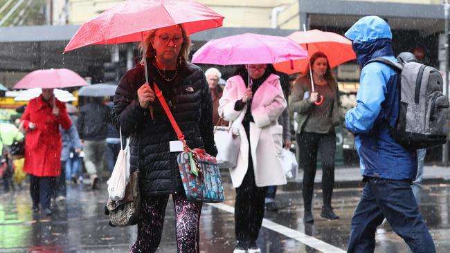
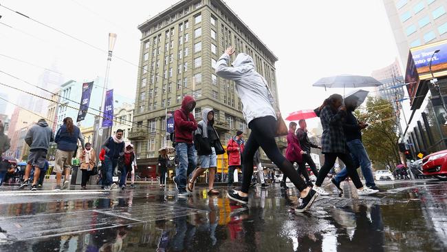
But while the bulk of the heavy rainfall experienced across the city has moved toward East Gippsland, Melbourne’s run of mild autumn weather has come to an end.
Bureau of Meteorology senior forecaster Richard Carlyon said the cold and wet weather experienced yesterday had “delineated” the seasons.
“It’s a system that’s marked a seasonal change,” he said,
“Even though we won’t see a great amount of rain over the next few days, we won’t getting above 17 degrees for the next week.”
Melburnians are advised to pack their brollies on Saturday with late showers and a top of 16 predicted for the weekend.
STATE HIT BY DAMAGING WINDS ON FRIDAY
DAMAGING high winds buffeted Melbourne and southern Victoria today, with fallen trees and a power fault causing peak-hour traffic and trains delays.
The Werribee/Williamstown line was partly suspended during peak-hour while several other lines are experiencing major delays.
Bureau of Meteorology senior forecaster Kevin Parkin said a cool change had brought windy conditions across the city and the state.
“We saw 133km/h gusts in the Grampians, that is significant,” he said.
“(There were also) gusts of about 100km/h in the Otways and gusts of 90km/h in bayside suburbs.”
A power fault on the Werribee line caused trains to be cancelled between North Melbourne and Newport railway stations. Services have since resumed,
UPDATE Werribee/Williamstown lines: Buses replace trains between North Melbourne - Laverton/Williamstown due to an external power fault.
— Metro Trains (@metrotrains) May 11, 2018
Buses have been ordered but may take over 1 hour to arrive, please consider alternative transport. pic.twitter.com/fAzenrxZMm
A severe weather warning remains in place, with the Bureau stating heavy rains and damaging winds with gusts of up to 100km/h will move to Gippsland and alpine areas by early Saturday morning.
Heavy rain may lead to lead to flash flooding in central and west Gippsland, the warning states.
Mr Parkin earlier said the city had recorded 26mm of rain over the last two days.
“To put that in context we’ve had more rain over the last 24 to 48 hours in Melbourne than in the month of April,” he said.
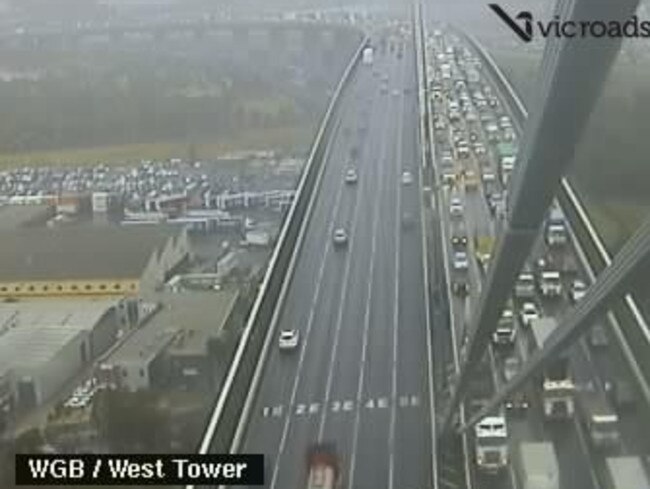
Outbound motorists on the West Gate Freeway were stuck in traffic gridlock as VicRoads crews responded to reports of a fallen tree closing three lanes on the busy arterial.
Cars headed west were banking up from Altona North, near Millers Rd, to the other side of the West Gate Bridge with heavy delays expected.
Gusty conditions left thousands without power in the state’s southwest.
“The focus for the heavy rainfall (now) is East Gippsland on Saturday with 50mm to 100mm expected widespread,” Mr Parkin said.
“That’s about a month’s worth of rain in a day.
“The good news is that the region has been quite dry to this point and the ground should be able to absorb that rain.”
Emergency services had 270 requests for assistance from midnight last night as wild winds felled trees and flash flooding impacted homes in low lying areas.
A tree has fallen onto the Westgate Freeway outbound near Millers Road in Altona North causing lane closures.
— Victoria Police (@VictoriaPolice) May 11, 2018
Please reduce your speed, turn your headlights on and take extra care in the wet weather. Stay up to date → https://t.co/r2dtI2bKaN pic.twitter.com/1r4bQBWUPB
The Bureau of Meteorology says the windy conditions, responsible for downed power lines in and around Apollo Bay, reached 100km/h at Aireys Inlet and Cape Otway early this morning.
Melbourne is on track to have the wettest May day in six years with nearly 18mm of rain falling in just under 24 hours, but more is on the cards.
WHERE THE RAIN HAS FALLEN
Residents in the Upper Yarra and Gippsland catchment are on flood watch, including areas around Lilydale and Healesville.
So far southwestern parts of Victoria have been hit hardest, with power outages are around Apollo Bay, including Wye River and inland near Beech Forest, according to Powercor.
Bureau of Meteorology duty forecaster Stuart Coombs said there were rainfall totals of 46mm in Mortlake and 40mm in Benwerrin.
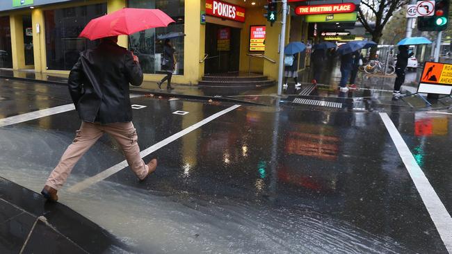
“Closer to Melbourne, Montrose and the Basin has seen 30mm while Avalon has been drenched with 28mm of rain,” he said.
Rainfall totals are expected to reach 50 to 100mm in parts of the Central and Gippsland Ranges over the next 24 hours as the front from Tasmania moves across the state.
Locations which may be affected include Seymour, Maryborough, Ballarat, Geelong, Melbourne, Traralgon and Bairnsdale.
#Melbourne has had more rain over the past 24 hours than the whole of April. Sor far, the city has received 19mm - more to come today #MelbWeather. Severe Weather Warning for heavy rain and damaging winds is current: https://t.co/rX6pypBp6w pic.twitter.com/VClEEYPHmX
— Bureau of Meteorology, Victoria (@BOM_Vic) May 10, 2018
Wild winds and heavy rain battered Victoria overnight. The state's east will bear the brunt of the severe weather today. @nathantemp7 #7News pic.twitter.com/REsYlrXtlK
— 7 News Melbourne (@7NewsMelbourne) May 10, 2018
An overbanker in #NorthMelbourne today @BOM_Vic pic.twitter.com/64iGEtvJRL
— Charlie Brydon (@CABrydon) May 11, 2018
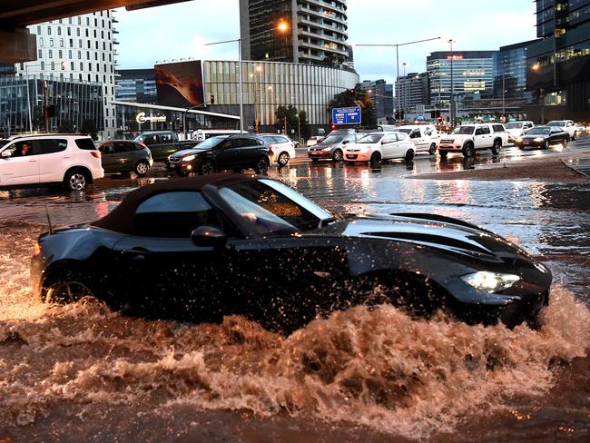
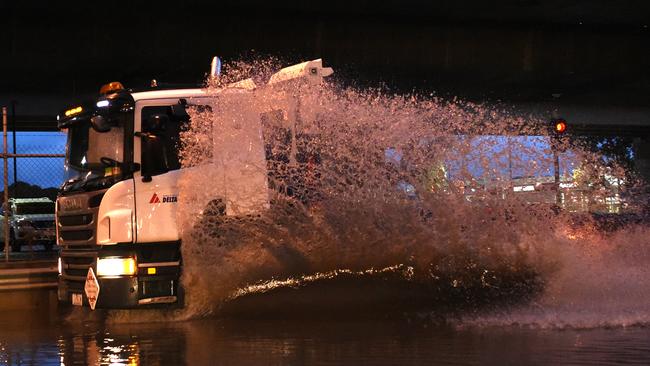
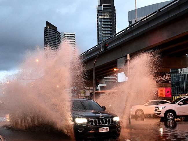
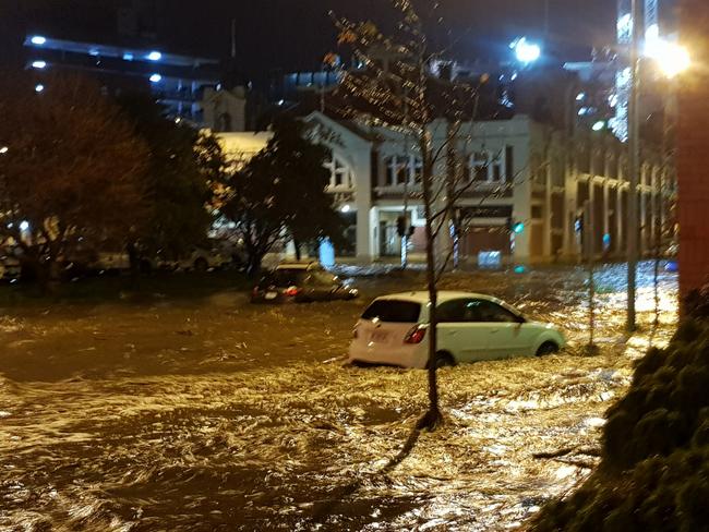
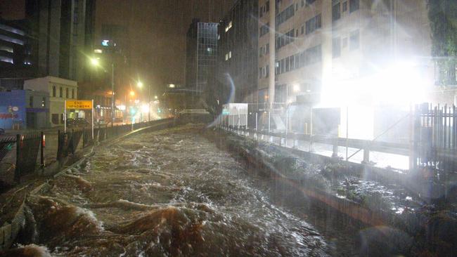
Flash flooding has greeted commuters this morning, with a severe weather warning for damaging winds and heavy rain still in place across the state.
It follows near record rainfall in Hobart overnight.
Severe weather warning has been updated to include southern parts of the Wimmera. Wind gusts have reached 95km/h over the southwest this afternoon. Check the warning text for the latest information https://t.co/JrHe5r6hFC pic.twitter.com/XMRBam5uUe
— Bureau of Meteorology, Victoria (@BOM_Vic) May 10, 2018
There's an unfolding weather emergency in Hobart, after wild storms and record rainfall. @jacquelinrobson #7News pic.twitter.com/VOqL0UiVAO
— 7 News Melbourne (@7NewsMelbourne) May 11, 2018
Tasmania Police said major roads in the city’s CBD were significantly affected by floodwaters and debris.
Schools across Tasmania’s capital have been closed.
In Melbourne, sections of Queen and Collins Street were described by commuters as “like a river” earlier this morning.
Delays were also reported along Montague St, South Wharf, and the Wurundjeri Way underpass due to flash flooding.
WET WEEKEND FORECAST
The wild weather is set to continue into the weekend, with Victorians warned to brace for a few wet days as the massive cold snap delivers gale-force winds, hail and heavy rainfall across the state.
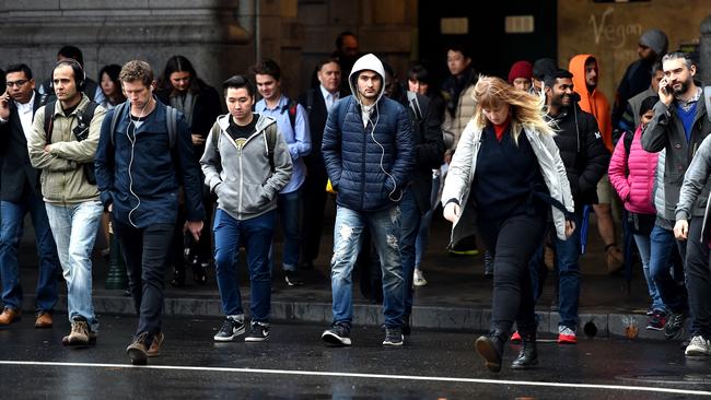
It was a chilly commute today after Melbourne shivered through a cold night.
Overnight it was 6C at Melbourne Airport but Bairnsdale was just 2C while alpine areas dropped to 0C.
A severe weather warning remains in place with strong winds and thunderstorms expected to lash the state through to Saturday.
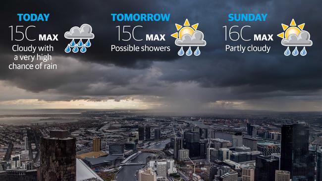
Up to 25mm of rain will be dumped on Melbourne today, concentrating in the northern and eastern suburbs, with gusts of more than 50km/h predicted.
Bureau of Meteorology severe weather manager Steven McGibbony said the “cold, biting” conditions would take Victorians by surprise.
“I’m sure it (will come) as quite a shock to a lot of people after what has been a relatively warm autumn so far — it’s going to feel very wintry and very cold,” he said.
But the soaking could delight farmers in regions parched from below-average rainfall in the past three months.
Lovely view, but my raincoat soaked up three times it’s own weight in water whilst I was out. Maybe it’s time for a new one. #Melbourne #MelbWeather #soggy pic.twitter.com/2WqKt8Oz0R
— Peter ðŸ”â˜•ï¸ (@cafuego) May 11, 2018
Melbourne will get a top of 14C today with an overnight dip to 10C that could have thousands reaching for extra blankets.
Tonight’s MCG clash between Hawthorn and Sydney is set to be a wet affair and fans have been urged to come prepared.
Eastern Victoria can expect up to 150mm in the next 48 hours, with Gippsland to bear the brunt of the rain.
And snowbound travellers are in for a treat with more than 50cm of white powder expected to fall in alpine regions by Sunday.
HOW TO DRIVE IN THE WET
State Emergency Services chief operations officer Tim Wiebusch pleaded with motorists to avoid a repeat of last weekend’s horror events, in which eight Victorians lost their lives on our roads.
“The heavy rain will bring challenging road conditions so don’t attempt to drive through flood waters — it can take as little as 15cm, the height of a pencil, for a car to float,” he said.
“We really are appealing to Victorians to take it easy ... make sure that you’re alert to your conditions,” he said.
10 tips for safer driving in the wet (autocraze) - have a look while eating your toast. Who knows, may save your life #victraffic #melbweather #ATN pic.twitter.com/udBI49xCTq
— Jimmy Traffic (@JimmyTraffic) May 10, 2018
Just a bit wet in @Melbourne today. Remember to bring an umbrella ... & a towel! @cityofmelbourne#Melbourne #MelbWeather #MelbourneWeather pic.twitter.com/zdzO9PYaX2
— B1ack Sword 🇦🇺 (@B1ackSword) May 11, 2018
Holiday-makers should avoid setting up camp near rivers or under trees, Mr Wiebusch said.
And he advised homeowners to clear gutters and stormwater drains to prevent flooding.
The cold front formed in the state’s west on Wednesday and moved over the central regions, including Melbourne, last night.
Sunday should bring relief with light showers giving way to a sunny afternoon.
MORE HERALD SUN NEWS:
EUROVISION 2018: DID AUSTRALIA’S JESSICA MAUBOY MAKE THE FINAL?


