
Power outages flicker across the state, black clouds have state on high alert for incoming downpour
Thousands of properties across the state are without power as the state braces for the worst of the forecast rain. Find out when it will hit.
SA News
Don't miss out on the headlines from SA News. Followed categories will be added to My News.
Thousands of properties across the state have lost power as a wild weather system over South Australia intensifies.
The Bureau of Meteorology expects the worst of the rain to hold off largely until at least late on Friday night, with the chance of rain in the city increasing after midnight.
Emergency Services Minister Joe Szakacs says relief from the heat may not arrive until 2am on Saturday for some parts of the state. It was still 37C in Renmark and 44C in Marree at 6pm on Friday.
It is expected up to 20mm of rain may fall tonight before 40mm tomorrow, continuing into Sunday with up to 20mm tipped in the city.
Wind gusts across much of the state are easing after reaching 106km/h at Mount Crawford, 95km/h at Roseworthy and 89km/h at Snowtown and Coober Pedy on Friday afternoon.
The extreme weather conditions led to widespread blackouts across SA.
At their peak, about 25,000 properties were blacked out. At 6pm, there were still about 11,000 properties without power among 29 outages.
The majority of them are concentrated around Gawler, the northern Mount Lofty Ranges, Mid North and southern Flinders Ranges.
Earlier, about 12,000 properties across SA were disconnected by SA Power Networks, owing to catastrophic fire danger.
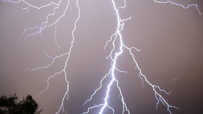
Dry lightning also took out electrical wires in the far-north Aboriginal community of Fregon, leaving 100 residents without power for two hours this afternoon.
In Port Augusta, where temperatures have reached 42.4C on Friday, the rain is expected to be heaviest after 12pm tomorrow with 40mm tipped for Saturday and 40mm for Sunday.
SES acting chief officer Liz Connell said emergency services were bracing for further onslaught as heavy rains began to batter the state early on Saturday morning, with biggest falls expected from about 2am to 8am.
Falls of between 30mm to 50mm are expected in the Mt Lofty Ranges region and falls of 40mm to 80mm around the Eyre Peninsula.
Ms Connell warned there was a high chance of flooding in a number of northern catchments, with initial flood warnings in place for the Mt Lofty Ranges, Mid North and Eyre Peninsula regions.
Power outages grow
Almost 11,000 customers across 28 separate outages remain without power on Friday evening, as wild weather sets in and lightning strikes are reported across the state.
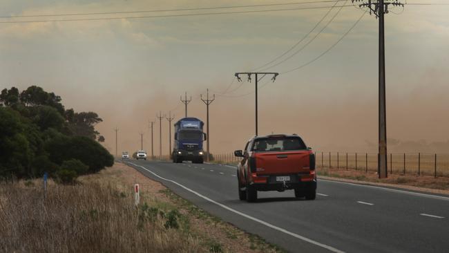
SA Power Networks warned a “weather trifecta” threatened electricity supply throughout Friday as they battled a mix of catastrophic bushfire risk, thunderstorms, wind gusts of up to 100km/h and lightning strikes.
Several of Friday’s outages were a result of power being proactively disconnected because of a catastrophic fire danger rating.
About 12,000 properties around Gawler, Roseworthy, Barossa Valley and across parts of the Mid North, including around the Wirrabara Forest, were without power on Friday afternoon after SA Power Networks disconnected them.
A spokesman for SA Power networks said all non-critical planned work had been called off today and that contractors were called in to help technicians.
“It’s quite unpredictable and the fire conditions are fluctuating quite a lot,” the spokesman said.
“We will continue to monitor that until these conditions abate, and when they do abate, we will look into reconnecting homes.”
At 6pm, remaining outages were concentrated around Gawler, the northern Mt Lofty Ranges, Mid North and southern Flinders Ranges.
About 1300 properties remained without power in regional areas east of Port Augusta, with outages reported in Melrose, Booleroo, Carrieton, Craddock, Orroroo and Peterborough.
Pockets of outages remained in the Adelaide Hills and near Wallaroo on the upper Yorke Peninsula.
Reports of lightning activity were widespread across the state, with strikes suspected to be the cause of active grass fires north of Adelaide.
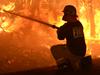
The Bureau of Meteorology and emergency services had warned Friday’s conditions made for the “most significant fire weather risk that South Australia has faced in recent years”.
Adelaide reached a high of 34.8C at 1.16pm on Friday. A cool change had dropped the temperature to 25.8C at 6.10pm on Friday. A much cooler maximum of 17C is forecast in the city on Saturday, with “possible heavy falls”.
Forecasters expect 10-35m of rain in Adelaide on Saturday and 3-15mm on Sunday.
The severe weather has led to the cancellation of a number of Christmas events scheduled for the weekend.
SA TOTAL FIRE BANS
Total fire bans have been declared in 10 regions on Friday.
In these areas, the bushfire risk is rated as catastrophic: Eastern Eyre Peninsula, Flinders, Mid North, Yorke Peninsula and Riverland. Thirty-four schools in these areas will be closed.
In these areas, the bushfire risk is rated as extreme: Mount Lofty Ranges, North East Pastoral, West Coast, Upper South East and Murraylands.
SA WEATHER RADARS
More Coverage

Originally published as Power outages flicker across the state, black clouds have state on high alert for incoming downpour

Adelaide Uni abortion crusader accuses pro-life MP of ‘abject betrayal’
One of the key architects of the state’s defeated abortion reforms has accused a conservative MP of betraying the pro-life movement after a last-minute deal.

Cop, motorist injured after police patrol car crash
Police are investigating a crash involving one of their own patrols and two other vehicles after a U-turn to stop the vehicle went very wrong, leaving two people in hospital.