Catastrophic bushfire risk day in SA: Several blazes reported as lightning storms and high winds sweep across the state
Emergency services have delivered an update on the catastrophic fire risks and extreme storms threatening the state. Watch it here.
SA News
Don't miss out on the headlines from SA News. Followed categories will be added to My News.
This story is unlocked and free for everyone to read in the interests of public safety. Get full digital access to trusted news from The Advertiser with our great introductory offer.
Relief from the horrific heat and wind threatening SA may not arrive until the early hours of tomorrow morning, authorities have told the state in a press conference on Friday.
Emergency Services Minister Joe Szakacs says relief from horror weather conditions is not expected to come through the state’s north and east until at least 2am on Saturday morning, as firefighters battle a number of blazes across the state.
More than 30,000 lightning strikes have been recorded across the state in the past 24 hours, with dozens of blazes contained by firefighters in the wake of the dry storm.
As of 2pm on Friday afternoon, MFS and CFS crews were attending 12 blazes – with significant flames at Fourteenth St, Gawler South, and on Crouch Rd at Golden Grove.
Wind gusts of more than 80km/h have been recorded at Snowtown, combined with “extremely hot” temperatures – creating a perfect fire storm.
CFS Chief Officer Brett Loughlin said there had been no major damage or losses from fires so far across the state, but warned the catastrophic fire danger was not over yet.
“We have a lot of difficult conditions to get through before that risk is eased ... we have hours and hours to go and people need to remain vigilant,” Mr Loughlin said.
“It’s unfortunately a broad part of South Australia that’s a risk under these current conditions.”
Catastrophic fire danger conditions are currently in place in the eastern Eyre Peninsula, Flinders and Mid North regions.
Mr Loughlin said the worst of the weather conditions were expected over the next four to six hours, with the fire risk likely to ease around sunset.
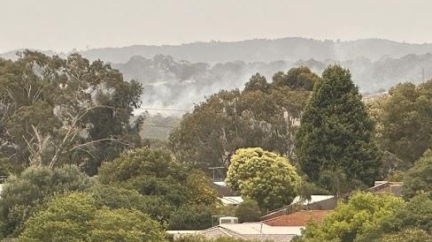
Mr Loughlin said all of the state’s fires in the past 24 hours had been sparked by lightning and urged residents in rural areas to report any unattended fires as the storm band continued to move through the state.
“If you know anyone in emergency services, be very proud of them for their work so far today but keep them in your thoughts as we get through a difficult afternoon,” Mr Loughlin said.
SES Acting Chief Officer Liz Connell said emergency services were bracing for further onslaught as heavy rains began to batter the state early on Saturday morning, with biggest falls expected from about 2am to 8am.
Falls of between 30mm to 50mm are expected in the Mt Lofty Ranges region and falls of 40mm to 80mm around the Eyre Peninsula.
Ms Connell warned there was a high chance of flooding in a number of northern catchments, with initial flood warnings in place for the Mt Lofty Ranges, Mid North and Eyre Peninsula regions.
Fires break out across SA
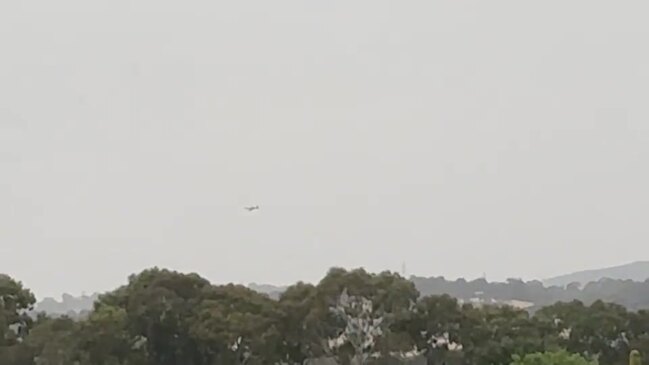
Fire crews are responding to multiple grassfires this morning as South Australia braces for a day of extreme heat and high winds.
At midday there were three main fires of concern.
A series of fires has ignited along the Stuart Highway between Pimba and Glendambo, and Tarcoola Rd stretching west to Kingoonya, approximately 630km northwest of Adelaide.
The fire could reach four major cattle stations – Kingoonya Station, Monlena Station, Glendambo Station and Wirraminna Station – but at this time roads in the area remain open.
Another bushfire is burning at Melrose in the Mount Remarkable Ranges, 260km north of Adelaide, with about 35 CFS, National Parks and Wildlife Services and Farm Fire Unit firefighters, supported by six aircraft.
The CFS reported crews have halted the forward rate of spread of this fire, but warned the fire may be causing smoke in the area. At 1pm the Melrose fire was listed as contained.
A third blaze is burning in mostly inaccessible terrain in the Gammon Ranges National Park, 625km north of Adelaide.
CFS crews are battling a series of grass fires including at Melrose in the state's north. Thousands are also without power as South Australia's extreme weather bears down. The latest weather warnings in 7NEWS Adelaide at 6pm | https://t.co/Ufr4GT7Nfx#7NEWSpic.twitter.com/8sei7CigUk
— 7NEWS Adelaide (@7NewsAdelaide) December 8, 2023
There have been several other fires around the state today, including at Bungeroo, West Bundaleer and Lochiel, but none were of serious concern.
The Bureau of Meteorology and emergency services have warned conditions today create the “most significant fire weather risk that South Australia has faced in recent years”.
Many of these fires are believed to have been ignited by a band of lightning storms moving across the state.
OUTBACK CAMP ON ALERT
David Wark, CEO of Operation Flinders – a foundation working with at-risk kids – said he and his team are “carefully watching” a fire threatening to destroy their base.
The Operation Flinders base is located on the west side of the Gammon Range and while it is currently clear of the fire which is burning to the east in a southwesterly direction, they are still on high alert.
The fire has so far burnt about 12,000 hectares in largely inaccessible terrain.
“That is one of the hazards, having a facility like this … we enjoy the benefits, but there are risks,” Mr Wark said.
The CEO said he appreciates the efforts of the volunteers who are fighting to keep his foundation’s base safe.
There are currently no events scheduled at the Operation Flinders based until next year.
SA TOTAL FIRE BANS
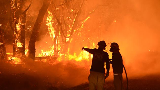
Total fire bans have been declared in 10 regions on Friday.
In these areas, the bushfire risk is rated as catastrophic: Eastern Eyre Peninsula, Flinders, Mid North, Yorke Peninsula and Riverland. Thirty-four schools in these areas will be closed.
In these areas, the bushfire risk is rated as extreme: Mount Lofty Ranges, North East Pastoral, West Coast, Upper South East and Murraylands.
SA WEATHER FORECAST
The CFS has warned SA faces the most serious bushfire risk in years on Friday, as high winds and dry lightning storms sweep across the state.
Power outages affecting thousands of customers are already being reported in multiple areas around the state.
The temperature in Adelaide is forecast to rise to 36C, but much cooler temperatures and potentially heavy rain is forecast across much of the state on the weekend.
The Bureau of Meteorology is forecasting potential storm activity in the Adelaide region and Mount Lofty Ranges until mid-afternoon, and possibly worsening again at night.
On the weekend, the temperature is only forecast to reach 19C with 5-25m of rain forecast for Adelaide on Saturday and 2-15mm on Sunday.
The forecast deluge has also led to the cancellation of many Christmas events scheduled for the weekend.


