
Gold Coast drenched, Sunshine Coast flooded as cyclone threat grows
Storms have brought heavy rain and flash flooding to parts of the South East, as the chances of a tropical cyclone forming off the Queensland coast have ramped up.
QLD News
Don't miss out on the headlines from QLD News. Followed categories will be added to My News.
Storms have brought heavy rain to parts of the South East, as the chances of a tropical cyclone forming off the Queensland coast have ramped up.
Flash flooding has been recorded near Boonah and Aratula in the Scenic Rim.
Several South East areas have received between 30-40mm since 9am this morning, with Forestdale receiving the highest rainfall total of 47mm.
Six Mile Creek received 40mm, BellBird Park 42mm, Redbank Plains 32mm, Townson 30mm, Round Mountain 46mm, Collingwood Park 30mm, Manly 37mm and Wishart 37mm.
Coolangatta has received 17mm since 9am, Amberly 22mm and Brisbane Airport 10mm.
Redlands received 6mm, Nambour 9mm and the Gold Coast Seaway 5mm.
A severe storm warning for residents in Ipswich, Scenic Rim, Southern Downs, Lockyer Valley and Toowoomba was issued Monday morning but has since been cancelled.
A general storm warning for heavy rainfall has also been cancelled to the South East coast for residents in the Darling Downs and Granite Belt districts.
STATE ON CYCLONE WATCH
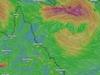
Authorities report there is now a 40 per cent chance of another tropical cyclone forming, with a monsoonal system brewing off the coast of Far North Queensland continuing to develop and deliver wet weather to the region.
Bureau meteorologist Patch Clapp confirmed the increase on Tuesday morning, saying the trough is forecast to hit early next week.
“As of Monday evening we are predicting a 40 per cent chance of it developing into a cyclone system,” Mr Clapp said.
“It is certainly looking like it will head out offshore and potentially in its return track the conditions will become more conducive to becoming a cyclone.
“The system will most likely make landfall on Monday next week.
“Residents are again urged as always to stay up to date on the system, especially along the coast and to always be ready.”
RESCUES AFTER SOUTH EAST DRENCHED AGAIN
Meanwhile, South East Queensland was drenched by heavy rain overnight, with Gold Coast rain gauges hitting well over 100mm, while on the Sunshine Coast emergency services rescued three people near flood water, with the Bureau of Meteorology confirming more storms are on the way.
Emergency services were called to Boolumba Creek Rd in Kenilworth when three people became trapped near flood waters, and a swift-water rescue was conducted just before 8pm.
All patients were uninjured and did not require any further treatment.
Most of the Sunshine Coast recorded 10mm to 80mm of rain overnight, but Caloundra was smashed with 101mm, while the highest rain totals fell on the storm-hit Gold Coast, with Upper Springbrook recording 145mm, Upper Tallebudgera 138mm and Burleigh Waters 111mm.
Emergency services also responded to a reports of a tree falling on a man on the Gold Coast overnight. A male in his 50s was hit on Mundoolun Connection Rd at 7pm and was transported to Gold Coast University Hospital in a stable condition.
The Bureau said there was a potential for more flash flooding around the metro areas in coming days.
“We always advise people to be wary of flash flooding especially with this continued rainfall and thunderstorm potential. The ground is already wet so people are advised to keep informed,” Mr Clapp said.
“The same air mass as Monday is hanging around and will be for the rest of the week, that south south-easterly offshore swinging by and then the high humidity.
“The storms should hit around the afternoon period, and are expected to continue for most of the week, residents are urged to stay across warnings as always.”
Mr Clapp said while most of the severe storm activity will hang over the west of Brisbane, high rainfall totals are expected around Southeast Queensland’s major cities.
“There is certainly a chance we will see some severe storm warning out in the west, and even on the western outskirts of Brisbane today, it definitely is quite widespread,” Mr Clapp said.
“Looking with broad brushstrokes, the Brisbane metro area could see up to 20mm this afternoon and Gold Coast is in for about 30mm.”
Persistent rain and storms will plague those in the north this week according to Weatherzone meteorologist Ben Domensino, “adding more water to already sodden catchments”.
Thanks to the monsoon sitting over Australia’s north, heavy rain is forecast until next Monday for the Cape York Peninsula and as far south as Townsville.
Cairns, which has been plagued by wet weather since it was hit by ex-Tropical Cyclone Jasper in December, is likely to receive 20mm a day for the rest of the week and into the weekend.
Flood warnings remain in place for the Paroo, Barcoo, Bulloo, Herbert, Murray, and Diamantina Rivers.
Most worrying to authorities is the Paroo River, with towns like Eulo and Hungerford urged to be on high alert as the flooding nears its peak.
The river is currently just shy of four metres at Eulo and rising.
There are also fears that even more rain could be on the way, with “indications” that a tropical cyclone could form over the Coral Sea toward the end of this week.
More Coverage
Originally published as Gold Coast drenched, Sunshine Coast flooded as cyclone threat grows
Join the conversation

Sky’s the limit for first-year apprentice in a man’s world
A former deep-sea fisher who climbs 60m towers is transforming Australia’s energy sector as Zinfra’s pioneering female transmission line apprentice working in Teebar Creek.
Read more

Whistleblower’s bold bid to expose secret teacher’s union elections blocked
A whistleblower's bid to challenge Queensland Teachers' Union's delegate selection process has been rejected, despite evidence of members being excluded from crucial votes.
Read more