
Lismore flood: Rain to hit Yamba, Coffs, Smokey Cape
While parts of the Northern Rivers are experiencing sunshine, the Bureau of Meteorology is warning there is more rain to come with no reprieve from the weather until Thursday. SEE OUR VIDEO UPDATE
Tweed Heads
Don't miss out on the headlines from Tweed Heads. Followed categories will be added to My News.
While parts of the Northern Rivers are experiencing sunshine late Tuesday morning, the Bureau of Meteorology is warning there is more rain to come.
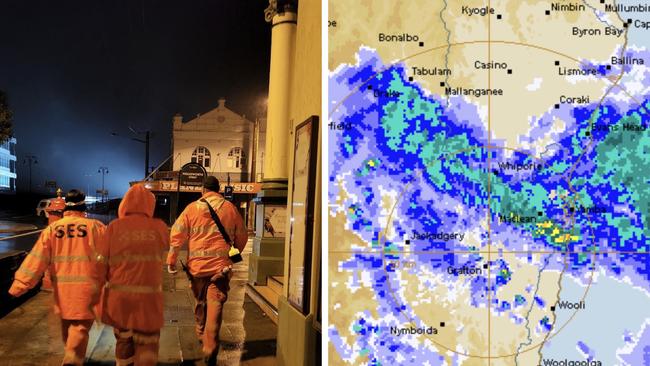
Meteorologist Helen Reid said while more rain was on the horizon, the worst hit zones were expected to be between Yamba and Smokey Cape on the mid-north coast.
She said that band of rainfall was expected to continue throughout the day with rivers continuing to rise, causing risk of flash flooding around the region.
“We are expecting tomorrow through that part of the world to be a little less horrific and ease back to wet weather from very wet weather,” Ms Reid said.
She said the region was unlikely to notice much reprieve until Thursday.
In the Northern Rivers around Lismore and the Tweed while there may be gaps in the rainfall Ms Reid said more was expected into the afternoon and overnight with another 60 to 80mm expected to fall.
She said to expect rain to remain patchy with possible thunderstorms in the Northern Rivers throughout Tuesday and into Wednesday, however in the north of the state the worst of heavy rainfall appeared to be over.
With the grounds still saturated from recent rainfall she said spikes of flash flooding were also likely around the region.
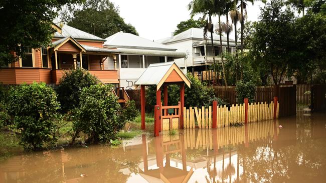
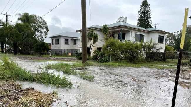
The Wilsons River at Lismore is likely to exceed the moderate flood level, 7.20m, around midday Tuesday with the river expected to peak around 10.60 metres on Tuesday evening.
The Orara River is also expected to peak Tuesday night at 9 metres at the Glenreagh Automatic Gauge and 12m on Wednesday morning at Coutts Crossing.
Mega gallery: Lismore flood ravaged communities hit again
‘Kick in the guts’: New rain bomb threatens homes, businesses
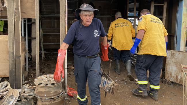
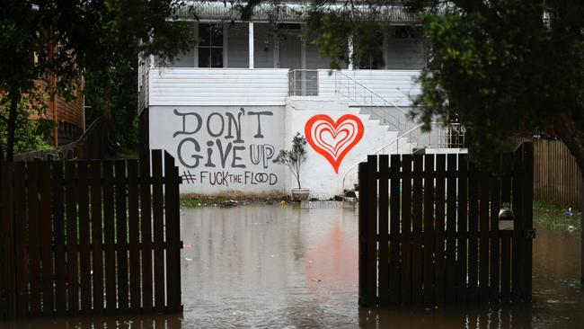
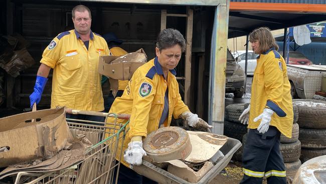
Flood-ravaged business owners, some who have only just got back in operation after Mother Nature’s annihilation, are evacuating again ahead of a rain bomb which threatens to destroy more homes, roads and cause major landslips.
“Basically we are praying for the best and preparing for the worst,’’ Lismore Mayor Steve Krieg said of the situation.
The weather bureau is predicting up to 300mm of rain could hit the already soggy areas of the NSW Northern Rivers, from Tweed Heads through to Coffs Harbour.
The State Emergency Service has warned of major landslips and trees and powerlines coming down as the rain is accompanied by winds of up to 90kmh.
Cr Krieg described the return of the rain as “just another kick in the guts”.
“I’ve talked to many people who had moved back into homes... They are the people I am really feeling for at the moment.
“It’s really heartbreaking for the town and the citizens.
“At this stage we are just hoping that our levee is not breached and the low-lying areas are protected.’’
Lismore City SES posted the below video from flood rescue operators at Corndale Road.
The weather scenario is not predicted to be as bad as the most recent 1 in 500 year flood event and this time there are far more personnel on the ground, including SES volunteers as well as Australian Defence Force crews who have been helping clean up efforts for weeks.
Lismore has also installed mobile service centres, including mobile Centrelink, all of which are being moved to higher ground, along with about 45 mobile homes which have been used for temporary accommodation.
Lismore City Council reported that if the rainfall continues, levels would near the Lismore Levee Height (10.60m) Tuesday afternoon.
“The Wilsons River at Lismore is likely to exceed the moderate flood level (7.20m) around 11am Tuesday. “The river level may exceed the major flood level (9.70m) around 02:00pm Tuesday and may reach around 10.60 metres Tuesday afternoon, with further rises possible.
Thousands of homes have been made uninhabitable by the last flood and more are expected to be added to the list.
Cr Krieg said Lismore was made up of ‘stubborn bastards’ who would have to just take the rain and get up again.
“We’re a tough batch in Lismore and in the region we will get up and move again.’’
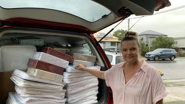
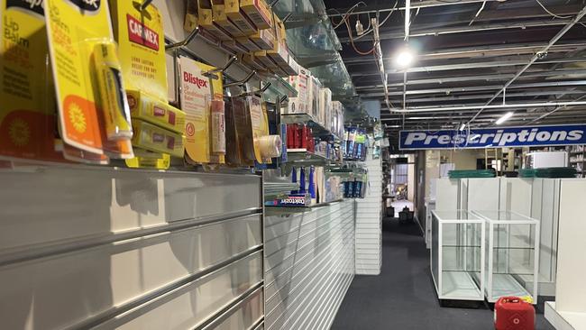
Lisa Bryant from Bryants Beds and Mattresses in Lismore was on the front foot Monday to pack up her shop.
After only three weeks, the business is moving stock in preparation for yet another flood.
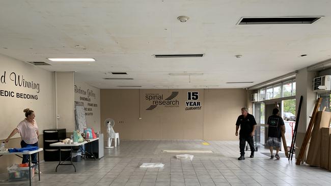
‘We lost our entire warehouse and the store last time,” Mrs Bryant said.
“We’re not doing that again.”

One of the first to get back on their feet after their store was completely inundated the Byrants had new mattresses and linen for the community ready to go.
Island golf course on high alert
At Nambucca Heads, management and members of Australia’s iconic Island Golf Course are bracing themselves for the forecast torrential onslaught.
The championship course is unique in that it is the only 18-hole layout which occupies the entirety of an island - and it went almost completely under in the March, 2021, flood.
Club general manager Johnathon Zirkler said the golf community is on tenterhooks with the latest rain event.

“There’s already an inch of surface water at the back of the ninth hole,” Mr Zirkler said.
The sodden course has been closed since Saturday and the local rainfall measurements tell why.
“We’ve had 384mm so far this month and that includes eight days of no rain,” Mr Zirkler said.
“We’ve had almost 1100 year to date and that comes on the back of the 2600 last year.
“The playing surface is okay but the greens staff can’t get out there because the machinery tends to sink.”
The licensed club with restaurant continues to trade, but that hangs by a fingernail as the causeway on the sole access road can go under in flood, and even in big tides.
Heavy rain, flash flooding and landslips
On Tuesday, the weather bureau warned that six-hourly rainfall totals between 80 to 140 mm are possible, reaching up to 200 mm over coastal areas and ranges on northern NSW. Some areas could face up to 300mm.
Damaging winds with peak gusts of around 90km/h are possible about coastal areas during Tuesday.
Heavy rainfall increases the potential for landslides and debris across roads.
Flood Watches and Warnings are current for parts of northeast New South Wales. For more details, please visit www.bom.gov.au/nsw/warnings.
Locations which may be affected include Lismore, Grafton, Coffs Harbour, Port Macquarie, Tenterfield and Dorrigo.
Rainfall reported in the last 6 hours
Burringbar 149mm
Murwillumbah 147mm
Tumblegum 134mm
Mullumbimby 129mm
Alstonville 124mm
More Coverage


Originally published as Lismore flood: Rain to hit Yamba, Coffs, Smokey Cape

NRRRL: Contenders prevail in finals shootout
A couple of finals contenders have landed big blows in their quest to make the top six after crucial wins in the NRRRL.
Read more

‘Shut for repairs’: Driver’s quick-thinking excuse for court no-show
A Northern Rivers driver who repeatedly got behind the wheel while disqualified was arrested after a court no-show, claiming he believed the court house was “shut for repairs”.
Read more