
Gold Coast weather: Bureau of Meteorology (BOM) issues flood watch warning for city
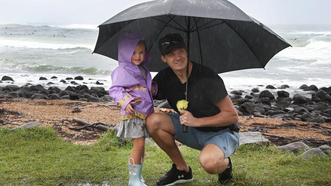
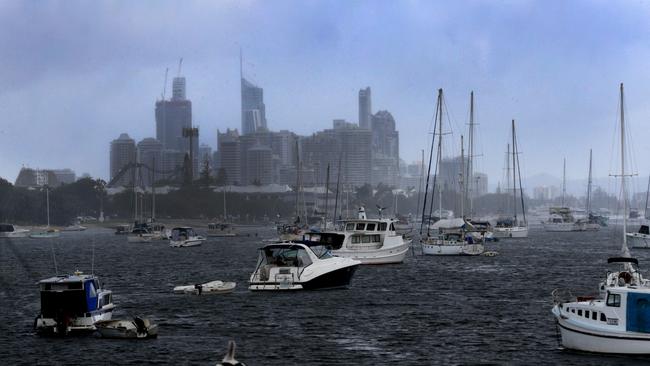
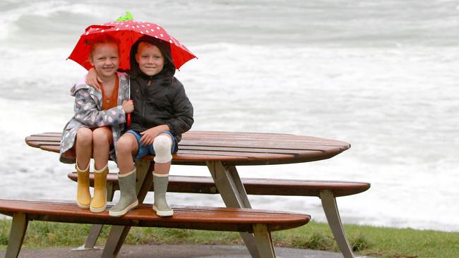
The rain which has been falling nearly non-stop has flooded some roads on the Gold Coast.

Gold Coast
Don't miss out on the headlines from Gold Coast. Followed categories will be added to My News.
FORECASTERS have warned of flooding across the Gold Coast because catchments in southeast Queensland are already swollen after recent heavy rain.
The Bureau of Meteorology (BOM) has issued a flood watch for coastal catchments between the Sunshine Coast and the Queensland-New South Wales border.
Queensland Fire and Emergency Services was called to help several times after motorists drove into floodwaters overnight, either deliberately or accidently, a spokeswoman said.
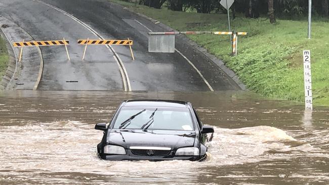
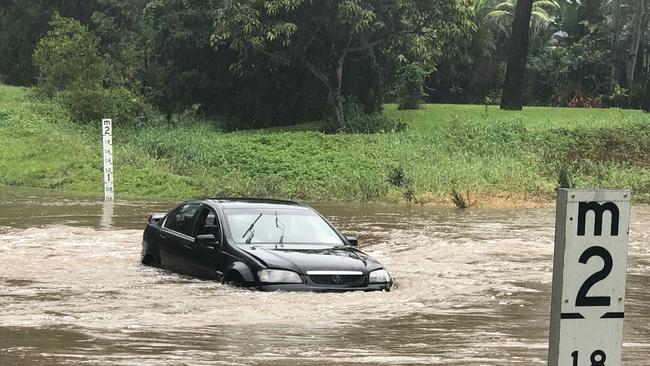
On Tuesday morning, various roads across the city were flooding to some degree, including Hardys Rd and Somerset Dr at Mudgeeraba, Birds Rd at Guanaba.
A Holden Commodore was spotted in floodwater on Hardys Rd, which was badly flooded.
MORE NEWS
Destination Gold Coast chairman Paul Donovan urges city to get the COVID-19 vaccine
Gold Coast dive site Wonder Reef named: What do you think of the name?
Gold Coast Easter school holidays free activities: Full list of events and activities
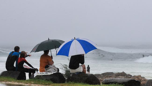
City residents have also been warned about large and powerful surf conditions expected to be too hazardous for activities such as rock fishing, swimming and surfing.
Localised flooding had already affected some areas across the Coast by Tuesday morning.
The BOM has also warned of potential thunderstorms across southeast Queensland.
“The low currently off the southeast Queensland coast may bring isolated heavy rainfall to the flood watch area with thunderstorm activity,” a statement read.
“The most likely timing of the isolated heavy rainfall is from Monday afternoon through to Tuesday evening.
“The heaviest falls are likely to occur around the Sunshine Coast area on Monday and extending southwards to the Queensland-NSW border during Tuesday.
“Catchments to the north of the Sunshine Coast are generally dry and will be slower in responding to heavy rainfall.
“Catchments in southeast Queensland however are wet from recent rainfall and are likely to respond quickly.”
The BOM has warned of possible disruption to transport routes.
Anyone living or working along rivers and creeks should keep a close eye on the latest weather forecasts and warnings.
Motorists have also been warned to keep well clear of flooded roads -iIf it’s flooded, forget it.
For emergency assistance in floods phone the State Emergency Service (SES) on 132 500 and for life threatening emergencies phone triple-0 (000) immediately.
The BOM flagged an update on the situation early on Tuesday afternoon.
Coast drenching: Heavy rainfall on the way
Monday, April 5: Up to 200mm of rainfall is set to fall on the Gold Coast in the next 72 hours following major flooding across the city a fortnight ago.
Bureau of Meteorology forecaster Michael Gray said Monday would be a sign of what the week had to offer after heavy rain fell on the Coast on Sunday.
“The Gold Coast will experience from 70mm to 130mm on Monday,” he said
“We will see shower activity of around 25mm to 27mm in Coomera and at the Gold Coast seaway.
“With Tuesday between 25mm and 60mm will fall while Wednesday will see between 2mm and 10mm.”
Two weeks ago the Gold Coast experienced flooding across the city with over 180mm of rain recorded in the Seaway from March 22 to 24.
Mr Gray said the weather would improve toward the week’s end.
“By the time we get to the end of the week we will start to see things dry up,” he said.
There is a hazardous surf warning for the Gold Coast waters on Tuesday.
“The winds will pick up a little bit, there is a southeasteryly around 20 knots tomorrow.”
Temperatures on Monday through to the end of the week will stay in the 20s.
But the gloomy weather wasn’t enough to trample Gold Coast spirits, including that of Bree Hall.

The Southport resident said: “I just try to go out and do something to make me happy, I don’t let the weather stop me.
“(For Easter) I’m going to spend time with my family, time by the pool, maybe go down to the beach. We can always go down to the beach.
“A lot of my work got shutdown this week. It’s good we’re in the clear. I’m still wearing my mask!”

How they work, who they target: The scams catching out everyday Qlders
Millions have been lost by everyday Qlders over the years to elaborate scams. We breakdown the worst – who were the victims, how much they lost and how the scams worked.

Camper pitches tent in absurd new location at Burleigh Heads
Residents begging council to take action over an “eyesore” illegal camper parked on Burleigh headland for months say the situation has reached an absurd new peak. Watch the video