
Gold Coast flooding: What it means for insurance premiums
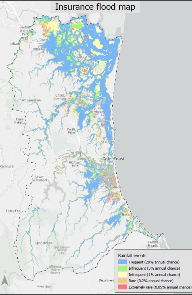
More than 90,000 properties have been reclassified as being at flood risk, with new maps revealing what it will mean for insurance premiums. SEE THE MAPS
Council
Don't miss out on the headlines from Council. Followed categories will be added to My News.
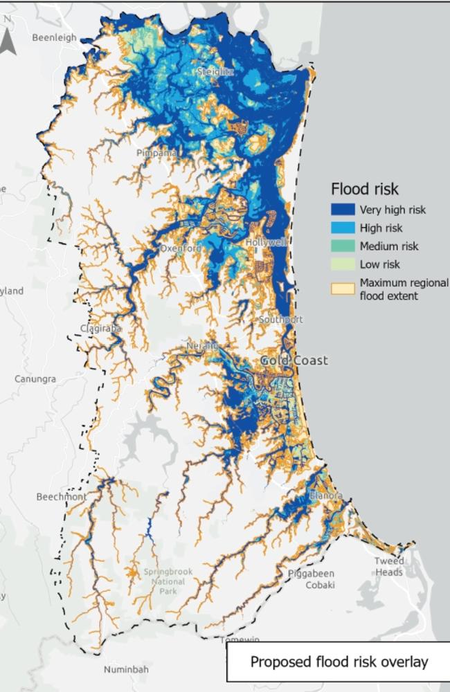
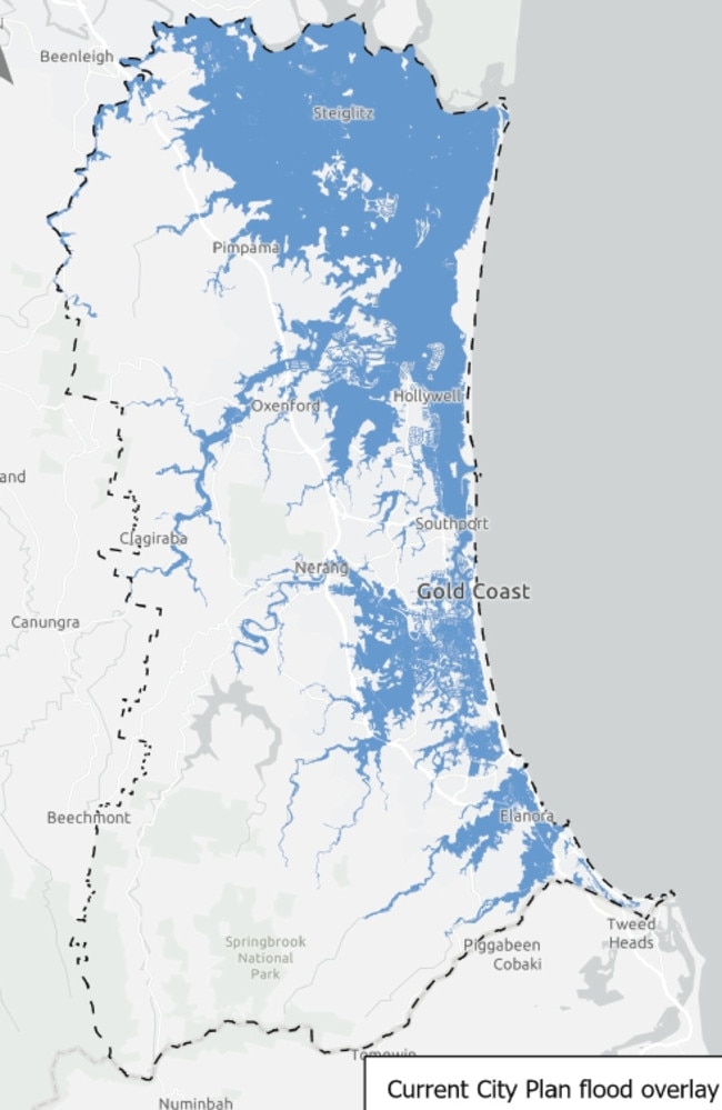
MORE than 90,000 properties have been reclassified as being at flood risk by the Gold Coast City Council.
However, city leaders have warned insurance companies against taking advantage of the situation to bump up premiums.
According to the data, which will be released on December 3, more than 173,000 properties, or around 62 per cent of the city were now represented as being at flood risk.
Council planning boss Cr Cameron Caldwell dismissed concerns that the maps meant increased danger for property owners.
“This does not mean they are suddenly at more risk,” he said.
“It is simply a tool to help all of us understand what could occur if we were to see a worst-case scenario event on the Gold Coast.”
The maps, which take a “long-term” view”, are based on “what is considered to be the upper limit of a flooding event in the future” and considered a range of potential inundations, rather than a “one in 100 year flood”.
They were developed using new flood modelling technology, which analysed topography, structures tidal influence and future climate scenarios.
It was developed in consultation with the Insurance Council of Australia, the Planning Institute of Australia and Property Council.
However, Cr Caldwell warned insurance providers against using the maps as an excuse to jack up premiums.
“We know the Insurance Council will do the right thing, they have been on this journey every step of the way,” he said.
“There are a set of maps which are design to show the insurance companies to ensure they are putting a premium on your property which is fit for purpose.
“It is important they do the right thing by the residents of the city … we want to make sure there is no price gouging as a result of these maps being produced so Gold Coasters can shop around to get the right price for their insurance premiums.”
It comes as weather experts warn it’s “just a matter of time” until monsoon conditions start developing over the Sunshine State.
The Bureau of Meteorology’s atmospheric scientist Brooke Pagel said, while it is too early to predict exactly when the monsoon trough will form, it would likely be over the coming weeks as an eastwards moving “pulse” of cloud and rainfall heads towards Australia.
“If a monsoon trough does become active there would be an increased risk of tropical low or tropical cyclone development over waters adjacent to the mainland,” Ms Pagel said.
Ms Pagel said although Queensland has largely been spared dangerous wet conditions so far, La Nina is still active alongside other climate drivers heading to the coast.
Queenslanders saw a drier than expected start to November after a third La Nina was declared and Premiere Annastacia Palaszczuk warned of cyclones starting this month, while rural NSW has been devastated by flooding.
More Coverage


Electric shock: Council pulls plug on EV chargers
Ten public charging stations across the Gold Coast have been suddenly switched off, leaving electric vehicle owners scrambling to find alternatives. FULL DETAILS

Council issues notice at Gold Coast homeless encampment
Police and council officers have issued move on notices to at least 10 individuals at a major homeless encampment in Southport. SEE THE VIDEO