
Sutherland Shire Council orders change to overland flood study parameter
A southern Sydney council has ordered a change to the measures used in determining a flood study that has caused weeks of angst for residents.

St George Shire Standard
Don't miss out on the headlines from St George Shire Standard. Followed categories will be added to My News.
Residents who were told their property would likely be identified as flood prone have scored a small win.
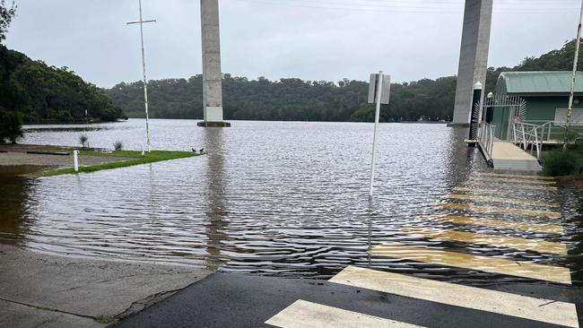
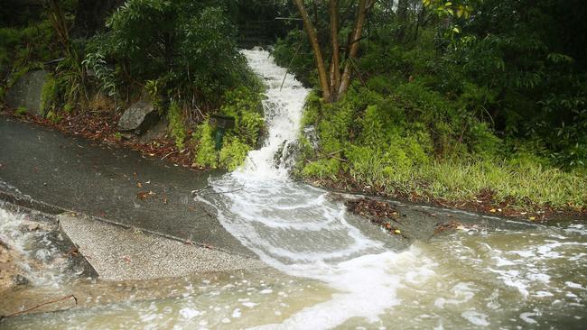
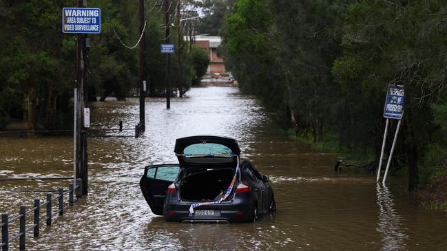
Last month more than 15,600 residents across the Sutherland Shire were shocked and alarmed when they were advised via a letter their homes were potentially flood-affected following the council’s draft overland flood study.
Residents have been left anxious, with many raising concerns about the unlikeliness of flooding on their property, the impact on insurance premiums, land value and a notation on their planning certificates.
During the November council meeting, councillors moved to immediately have all the recent notations removed from planning certificates until the flood study was finalised.
Mayor Carmelo Pesce said the council had engaged BMT as a consultant to conduct the draft overland flood study and it was agreed the most conservative approach to tagging properties susceptible to overland flooding would be taken.
Councillors believed, based on the advise of BMT experts, that a freeboard range of 0.5m – which measures overland flood – be used to calculate the number of affected lots.
This resulted in 8737 lots and 15,638 properties being identified as flood prone.
However, at a recent subcommittee meeting, councillors were informed a range of 0.3m could be applied - which may change the number of affected properties.
Cr Pesce said the council would now instruct BMT to use 0.3m range which would be in line with other councils when finalising the study.
He said the council would not know how many properties would be affected by using the 0.3m parameter until the study was completed.
“That may reduce 60 homes or 2000 homes, we don’t know yet,” he said.
“As councillors we weren’t given all the information.”
The mayor agreed to notify residents as soon as practicable that their property would no longer be flood affected under the new matrix.
Cr Pesce said the Planning and Environment Department would have to approve the 0.3m freeboard measure along with other parameters.
Cr Haris Stangas said he was “stunned and flabbergasted” to learn the council had other parameters they could have considered when the study was initially carried out.
“We don’t want to be notating properties unless we have to,’’ he said.
“I take the view that understanding where flooding has historically taken place in the shire is essential.’’
Cr Stangas said learning from past incidents of overland flooring would be a proactive way to keep the community safe from future incidents.
Community consultation was extended to March.


‘Runs like a freight train’: U14s City v Country rugby girls making noise
Fierce, fast and ferocious - and just 13 and 14 years old. First peek at some special talent to watch in the U14s City v Country girls rugby clash this weekend.

From City v County to Aussie rugby jersey! Teen’s story inspiring
Last year a teenager made his first NSW country team, played his heart out and is now inspiring other young guns from the bush as a rising star of rugby.