
NSW Floods: Driveway collapse Emu Plains, Hawkesbury, Nepean Rivers water levels rise
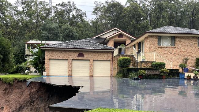
The wild weather which has lashed the Sydney region in recent days has taken another victim, with a western Sydney home losing half of its driveway following a landslide.

Penrith
Don't miss out on the headlines from Penrith. Followed categories will be added to My News.
The wild weather which has lashed the Sydney region in recent days has taken another victim, with a western Sydney home losing half of its driveway following a landslide.
Pictures show the parts of the driveway, located on a private road at Emu Plains in western Sydney, hanging precariously as a significant portion of the surface has crumbled away.
The driveway is now barricaded with construction tape warning drivers of the nearby danger.
It is unclear when the landslide took place.
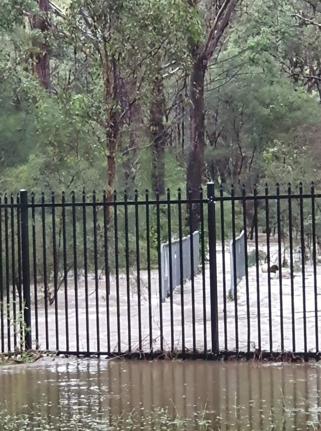
Part of Mulgoa ordered to evacuate within hours
A stretch of Mulgoa properties have been ordered to evacuate by 6pm, as rising floodwaters could potentially see residents trapped without power and water.
All residents and businesses on the western end of Martin St, between Nepean River and Mulgoa Creek, have directed to leave.
The evacuation route to move out of the flood affected area is by travelling to Mulgoa Rd before heading to Glenmore Parkway or the M4 Motorway.
Cranebrook, Penrith and Regentville streets issued evacuation warnings
A number of suburbs across the Penrith area are on high alert after evacuation warnings were issued by the NSW SES.
Residents and businesses have been urged to have evacuation plans prepared in case the situation worsens.
In Cranebrook, people located in the Waterside Estate have been given an evacuation warning after the SES have advised that flood water may isolate the area.
The streets of concern include: Waterside Boulevarde, Gannet Drive, Lapwing Way, Piper Way. Wader Street, Knot Street, Kittiwake Place, Guillemot St, Jabiru Way, Wedgebill Place, Oystercatcher Place, Fulmar Way, Avocet Circuit, Spinehill Place, Prion Ave, Sanderling Crescent, Teal Place, Bronzewing Common, Lakeview Drive, Shellbourne Place, Firetail Circuit, Nightjar Street and Janger Street.
Elsewhere in Cranebrook, a similar warning has been issued for all properties along Old Castlereagh Rd including Penrith Regatta Centre, as well as Grey Gums Oval.
In Penrith, all residents and businesses near Penrith Water Recycling Plant, Hickeys Lane and Visy Glass Recycling have been advised to leave due to risk of isolation.
Properties in Penrith Panthers area, between Jamison Rd and Retreat Drive. The area includes HardiAged Care Facility.
Smith Rd, Castlereagh has also been issued a flood evacuation warning.
Parts of Regentville, including properties along Bundarra Rd, Cross Rd, Bellevue Rd and Factory Rd (from the Nepean River to No 88 Factory Rd) have also been issued a flood warning.
Penrith Sport Centre hit hard by rain and hail
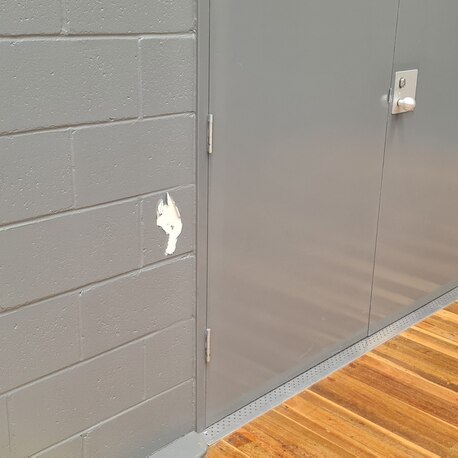
Penrith Valley Regional Sports Centre has copped it in recent days with its recently renovated bathroom left in tatters and towels sprawled across basketball courts to catch roof leaks.
Centre general manager Lukle Hepburn said the bathroom had only just been renovated about 12 months ago.

“The bathroom has been affected since Wednesday’s hail event,” he said.
“The pipe filled with ice and water, it got heavy, broke and separated from the roof flooding the bathroom.”

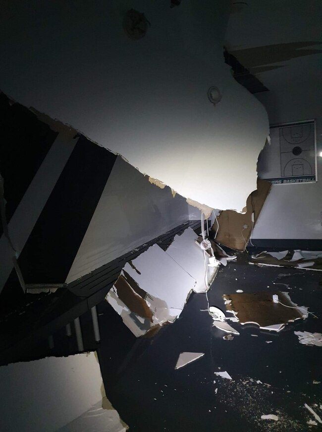
“It came through our roof and onto our courts. We even had ice going through the fans and it was almost like putting snow onto the courts.
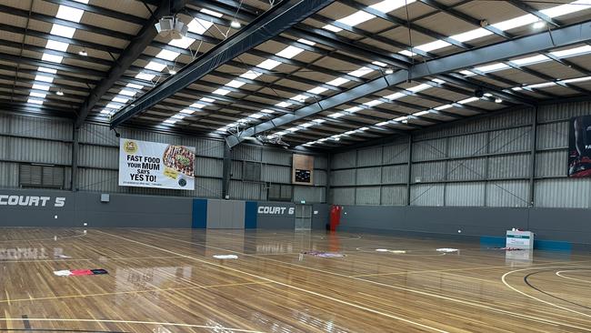
Following the hail event, the sports centre has been pummelled by floods which has only worsened the situation.
“It started pouring a few days later, the floods have made it worse. We’ve had other issues with our roof and paint coming off bricks,” Mr Hepburn said.
“We were chosen to host a Paralympic event but with the damage, it could impact our ability to bring the comp to our centre.”
Even the nearby waterbody gave way.
“The back creek, I’ve never seen it break its banks. This is the first time in 35 years we’ve had water from the creek filling up our car park,” Mr Hepburn said.
The staff at the centre have been feeling overwhelmed the last couple of years.
“We just got over the Covid closures and now this. Things just keep happening. It’s feels like it’s just hit after hit but we’re taking it with a smile on our faces,” Mr Hepburn said.
The damage from this week’s floods may take a couple of months to fix but in the meantime the centre hopes the community will continue to support them through these difficult times.
“Please come, play sport and bring your families. That’s all we can ask for. As a result of Covid, we’ve seen spectator rates drop for sporting events so we hope to see that go back up once this clean up is done,” Mr Hepburn said.
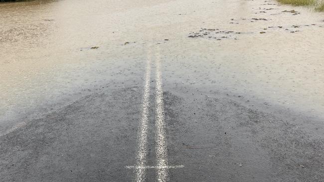
‘THE WATER IS SO HIGH’
The main road into Windsor, Windsor Rd is completely flooded, with neighbouring land completely underwater.
Bus driver Chris said he had only been in the area a couple of years but couldn’t believe how high the water had gone.
“The water is so high,” he said. “All this land, usually full of animals, is so many metres underwater.
“I cannot believe how high it is.”

On Tuesday morning near Windsor, a truck drove into flood waters, with the driver having to be rescued.
The truck reportedly flowed down the rapids towards Windsor.
Windsor locals band together
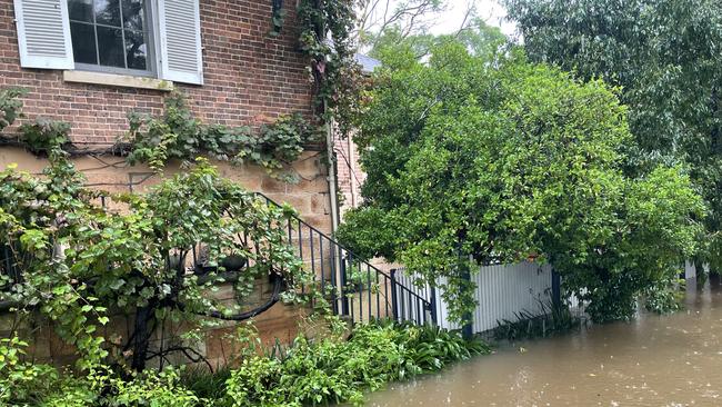
At a historic building in the heart of Windsor, 3 Thompson Square, locals joined forces to help flush water out of the building’s basement.
A worker frantically trying to flush out the water which he said had been entering through the side of the basement.
“It’s coming up round the back through the basement,” he said. “We are just trying to stop it from getting worse.”
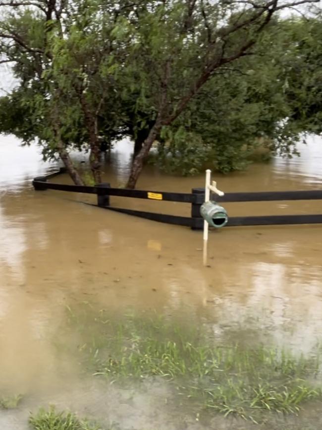
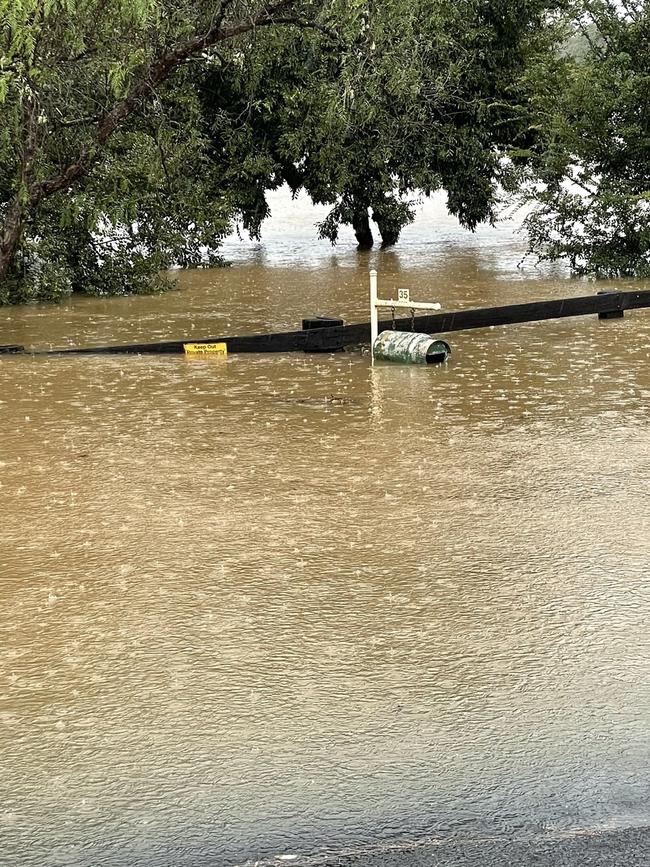
Waters creep closer to 2021 flood level
McGraths Hill residents made a mark on Wolseley Road to mark the height of last year’s floods.
At 4pm today, as the water levels continued to creep closer and closer to the mark, it appeared the mark would be inevitably gobbled up by flood water in the coming hours.
The flood waters are rising so rapidly, that a mailbox which was completely visible just a few hours ago, now is about to be covered by flood water.
‘Rain bomb’ set to hit western Sydney
The Bureau of Meteorology has advised a rain bomb is about to hit western Sydney with heavy rainfall likely to lead to flash flooding.
Flooding is currently continuing throughout the Hawkesbury area, with many communities isolated.
A Hawkesbury SES spokesman said, in a statement, they were “actively supporting our more isolated communities with resupply food, medicine and fuel, and relocating persons in danger or in need of urgent transport”.
SES boats have been operating out of Wisemans Ferry, Wilberforce and Windsor with an Rural Fire Service helicopter operating out of the Hawkesbury SES unit at Wilberforce.
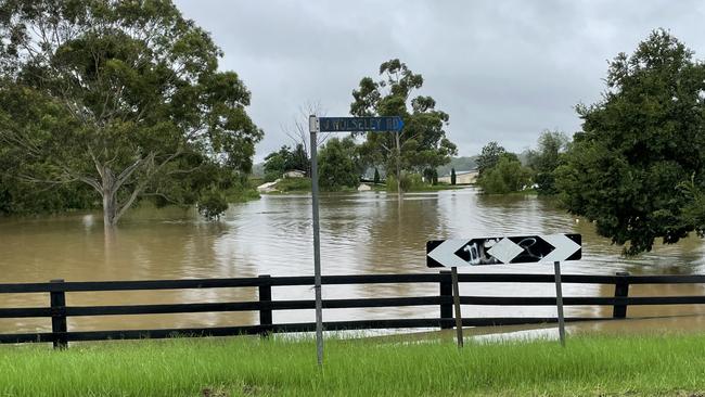
Roads in Mulgrave and McGraths Hill have now been shut as water levels rise. At McGraths Hill, Wolsley Rd is badly flooded with some properties now fully submerged with the tops of their fences the only just able to be seen.
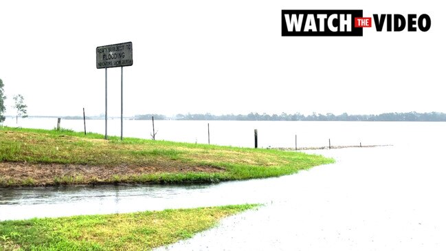
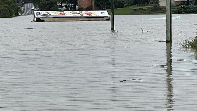
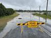
Flood rises incoming for Hawkesbury, Nepean Rivers
Constant rainfall has seen the Nepean River rise once more, with ‘moderate’ flooding taking place at Penrith.
In western Sydney major flooding is taking place along the Hawkesbury River at North Richmond, Lower Portland, Wisemans Ferry and Sackville, as well as along the Colo River at Putty Road.
This is Werrington near Penrith from the train! #SydneyStorm#weather#sydneyrain#sydneyweatherpic.twitter.com/UgV6Sgis1y
— Yasmina Rifai (@yasminabanana) March 7, 2022
Check out how high and how fast Nepean River is! Taken a few minutes ago. #SydneyStorm#sydneyrain#sydneyweather#weatherpic.twitter.com/4ds0rpjjDZ
— Yasmina Rifai (@yasminabanana) March 7, 2022
The wet weather has caused havoc in the region’s roads and public transport system with Blue Mountains line trains not running between Penrith and Lithgow due to a landslip near Zig Zag.
Replacement buses are running but commuters are asked to allow extra travel time.
Road closures:
- St Marys Road/Stony Creek Road (at Causeway)
- Eighth Ave, Llandilo (between 2nd Ave and Bridge)
- Torkington Rd, Londonderry
- Devlin Rd, Londonderry (Nutt Road End)
- Carrington Rd, Londonderry (between Bowman Rd and Milford Rd)
- The Kingsway, Werrington
- Luddenham Road, Orchard Hills (Mamre Rd end)
- Reynolds Road, Londonderry
- Wilshire Road, Londonderry (east end)
- Second Ave, Llandilo (between Ninth Ave and Eighth Ave)
- Durham St, Oxley Park (in both direction)
- Dunkley Pl, Werrington
- Barker St, St Marys (near Cook Park)
- Lee Holm Rd, St Marys (partly closed)
- Woodriff St, Penrith (partly closed between Tindale St and Lethbridge St)
- The Driftway, Londonderry (between Reynolds Rd and Blacktown Rd)
- Bennett Rd, Londonderry (near Blacktown Rd)
- Jockbet St, Londonderry
- Llandilo Rd, Berkshire Park (between Richmond Rd and First Rd)
- Wedmore Rd, Emu Heights (near Palomino Rd)
- Vincent Rd, Cranebrook (The Northern Rd end)
#BlueMountainsLine trains are not running between Penrith and Lithgow due to a Landslip near Zig Zag earlier.
— NSW TrainLink West (@TrainLinkWest) March 7, 2022
Replacement buses are running.
Please allow extra travel time and contact us if you need any travel assistance. pic.twitter.com/35fT3tSQ2y
River level updates:
The Nepean River at Wallacia Weir may exceed the major flood level (11m) this evening and may peak near 12m on Tuesday night.
The Hawkesbury River at North Richmond (WPS) may reach around 14m this morning, while at Windsor (WPS) it may reach about 13m.
The Hawkesbury River at Sackville is likely to reach the major flood level (9.7m) around midday, reaching heights of 9m at Lower Portland this evening and 4.8m at Wisemans Ferry about 1pm today, with high tide.
The Colo River at Putty Road peaked at 13m around 6am this morning with major flooding.
Evacuation warnings
Evacuation warnings and notices were issued for a number of areas across Penrith last night.
Local activity
Despite the wet weather conditions, some locals have braved the weather.
Meanwhile, the rowing club couldn’t make it out.


Driver charged over death of high-ranking Bandido bikie
A man who was driving an allegedly stolen SUV when it collided with two motorbikes, killing a high-ranking Bandidos bikie, has been charged over the death. Read the latest.
Roofer to fight claims he touched teen on western Sydney train
A western Sydney roofer accused of inappropriately touching a teenage girl on a train in Sydney’s west has pleaded guilty to urinating on a train station, but will go to hearing on allegations he touched the girl.