
Inner west roads set to slow down to 40km/h in 20 locations as Sydenham to Bankstown line converted for Metro
Drivers in Sydney’s inner west are about to hit the brakes, with speed limits set to drop on 20 roads while a nearby railway line is converted for the new Metro.
Inner West
Don't miss out on the headlines from Inner West. Followed categories will be added to My News.
Drivers in Sydney’s inner west are about to hit the brakes, with speed limits set to drop on 20 roads while a nearby railway line is converted for the new Metro.
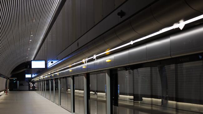
With the closure of the T3 train line – from Sydenham to Bankstown – drivers can expect slower roads as Transport for NSW implements temporary 40km/h limits.
According to council documents, the train line will be replaced during conversion works by buses that are expected to carry up to 72,000 passengers daily, sparking safety concerns.
The limits on most of the roads affected by the change will drop by 10km/h, with hopes the slower speeds will mitigate against the risks of collisions, particularly between buses and cars.
However, safety is not the only reason behind the implementation of the one-year speed limit, with the change also being billed as something that will help give people “confidence to walk”.
“The speed limit will also offer opportunities for people to build their skills, confidence and desire to ride and walk more during the T3 Bankstown Line conversion period,” council documents said.
A Transport for NSW spokesman said the state government organisation was “finalising plans” to improve safety for all road users in the inner west during the T3 line shutdown.
“These temporary speed limit reductions will be in place on sections of roads where bus service frequency has increased and where motorists and cyclists share the road,” he said.
“The lower speed limit reduces the likelihood and severity of crashes, including between buses and cars, as well as improving safety for vulnerable road users such as pedestrians and bike riders.”
“These zones are expected to be in place for the duration of the T3 line shutdown, but will be reviewed on an ongoing basis during the closure.”
Marrickville, Sydenham and Dulwich Hill will all be affected by the change.
The Inner West Council was contacted for comment but had not responded by the time of publication.
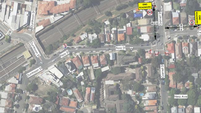
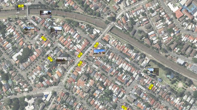
AFFECTED ROADS
- Garnett St, between Floss St and Tennent Pde
- Ness Ave, between Garnett St and Tennyson St
- Tennyson St, between Ness Ave and Riverside Cres
- Riverside Cres, between Tennyson St and Wardell Rd
- Albermarle St, between Kays Avenue E (shared path) and Livingstone Rd
- Moncur St, between Livingstone Rd and Moyes St
- Jersey St
- Livingstone Rd and Moyes St, between Jersey St and Moncur St
- Warburton St, between Moyes St and Illawarra Rd
- Lower Railway Pde, between Marrickville Rd and Sydenham Rd
- Gleeson Ave, between Railway Pde and Burrows Ave
- Burrows Ave, between Railway Rd and Gleeson Ave
- Hill Rd, between Illawarra Rd and Livingstone Rd
- Carrington Rd, between Richardsons Cres and Premier St, Marrickville.
- Wardell Rd, between Lang Rd and Pine St
- Illawarra Rd, between Harnett Ave and Marrickville Rd
- Marrickville Rd, between Meeks Rd and Railway Pde
- Buckley St, between Marrickville Rd and Sydenham Rd
- Railway Pde, between Marrickville Rd and Sydenham Rd
- Railway Rd, between Burrows Ave and Gleeson Ave


Inside the Shute Shield! Rugby’s cardiac kids, big improvers, high flyers
A Shute Shield contender has a new nickname with a deep dive into the famous rugby competition exposing some interesting trends and statistics ahead of the second half of the season

Sporting dynasty! Why this teen gun was born to play rugby
He’s the grandson, son, nephew and brother of sporting guns so its no surprise this teenager is turning plenty of heads himself in rugby.