
NSW floods: Hawkesbury river threatens Greater Sydney as rescues soar in Central Coast, Illawarra
Torrential rain across NSW has left many communities flooded, others on high alert and emergency crews racing to help before weather forecasts turn again.
NSW
Don't miss out on the headlines from NSW. Followed categories will be added to My News.
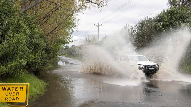
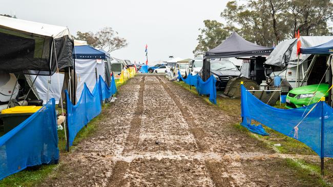
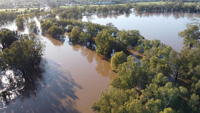
Flood-ravaged communities across NSW are bracing for further deluges this summer after a horror week of record-breaking torrential rain.
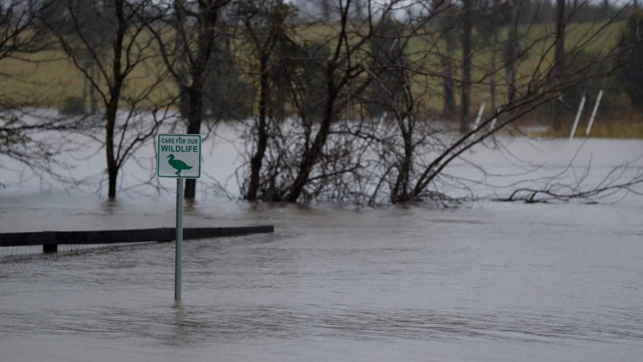
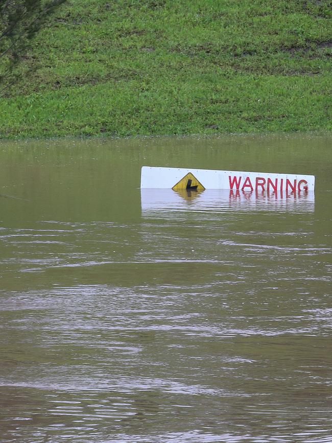
Isolated downpours of up to 100mm have plagued the Central West, Hunter and Illawarra regions and left rural communities isolated as 108 flood warnings remain in place – 12 of those being evacuation orders.
Over half of SES help calls last week were received on the weekend, while swollen river systems cause major flooding at Warren Weir near Nyngan and Lachlan River at Euabalong. Watchful eyes remain on the Hawkesbury-Nepean river in North Richmond and Windsor, which are reporting steady levels.
Last Thursday, Sydney’s annual rainfall surpassed the 72-year record of 2194mm and saw its tenth day of more than 50mm of rain this year, with two days going beyond 100mm.
Although the state will experience a reprieve this week, it continues to face an increased flooding risk with inundated soils and more wet weather on the way.
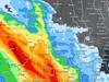
Renewed river level rises after heavy rain have led to #Moderate to #Major Flooding in many inland rivers across #NSW today.
— Bureau of Meteorology, Australia (@BOM_au) October 9, 2022
Major flooding is occurring at #Warren#Euabalong with many other locations forecasting Major flooding
Latest flood warnings https://t.co/Ad3AkvLvClpic.twitter.com/TDr00kj0d7
Flood evacuations orders in NSW
Of the 108 flood warnings issued by the State Emergency Service (SES), 12 are evacuation orders that have been issued predominantly around the Hawkesbury area. The rest are a mix of ‘watch and act’ and ‘advice’ that update regularly.
Residents are being urged to leave in parts of Sackville, Sackville North, Pitt Town, Lower Portland, Cornwallis, Richmond Lowlands, Agnes Bank, Cattai, Cumberland Reach, Gronos Point, Oura and Western Plains Tourist Park – where evacuation orders are in place.
Hawkesbury, Wagga Wagga, Dubbo and Forbes are also areas of concern, alongside Warren where isolated properties are expected to remain stranded for another six to eight weeks.
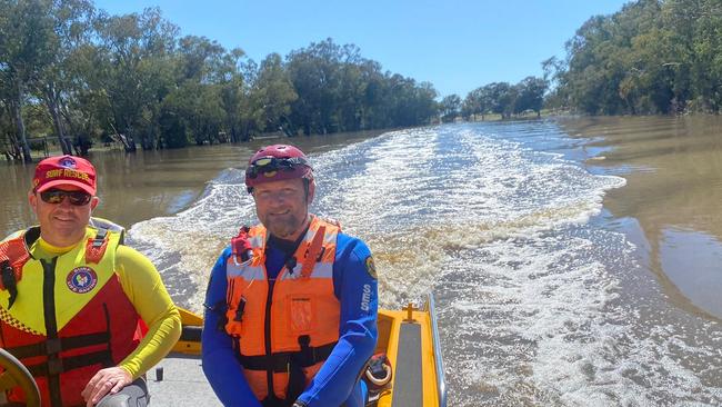
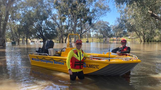
SES call-outs and flood rescues
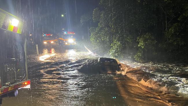
Over the weekend – since Friday 5pm until Monday morning – the NSW SES received 1036 calls for help and conducted 44 rescues.
Since October 3, there were 2049 calls for assistance and 56 flood rescues.
The Central Coast was the most affected area, accounting for about half of those numbers. SES teams were also called out to areas in the Mid North Coast, Wagga Wagga, Sydney, and Illawarra.
NSW SES Operator Adam Jones said teams were spread out across NSW and were preparing for another weather front to hit the state on Wednesday.
“We urge people to pay attention and make sure they’ve prepared their home and have got a plan,” he said.
“If they’re doing any travel, plan ahead and take your time.”
SES team are expected to continue working for another four to six weeks of prolonged operations with their partner agencies, including Surf Life Saving (SLS), Fire and Rescue NSW (FRNSW), Volunteer Rescue Association (VRA), Rural Fire Service (RFS) and others.
Premier Perrottet’s plea
With a “difficult summer” ahead, NSW Premier Dominic Perrottet has urged people to heed the latest advice as it changes.
“We see time and time again in these situations people put their lives at risk (and) their family’s lives at risk. Please do not do that,” he said.
“Follow those instructions from our emergency services personnel. They are putting their life on the line to help us. It’s going to be a difficult summer.”
Rainfall totals across NSW
Heavy rain and severe thunderstorms that battered the state last week resulted in NSW’s fourth flooding event this year alone.
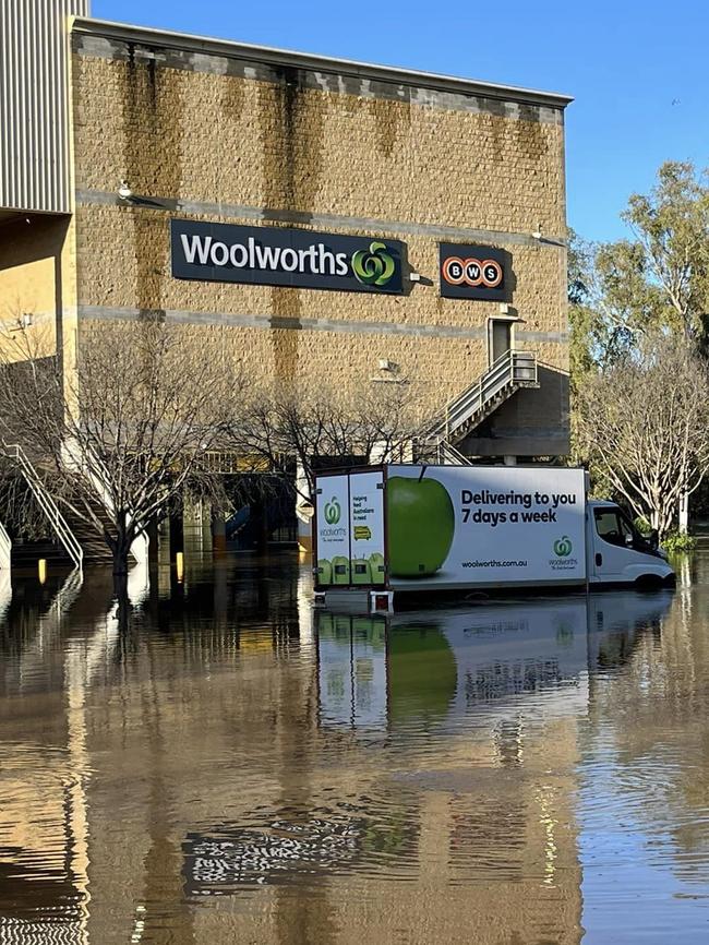
In the last 24 hours, the Illawarra region crushed rainfall totals across the state with the top three downpours in Lake Conjola at 127mm, Vincentia at 125mm and Ulladulla at 110mm. In fourth place, Lake Macquarie’s Windale saw 103mm.
Between October 3 and October 9 Sydney recorded 192mm – the highest weekly rainfall across the state – while Darkes Forest copped 191mm followed closely by 166.4mm at Camden airport and 163.4mm at Wahroonga.
On the south coast, Ulladulla and Sanctuary Point saw 168.8mm. A bit further north, 181mm dropped at the Robertson Pie Shop on the Illawarra Hwy between Wollongong and Nowra.
Areas in the Central West also saw significant rainfall totals between 50mm and 100mm last week, while Dubbo topped 106.6mm.
Weather forecast this week
Although heavy rain is expected to ease from Monday, BOM has warned the worst is yet to come with a new weather system predicted to charge across the state on Wednesday.
“At this stage, the forecasts are focusing most of the rain over southern areas and across to Victoria, however it is early in the week and the forecasts may change,” BOM Public Information Officer Helen Kirkup said.
“Forecasts are suggesting we will see some rainfall to come through Sydney on Friday, but the front which moved slowly through inland areas will likely cross the coast reasonably fast, so estimated rainfall numbers are not that high – although this could change.”
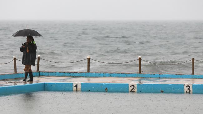
Clouds will blanket Sydney for most of the week with easterly to north-easterly winds and a chance of light showers before the sunshine returns on Saturday.
Freezing conditions are also sweeping the city with a six degree drop – 25.63 degrees down to 19.7 degrees – in below average maximum temperatures since the same time last year.
“Winds are likely to be fresh northeast to northwest along the coast ahead of the front but it loses definition as it comes through so currently we aren’t expecting the type of southerly winds we saw with the previous system,” Ms Kirkup said.
“Coastal temperatures will slowly warm along the coast through the week. Today’s max temperatures along the coast are below the average but should be near average by Thursday.
“Areas west of the divide will see bigger fluctuations in temperatures as the system goes through.”

Join the conversation

’Profits before patients’: Hospital slammed for hiring out maternity ward
The controversial Northern Beaches Hospital is putting “profits before patients” by hiring out one of its two maternity wards to film and TV crews rather than accommodate birthing mothers, irate staff claim.
Read more

Cancer that killed dad won’t get me: Miracle drug gives Ryan hope
Ryan Harding has no memories of his father but he has lived with the same rare disease that took his life. Now, thanks to a newly PBS-listed miracle drug, he finally has hope—for himself and his future children.
Read more