
‘Life-threatening’ floods forecast to hit Coffs as low develops off coast
A warning has been issued for damaging flash floods as a low develops off the mid north coast.
Coffs Harbour
Don't miss out on the headlines from Coffs Harbour. Followed categories will be added to My News.
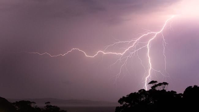
A warning has been issued for potential life-threatening floods on the Mid North Coast as a coastal trough continues to deepen off the coast.
The Bureau of Meteorology is expecting the trough to develop into an east coast low on Friday, before slowly tracking down to Sydney later in the day.
In the Coffs Coast region, the deepening trough is affecting Coffs Harbour, Woolgoolga, Sawtell and Dorrigo.
The warning has also been issued for Port Macquarie, Taree, Kempsey, Newcastle, Gosford, Cessnock, Maitland and Dungog.
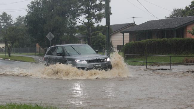
Intense rainfall which may lead to dangerous and life-threatening flash flooding may develop and roads are likely to be cut off by water. Some roads on the Coffs Coast are already being impacted by flood waters.
The image below was taken at Bray St on Thursday.
There will also be an increased risk of landslips over this period.
A warning has also been issued for damaging winds, averaging 60km/h to 70km/h with peak gusts in excess of 90km/h, which are also likely to form on Friday and move south by the evening.
Riverine flooding is possible as catchments are already soaked from weeks of heavy rainfall on the Mid North Coast.
Flood watches continue to be in place for the Orara, Bellinger, Kalang and Nambucca rivers.
BOM climatologist Agata Imielska said some areas may see rainfall of 100m or more forming within a 24 hour period, depending on the location of the coastal low.
The exact position and movement of the coastal low will impact just where the strongest winds and highest rainfall will hit, and further updates will be issued as the system develops.
"It's already raining … and now we're talking about a low pressure system developing and potential for widespread heavier rainfall," she said.
"Now that falling within that 24 hour period, or potentially shorter, will really increase the risk of flash flooding."
Coffs Harbour SES have activated the public sandbag collection point at Brelsford Park, near the intersection of Earl Street & Park Avenue.
The State Emergency Service advises that people should:
* Move vehicles under cover or away from trees.
* Secure or put away loose items around your house, yard and balcony.
* Keep at least 8 metres away from fallen power lines or objects that may be energised, such as fences.
* Trees that have been damaged by fire are likely to be more unstable and more likely to fall.
* Report fallen power lines to either Ausgrid (131 388), Endeavour Energy (131 003), Essential Energy (132 080) or Evoenergy (131 093) as shown on your power bill.
* Don't drive, ride or walk through flood water.
* Keep clear of creeks and storm drains.
* If you are trapped by flash flooding, seek refuge in the highest available place and ring triple-0 if you need rescue.
* Be aware that run-off from rainfall in fire affected areas may behave differently and be more rapid. It may also contain debris such as ash, soil, trees and rocks.
* After bushfires, heavy rain and the loss of foliage can make the ground soft and heavy, leading to a greater chance of landslides.
* Stay vigilant and monitor conditions. Note that the landscape may have changed following bushfires.
* For emergency help in floods and storms, ring your local SES Unit on 132 500.

‘Shining light’: Former Lismore Mayor farewelled
A former Lismore mayor is being remembered as a “trailblazer” and “shining light” for women in local government. Read the tributes here.

Former News Corp cartoonist, marine animal advocate dies
Tributes are flowing for former Coffs Coast Advocate cartoonist and animal advocate Hec Goodall, who was known for living a “unique life”.