
Island resort trips, free sandbags to prompt residents to prepare for horror flood season
Tangalooma resort family holidays, automatic warning signs and a “Super Saturday’’ sandbagging event: Brisbane’s summer flood preparations have been revealed following February’s heartbreaking rainfall.

South West
Don't miss out on the headlines from South West. Followed categories will be added to My News.
Brisbane residents are being lured with the promise of giveaways including family trips to Tangalooma Island Resort as preparations for an expected horror summer flood season ramp up.
The Bureau of Meteorology has predicted there was a 70 per cent chance of a third La Nina in a row forming this spring, which could lead to more deluges.
Council has announced it would install automated warning signs on floodprone streets, begin negotiations for voluntary buybacks of some homes, close or relocate badly damaged dog offleash areas and parks, and push ahead with repairs to CityCat terminals.
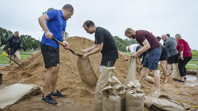
After sandbags ran out in February’s flood about 150,000 new, filled sandbags are ready to go.
Council confirmed at Tuesday’s meeting that another 20,000 were coming in the next fortnight.
Lord Mayor Adrian Schrinner said there would be a “Super Saturday’’ on September 17, where residents could go to one of Council’s five depots at Darra, Morningside, Newmarket, Lota and Zillmere to fill sandbags and take them home to store ahead of summer.
It would be the first of several such Super Saturdays, believed to be the first time any Queensland council had done such a thing.
Just more than 173,000 people have signed up for the Brisbane Severe Weather Alert Service, an increase of about 80,000 since February.
A Council promotion with prizes including family holidays to Tangalooma, a trailer full of $3000 in tools and household emergency kits were on offer for people who signed up this month.
“Residents will not only get access to this important service for free, they will get the chance to win some fantastic prizes,” Mr Schrinner said.

The Tangalooma prize included three nights in a deluxe beachfront villa valued at almost $5000 for a family of five, with a desert safari tour, snorkel experience, quad bike tour and helicopter flight thrown in.
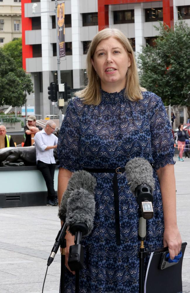
The Lord Mayor say 39 evacuation sites had been “identified’’ across the city, but under grilling from the Labor Opposition conceded that did not mean there would be 39 centres.
“I’m not saying there will be 39 centres, but we will let people know as soon as that process is finalised,” he said.
Council would also start negotiations with 16 people who wanted to sell their flood-prone properties, including in Herston.
Work was due to start soon on fixing up Jindalee Boat Ramp.
But a number of parks and dog offleash areas might have to be closed or moved including: Cliveden Park, Fig Tree Pocket; Taylor Bridge Reserve, Chelmer; Kookaburra Park West, Karana Downs.
Independent Councillor for the inner-south ward of Tennyson, Nicole Johnston, said she had still been given no time frame to fix Taylor Bridge Reserve.
“Cactoblastis Corner park in Sherwood has a massive landslip that destroyed two houses and there are huge cracks on two vacant blocks,’’ she said.
“Geotech reports have started but there is also no time frame.
“There’s another big landslip in Consort St, Corinda, at the river end.’’
Ms Johnston was very concerned about a major drain and bioretention basin in Ortive St, Yeronga, which drained the sprawling new Yeerongpilly Green urban renewal project.
She said it, and an open channel in Logan Ave, Oxley, were both still blocked with silt and flood debris.
Council had identified 78 roads across the city that still needed resurfacing, but Ms Johnston said none were in her ward despite 3000 houses flooding and large cracks re-emerging on Oxley Ave.
She said there needed to be more sandbagging depots, particularly as some were hard to access in floods, and no progress had been made in helping the Sherwood and Yeronga community centres function as evacuation centres, should that be needed.
Not one property in her ward had received money under the $700 million state-federal flood recovery initiative, she said.
But Mr Schrinner said Council had made huge progress repairing damage and preparing for the future.
Work was still progressing to get eight ferry terminals back online: Holman Street; Maritime Museum; Milton; North Quay; QUT Gardens Point; Regatta; Sydney Street; UQ St Lucia.
The (approximately) $15 million terminals, which won major design awards when they were first installed, were touted as the world’s first flood-resistant ferry terminals.
They were supposed to pivot out of the way in heavy river flows, but could not withstand the immense volume of debris – including pontoons and powerboats — which washed down the river.
A Council spokesman said “almost all’’ would be repaired by the end of the year — better than after the 2011 floods, when seven were destroyed and took years to rebuild.
“There’s a lot we’ve learned from recent events,’’ Mr Schrinner said.
“We will not have the same flood event we saw this year next year, it will be different, if it happens.
“It could be a flood event which includes river flooding, it could be flooding involving creek flooding.”

A total of 26 of the city’s 166 dog offleash areas were damaged in February, with 19 now repaired. Seven were still closed.
Repairs were about to start at Blackbutt Place Park, Chermside and work was due to start soon at 7th Brigade Park in Geebung, Jim Walding Reserve in Bridgeman Downs, Martindale Street Park in Chermside West and Shand Street Park in Stafford.
Julatten Place Park at Upper Kedron and Tillack Park at Mansfield were still closed and might have to be moved.
Half of Council’s 640 sports and community facilities were damaged, but all were partially or fully back to normal.
Council handed out one-off disaster relief payments of $5000 to 313 community groups and more than $4.5 million in rates relief for flood-affected property owners.
Civic Cabinet Chair for Infrastructure, Andrew Wines, said solar-powered, illuminated LED signs would be installed on high-risk roads.
They would have an alarm gauge that activated the sign once a creek or waterway reached a preset level, plus a camera to remotely monitor water levels.
The signs would also alert Council officers.
The first three signs would be installed at Gap Creek Rd in Kenmore Hills, Bowen Pde in Bardon and Lucy Street in Moorooka.
Council would spend a further $500,000 installing up to 12 additional signs across Brisbane by the end of the year, Mr Wines said.
He said Council would now identify other sites where the signs could be installed.
“We will prioritise locations where there’s a history of flooding along with a history of motorists entering flood waters,” Cr Wines said.


SEQ development war: State caught in councils legal crossfire
Queensland councils are racking up hefty legal bills in development disputes, with ratepayers footing the tab for an explosion of planning court cases.

Southside study reveals real cost of ignoring mental health
Taxpayers could save $482 million over the next decade if governments tackle root causes of mental distress in Brisbane’s southern suburbs and Logan, a groundbreaking study has found.