
Cyclone Debbie comparison photos in Whitsundays
It’s five years since Cyclone Debbie ripped through the Whitsundays and dumped a bucket load of rain on Mackay. Newly released aerial images starkly show the damage and the recovery.
Whitsunday
Don't miss out on the headlines from Whitsunday. Followed categories will be added to My News.
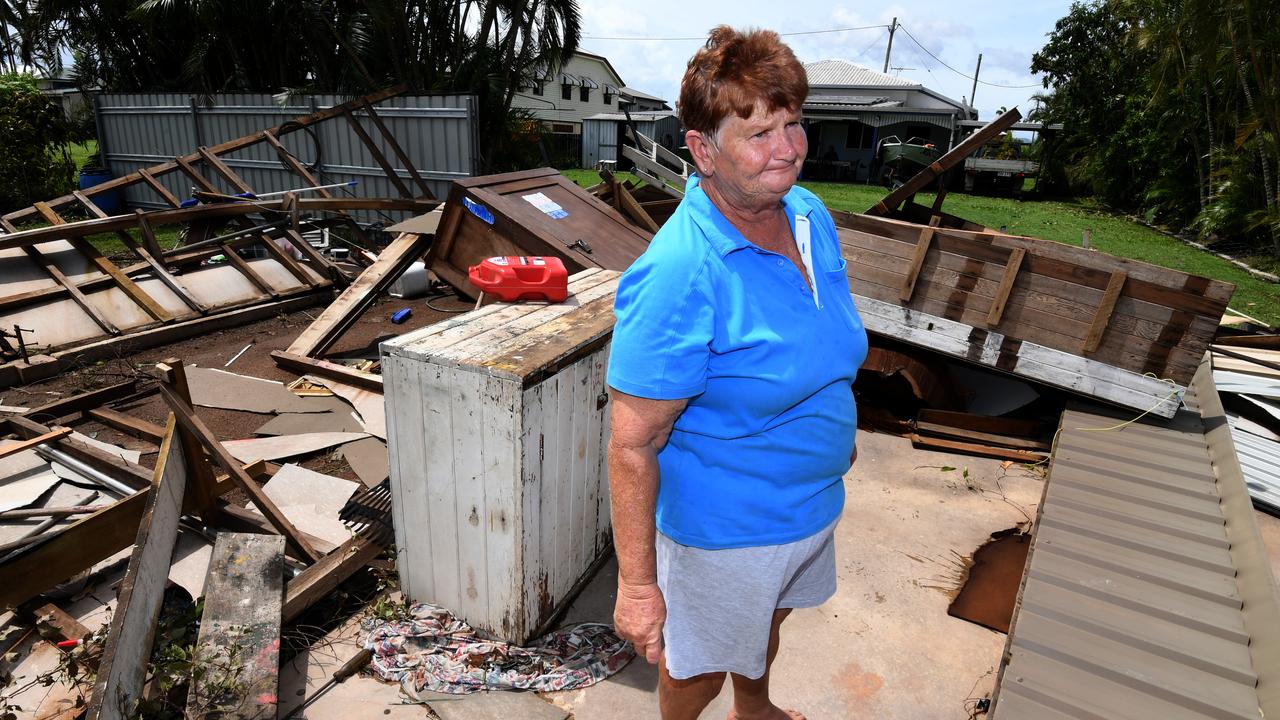
Mackay and the Whitsundays have come a long way since Tropical Cyclone Debbie intensified into a Category 4 before making landfall and causing catastrophic damage.
The Whitsunday Islands, including Hamilton and Daydream islands, bore the brunt of the winds from Debbie as she ripped through.
Images in the weeks after the March 2017 nightmare showed how once lush and thriving natural environments have been thinned to an almost barren landscape.
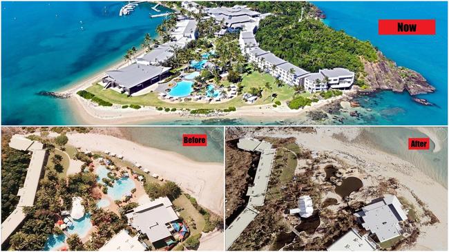
Daydream Island’s main pool looked brown and polluted instead of its usual blue perfection.
Hamilton and Hayman required rebuilds, while Proserpine copped it inland too.
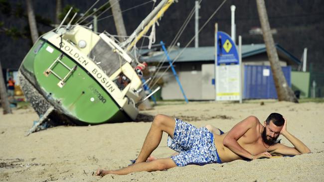
Coastal areas were not spared. Debbie’s fury appeared to rip jetties at Shute Harbour from the shore.
Several points along Airlie Beach also showed jetties damaged, and boats forced into each other.
But aerial images now show just how far along the recovery is.
Images are from immediately after the cyclone in 2017, and then two years later in 2019.
The exception is Hamilton Island, where the comparison image is one year before the cyclone in 2016.
Airlie Beach
Cannonvale
Hamilton Island
Shute Harbour
Shute Harbour 2
Shute Harbour 3
These images are captured through the Nearmap proprietary aerial camera system attached to planes. They are not satellite images.
Nearmap aims to capture aerial imagery following every major natural disaster in Australia that has a significant impact on property, infrastructure, and communities.
Nearmap ImpactResponse combines the firm’s leading aerial imagery, location intelligence and geospatial tools so businesses in sectors including government, insurance, and property have access to current information on the ground following natural disasters, at a time when ground access is limited, and inspection resources are stretched.

Join the conversation

Class act! School girl rugby sevens champions, stars, award winners
Explosions of speed, try scoring heroes, stars and standouts as Australian school girls rugby champs conclude. Award winners, best players and results wrap.
Read more

Monsters, lawless teens: Inside record number of Qld court appeals
Since taking the legal helm of a state rocked by senseless crimes, Qld’s Attorney-General has challenged a record number of sentences. We speak to the families of victims and get rare insight into the process.
Read more