
Satellite images show Debbie's destruction in Whitsundays
While damage on the ground was severe, seeing the devastation from above paints an entirely different picture.
Mackay
Don't miss out on the headlines from Mackay. Followed categories will be added to My News.
AS THE restoration of the Whitsundays steadily continues, the full devastation wrought by Cyclone Debbie is slowly becoming clearer.
While damage on the ground was severe, seeing the destruction from above paints an entirely different picture.
Satellite images released by the Queensland Government show specific locations in coastal areas, as well as a few inland positions, affected by the storm.
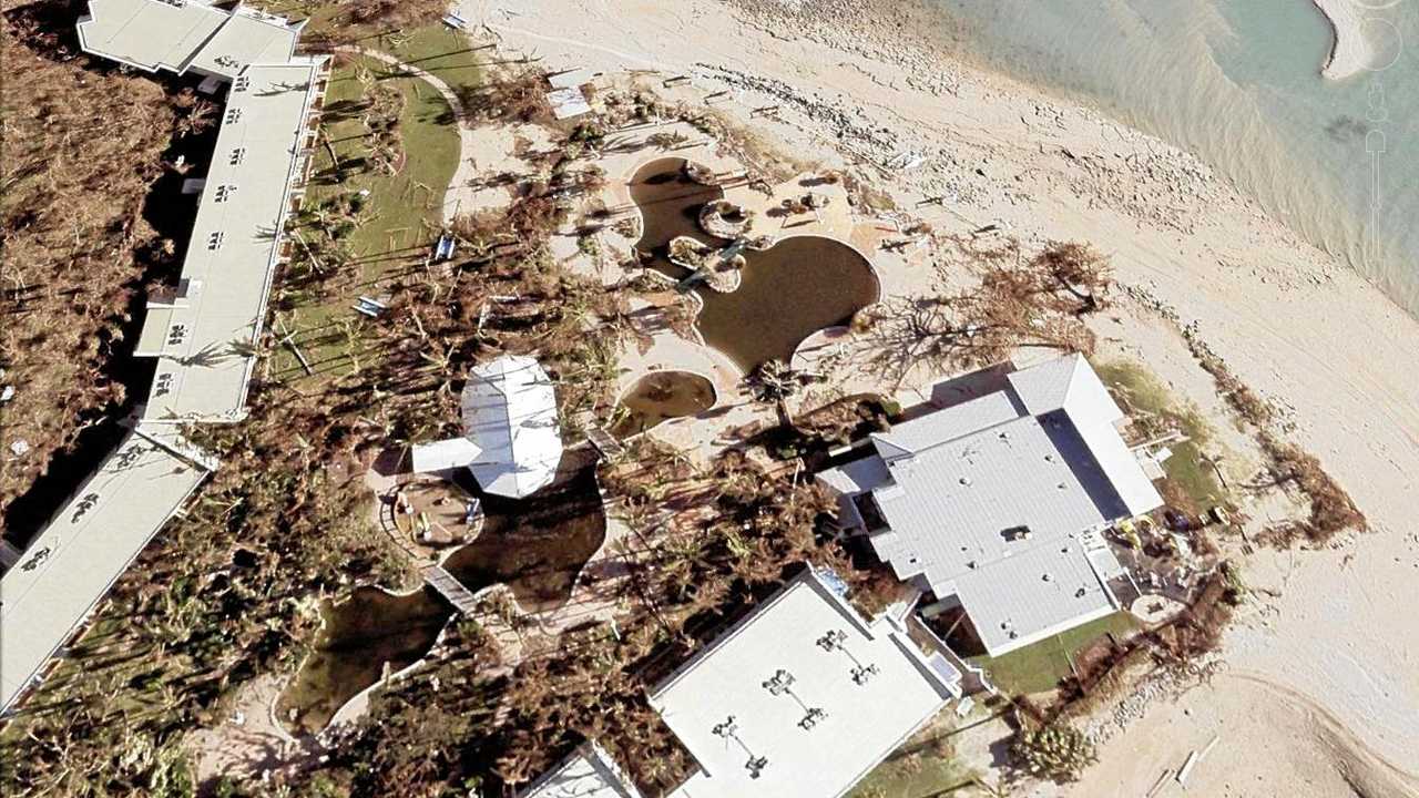
The Whitsunday Islands, including Hamilton and Daydream islands, bore the brunt of the winds from Debbie. As can be seen from the after images, what was once a lush and thriving natural environment has been thinned to an almost barren landscape.
Daydream Island's main pool looks brown and polluted compared with its previous state.

Even the iconic three mermaids off the point were visibly impacted, with two swimming away in the storm.
Photo of the day submissions for September 5
Coastal areas weren't spared. Debbie's wind and rain appears to have been ripped jetties at Shute Harbour away from the shore.

Several points along Airlie Beach also show jetties damaged, and boats forced into each other.
Further up the coast, at Hideaway Bay, trees and bushes have disappeared and debris has washed up on shore.

While avoiding the worst of the storm, Collinsville wasn't left untouched by Debbie's passing.
The full cost of the clean-up is yet to be established, but insurance claims from households alone has already reached hundreds of millions of dollars.
Originally published as Satellite images show Debbie's destruction in Whitsundays

Rape, grooming: Man, 61, charged with horror child sex offences
Police are investigating a North Queensland man’s history in Brisbane after charging him with multiple child sex offences, including rape and grooming.

Ex-mayor hopeful rules himself out of election
Mackay’s mayor hopes the councillor candidates won’t have any ‘private agendas’ as the postal ballot to replace George Christensen saves ratepayers $230,000.