
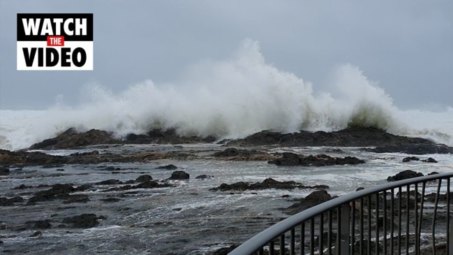
Cyclone-like conditions as 800mm rain dumped on parts of southeast Qld
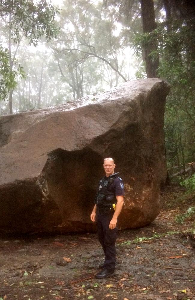
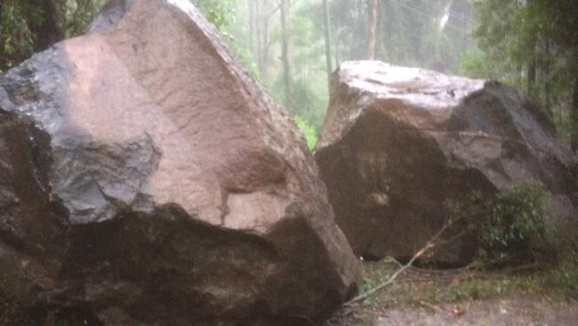
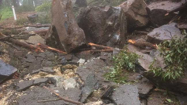
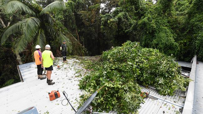
Massive boulders have been brought down in a huge landslide caused after more than 800mm fell during a three-day extreme weather system in southeast Queeensland.
QLD weather news
Don't miss out on the headlines from QLD weather news. Followed categories will be added to My News.
A significant landslide has occured in the Gold Coast hinterland this afternoon, leaving massive boulders blocking a road.
Queensland Police have advised that Tamborine Mountain Road will be closed for signficant due to the landslide.
It comes after the severe weather system that dumped more than 800mm of rain in parts of the southeast in three days.
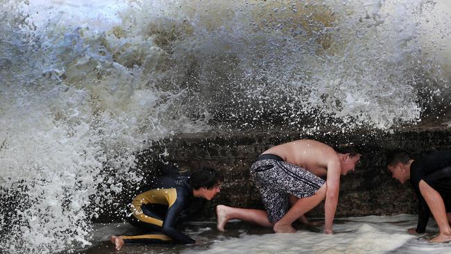
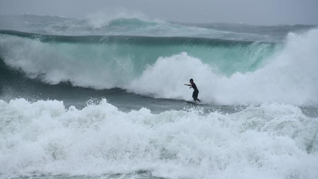
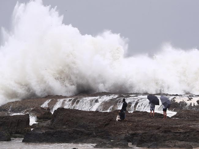
It is expected to weaken this evening but dangerous surf and tidal conditions remain, with the highest tide of the year expected tomorrow.
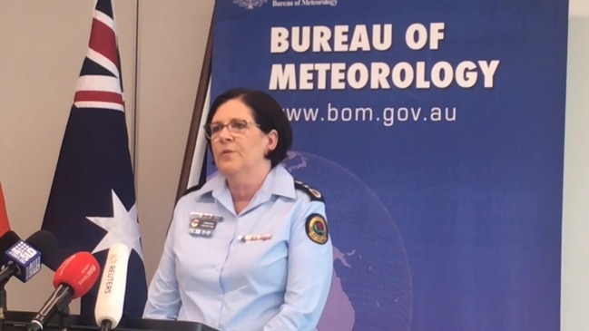
The Bureau of Meteorology this afternoon said the “complex surface low and associated trough are slowly moving ashore over southeast Queensland”.
“This system will continue to track southwestward while weakening tonight and into Tuesday,” the warning said.
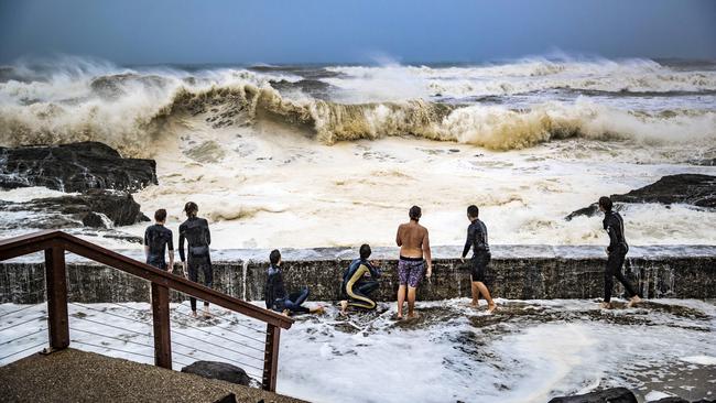
“Abnormally high tides exceeding the highest tide of the year are once again expected on Tuesday morning’s high tide. Dangerous surf conditions will continue about exposed beaches for the remainder of today and in combination with the abnormally high tides could lead to significant coastal erosion about areas exposed to wave action.”
PHOTO GALLERY: Southeast battered by wild weather
The threat of damaging wind gusts and widespread heavy rainfall has now ceased. Locally heavy falls and thunderstorms are possible tonight and into Tuesday.

Slow-moving thunderstorms were moving across the Wide Bay and Burnett region in the afternoon but the BoM cancelled the severe thunderstorm warning by 4.30pm.
It cames after more than 100mm of rain fell at Springbrook in the Gold Coast hinterland in the seven hours to 4pm Monday. It follows the weekend’s downpour that dumped 704mm in the region.
Tallebudgera on the Gold Coast received a further 59mm in the seven hours to 4pm Monday on top of the 487mm is had over the weekend.
O’Reilleys saw 56mm fall on Monday, on top of the 451mm dumped there over the weekend.
Binna Burra had 45mm dumped on Monday, after receiving 385mm over the weekend.
Further north, Boompa Rd, inland of Maryborough, received 160mm of rain in the seven hours from to 4pm Monday.
Brooweena had 83mm of rain on Monday.
Mount Elliott received 37mm on Monday while Coops Corner had 34mm.
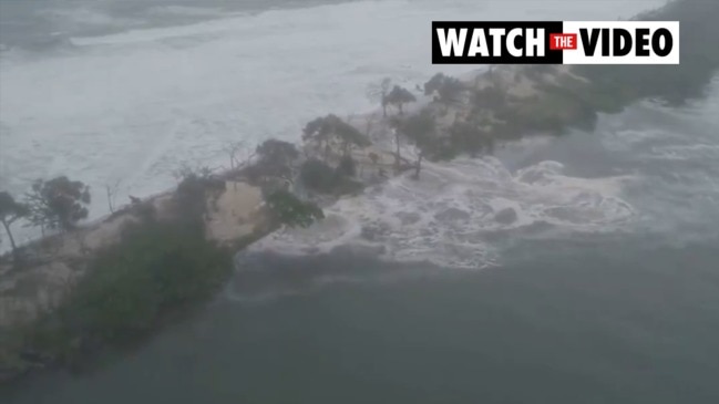
A minor flood warning is current for the Logan and Albert Rivers. A flood watch is current for catchments from Fraser Island to the Queensland/New South Wales border.
Locations which may be affected include Gold Coast, Sunshine Coast, Moreton Island, North Stradbroke Island and Fraser Island.
The weather warnings come as 150mm plus of rain was dumped on the Wide Bay & Burnett region since 9am this morning, with Fairlies Knob recording 155mm and Boompa Road recording 149mm.
Southeast residents had been warned by authorities to brace for cyclone-like conditions as a big wet drenches areas from Bundaberg to northern New South Wales in a 500km monster system.
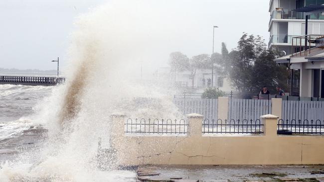
Parts of the southeast were soaked by more than half a metre of rain at the weekend and 10m swells with wild weather prompting more than 600 emergency calls.
RECORDS SMASHED: SCROLL DOWN FOR WEEKEND RAINFALL TOTALS
Along with flash flooding warnings, drivers were warned of several trees down across southeast roads, including on Sandgate Rd at Virgina and Redbank Plains Rd at Redbank Plains.
Powerlines were also reported to be down in several areas including on Beilsen Rd at Virgina.
There were more than 13,500 without power at 1.30pm Monday.
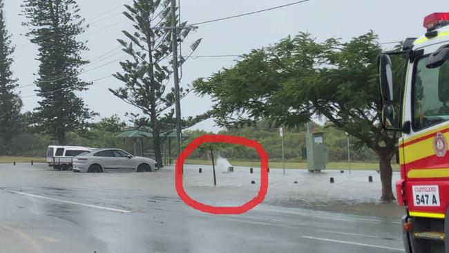
At Cleveland Point, waters swamped an Energex power box on the waterfront, which exploded and was steaming.
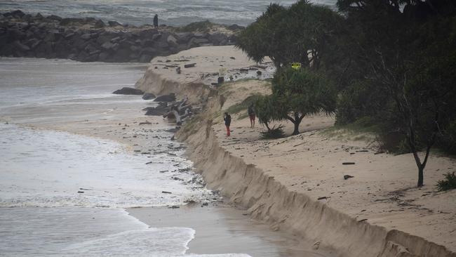
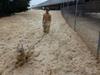
The wild weather has seen a swollen Moreton Bay lapping at the foundations of at least one home at Amity Point on North Stradbroke Island.
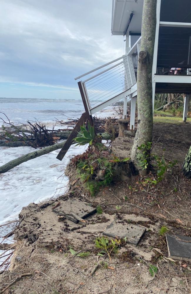
The back steps of the Old Ballow St have already fallen into the sea and there are fears further erosion will claim its verandah.
Amity Point, located on the exposed northwestern point of Stradbroke Island, has a long history of erosion.
RACQ had received 256 insurance claims by 1pm Monday, including 225 property and 31 motor claims, related to the heavy rainfall experienced over the weekend and today.
RACQ spokeswoman Lucinda Ross said most of the home claims were for roof damage and water ingress.
RACQ have also cautioned against drivers attempting to operate vehicles that have been submerged in high saltwater like those seen on flooded Sandgate and Beachmere streets and on the coasts throughout today.
“We are expecting more claims from this weather event which may include some tidal/salt water claims.” Ms Ross added.
“Saltwater is very corrosive and rust can set in quickly damaging anything metal – If salt water has risen up to wheel level but hasn’t entered the cabin and the vehicle is operating normally with no warning lights, give it a really good hose and flush out.
“If your vehicle has been flooded at all, don’t attempt to drive it, contact your insurer and speak to them about what you should do next.”
The Bureau of Meteorology said winds stronger than 90kmh were passing over Brisbane about noon.
A flood watch is current from Hervey Bay all the way to the New South Wales border today – “with continued river rises expected today”.
Very windy over #Brisbane right now! The dark blue blob over the city is an area where winds are >90km/h, off the end of the red colour scale on Doppler radar. These winds are a bit above the ground, with conditions at street level less intense. Warnings: https://t.co/p1IivTxOJQ pic.twitter.com/7ycYhuiNXr
— Bureau of Meteorology, Queensland (@BOM_Qld) December 14, 2020
A severe weather warning issued this morning for parts of the Wide Bay and Burnett and Southeast Coast said there was a “complex surface low” over Gold and Sunshine Coast waters.
It was expected to move ashore early this afternoon before weakening into tomorrow. But there was still the likelihood of heavy rain and possible flash flooding south of Bribie Island, with totals of up to 150mm possible in some areas.
Tides that equal the highest of the year are forecast for Tuesday morning’s high tide and damaging winds of up to 90km/h were said to be possible.
RACQ’s Ms Ross had earlier said she expected claims to increase.
“We’ve seen torrential rain cause serious damage across the region and with the drenching expected to continue today and possibly throughout the week, our claim numbers are only going to continue to rise,” Ms Ross said.
She urged Queenslanders to exercise caution when returning home to assess the damage.
“We’ve already seen a number of roads closed due to flooding and we could see more today with the weather expected to intensify,” she said.
“If your street or home has been flooded, please don’t go home until flood waters have receded and it’s safe to do so.
“You should also avoid turning on any electrical appliances that have been wet and take photos of any items which could become a health and safety hazard before throwing them out.”
Severe weather has flooded parts of the underground network and blown large trees across powerlines. Stay safe SEQ and keep away from flooded network and fallen powerlines then call 000. Our crews thank you for your patience. pic.twitter.com/OcmM4gXpLQ
— Energex (@Energex) December 14, 2020
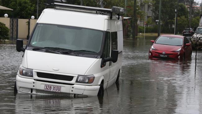
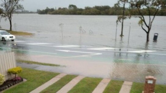
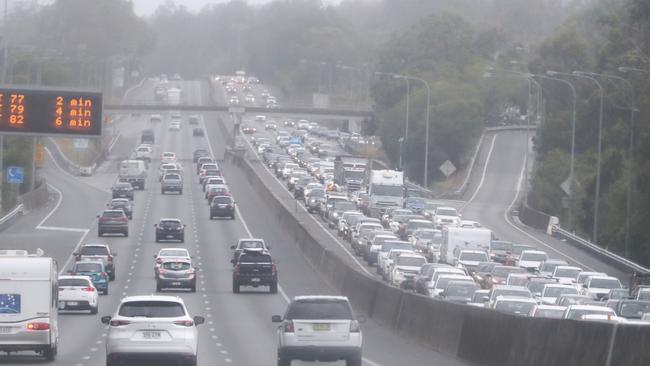
Roads in some parts of the southeast, including in Brisbane, have gone under and the State Emergency Service received dozens more calls for help overnight.
The Bicentennial Bikeway at Milton has been partially submerged this morning following the high tide of the Brisbane River, pushing up bark and debris.
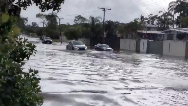
Cars have been inundated by water on flooded streets in Sandgate, where water can be seen up to the cars’ wheel arches.
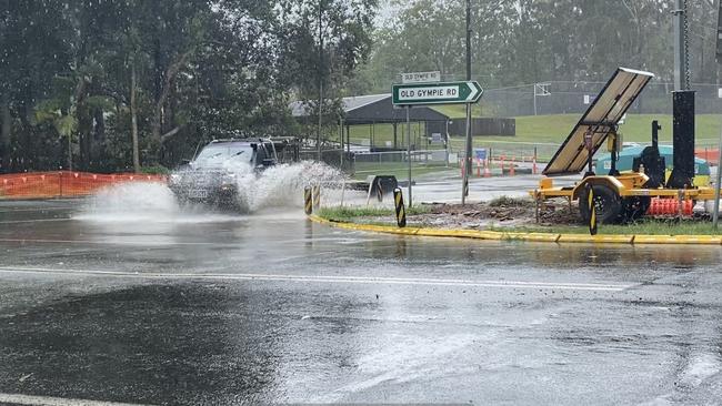
There has been flash flooding west bound on Coronation Drive, and Mott Rd at Brendale.
On the Gold Coast, Bonogin and Somerset Rd at Mudgeeraba were closed. Bradman Ave at Maroochydore was inundated this morning, with flash flooding affecting all lanes.
And thousands of homes and businesses have been left without power, as many as 8400 at 9.30, with Bli Bli (1600), Victoria Point (1200), Nerang (764), Tallebudgera Valley (500), Rosemount (614) and Forest Glen (440) among the worst affected.
In Surfers Paradise, wind gusts caused mayhem when glass was blown from a building.
Police advised that parts of Ferny Ave, Beach Rd and Elkhorn Ave were closed due to traffic disruptions and debris on the road.
Motorists are advised to avoid the area if possible.
Wild and woolly â¦@vikingssurfclubâ© this morn as the high tide approaches pic.twitter.com/J8kXO3hgAa
— Greg Stolz (@GregStolzJourno) December 13, 2020
North of Brisbane, the wild weather was making an impact on the Redcliffe foreshore.
Shane Leach, from Newport, said he’d never seen anything like it.
“There were a couple of guys out there surfing yesterday at Queens Beach, which was pretty cool,” he said.
“It’s a bit of a phenomenon, I knew the king tide was up because I live at the back of the canal and I see the water rise up and I went for a quick look to get footage to share in the local community page.
“There is localised flooding just at Scarborough near Morgan’s Seafood there’s a bit of flooding there at the moment.”
Mr Leach, who is no stranger to capturing footage in the moment after having his own YouTube channel, said he unexpectedly has the day off from his excavation business due to the weather.
He said locals gathered around the foreshore to capture a glimpse of the wild weather during high tide.
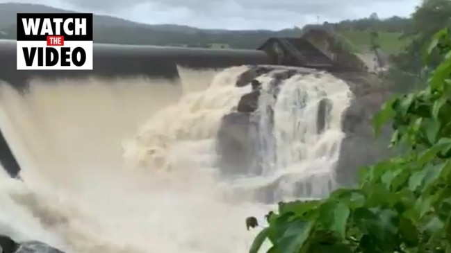
On Gold Coast hinterland, Little Nerang dam is now spilling after rising by more than 35 per cent in the last seven days.
Wappa Dam and Lake MacDonald are also spilling, after a triple digit deluge on the Sunshine Coast.
Meanwhile, drought-ravaged Stanthorpe, the last two weeks have brought more rain than in the three months prior.
Forecaster Laura Boekel said the weather was being generated by a coastal trough and slow moving upper low over the southeast.

Heavy falls are likely to stretch from south of Fraser Island down to the Gold Coast today.
It brings the risk of “strong-to-gale force winds”, increasing tides and coastal erosion.
The Bureau of Meteorology has issued minor flood warnings have been issued for the Logan and Albert rivers.
“Sea levels about the southeast Queensland coast are expect to exceed highest astronomical tide today with large sea level anomalies due to the spring tides and the expected winds,” Ms Boekel said.
“Flooding is therefore possible along coastal locations and about low lying locations around Brisbane river.
“Out in the oceans where we’re seeing the hazardous surf and the high tides, that is what we would see with a low pressure (system) or a tropical cyclone moving towards the coast,” Ms Boekel said.
“The hazardous surf and abnormally high tides, when you mix that sort of impact with rainfall that’s when we start to see flooding in low lying areas.”
The heaviest falls were recorded in Upper Springbrook where a two-day downpour brought almost 700mm of weekend rain.
“In 24 hours, over the weekend, they saw 475mm … and the following day within 24 hours they saw another 200mm as well,” Ms Boekel said.
Earlier, Bureau of Meteorology senior forecaster Rickus Lombard this morning warned of intensifying conditions, with a strong coastal cloudband sitting off the coast.
“Going through the morning, up until lunchtime, a band of showers sitting offshore – probably are the ones we’re more concerned about, they have thunderstorms in them as well.”
“Hopefully it doesn’t get too crazy under it.”
Mr Lombard said showers would hang around the southeast tomorrow and Wednesday.
“From this afternoon it will be easing into tonight – just make it through today and we’ll be alright.
“Intense rainfall will remain throughout today – but we’re still expecting smaller rain to continue through Tuesday and Wednesday.”
Despite the multiple reports of minor flooding occurring along the Brisbane River this morning, BOM Flood Forecaster Andrew Preece told The Courier-Mail the river’s level wouldn’t reach an area of concern.
“The water reaching minor flooding this morning is just because of the tide – it’s actually reached the highest astronomical tide.” Mr Preece said.
The Highest Astronomical Tide (HAT) is the highest expected level that occurs under normal meteorological conditions every year, with today’s river levels expected to stay within that range.
“The highest astronomical tide is actually bang on the minor flood level for the river, so it can be a bit misleading reading the gauge and thinking that might be abnormal.”
Levels are expected to stick around for the rest of the morning with the high tide before falling down this afternoon, however are expected to return tomorrow morning.
“The high tide this evening will be lower, then you have a similarish high tide to the one we’re experiencing now this time tomorrow morning.”
24 hour rainfall totals to 9am Monday:
Upper Springbrook: 229mm
Maleny: 211mm
Miami: 207mm
O’reillys: 175mm
OVERNIGHT
Fire and Emergency Services Minister Mark Ryan warned on Sunday afternoon that the significant weather event would last through to Monday night.
Isolated parts of the southeast were warned of a possible 200-300mm rainfall on Sunday night and into Monday morning.
âš ï¸ WATCH & ACT: Currumbin and Tallebudgera
— City of Gold Coast (@cityofgoldcoast) December 13, 2020
In the event you need to evacuate, seek shelter with friends and family where possible. However an Emergency Assembly Point has been established at our Reedy Creek Waste and Recycling Centre 📌 61 Hutchinson Street, Burleigh Heads. [2/3]
The City of Gold Coast at 7pm on Sunday issued a ‘watch and act’ warning for residents in Currumbin and Tallebudgera, with an emergency assembly point established in the area.
Residents in these areas were warned properties may be impacted by flooding in the coming hours.
“In the event you need to evacuate, seek shelter with friends and family where possible,” the City of Gold Coast wrote in a statement.
“An Emergency Assembly Point has been established at our Reedy Creek Waste and Recycling Centrelocated at 61 Hutchinson Street, Burleigh Heads.
“Anyone needing shelter will be processed at this location before being provided details on shelter arrangements.”
Moreton Bay Regional Council opened three evacuation centres, at Bongaree (Bribie Island Rec Hall), Caboolture (Caboolture Memorial Hall) and Woodford (Memorial Community Hall) and opened at 10pm.
“I am told by the bureau that whilst this is not a cyclone many of the impacts from this weather event will be similar to a category one cyclone event,” Mr Ryan said.
“It’ll be the equivalent of an east coast low.”
Residents from Bundaberg to Northern New South Wales were warned to expect heavy rain, damaging winds, and the possibility of flash flooding.
Mr Ryan said tides and waves would impact parts of Moreton Bay including Redcliffe and urged parents in the area to ensure their children do not enter the water.
“This is not a playground, so whether it’s localised flooding or flash flooding, or it is Moreton Bay and we see waves where we don’t usually see waves, keep your kids away,” he said.
“There is a dangerous possibility if kids playing in floodwaters or they are playing in those tides.”
At 7pm Sunday the State Emergency Service had received 618 requests for assistance across the state since 6pm Saturday night for water leaks, damaged roofs and fallen trees across Ipswich, the Gold Coast and Logan regions.
Sandbagging stations were opened on the Gold Coast but had to be closed at 6pm Sunday for safety reasons.
Queensland Fire and Emergency Services (QFES) Commissioner Greg Leach urged motorists to avoid unnecessary travel until this afternoon because of the risk of low-level and flash flooding.
IN PICTURES: SOUTHEAST’S WILD WET WEATHER
“The roads are going to be slippery and dangerous so we urge you to keep off the road,” he said.
“The main areas affected have been Ipswich, Logan and the Gold Coast and that’s where the predominance of the weather is likely to impact over the next 24 hours, but this system is potentially going to impact from Bundaberg right through into North New South Wales.”
Commissioner Leach said the significant deluge had brought the Fraser Island bushfire under control and management of the fire would now move to a recovery phase.
Bureau of Meteorology forecaster Shane Kennedy said the weather system was forecast to begin to move south from Monday afternoon but unsettled weather would continue through the rest of the week.
“We’re expecting the winds to ease right out as that moves on shore, we’re still expecting gale (wind) warnings for the Sunshine Coast and Gold Coast today, but those should ease by the afternoon and that risk of heavy rainfall should ease as well,” he said.
“The damaging winds and the heavy rainfall should be done by Tuesday but we’re likely to see unsettled weather continuing for pretty much the rest of the week, so some shower activity, cloudy skies for pretty much the rests of the week and much more modest rainfall from Tuesday.
“Dangerous surf, abnormally high tides could linger into Tuesday.”
Mr Kennedy said almost all sites across the Gold Coast hinterland broke their records for daily rainfall in December.
In Upper Springbrook, a whopping 475mm of rain in 24 hours replaced the weather site’s former daily rainfall record of 131mm on December 13 2007.
Meteorologist Rosa Hoff said this was the first display of the dramatic La Nina weather pattern that has been sitting over Queensland for several months.
“This is finally a weather system that is strong enough, big enough and deep enough that is taking advantage of La Nina and that’s why it’s not just giving us a bit of rain, it’s giving us a lot,” she said.
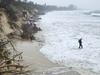
The Queensland Government’s Brisbane wave monitoring website recorded a huge 10m swell before midnight on Saturday off the shore of North Stradbroke’s Point Lookout.
All beaches on the Gold Coast and 20 on the Sunshine Coast were closed on Sunday with a combination of wild weather and abnormally high tides making conditions dangerous.
Mr Kennedy said the conditions could lead to significant coastal erosion about areas exposed to wave action.
“That significant and dangerous swell around the 3-4m mark, in combination with strong to gain for winds as well, that’s really helping to drive quite a lot of wave action into the shore,” he said.
RAINFALL TOTALS Friday 9am to Sunday 5pm
Upper Springbrook – 534mm
Tomewin – 401mm
Lower Springbrook – 388mm
Upper Tallebudgera – 386mm
Binna Burra – 292mm
Coolangatta – 216mm
Sunshine Coast Airport – 157mm
Brisbane – 41mm
RECORDS BROKEN
Daily rainfall levels for December
Upper Springbrook
Previous record of 131mm on 13 Dec 2007
New record 475mm
Coolangatta
Previous record of 157mm on 8 Dec 2004
New record 166mm
Binna Burra
Previous record of 128mm on 17 Dec 2018
New record 254mm
Join the conversation
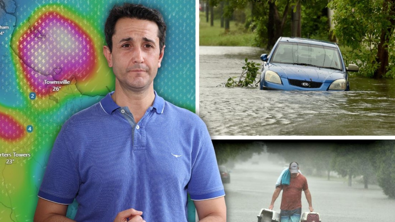
‘Testing NQ’s resilience’: Life-threatening flood warning, 250mm weekend forecast
Extra swiftwater rescue crews, police and boats are being sent north from SEQ ahead of what the Premier has warned will be another severe weekend of devastation for an already-saturated and “hurting” region.
Read more

Airport ‘evacuated’ and shut down amid fresh flood fears
A North Queensland airport has been closed with reports waiting passengers were being evacuated from the building amid flooding concerns as the region is battered by rain.
Read more