
Southeast warned as deluge arrives
Authorities are warning that southeast Queensland is only halfway into an extreme weather event, with residents told the impacts will be similar to those of a category one cyclone, as a flood warning is issued.
QLD weather news
Don't miss out on the headlines from QLD weather news. Followed categories will be added to My News.
Southeast Queensland residents have been warned a big wet set for the next 24 hours will have impacts similar to a category one cyclone.
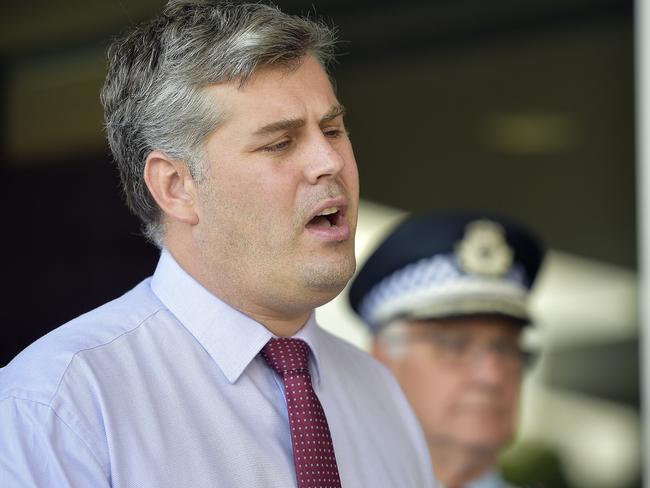
Minister for Fire and Emergency Services Mark Ryan said the significant weather event will bring severe heavy rain, damaging winds, and the possibility of flash flooding between Bundaberg and the south coast.
“I am told by the bureau that whilst this is not a cyclone many of the impacts from this weather event will be similar to a category one cyclone event,” he said.
“It’ll be the equivalent of an east coast low.”
Mr Ryan said tides and waves would impact parts of Moreton Bay including Redcliffe and urged parents in the area to ensure their children do not enter the water.
“This is not a playground, so whether it’s localized flooding or flash flooding, or it is Moreton Bay and we see waves where we don’t usually see waves, keep your kids away,” he said.
“There is a dangerous possibility if kids playing in floodwaters or they are playing in those tides.”
Rainfall records have been smashed in a number of localities, as more than half a metre of rain fell in some places.
Upper Springbrook’s daily total of 475mm smashed its previous December record of 131mm and meant more than 530mm of rain fell there over the weekend.
The City of Gold Coast has issued a ‘watch and act’ warning for residents in Currumbin and Tallebudgera, with an emergency assembly point established in the area.
As of 7pm Sunday, residents in these areas were warned properties may be impacted by flooding in the coming hours.
“In the event you need to evacuate, seek shelter with friends and family where possible,” the City of Gold Coast wrote in a statement.
“An Emergency Assembly Point has been established at our Reedy Creek Waste and Recycling Centrelocated at 61 Hutchinson Street, Burleigh Heads.
“Anyone needing shelter will be processed at this location before being provided details on shelter arrangements.”
Queensland Fire and Emergency Services (QFES) Commissioner Greg Leach said earlier significant rainfall had soaked into the ground and any further rain may lead to low-level or flash flooding.
RECORDS BROKEN
Daily rainfall levels for December
Upper Springbrook
Previous record of 131mm on 13 Dec 2007
New record 475mm
Coolangatta
Previous record of 157mm on 8 Dec 2004
New record 166mm
Binna Burra
Previous record of 128mm on 17 Dec 2018
New record 254mm
“If you don’t need to be on the road, stay off the road in the next 24 hours if you can,” he said.
“If you must travel around and you come across flood water, please, don’t drive through floodwater.
“The roads are going to be slippery and dangerous so we urge you to keep off the road.”
At 4pm, emergency services had received more than 530 calls for assistance since 6pm Saturday for jobs including water leaks, damaged roofs and fallen trees across Ipswich, the Gold Coast and Logan regions.
“That’s where the predominance of weather is going to impact,” Commissioner Leach said.
More than 4783 homes are without power across the southeast, with the majority of outages in the Gold Coast, Wynnum and Gympie regions.
Commissioner Leach said there have not yet been any calls for flood water rescues but additional swift water rescue personal had been rostered on.
IN PICTURES: SOUTHEAST’S WILD WET WEATHER
The extreme weather system that has dumped in excess of 500mm on parts of southeast Queensland in the past 24 hours is expected to peak early tomorrow morning.
There have been reports of landslides in northern NSW while warnings have been issued for extremely dangerous surf conditions.
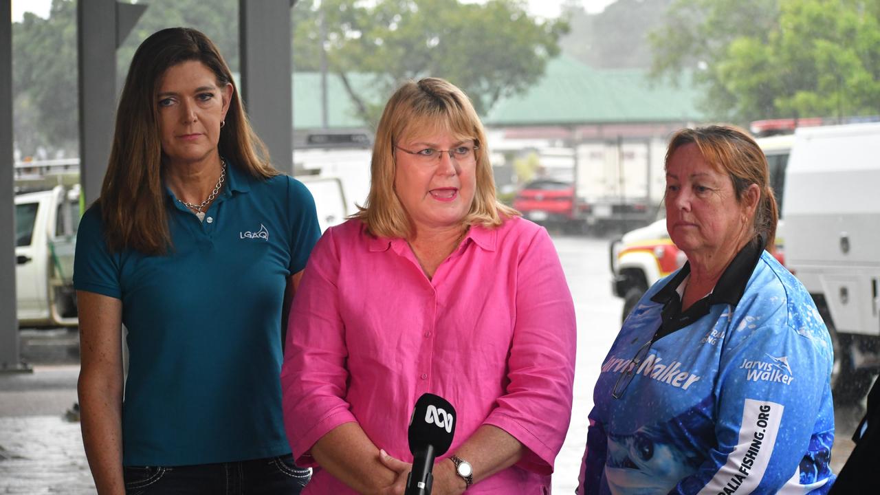
Emergency Services Minister Mark Ryan and his Queensland counterpart Greg Leach will provide an update on the conditions and response activities will provide an update on conditions at 3.30pm.
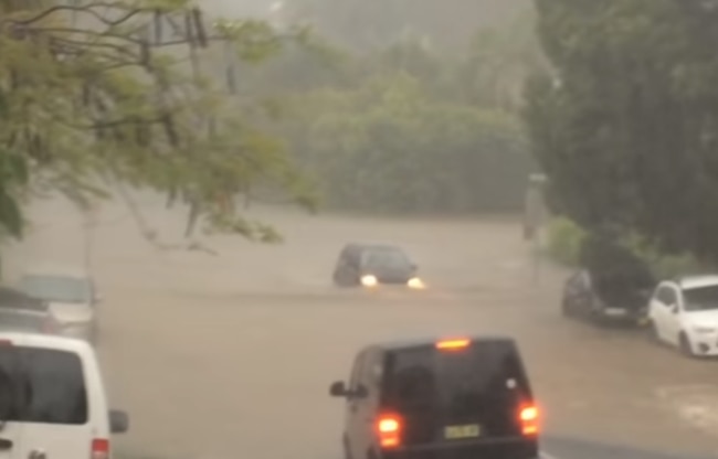
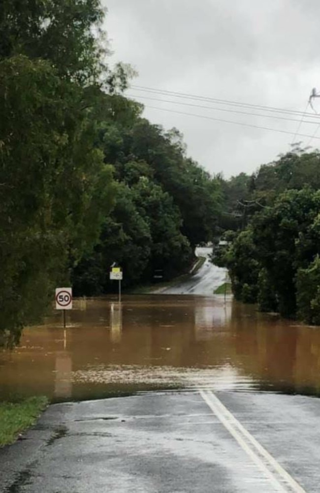
Communities across southeast Queensland are being warned to stay away from floodwater and avoid unnecessary travel.
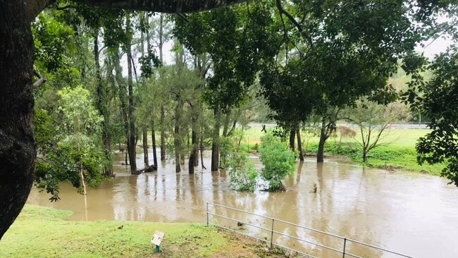
A flood warning has been issued for the Albert and Logan rivers, with their catchment areas now saturated with renewed river level rises expected with forecast rainfall.
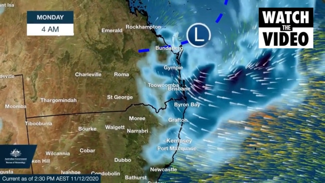
Gold Coast Mayor Tom Tate says he expects the worst of the extreme weather system to hit at 2am Monday and continue until at least 11am.
Some parts could be hit by another 300mm, which could coincide with king tides.
Cr Tate said areas on the Gold Coast most at risk included Tallebudgera, Currumbin Valley and the hinterland.
Twenty caravans at Murwillumbah in northern NSW have been evacuated and residents moved to higher ground.
Nearby, a number of horses remain stranded in floodwaters with emergency crews unable to reach them.
It comes after parts of southeast Queensland have recorded more than 500mm since Saturday morning.
“We’re only halfway,” Cr Tate said.
“We haven’t quite dodged a bullet yet, but we’re bunkered down and making sure we watch and remain alert.”
Cr Tate said there was potential for evacuations if flooding escalated and disaster centres would be activated when necessary.
“That decision will be made well in advance.”
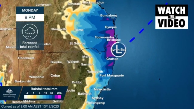
LATEST RAINFALL TOTALS
Friday 9am to Sunday 5pm
Upper Springbrook - 534 mm
Tomewin - 401mm
Lower Springbrook - 388mm
Upper Tallebudgera - 386mm
Binna Burra - 292mm
Coolangatta - 216mm
Sunshine Coast Airport - 157mm
Brisbane - 41mm
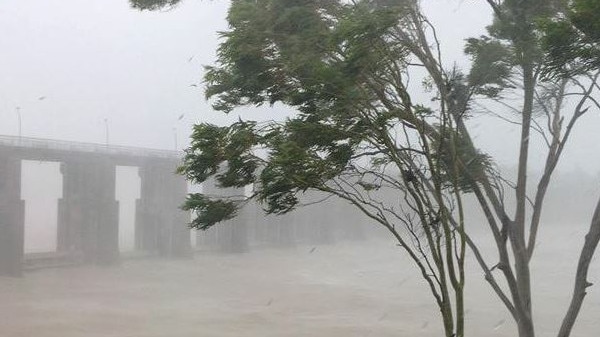
Redland City Council has established self serve sandbagging stations in preparation for forecasted heavy rain, damaging winds and abnormally high tides from late tonight, Sunday and Monday.
The Queensland Fire and Emergency Service has warned most of the severe weather is expected tonight and into Monday.
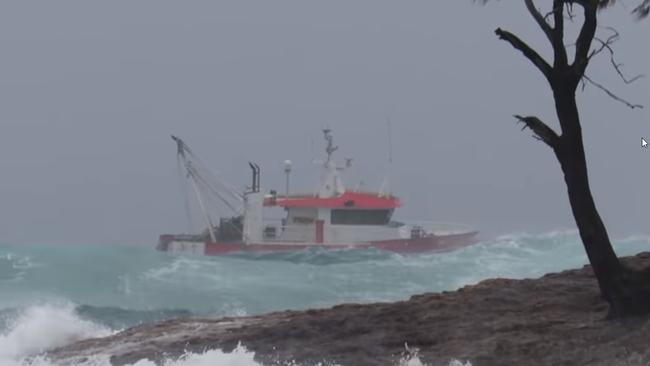
It comes after almost 300mm of rain was dumped on parts of the southeast in just six hours overnight, while waves reached up to 10m off the coast.
Meteorologist Jonathan How described the overnight rainfall as “relentless” and said the weekend’s falls were the most significant rainfall event since February.
The Gold Coast saw rainfall totals of up to 475mm in the 24 hours to 9am Sunday while the worst of the heavy rain was yet to reach Logan, Brisbane and the Sunshine Coast.
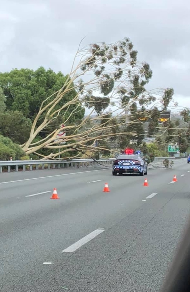
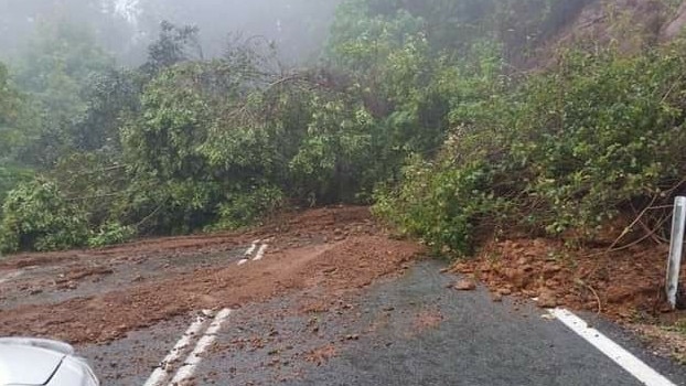
Debris from the heavy falls have affected traffic across the Gold Coast, with a tree blocking two northbound lanes of the M1 at Nerang.
Meteorologist Jonathan How said almost half a metre had already fallen in the Gold Coast hinterland’s Upper Springbrook.
“Rainfall overnight on Saturday night has been relentless, and huge totals were recorded on both sides of the border,” he said.
“Warnings are current for heavy rainfall and damaging winds to 90km/hr while king tides and damaging surf could generate considerable coastal erosion.”
“This is the most significant rainfall event since February and flooding will pose a risk to many people.”
Meteorologist Rosa Hoff said rain would increase in the late afternoon.
“We’re expecting to continue to see rain and showers among southeast Queensland today. We did have a period of very intense rainfall from about midnight until 6am overnight, that has since eased back to the current level of showers and rain,” she said.
“It’s likely that we’ll see rainfall pick up from late this afternoon, into this evening and overnight and we could potentially see intense rainfall over the southeast overnight tonight from about Hervey Bay all the way down to New South Wales.”
With temperatures expected to remain cool, Ms Hoff said there was a flood watch for the entire southeast region.
Further rainfall totals of up to 150mm are predicted on the Gold Coast, while Brisbane could see another 80mm fall, and on the Sunshine Coast up to 120mm is predicted.
“We do currently have a flood watch, which is current for pretty much all regions from Hervey Bay down to the Gold Coast and then over the border in New South Wales,” Ms Hoff said.
“We’ve had an upper trough stall over southeast Queensland yesterday and into today, l now that’s slowly driving the development of a coastal trough which is what’s going to reintensify our rainfall later today.”
As at 8am the State Emergency Service had received 240 requests for assistance across the state since 6pm last night.
A Queensland Fire and Emergency Service spokeswoman said the majority of the calls were for the Gold Coast area but there have been several calls for assistance in Ipswich and Logan as well.
She said most of the calls were for tarp requests and leaking roofs after a massive deluge of rain fell overnight.
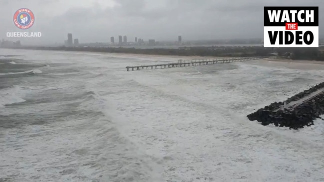
Flash flood warnings are in place stretching from the Gold Coast, through Brisbane and up to the Sunshine Coast as rapidly worsening wild weather lashes the region.
The Bureau of Meteorology warns heavy rain, dangerous winds, abnormally high tides and dangerous surf will continue across Sunday.
The Queensland Government’s Brisbane wave monitoring website recording a huge 10m swell before midnight off the shore of North Stradbroke’s Point Lookout.
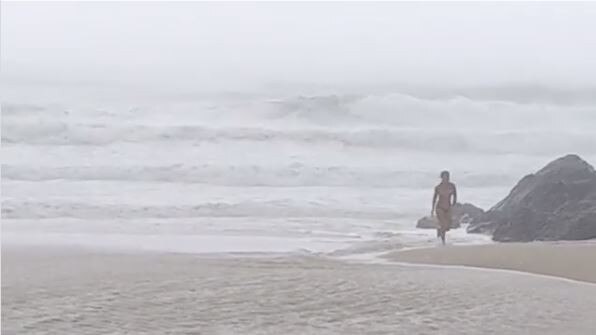
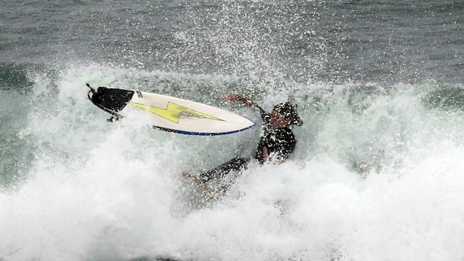
All Gold Coast beaches are today closed, as are many Sunshine Coast beaches.
Upper Springbrook recorded 475mm of rain in the 24 hours to 9am Sunday, 279mm of which fell within the 6 hours until 1am.
Tomewin has recorded 370mm in the 24 hours to 9am Sunday, 274mm was observed within the 6 hours to 1am.
Currumbin Creek has recorded 378mm until 7am Sunday, 264mm was observed within the 6 hours until 1am.
Tallebudgera saw 378mm fall until 9am Sunday while Binna Burra recorded 254mm, Tallai received 149mm and Carrara had 134mm.
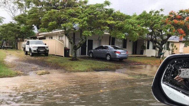
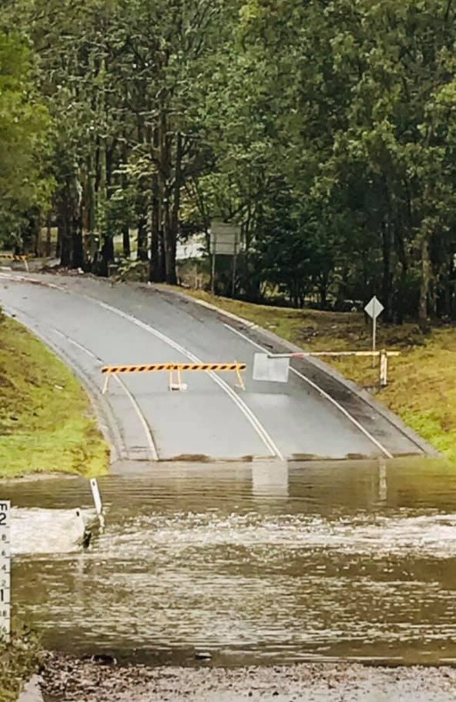
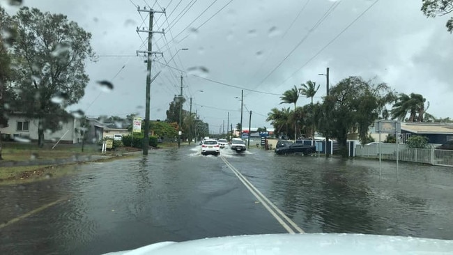
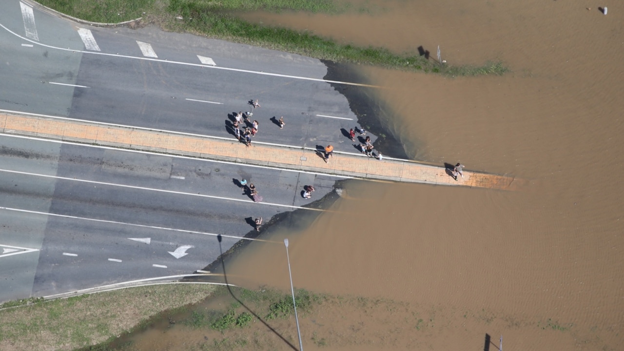
Many areas on the Gold Coast are now flooded.
Hardy’s Road has been closed to all traffic in Bonogin while flash flooding has impacted Somerset Drive between Bonogin Road and Gold Coast Springbrook Road in Mudgeeraba.
SEQ Water said the Little Nerang Dam was spilling and warned of potential safety hazards downstream.
In the Logan-Albert region, O’Reillys saw 276mm dumped from 9am Saturday to 9am Sunday, while Darlington received 199mm.
Further north, Inala saw 70mm fall in the 24 hours to 9am Sunday, Calamvale had 69mm dumped, Oxley Creek saw 62mm fall, Greenbank had 58mm, Archerfield saw 56mm and Forest Lake received 53mm. Brisbane city saw 15mm fall in that time frame.
Surf Life Saving Queensland said beaches at Alexandra Headland, Boardwalk, Bribie Island, Coolum, Kawana, Kings Beach, Marcoola, Maroochydore, Mooloolaba, Mudjimba, Peregian, Sunrise, Sunshine and Twin Waters were all closed.
Abnormally high tides exceeding the highest tide of the year are expected to develop about the southeast Queensland coast on Sunday morning’s high tide.
Dangerous surf conditions are also expected to develop during Sunday and in combination with the abnormally high tides could lead to significant coastal erosion about areas exposed to wave action.
The BOM warns locations in the firing line of the severe weather include Gold Coast, Brisbane, Moreton Island, North Stradbroke Island, Sunshine Coast and adjacent hinterland areas, Fraser Island, Caboolture, Cleveland, Redcliffe, Jimboomba, Beaudesert and Springbrook.
The worst of the weather system is expected later today.
RAINFALL TOTALS IN THE 24 HOURS TO 9AM SUNDAY
Upper Springbrook – 475mm
Currumbin Creek – 370mm
Upper Tallebudgera – 346mm
Lower Springbrook – 338mm
Springbrook – 318mm
Binna Burra – 254mm
Bonogin – 170mm
Bli Bli – 60mm
Picnic Point – 58mm
Brisbane – 32mm
Maroochydore – 35mm
OVERNIGHT: Southeast warned as deluge threatens
Weather experts are warning southeast Queenslanders not to be complacent, as warnings of flash flooding and severe weather look set to come to fruition today.
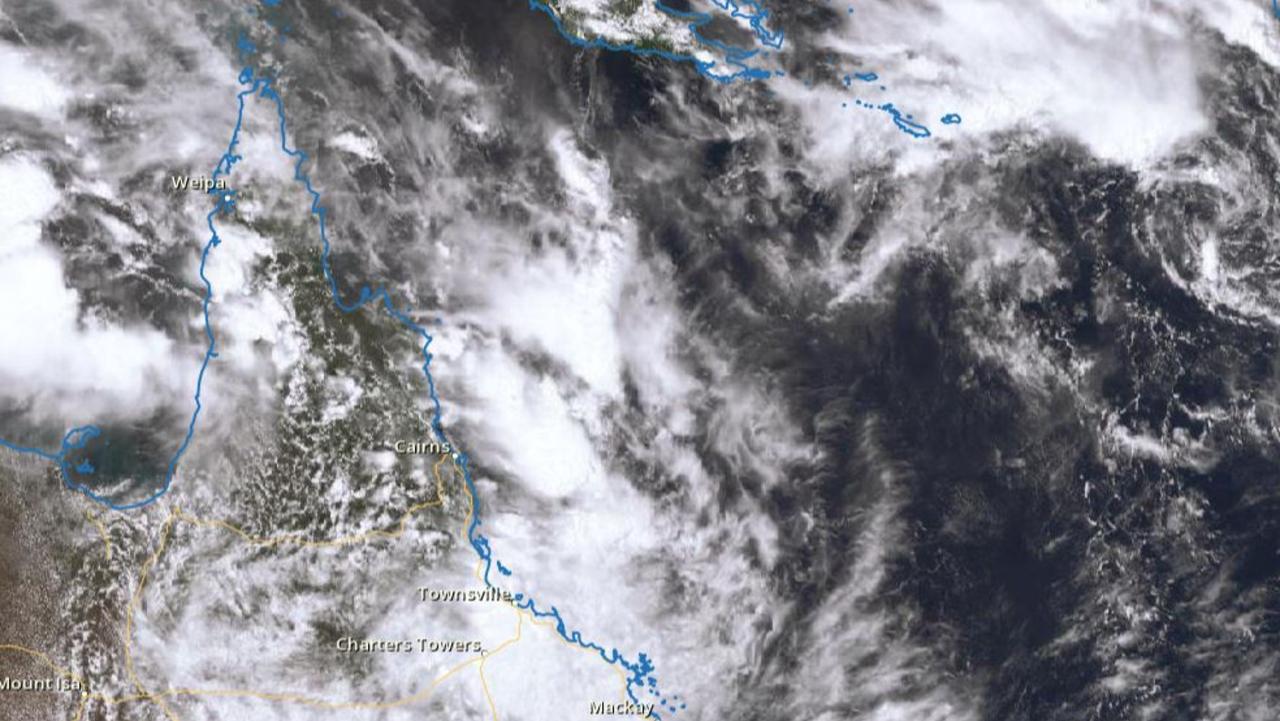
A severe weather warning from the Bureau of Meteorology has joined existing flood and hazardous surf condition alerts, as a system that already dropped 180mm on northern NSW continues north.
Forecasters say it is expected to hit Queensland’s southeast today, with isolated falls of 150mm forecast from Coolangatta to the Sunshine Coast.
More than 60mm fell in just an hour on the Gold Coast as a large system moves over the southeast.
Hinze Dam on the Gold Coast Hinterland recorded 63mm between 8pm and 9pm on Saturday night, while Coolangatta copped 90mm in 12 hours from 9am Saturday.
Coomera recorded 43mm between 7pm and 8pm.
A flood watch from the Bureau of Meteorology has warned all significant catchments along the southeast are at risk.
A flood watch has been issued for parts of the state stretching from Fraser Island to the Tweed with water catchments, including the Brisbane River, likely to be affected on Sunday and Monday.
BOM meteorologist Harry Clark said minor flooding is likely, with river rises which could possibly affect transport routes.
“Because this rainfall is so dependent on exactly where the low forms it’s quite difficult to say exactly where but really anywhere from the Sunshine Coast down to the Gold Coast is at risk,” Mr Clark said.
“Anywhere between 100mm and 150mm are possible in isolated high totals with some fairly widespread rain, which is when we’re likely to see the most damaging falls.”
BOM have warned people to stay away from beaches with dangerous surf conditions, coastal erosion and inundation likely.
“Its almost like a trifecta of things coming together, we do have some tide shifts so the normal tide is really high, combined with gale force winds and some dangerous surf as well,” Mr Clark said.
“It’s a particularly good day to stay away from the beach and even those higher tides getting in to the tidal creeks and catchments around the usual spots like Windsor and Albion that tend to get inundated will be at risk as well.”
QFES issued a reminder for people to prepare for the weather event by tying down loose items, having an emergency plan ready to clear gutters and remove debris from the home.
It comes as parts of the state yesterday recorded over 90mm of rain in 24 hours, with the Sunshine Coast and North Stradbroke receiving 93mm and 91mm respectively.
Meanwhile parts of the Gold Coast recorded over 30mm and Brisbane recorded just under 20mm.
North Queensland also continued to be drenched through ongoing monsoon conditions, with scenes out of Julia Creek showing backyards normally sunburnt completely flooded with water.
Join the conversation
Piles of heartbreak: Ingham counts devastating cost of floods
The Hinchinbrook region has begun counting the cost caused by the “perfect storm” as talk turns to potential buybacks and re-building homes ravaged by the floods.
Read more
Search for man missing in flood waters as NQ faces another 300mm monster
A search and rescue mission is underway in NQ for a man who drove into flood waters while the region braces for an active monsoon trough expected to dump falls of up to 300mm.
Read more