
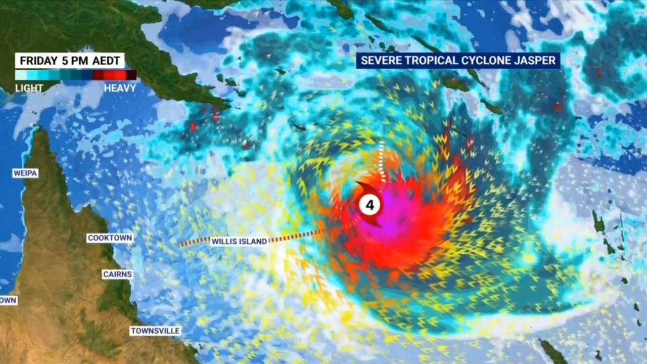
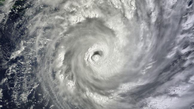
Tropical Cyclone Jasper: Storm could be worse than Yasi
The impact from Cyclone Jasper on parts of the state’s Far North may be more intense than 2011’s catastrophic Yasi, weather experts warn.

QLD weather news
Don't miss out on the headlines from QLD weather news. Followed categories will be added to My News.
The impact from Cyclone Jasper on parts of the state’s Far North may be more intense than 2011’s catastrophic Cyclone Yasi.
Sky News Weather meteorologist Rob Sharpe said while the system’s scope and severity broadly pales in comparison to Cyclone Yasi, specific locations may face worse impacts.
“This one is expected to be smaller in its region of gales around the system, so it’s unlikely to have as broad an impact as Yasi and it’s unlikely to have as severe an impact at the landfall point,” he said.
“But for areas around Cairns, there’s potential that the impact could be worse than what was experienced during Yasi.”
Mr Sharpe said the worst impacts would be wherever the cyclone directly hit, and just south of that region.
“When Yasi made landfall, it was just south of Innisfail, more than 100km south of Cairns, who did get some gale-force winds and some rain, but it wasn’t crazy,” he said.
However, 50km south of Innisfail, Mission Beach had a huge storm surge and torrential rain and extreme winds.
“So I’d say to people who experienced Yasi, don’t just think that this one’s going to be smaller, so it’s not going to be as bad,” Mr Sharpe said.
“It really depends on exactly where you are and exactly how the system will impact you compared to Yasi.”
Mr Sharpe said the only similarities between Jasper and the category 5 Yasi were in how they formed. “The two systems were both formed way out to sea from Queensland and both become severe tropical cyclones very early in their life cycle, but one of the differences is its weakening phase,” he said.

The Bureau of Meteorology’s Tropical Cyclone Warning Centre said while the timing of a coastal impact remained uncertain, Jasper’s approach would bring a risk of re-intensification and the potential for severe impacts.
“So it might be a severe system on landfall, but it’s unlikely to be at category 5,” Mr Sharpe said.
Tropical Cyclone team leader Andrew Burton agreed, and said Jasper was “nothing like Yasi in lots of different ways”.
“Yasi was a category 5 cyclone coming on to the coast; there is an extremely low chance of this system being category 5, and a very, very low chance of being category 4,” he said. “There’s a chance that it’s category 3, as it comes into the coast … and is actually more likely that it’s going to be category 1 or 2.”
Mr Burton said the risk of storm surge, the most deadly and destructive impact from any cyclone, depended on tide conditions but was much lower with Jasper.
Mr Sharpe added that king tides forecast during the week combining with a storm surge could be “really bad news” for where Jasper makes landfall.
“That was kind of the case with Yasi, it made landfall as the tide was dropping and there was still a 5m storm surge at Mission Beach,” he said.
“It could have been much worse if it was making landfall at high tide or (a) king tide.”
WHAT ARE THE CYCLONE CATEGORIES?
Category: 1 – Tropical Cyclone
Strongest gust: Less than 125 km/h. Gales
Typical effects: Minimal house damage. Damage to some crops, trees and caravans. Boats may drag moorings.
Category: 2 – Tropical Cyclone
Strongest gust: 126-164 km/h. Destructive winds
Typical effects: Minor house damage. Significant damage to signs, trees and caravans. Heavy damage to some crops. Risk of power failure. Small boats may break moorings.
Category: 3 – Severe Tropical Cyclone
Strongest gust: 165-224 km/h. Very destructive winds
Typical effects: Some roof and structural damage. Some caravans destroyed. Power failure likely.
Category: 4 – Severe Tropical Cyclone
Strongest gust: 225-279 km/h. Very destructive winds
Typical effects: Significant roofing and structural damage. Many caravans destroyed and blown away. Dangerous airborne debris. Widespread power failures.
Category: 5 – Severe Tropical Cyclone
Strongest gust: More than 280 km/h. Extremely destructive winds
Typical effects: Extremely dangerous with widespread destruction.
Source: Get Ready Queensland
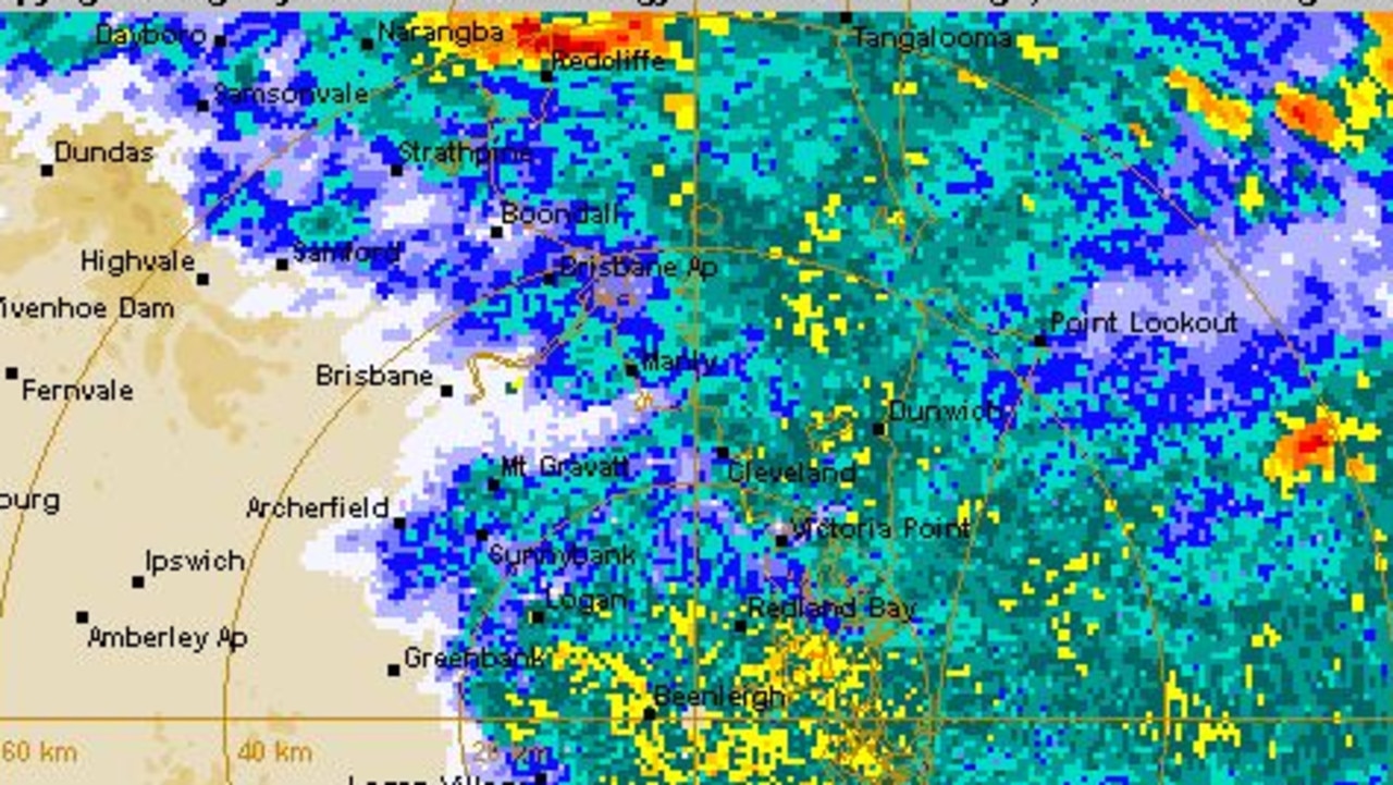
Severe weather warnings continue after supercell storms smash SEQ
Brisbane, Moreton Bay and parts of Wide Bay are in the firing line for more severe weather this evening after the South East was smashed with supercell storms leaving 3000-plus without power.
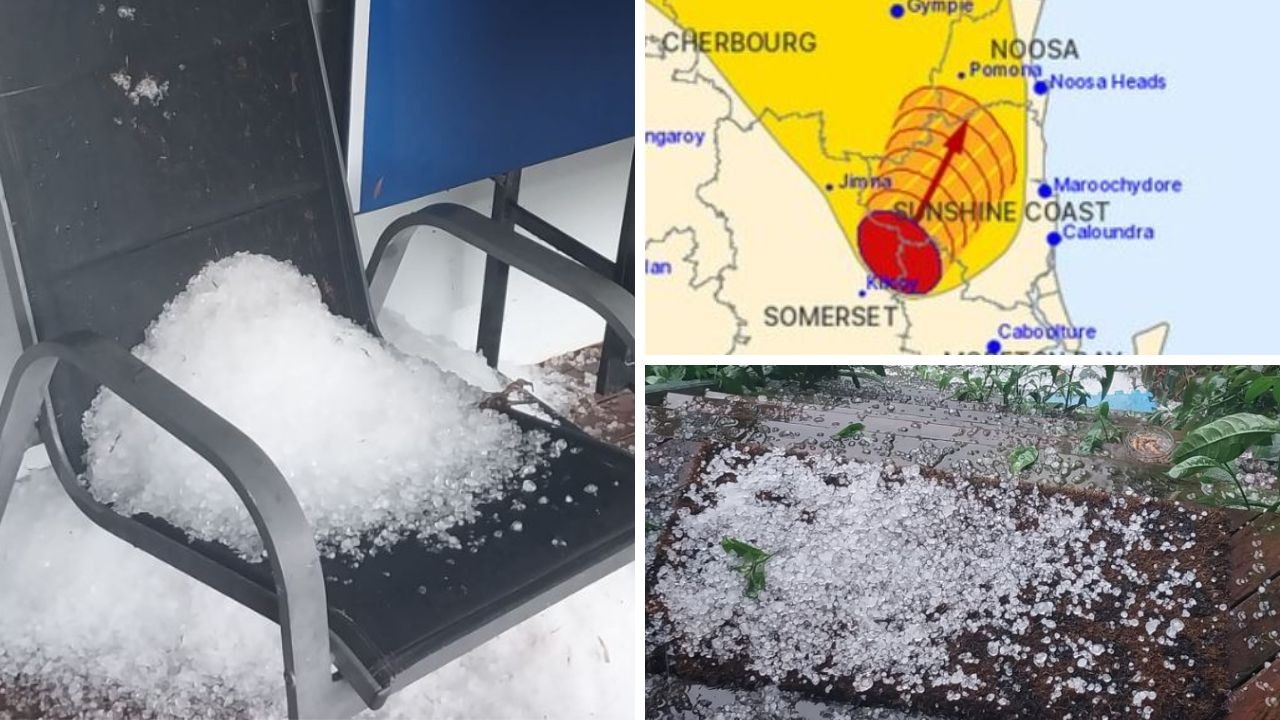
Wild hailstorm slams into Sunshine Coast, warning active
A severe storm warning has been issued for areas of north of Brisbane with large hail and damaging winds likely. Hail has been recorded across the Sunshine Coast.