Three more months of drenching rain as triple La Nina smashes Queensland
Queensland is set to experience its third consecutive year of La Nina, with a ‘rare double’ of climate drivers ensuring the state gets no reprieve from drenching rain.
QLD weather news
Don't miss out on the headlines from QLD weather news. Followed categories will be added to My News.
A ‘rare double’ of climate drivers will ensure Queenslanders will get no reprieve from wet weather into winter and spring.
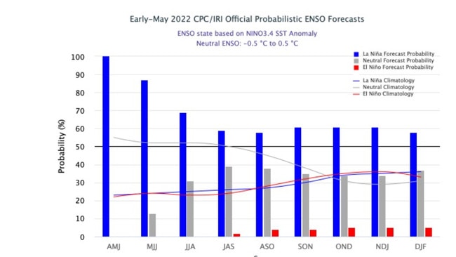
La Nina, which began more than 18 months ago, is likely to continue for its third consecutive year, with the event threatening the sunshine state with above average rain into spring.
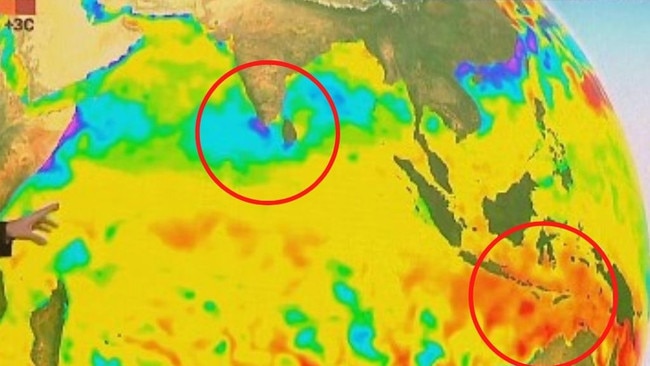
The cold weather event is accompanied by a Negative Indian Ocean Dipole, a separate event originating in the Indian Ocean, with both likely to impact weather across the country.
After a month of cloudy and rainy conditions, Brisbane has recorded its wettest start to a year since 1974 and its third wettest year on record, with data dating back to the early 1800s.
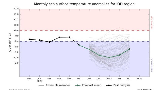
“Since 1960 we’ve only had five years with both a Negative Indian Ocean Dipole and a La Nina, so it’s a rare double.” Sky News Meteorologist Tom Saunders said.
“In the past when we’ve had both of those climate drivers, it’s led to exceptionally wet years across Australia.”
Brisbane’s annual average of rainfall is up 400mm and as of 9am this morning, Brisbane’s total rainfall has reached 1566mm.
The prolonged wet weather conditions comes as Brisbane is forecast to reach single-figure minimums late next week, with the lowest temperature predicted to be 9C.
Queensland will experience a minimum decile of seven compared to data from 2010.

