
‘Significant’ rain set to return following late storms in Central Queensland
Queensland is in for a week of unsettled weather and “seasonally significant” rainfall, with parts of the state likely to receive up to 100mm of rain before the weekend.


QLD weather news
Don't miss out on the headlines from QLD weather news. Followed categories will be added to My News.
Queensland is in for a week of unsettled weather and “seasonally significant” rainfall as an upper level trough moves northwest through South Australia and into western Queensland.
Bureau of Meteorology forecaster Kimba Wong said the risk of thunderstorms would increase throughout the week, with “broad” parts of the state likely to receive more than 50mm accumulated rainfall before next weekend.
“Sunday and Monday the focus will be most of western Queensland, so areas like the Channel Country will get some good rain,” Ms Wong said.
“Then on Tuesday and Wednesday the area of interest will shift to mostly southeast of Longreach around the Warrego district, before concentrating more on the coastal areas by Thursday.”
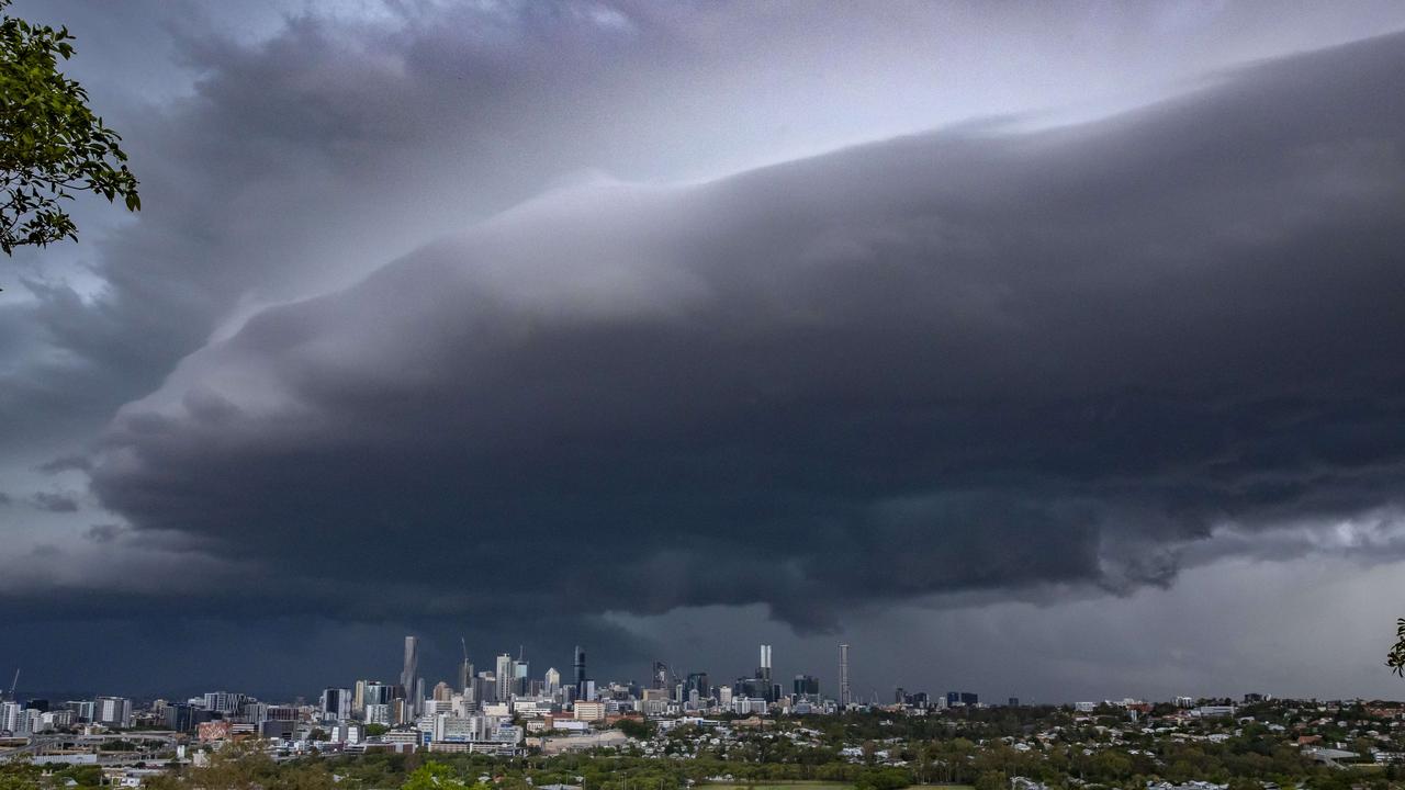
Monday’s storm forecast anticipated the possibility of severe thunderstorms that could deliver damaging winds, large hail and heavy rainfall over a large portion of the state, with the most likely to be affected being Central Queensland and Capricornia.
South East Queensland from the coast to the Darling Downs and Granite Belt is in the possible firing line, as are the Northern Goldfields and Gulf Country.
⛈ï¸Storm Forecast for TUESDAY 18/10⛈ï¸
— Bureau of Meteorology, Queensland (@BOM_Qld) October 17, 2022
Severe storms w damaging winds, large hail & heavy rain possible in western Qld tomorrow, likely in the far west. More dangerous storms w destructive winds, giant hail, intense rain possible in red area.
Local forecasts https://t.co/YST1SMRoT2 pic.twitter.com/gwKmEddba2
Ms Wong said parts of western Queensland could experience between 15mm and 30mm on Tuesday, while the Warrego region could see between 20mm and 40mm on Wednesday.
Emerald in Central Queensland is expected to get 100mm across the week, with the heaviest falls coming on Thursday.
“Accumulated totals will be the one to watch because a lot of these areas have already received above average rainfall in the last month and with broad parts of Queensland expecting more than 50mm throughout the week we have not ruled out issuing flood warnings.”

Ashgrove dad James Downton said he and his family were fortunate they made the most of the sunshine over the weekend prior to this week’s wet weather forecast.
“We were really lucky when we out, it was a complete blue sky and not a cloud in sight, and then obviously later in the day it got a bit more overcast, so we’re certainly lucky we got up nice and early”.
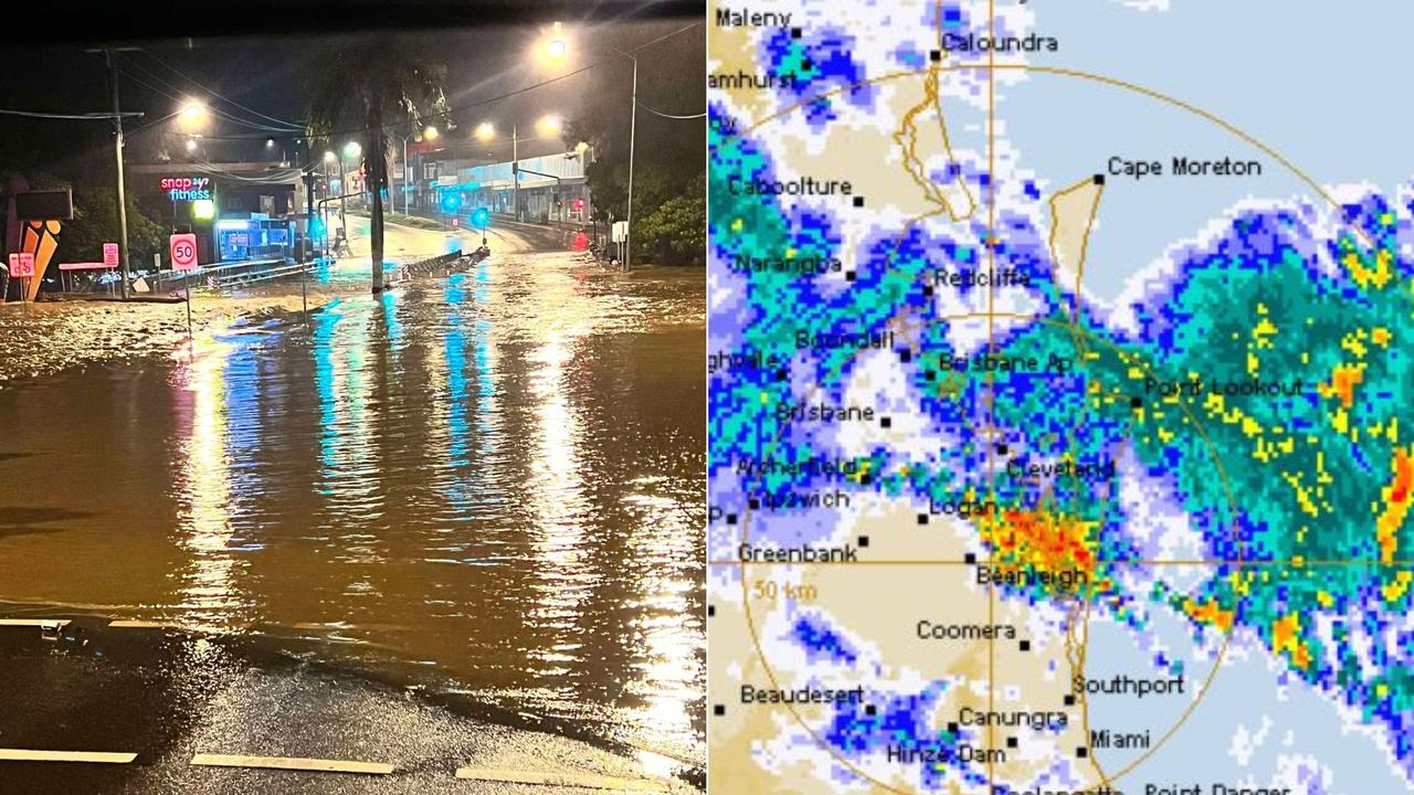
On Sunday evening, severe thunderstorm warnings were issued for parts of Queensland, with the Bureau of Meteorology warning of damaging winds, large hailstones and heavy rain.
The warning was for people in parts of Central Highlands and Coalfields and Capricornia forecast districts.
Wind gusts of 94kmh were recorded at Cloncurry just before 3pm following an earlier storm.
More Coverage


Active severe storm threat, flash flooding after 234mm rain bomb
The weather bureau has issued a severe thunderstorm warning for parts of South East Qld this morning after a monster overnight downpour caused flash flooding.
SEQ to be lashed with storms, 100mm downpour ahead of Anzac Day
Showers and storms are forecast to soak South East Queensland on Thursday afternoon with lingering rain expected to fall on Anzac Day Dawn Services and marches.