
Severe thunderstorms and possible flash flooding to smash South East
Severe thunderstorms are expected to hit Brisbane tonight, with warnings the heavy deluge could bring dangerous flash flooding to already waterlogged areas.
Severe thunderstorms are expected to hit Brisbane tonight, with warnings the heavy deluge could bring dangerous flash flooding to already waterlogged areas.
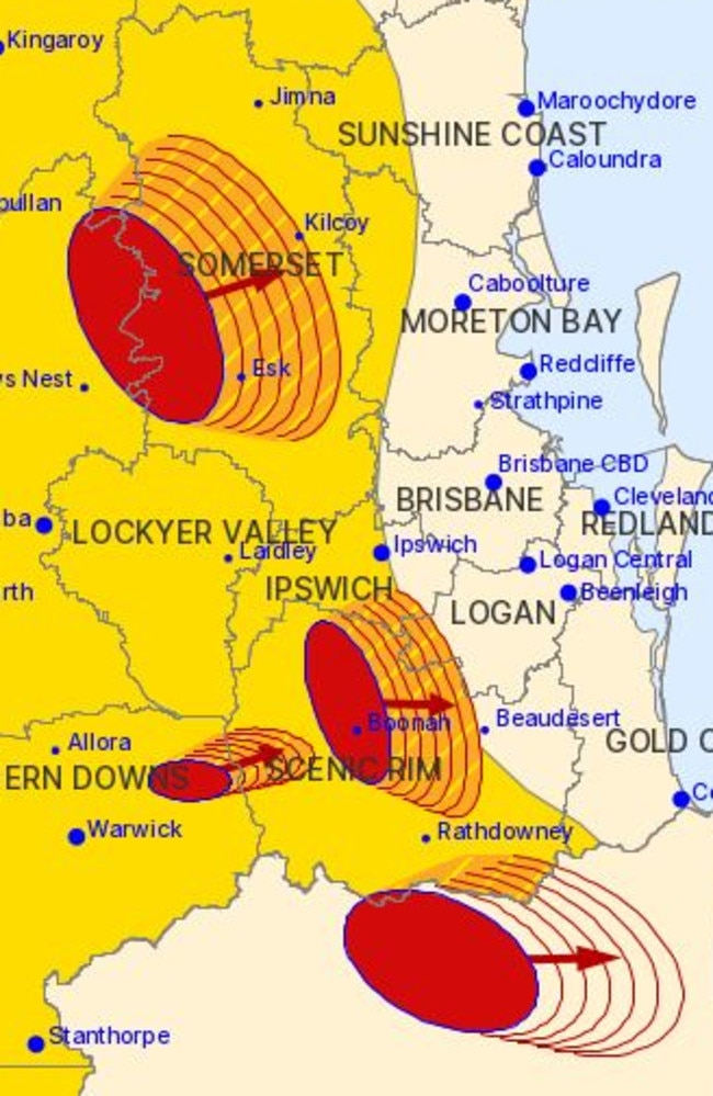
At 8pm The Bureau warned severe thunderstorms were due to hit Brisbane within the hour.
The storms, likely to produce heavy rainfall that may lead to flash flooding, were detected near Beaudesert, Jimna, Redbank Plains and the area north of Woodford at 7:55pm.
As they moved towards the northeast, The Bureau forecast to hit Beenleigh, Maleny and Borumba Dam by 8:25pm and Brisbane’s CBD, Maroochydore, Logan Central and Caloundra by 8:55 pm.
Mt Sugarloaf recorded 69mm in the 2 hours to 7:39pm
At 7pm, the Bureau said a very dangerous storm was located near Boonah, with the possibility of intense rain in the area.
The slow-moving storm was detected near Moogerah Dam and Aratula and moving toward Boonah.
Other severe storms likely to produce heavy rain were detected near Toogoolawah, Moore, Kooralbyn and the McPherson Range.
The Bureau said 52mm was recorded in one hour near Dalby this afternoon, with 40mm in 30 minutes at Giddi Giddi South, 77mm in an hour at Spicers Peak and 46mm in 30 minutes at Eskdale.
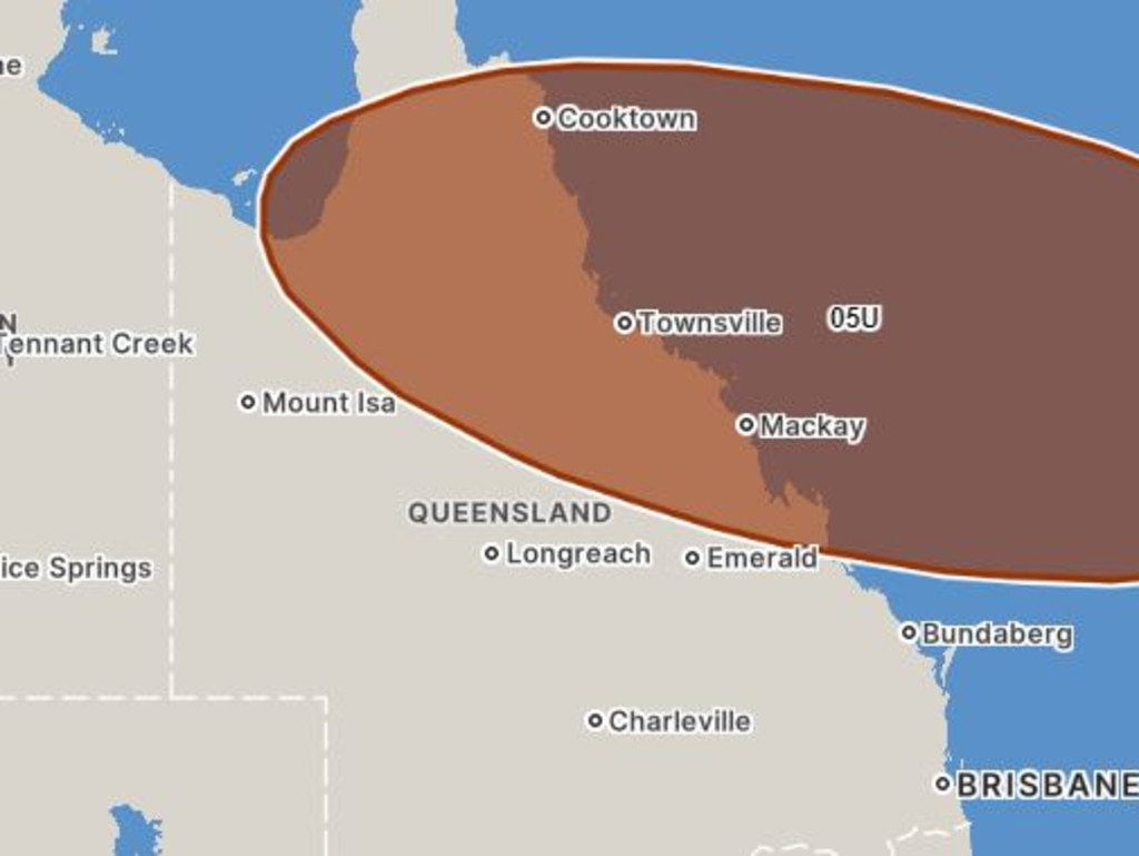
Meanwhile, the cyclone threat is fast closing in on Queensland, with a 75 per cent chance tropical low 05U will develop into a cyclone by Monday and begin tracking towards the coast.
This chance increases to 85 per cent on Tuesday and Wednesday.
The Bureau of Meteorology had previously forecast the tropical cyclone to develop on Wednesday, and is warning of “significant risk” and “severe impact”.
“There is a significant risk that this system may impact the Queensland coast during next week,” the Bureau said.
Communities along the entire east coast have been urged to stay up to date with forecasts and weather warnings.
A flood watch remains current for the Cape York Peninsula and parts of the Gulf of Carpentaria where the potential cyclone is forecast to make impact.
The monsoon trough extending over the northern breadth of the state and the Coral Sea will persist for several days, bringing heavy rainfall, storms and localised flooding to widespread areas.
The monsoon will also create abnormally high ties along the Gulf and Torres Strait for several days with the Bureau predicting sea levels to exceed the highest tide of the year.
The two combined weather systems will likely create catastrophic impacts for northern parts of the state.
Flood warnings are current for the Tully and Murray Rivers, Herbert River, Paroo River, Barcoo River, Bulloo River, Diamantina River, and Warrill Creek catchments.
Read related topics:Weather

