
Qld weather: Flood watch issued, SEQ drenched amid relentless rain
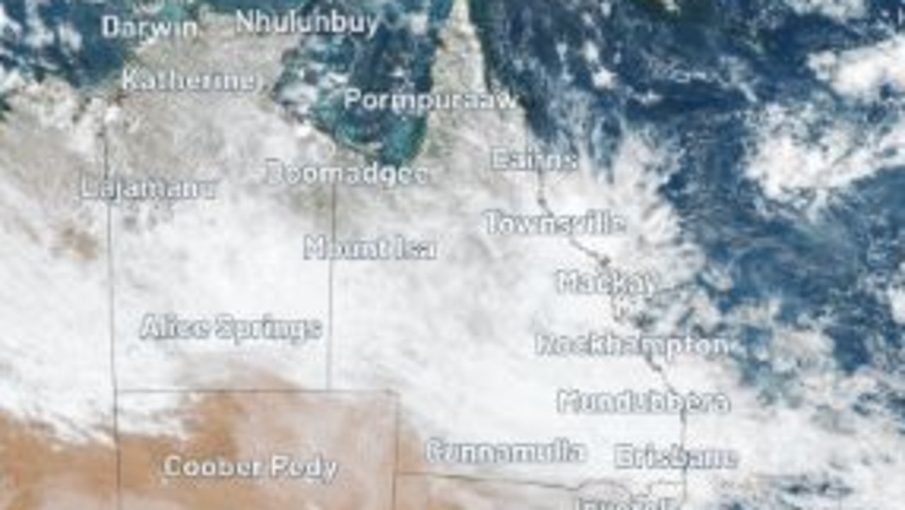
Relentless rain has fallen across South East Qld in the past day as a 7000km cloud band stretches from the Northern Territory to beyond New Zealand.
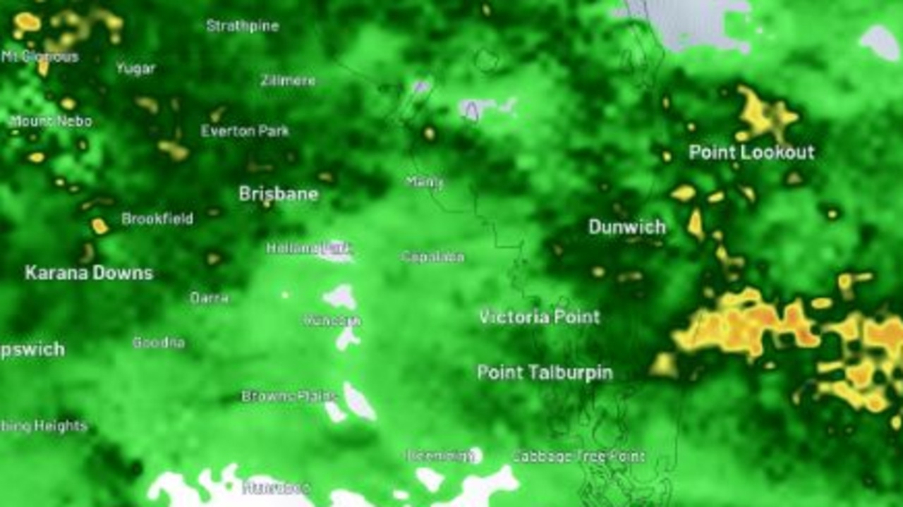
Relentless rainfall has hammered South East Queensland for more than three days now with radar images capturing showers approaching from two directions.
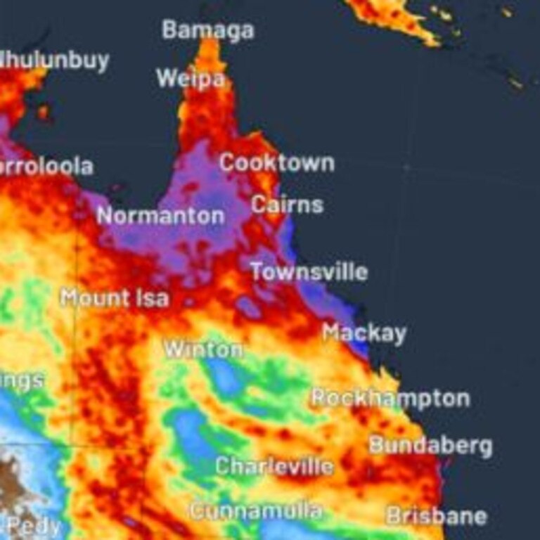
WeatherZone meteorologist Joel Pippard says the main feed of moisture is being caused by a low level trough with onshore winds blowing in from the east.
There is also an upper trough above Queensland around 5.5km up in the atmosphere with a feed of tropical moisture all the way from northern WA, according to WeatherZone.
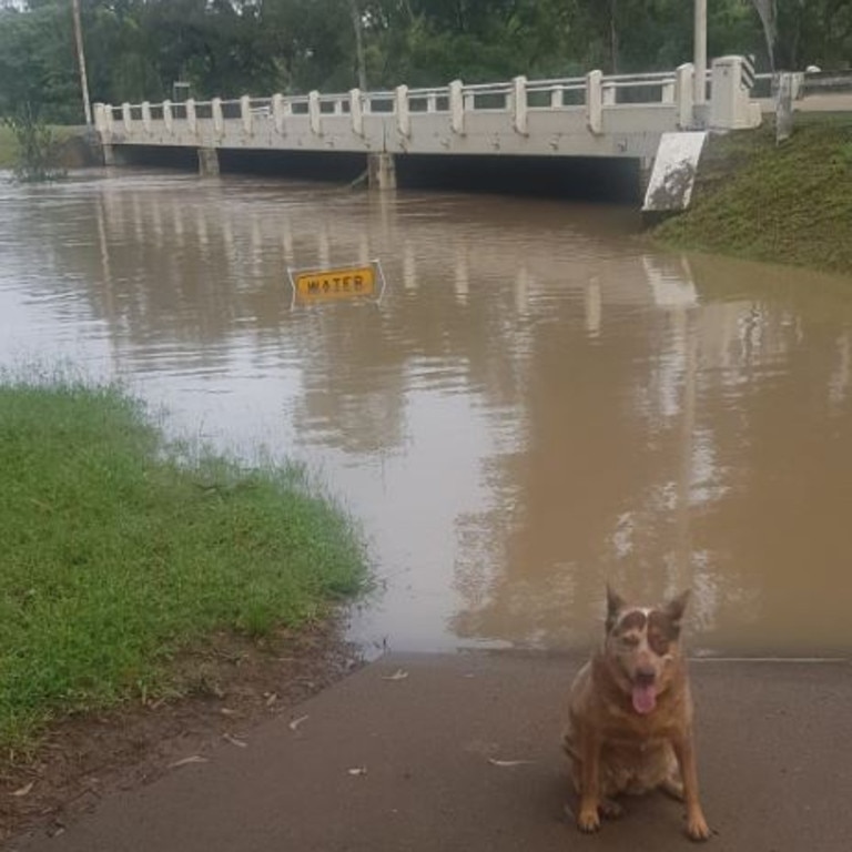
A flood watch has been issued for south west Queensland, with river level rises and minor riverine flooding possible.
Since 9am Tuesday, 91mm has fallen at Mt Tamborine, 78mm at Hinze Dam, 85mm at Dunwich, 77mm at Upper Springbrook and 71mm at Mudgeeraba.
In Brisbane, the heaviest falls have been at Lytton with 70mm, Manly 76mm, Kallangur and Hendra with 56mm, and Bracken Ridge with 53mm.
Further north, Maroochydore has recorded 54mm, Maleny 74mm and Palmview 71mm.
The Bureau of Meteorology has forecast rainfall totals to reach 20mm in Brisbane andon the Gold Coast on Wednesday, and up to 30mm in the Sunshine Coast as the rainband continues tracking north.
Temperatures are forecast to remain in the high 20s and low 30s across the entire state over the weekend, with Noosa, Mackay, Townsville, Cairns and Hamilton Island forecast to receive the final spout of heavy falls on Thursday, receiving around 10-15mm.
From Friday onwards, scattered shower activity will reduce to 1-5mm, with the exception of Cairns which will see up to 20mm, but the bureau has warned patchy showers will impact holidayers over the entire weekend.
Senior Meteorologist Steve Hadley said while grey skies and heavy falls would disappear by Friday, a high pressure ridge developing over eastern Queensland would bring strong winds and unfavourable sailing conditions.
“There will be patchy showers on the Gold Coast, Brisbane, Scenic Rim and Toowoomba from Thursday onwards, while widespread showers remain in Wide Bay Burnett and Capricornia until Friday as the cloud band retreats,” he said.
“It will then move offshore on Friday but residual wet season moisture will remain in the north with scattered light showers south.
“With the ridge pushing up that’s going to be clearing away some of the moisture from Townsville and Cairns which is why we see the reduction in rain activity from Saturday,” Mr Hadley said.
“It will also lead to strong winds over the South East coast and it means it won’t be that pleasant for sailing, but Sunday and Monday look better.”
It comes after days of torrential rain triggered by the remnants of Tropical Cyclone Megan and an associated low-pressure trough extending across the NT and Queensland.
Satellite images show that the moisture over northeastern Australia is also feeding a long band of cloud stretching over 7000km from the NT to the east of New Zealand.
Extreme weather watcher Thomas Hinterdorfer said the coastal trough was expected to become parked over the South East Coast, Wide Bay and Fraser Coast areas over the next 48-72 hours.
A small scale low pressure system developing offshore will enhance moisture being fed onto the coastline.
“This combination is expected to help produce increased rain areas and squally showers over the next 2-3 days with widespread falls of 50mm+ occurring over the South East Coast, Wide Bay and Burnett, along with some falls of more than 100mm,’’ Mr Hinterdorfer said.
“It wouldn't be a shock to see some isolated falls of more than 200mm either.”
Cold temperatures are accompanying the rain, with Brisbane already recording its lowest March temperature in 25 years.
Bureau of Meteorology senior meteorologist Steven Hadley said records look likely to be broken in Sunshine Coast, Tewantin and Kingaroy.
“Current record stands at 22.1C for Sunshine Coast Airport and that happened on the 30th of March 2003 … at the moment, it’s only 22C,” he said.
“Likewise at Tewantin … their record at the moment is 22.2C and that was on the 17th of March 2021, they have 29 years of data and currently they’re at 22.1C.
“Then Kingaroy … that previous current record stands at 19.9C that was on the 9th of March 2020 and they only got to 19.1C.”
FORECAST
BRISBANE
Tuesday: 7-40mm of rain with a top of 23C
Wednesday: 3-20mm of rain with a top of 26C
Thursday: 0-10mm of rain with a top of 27C
GOLD COAST
Tuesday: 10-60mm of rain with a top of 24C
Wednesday: 4-25mm of rain with a top of 26C
Thursday: 0-10mm of rain with a top of 27C
SUNSHINE COAST (Maroochydore)
Tuesday: High chance of rain with a predicted 10-40mm rain with a top of 23C
Wednesday: 6-30mm of rain with a top of 26C
Thursday: 0-10mm of rain with a top of 26C
More Coverage


Read related topics:Weather

