
Qld weather: Freak weather phenomenon Black Nor’easter threatens drenching rain, damaging winds, hazardous surf
Forecasters are concerned two intense storm systems could collide over South East Qld, bringing dangerous, torrential rainfall, as new warnings are issued. WATCH THE VIDEO
QLD weather news
Don't miss out on the headlines from QLD weather news. Followed categories will be added to My News.
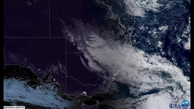
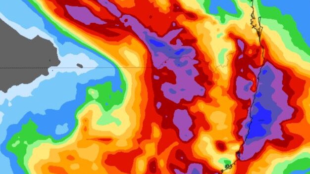
Two intense storm systems could collide over South East Queensland within the next 24 hours, possibly eclipsing the sun, dumping 300mm of rain and delivering 100km/h winds in a rare event dubbed the “Black Nor’easter”.
A Black Nor’easter occurs when a low interacts with a coastal trough along Australia’s eastern coastline, funnelling moisture and creating black cloud cover, usually during the months between autumn and spring.
Cool air from the upper trough collides with the building warm moisture leading to possible heavy rainfall, flash flooding, damaging winds and hazardous surf.
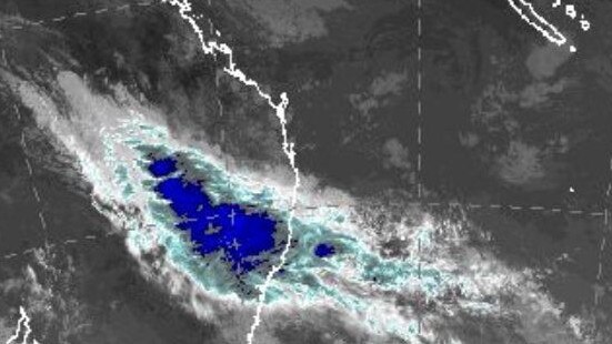
Several waterspouts could simultaneously form off the coastline, with damaging winds reaching up to 100km/h also possible.
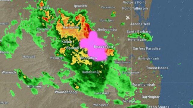
As conditions deteriorate, a severe thunderstorm warning has been issued at 5.16pm for people in parts of the Maranoa and Warrego, Darling Downs and Granite Belt and Central Highlands and Coalfields forecast districts.
It warns that thunderstorms causing heavy rainfall continue along a trough from the Central West to the Darling Downs.
“Severe thunderstorms are likely to produce heavy rainfall that may lead to flash flooding in the warning area over the next several hours," the warning said.
“Locations which may be affected include Inglewood, Injune, Texas and Millmerran.”
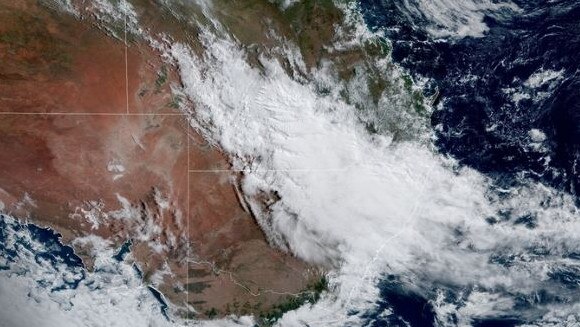
Senior meteorologist Felim Hanniffy said the significant upper-level low making its way through Queensland’s interior down to New South Wales was extremely stagnant and would likely sit for “a couple of days”.
The spiralling system is expected to draw in large amounts of moisture, which will fuel severe storms and cause heavy downpours.
Mt Hanniffy said an additional developing trough off the east coast would also likely track south over South East Queensland into New South Wales.
The trough could also end up travelling east, meaning it would likely “lose steam” and fizzle out.
If it tracks south, it will join forces with the interior low and bring dangerous, heavy falls to the South East over the weekend.
“The knock-on effects will be heavier rainfall across southern Queensland,” he said.
“The slow moving upper low to the west will help aid the development of the coastal trough, but a lot hinges on how the trough evolves.”
The two systems will likely bring isolated falls reaching 100mm, with coastal areas in the firing line of both systems seeing possible falls of over 200mm on Friday and Saturday.
Inland areas will likely see the most rain on Thursday and Friday.
“Certainly there is risk today and tomorrow for inland showers in excess of 100mm,” Mr Hanniffy said.
“The western half of the Darling Downs, and eastern half of Warrego are most at risk.
“Coastal areas, rainfall will depend on how slow moving the coastal trough is, but we could see hundreds of millimetres (of rain).”
Mr Hanniffy urged holidayers to be aware of the forecast, check road closures and never drive in flood waters.
“The storms can form at any time and continue into the night,” he said.
Flood risk begins to ease on Sunday, with rainfall tapering off on Monday and Tuesday as the main storm system crosses down into New South Wales.
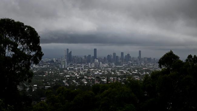
The term Black Nor’easter was first used in the 1800s and references the extraordinarily dark cloud cover that can quickly eclipse the sun in the middle of the day.
The Bureau of Meteorology has forecast a high-pressure system “directing moist easterly winds” on to the Queensland coast that will combine with the upper trough from Thursday and into the weekend.
The Black Nor’easter system is forecast to bring thunderstorms and heavy rain over inland parts of southern Queensland, and northeast New South Wales, producing intense falls of up to 300mm across three days.
It comes after more than 150mm fell at Greenbank and Jingle Downs, causing flash flooding.
Tragically, a man was found dead next to a car that became stranded in floodwaters at Greenbank, south of Brisbane, early Thursday morning.
A storm warning was this morning issued for the Maranoa and Warrego and Central West forecast areas, with several rivers and catchment areas on flood watch in anticipation of further drenching from the near-stationary trough.
Catchments likely to be affected include:
Condamine Rivers
Macintyre River
Weir River
Moonie River
Balonne River (Minor flood warning current from earlier rainfall)
Wallam and Mungallala Creeks
Warrego River (QLD)
Paroo River (QLD)
The following watches/warnings are current:
Initial Major Flood Warning for the Lower Brisbane River catchment
Moderate Flood Warning for Eyre Creek and Minor Flood Warning for the Georgina River
Minor Flood Warning for the Balonne River
Minor Flood Warning for the Bulloo River
Minor Flood Warning for the lower Flinders River
Minor Flood Warning for the Norman River and Final Flood Warning for the Gilbert River
Minor Flood Warning for the Thomson River and Final Flood Warning for the Barcoo River
Flood Warning for the Diamantina River
Final Flood Warning for the Dawson River
Final Flood Warning for the Nicholson and Leichhardt Rivers
Final Flood Warning for the Paroo River (QLD)
Initial Flood Watch for parts of southern Inland and Southwest catchments
More Coverage


Read related topics:Weather
SEQ sunshine for Easter break as inland ocean inches toward border
Showers are clearing after a wet weekend in south east Queensland, with a forecast of sunny days ahead of the Easter break.
Read more

Outback dream wiped out by flood disaster as repair bill tops $1m
The owners of an outback motel face a $1m repair bill in the wake of the once-in-a-generation flood in Thargomindah.
Read more