
Qld cyclone Oma: Fears turn to severe beach erosion
Cyclone Oma might not make landfall in southeast Queensland, but she’s still making her presence felt, with the Bureau of Meteorology reporting wind gusts of more than 110km/h and waves of up to 13m. | MORE AMAZING PHOTOS
QLD weather news
Don't miss out on the headlines from QLD weather news. Followed categories will be added to My News.
CYCLONE Oma will not likely make landfall this weekend but a severe weather warning will remain in place for southeast Queensland.
Bruce Gunn from the Bureau of Meteorology said the cyclone and flood watch had been cancelled but hazardous conditions would be felt along the state’s beaches.
Queensland king tides: Brisbane River inundates low-lying areas
Cyclone watch issued as Oma approaches southeast Queensland coast
Water over roads through Brisbane as king tides and cyclone combine
“There is a lot energy being handed out by TC Oma,” he said. “The diameter of this cyclone is huge.”
The scale of the system, coupled with abmormally high tides, means the state’s treasured tourist beaches face their most severe erosion threat in decades.
Oma has weakened to a Category One system but is expected to re-intensify.
As of 10am, it was located about 640km northeast of BRisbane
It is expected to re-intensify to Category 2 oday and continue moving in a generally south to south-westerly direction into early Saturday.
Its motion was then expected to shift slowly to the north during Saturday, remaining offshore through the weekend and early next week.
The Bureau says there was a wind gust of 113km/h reported recorded at Cape Moreton this morning, and 109km/h gust recorded at Double Island Point.
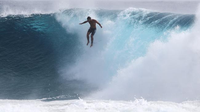
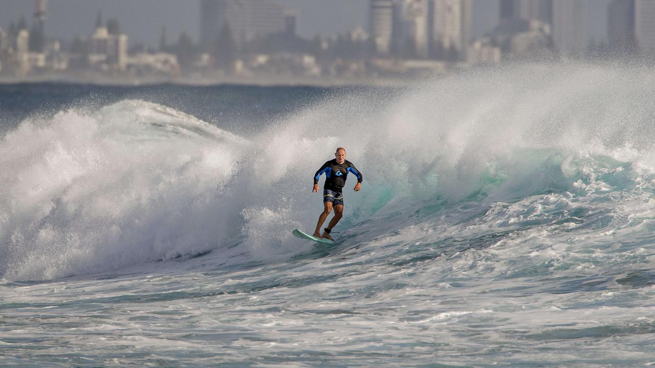
Wave heights of 12 to 13 metres have been detected at Mooloolaba and off Point Lookout, which is bigger than those recorded in cyclone Oswald.


BoM forecaster Lauren Pattie said Oma would this morning bring stronger winds, even more powerful waves and showers than were experienced on Thursday, emphasising that longer-range predictions of its path remained uncertain from Sunday onward.
“A couple of models show it heading north and one has it going back out into the Coral Sea,” she said.
Winds are predicted to reach consistent speeds of 85km per hour, with occasional gusts of up to 120km/h.
Wet weather conditions are still expected, however have lessened from yesterday’s prediction of up to 60mm to a reasonable 10mm on Saturday and 30mm on Sunday.

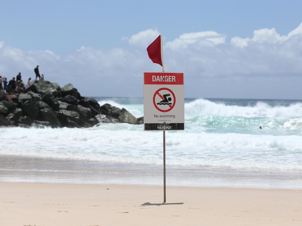
- All #GoldCoast and #SunshineCoast beaches remain closed.
— Surf Life Saving QLD (@lifesavingqld) February 21, 2019
- Beach closures to remain until at least Sunday.
- SLSQ is advising the public to avoid the beach this weekend.#TCOma #CycloneOma pic.twitter.com/QfvbXNyTrH
Flash flooding is expected for low-lying parts of Brisbane and the coast as tides continue to rise, with wave heights expected to peak at around three metres.
“Coastal areas are still vulnerable to higher tides and dangerous surf,” the BoM’s Michael Gray said.
“We are still expecting much higher tides than normal so inundation in areas closer to the coast is still expected.”
Waves are washing into the car park at Currumbin Surf Club. High tide is minutes away @9NewsGoldCoast @9NewsQueensland pic.twitter.com/LD8xTPrXmm
— Isabelle Mullen (@ijmullen) February 21, 2019
Tomorrow will see winds strengthening to 85km/h and seas surging to 6-8m.
All beaches have been closed, and Surf Life Saving Queensland has suspended all lifesaving duties, including training in creeks and rivers, for the next three days.
Leading surf forecaster Ben Macartney, of Coastalwatch, said a cyclone behaving like Oma was unprecedented in this area.
Mr Macartney said he had not found any precedents in terms of a system creeping up so slowly and hovering offshore, driving sustained giant swells at the Sunshine and Gold coasts.
He said the relentless pounding, combined with king tides, was set to cause the worst erosion in decades.
“It’s phenomenal really,” Mr Macartney said.
“We are looking at an exceptional swell event.
“It’s going to get more chaotic and there will be a lot of water movement and damage to the coastline.
“It is easily our most severe erosion event in decades.”
The BOM said abnormally high tides and dangerous surf conditions would continue along the southern Queensland coast over the next few days and into early next week.
Several waves in excess of 7.5m were recorded overnight at the Mooloolaba wave buoy which was located to sea off Yaroomba.
The significant wave height had also climbed past three metres while the period remained around 11 seconds.
Winds gusted to 57 km/h overnight at the Sunshine Coast Airport with gusts to 44 km/h at 5.04am.
The Gold Coast’s $20 million beach protection defences will face their toughest test.
In 2013, Cyclone Oswald’s fury carved a swath of destruction across Glitter Strip beaches, robbing the Gold Coast of its most valuable tourism asset for weeks.
Now, as Oma tracks towards southeast Queensland, measures put in place since that disaster are in line for a severe battering.
However Gold Coast Mayor Tom Tate said he was confident the beaches would cope.
Premier Annastacia Palaszczuk has urged Queenslanders not to go camping this weekend and to avoid dangerous conditions at beaches.
“You never turn your back on a cyclone,” she said.

Hail, rain, wind, SNOW: Winter storm on Qld collision course
A rare winter storm threatens to dump 15cm of snow on Queensland's Granite Belt this weekend as forecasters warn of an incoming polar air mass.

‘Can’t be ruled out’: Potential for freak Qld snowfall this week
Queensland could see snow this week with weather models predicting up to 14cm falling on the Granite Belt.