NewsBite

Water over roads through Brisbane as king tides and cyclone combine

Brisbane’s low-lying suburbs have been inundated with water, as the combined might of Cyclone Oma, the full moon and a king tide conspire to raise river levels. Creeks are brimming over and water is bubbling out of stormwater drains. | PHOTOS

Have you parked on high ground?

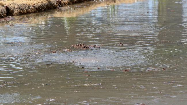
Brisbane’s low lying northern suburbs have gone under after a higher than usual tide today caused Breakfast Creek to rise and water to bubble back through the stormwater drain system.

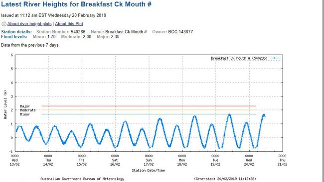
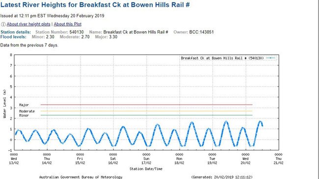
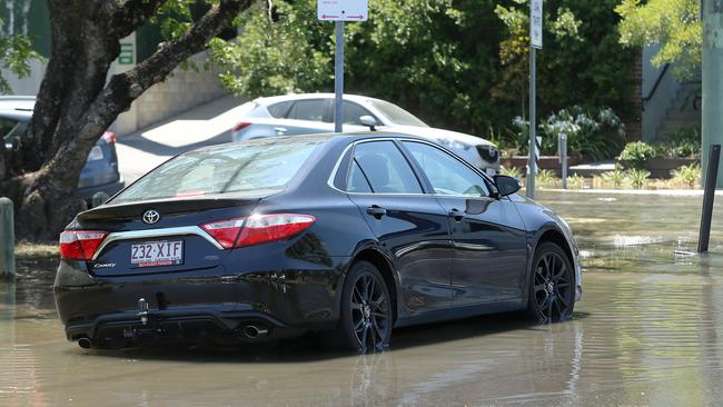
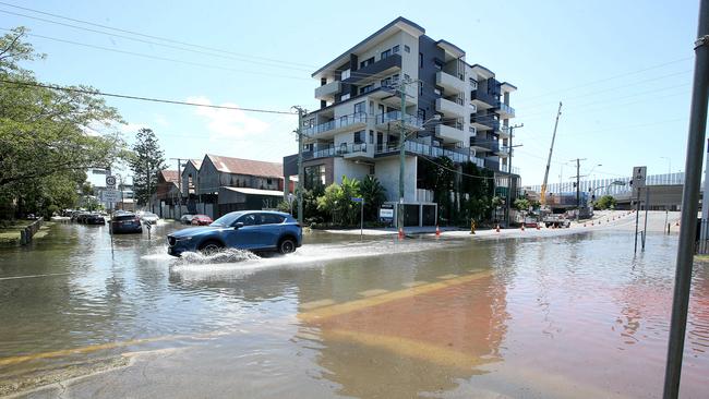
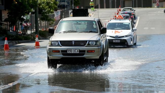
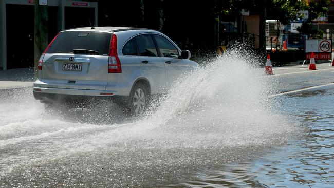
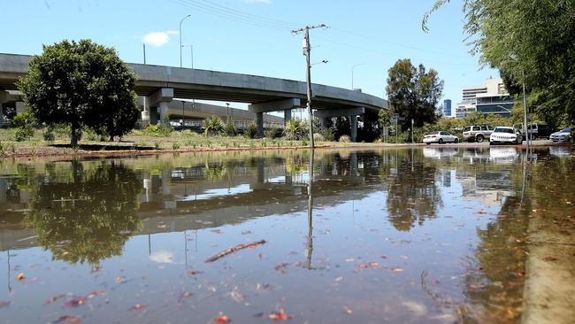
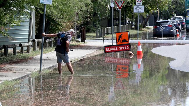
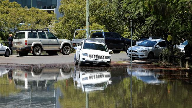
Northey St at Windsor was awash with water, as Breakfast Creek levels rose above “minor flooding” levels as measured at its Newstead mouth and at Bowen Hills.

$1 FOR 28 DAYS: SUBSCRIBE TO CITY NORTH NEWS & THE COURIER MAIL

Where is it flooding near you? Share your pics to questnews.com.au/citynorthpics

This week Brisbane City Council warned that residents in low lying areas around creeks and rivers should prepare for localised flooding, which covered yesterday, today, and tomorrow.
Northey Street Windsor, during local flooding from Enoggera Creek, Brisbane, about 10am today. (AAP Image/Jono Searle)

Residents in those areas were sent SMSs this morning warning of the flood risk. Northey St at Windsor and areas around Breakfast Creek are prone to regular flooding, but properties included in council’s Creek Flooding Alerts system are found in: Albion, Archerfield, Bardon, Boondall, Brookfield, Coorparoo, Corinda, Deagon, Doolandella, East Brisbane, Forest Lake, Greenslopes, Hemmant, Herston, Kenmore, Moorooka, Northgate, Nundah. Oxley, Rocklea, Salisbury, Windsor, Woolloongabba, Wynnum, Wynnum West and Zillmere.
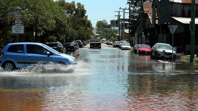
Northey Street, Windsor, looking into Victoria St, at 10am today. (AAP Image/Jono Searle)

The flooding comes just days before a predicted major deluge.

The Bureau of Meteorology has forecast rain from Friday, with 20 to 80mm of rain expected to fall on Saturday and 15-120mm for Sunday.

WHERE OMA IS LIKELY TO HIT

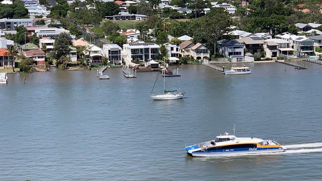
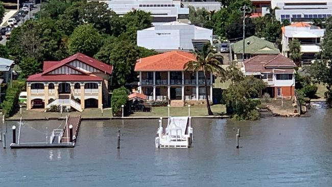
Some riverside homes had water lapping into their yards, including Bulimba houses whose riverbank walls were a few inches too short to hold back the tide. Other home owners were breathing a sigh of relief as water came within centimetres of breaching their wall.

Paul Spottiswood, who lives high on Hamiton hill in an apartment, said he was astonished to see how high the tide had risen.

“Yes, that’s very high,” he said. “I haven’t seen it like that in a long time.”
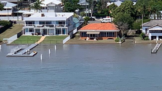
Water laps into the yards of houses across the river from Hamilton. Reader Paul Spottiswood snapped these pics from his Hamilton apartment balcony today about 11.30am, showing how high the tide rose.

MORE LOCAL NEWS:

Ferals get foxy after dark at city golf course

Do you know the difference between a pathway and a road?

Sneak peek at northside’s newest revamped shopping centre

The call no small business owner wants to get at 2am
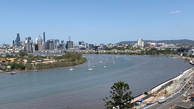
Reader Paul Spottiswood snapped these pics from his Hamilton apartment balcony today about 11.30am, showing how high the tide rose.
Reader Paul Spottiswood snapped these pics from his Hamilton apartment balcony today about 11.30am, showing how high the tide rose. The home owners across the river would be breathing a sigh of relief as water lapped dangerously close to the top of their riverbank walls.

This week’s king tides were predicted to peak at the Brisbane Bar:

TUESDAY: 2.73 metres (1.49m AHD) about 9.26am on Tuesday.

WEDNESDAY: 2.76 metres (1.52m AHD) about 10.13am.

THURSDAY: 2.72 metres (1.48m AHD) about 10.57am on Thursday.

Source: Queensland Tide Tables by Bureau of Meteorology.
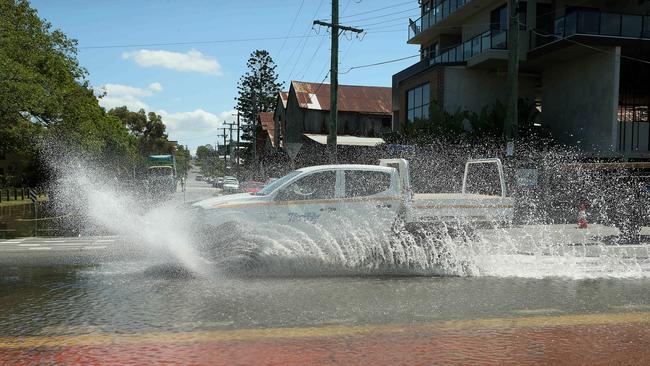
Northey Street, Windsor, today.  (AAP Image/Jono Searle)
Northey Street, Windsor, today. (AAP Image/Jono Searle)

(More flood pix, below)

How high did the tides go today?

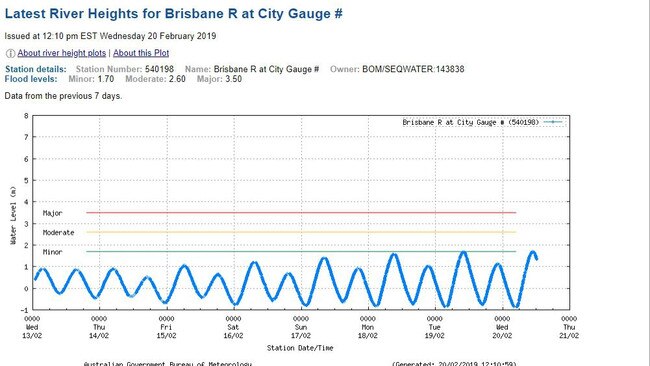
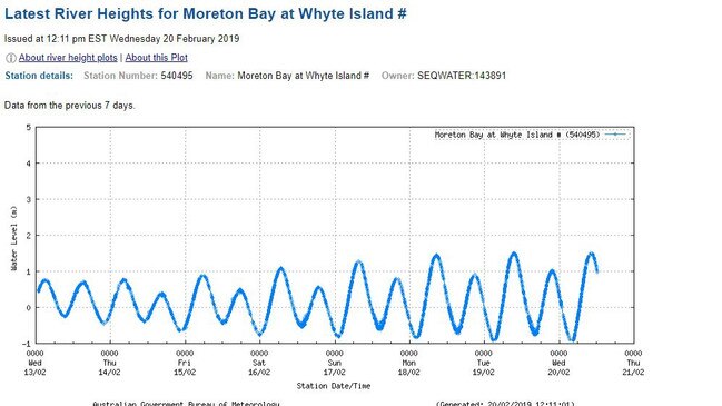
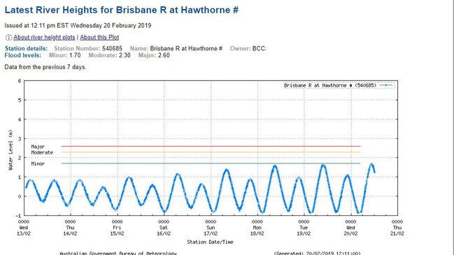
These images from the Bureau of Meteorology’s tide guage network shows that levels in the Brisbane River and Breakfast Creek breached the “minor” flood levels. The high tide is expected again tomorrow.
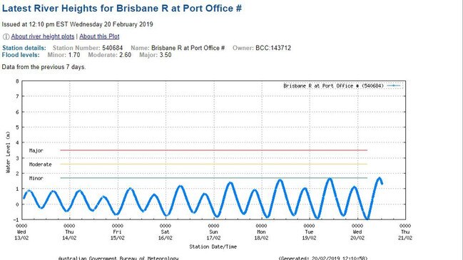
Brisbane River at Port Office: River Height data from the Australian Bureau of Meteorology for Brisbane about noon on February 20.
Brisbane River at Hawthorne: River Height data from the Australian Bureau of Meteorology for Brisbane about noon on February 20.
Brisbane River at City: River Height data from the Australian Bureau of Meteorology for Brisbane about noon on February 20.
Breakfast Creek mouth river Height data from the Australian Bureau of Meteorology for Brisbane about noon on February 20.
Breakfast Creek at Bowen Hills river Height data from the Australian Bureau of Meteorology for Brisbane about noon on February 20.
Moreton Bay at Whyte Island: River Height data from the Australian Bureau of Meteorology for Brisbane about noon on February 20.
Sooooo close: Reader Paul Spottiswood snapped these pics from his Hamilton apartment balcony today about 11.30am, showing how high the tide rose.
Northey Street, Windsor, today.  (AAP Image/Jono Searle)
Northey Street, Windsor, today. (AAP Image/Jono Searle)
Northey Street, Windsor, today.  (AAP Image/Jono Searle)
Northey Street, Windsor, today. (AAP Image/Jono Searle)
Northey Street, Windsor, today.  (AAP Image/Jono Searle))
Northey Street, Windsor, today. (AAP Image/Jono Searle))
Northey Street, Windsor, today.  (AAP Image/Jono Searle))
Northey Street, Windsor, today. (AAP Image/Jono Searle))
Northey Street, Windsor, today.  (AAP Image/Jono Searle))
Northey Street, Windsor, today. (AAP Image/Jono Searle))
Breakfast Creek/Enogger Creek at Windsor rarely reaches this height. Northey Street, Windsor, today.  (AAP Image/Jono Searle)
Breakfast Creek/Enogger Creek at Windsor rarely reaches this height. Northey Street, Windsor, today. (AAP Image/Jono Searle)
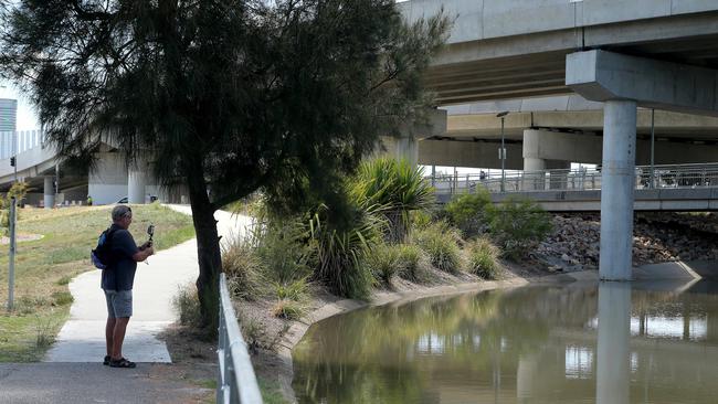
Storm water drain near Northey Street Windsor, during local flooding from Enoggera Creek, Brisbane, Wednesday, February 20, 2019. (AAP Image/Jono Searle)
Northey Street, Windsor, today.  (AAP Image/Jono Searle)
Northey Street, Windsor, today. (AAP Image/Jono Searle)

Original URL: https://www.couriermail.com.au/questnews/north/water-over-roads-through-brisbane-as-king-tides-and-cyclone-combine/news-story/8347979e8d9a412fb24dd06cb4facb74