
Queensland to receive big rainfall this week
A severe thunderstorm warning for parts of the state’s south has been cancelled, as flooding continues in the north and Far North.
QLD weather news
Don't miss out on the headlines from QLD weather news. Followed categories will be added to My News.
A severe thunderstorm warning for parts of the state’s south has been cancelled, as flooding continues in the north and Far North.
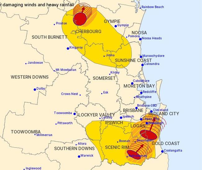
Several severe thunderstorm systems swept across the south Tuesday afternoon, impacting areas including Logan, Gold Coast, Sunshine Coast, Noosa, Darling Downs, Gympie, Scenic Rim and Redland City Council regions.
The areas saw heavy rainfall and damaging winds, with warnings of possible flash flooding.
Most of the storms had eased by 7.30pm and all were cancelled by 8.45pm.
It comes after 38mm of rain fell in just 30 minutes at Conondale, west of Maleny. The area received 59mm in the hour to 5.28pm.
BoM forecaster Michael Paech said the storm behind the heavy fall had fired up about 4pm and sent a “pretty intense” patch of rainfall down in the 30-minute burst.
At Dieckmans Bridge, south of Rathdowney, 42mm fell in the 30 minutes to 6.10pm.
The Bureau of Meteorology’s earlier warning for parts of Wide Bay and Burnett areas has also been updated.
The 7.27pm update was a warning for heavy rainfall for those in Gayndah, Mundubbera and Biggenden.
“Severe thunderstorms are likely to produce heavy rainfall that may lead to flash flooding in the warning area over the next several hours,” the warning said.
Bureau of Meteorology forecaster Pieter Claassen said showers will fall over Brisbane this evening with a slight chance of thunderstorm.
“There is a trough moving across currently over the southern districts today but there is a convergence ahead of that trough we have seen some storms go up over the eastern Darling Downs and even inland of Brisbane this afternoon,” Mr Claassen said.
The top total by 5pm today was 66mm, which fell north west of Oakey while 19mm fell at Little Nerang on the Gold Coast. Just 1mm had fallen over Brisbane by 5.15pm.
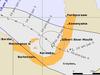
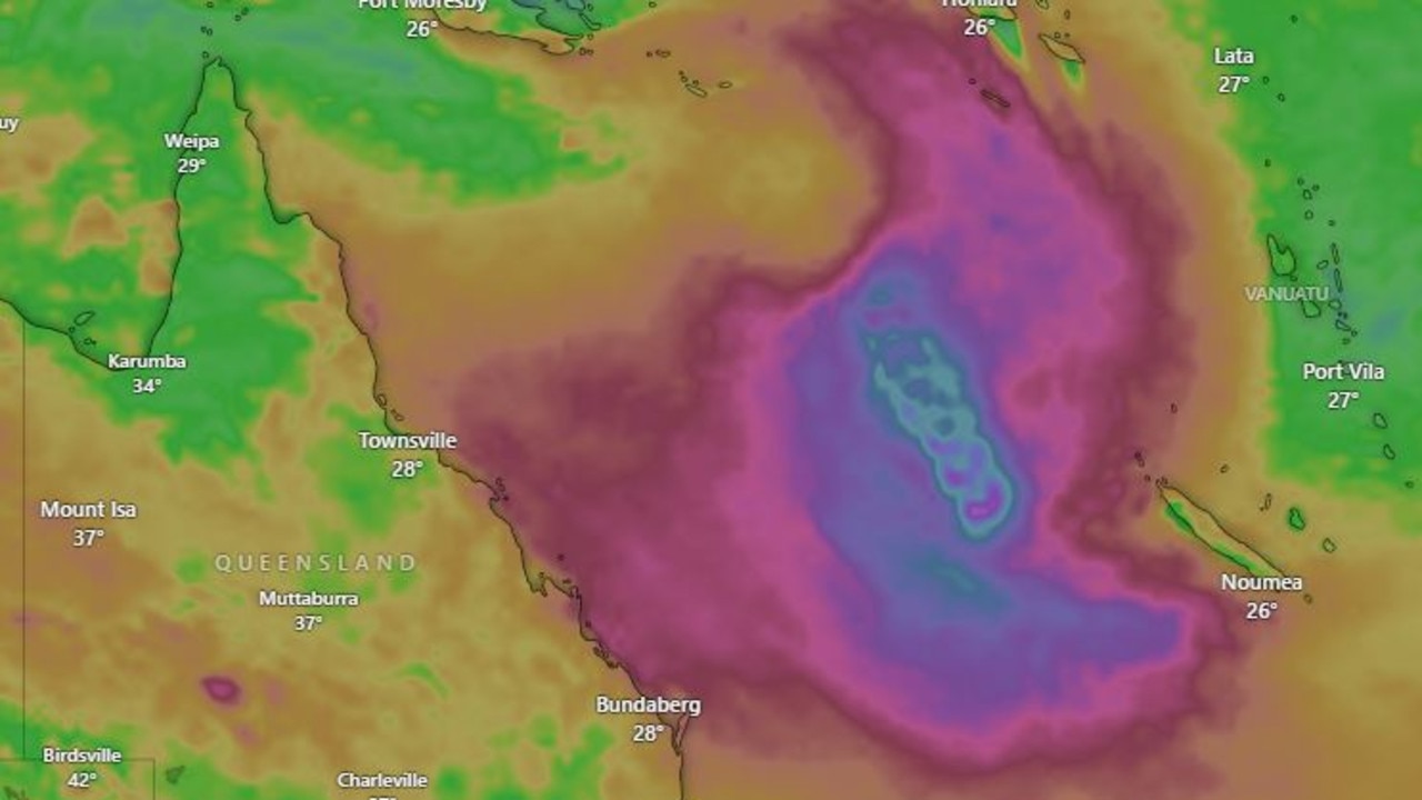
It comes as ex-tropical cyclone Imogen continues to wreak havoc in the far north after its downgrade to a tropical low yesterday, with possible rain totals up to 300mm.
A severe weather warning for heavy rainfall and damaging winds remains for people in parts of North Tropical Coast and Tablelands and Herbert and Lower Burdekin forecast districts, with six-hourly rainfall totals between 150mm to 200mm expected.
Heavy rainfall surged across the Far North coast Tuesday evening, with a late downpour dumping almost 80mm on the Cairns CBD in the hour to 6pm. The Cairns Racecourse saw 123mm fall from 9am to 6pm.
Cassowary Coast residents have been urged to conserve water due to the heavy rainfall from ex-tropical cyclone Imogen creating water supply issues across the region.
Meanwhile, alarming footage has emerged showing young children in danger of being swept into a large culvert south of Cairns, and has prompted a renewed warning about the risks of entering floodwater.
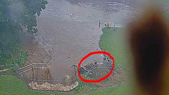
The flood camera footage was taken at McKinnon Creek Detention Basin in Edmonton as more than 260mm of rain fell in parts of the region in 24 hours.
Local Disaster Management Group chairman Terry James said the children would have been seriously injured, if not killed, if they had lost their footing.
“The photos are quite alarming, actually,” Cr James said.
“While this may look innocent enough, kids just having fun, there’s a real and serious risk for anyone entering flood waters, creeks and drains.
“As we have seen over the past 48 hours, the wet season can bring sudden downpours leading to significant amounts of fast-flowing water rushing into our water systems.
“Residents, especially children, playing in or near flood waters, can be quickly swept away, be injured by debris or drown if they become trapped.
“What starts off as some hijinks can be fatal.”
Once spotted on the flood cameras about 4pm Monday, two groups of about a dozen children and young adults were moved on by council officers.
Cr James said that while there hadn’t been any major road damage following heavy rain across the region, potholes would continue to appear over coming days, and residents should drive with care.
Earlier: Risk of storms as large systems move in
Multiple large storm systems are making their way across southeast Queensland.
Despite the large build-up, the Bureau of Meteorology has advised no severe storm warnings were currently needed.
BoM Meteorologist Kimba Wong said that despite the rain system appearing to flare up from about 2pm Tuesday, conditions should ease before it makes it way to the southeast coast.
“We do have that risk of southeast inland storms this afternoon into this evening, but we shouldn’t expect those worse conditions to hit the southeast coast,” Ms Wong said.
“Brisbane isn’t expecting any conditions that would lead to potential severe thunderstorms, it would most likely just be showers.”
Anduramba near Crow’s Nest recorded 12mm of rain in the hour to 2pm, while Gatton received just over 8mm.
If the system did manage to claw its way to the coast, Ms Wong did indicate rainfall would be expected around the late afternoon into the early evening.
EARLIER
Farmers are thanking the rain as more heavy falls are set to grace central and southern Queensland.
Bureau of Meteorology forecaster Rosa Hoff said an inland trough was becoming more mobile, which would increase showers across the southeast over the next few days.
Brisbane is forecast to get between 15-35mm tomorrow and 40mm on Thursday, the Gold Coast up to a max of 45mm on Thursday and up to 50mm predicted for Beaudesert tomorrow.
“We will see a separate trough move through southern Queensland in the coming days which will increase rainfall in southeast Queensland, Brisbane, Sunshine Coast, Gold Coast, but this will be away from any tropical low system remaining in the north,” Ms Hoff said.
It comes as ex-tropical cyclone Imogen continues to wreak havoc in the far north after its downgrade to a tropical low yesterday, with possible rain totals up to 300mm.
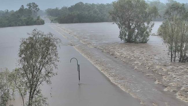
There were more than 10 roads completely flooded in the north yesterday, with widespread damage as the system made landfall at around 11pm on Sunday night at Karumba.
Severe weather warnings are in place for people on the North Tropical Coast and Tablelands and parts of Peninsula, Gulf Country, Northern Goldfields and Upper Flinders and Herbert and Lower Burdekin.
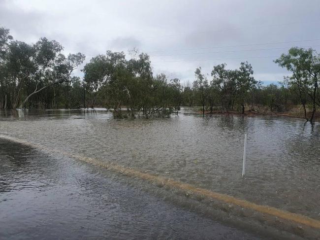
The Bureau of Meteorology says rainfall totals between 150mm and 200mm are likely, with localised periods of intense rainfall potentially reaching 300mm over six hours around the coast and ranges.
Free sandbags are available for Cairns residents ahead of heavy rain predicted to cause flash flooding this week, with several flood watches in place.
Despite being downgraded to a tropical low at 10am yesterday, the system is still being described by BOM as “very dangerous”. It is moving southeasterly towards the North Tropical Coast and will potentially become slow moving.
Locations which may be affected include Townsville, Georgetown, Cairns, Ingham, Cardwell, Mareeba, Ayr, Giru, Atherton, Yarrabah, Ravenshoe, Greenvale and Julatten.
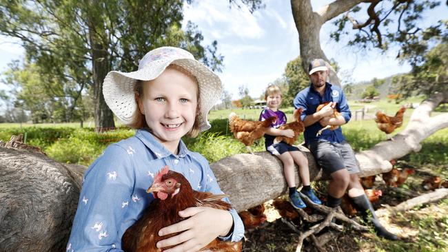
RAIN ADDS PLUCK TO FARMERS
All rain is welcome for Tom Hall, 27, who has been visiting his uncle and aunt’s Tommerup Dairy Farm in the Kerry Valley near Beaudesert since he was five, growing up surrounded by green.
But years of drought turned the green grass into a hard dry ground with a fire nearly reaching the property at the start of last year.
“We were lucky none of the property burned but it came very close, the ground was so dry, a lot of it didn’t even absorb in it took a long time for it to suck the moisture in, it just ran off,” Mr Hall said.
“Last year we were sort of like do we really want to keep doing this? It’s very draining, we saw the neighbours had to stop milking, another family up the road from us had to stop milking.”
But since the middle of last year and the recent rain season the farm has traded cracked ground for green paddocks and has meant Tom could start up ‘Tommy’s pastured eggs.’
“Its helped me immensely this rain, its brought the grain prices down for one and it’s so much better for the chooks, to have this green grass rather than just dirt and dry old rubbish,” Mr Hall said.
“It certainly gives me a bit more mental stability to get through, even though it’s a lot of work, but we’ll get there, the hens have been laying very well.”
New warning amid ‘high’ chance of cyclone forming
A tropical low that has a high chance of forming into a cyclone in coming days, with a number of different possible scenarios for its predicted path triggering a warning to Queenslanders to stay up-to-date with warnings.
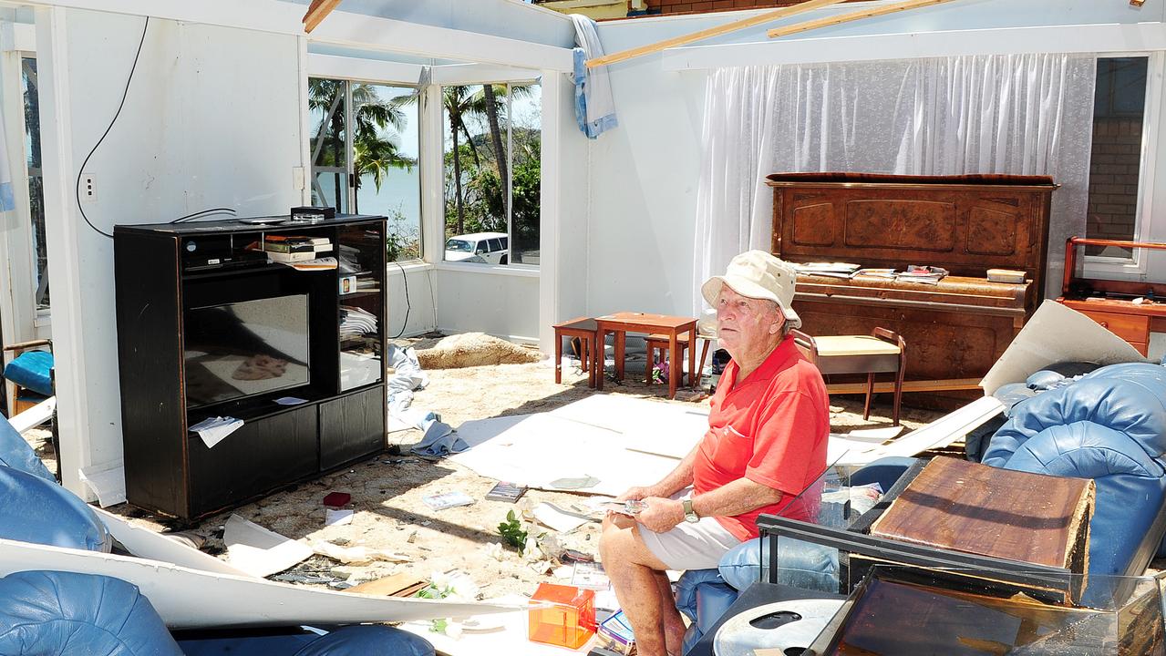
The day a monster named Marcia destroyed Qld homes
Ten years ago Severe Tropical Cyclone Marcia turned towards the Queensland coastline as a monster category 5 storm. What unfolded was truly terrifying for hundreds of residents. SEE THE PICTURES