
Tropical Cyclone Imogen crosses Queensland coast
Some residents have been cut off as Ex-Tropical Cyclone Imogen causes flash flooding in Far North Queensland. The system brought 128mm of rain in just two hours, with plenty more forecast.
QLD weather news
Don't miss out on the headlines from QLD weather news. Followed categories will be added to My News.
Residents of the Carpentaria Shire region have been cut off to the rest of Far North Queensland as heavy downpours from Ex-Tropical Cyclone Imogen flood major roads.
More than 260mm of rain fell at Normanton in the 24 hours to 9am this morning, while Croydon had 155mm.
Heavy rain has fallen across the Far North today, with about 189mm recorded at Rockfields in the six hours to 1.45pm, including 128mm in the two hours to 1pm.
Copperlode Dam collected 165mm in 6.5 hours.
On the Cassowary Coast, 115mm was recorded at the Tung Oil alert and 102mm fell at South Johnstone.
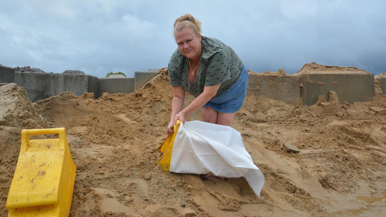
Remote communities in the path of the ex-Tropical Cyclone continue to brace themselves for days of wild weather, flooding and isolation.
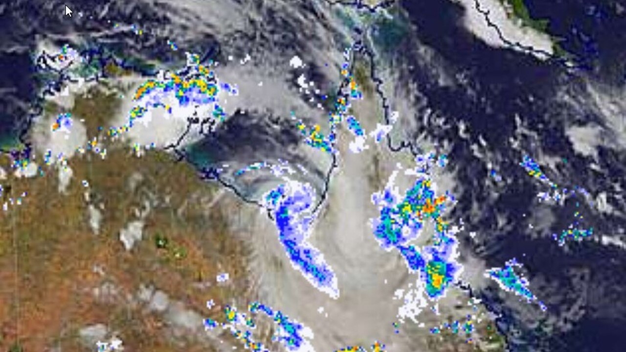
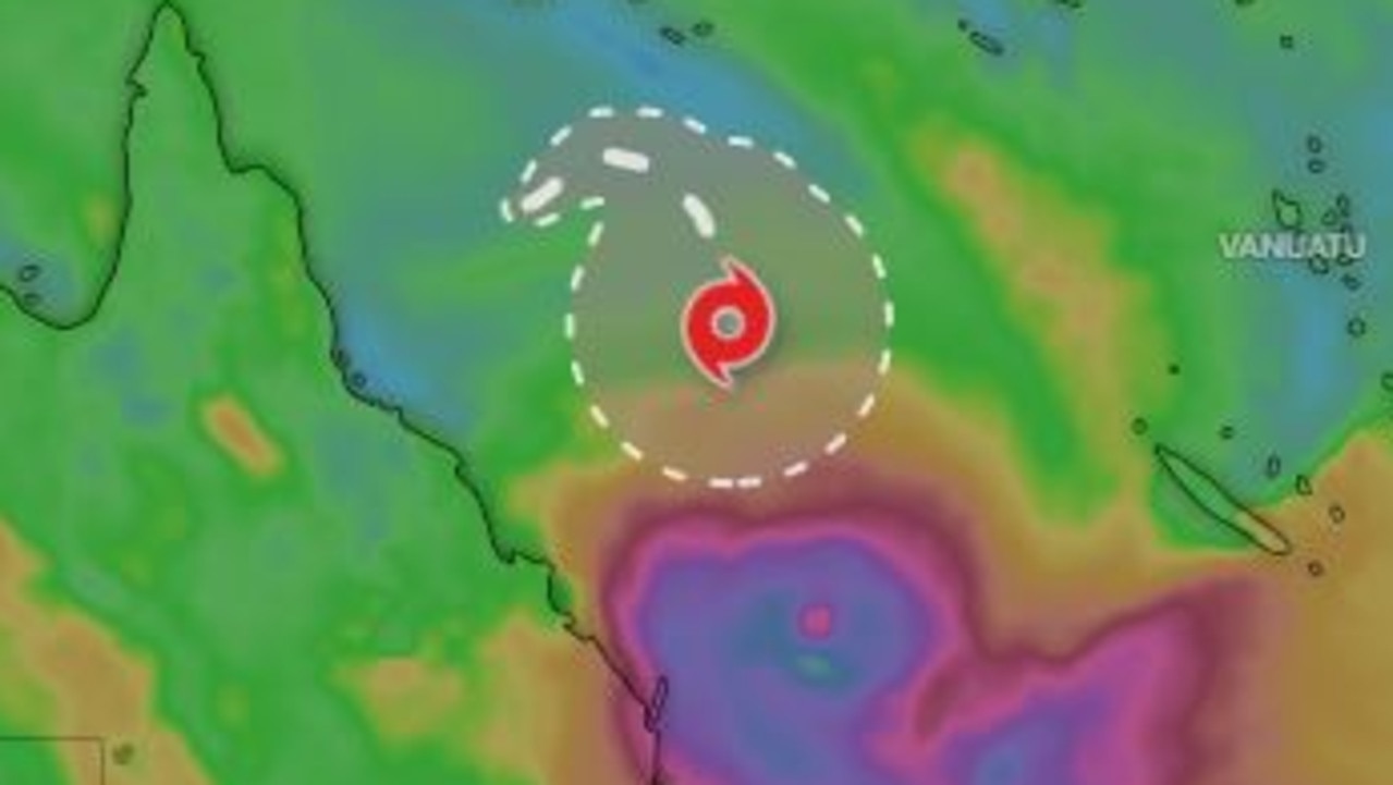
At 4pm the system was about 70km northeast of Croyden and 80km west-northwest of Georgetown.
Winds near the centre were still reaching about 55km/h this afternoon with gusts peaking at 85km/h, with the low expected to continue moving east-southeastwards and further inland throughout the day.

Longer term, the system was expected to track more slowly to the southeast towards the North Tropical and Herbert-Lower Burdekin coasts.
“Ex-Imogen is forecast to track slowly east-southeast towards the North Tropical Coast and Tablelands, and Herbert and Lower Burdekin districts during Tuesday and then potentially become slow-moving,” the Bureau of Meteorology said in a warning issued at 4.58pm.
“A trough also extends from ex-Imogen eastward through the North Tropical Coast and Tablelands and is forecast to slowly move southward during Tuesday.”
A severe weather warning remains for people in the North Tropical Coast and Tablelands, Herbert and Lower Burdekin and parts of Peninsula and Northern Goldfields and Upper Flinders regions.
The BoM warning said Ex-Tropical Cyclone Imogen was producing widespread heavy rain across the regions and that heavy rainfall was “expected to develop further and become more widespread throughout the remainder of the warning area between Port Douglas and Rollingstone tonight and then extend southward to about Ayr during Tuesday”.
“Six hourly rainfall totals between 150mm to 200mm are likely. Periods of localised intense rainfall leading to life threatening flash flooding are also possible, with six hourly totals of 300mm possible about the coast and ranges,” the warning said.
A Flood Watch and various Flood Warnings are current throughout the area.
Locations which may be affected include Townsville, Georgetown, Cairns, Ingham, Cardwell, Mareeba, Ayr, Giru, Atherton, Yarrabah, Ravenshoe, Greenvale and Julatten.
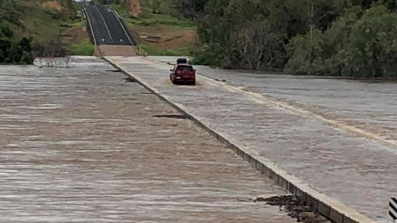
Motorists heading west along the Burke Development Road from the Far North’s east coast will only get as far Ferguson’s Crossing at Rockwood, west of Chillagoe, where flooding has closed the road in all directions, according to the Department of Transport and Main Roads.
The Gulf Developmental Road is closed at the Gilbert River, west of Georgetown due to flooding, and for Carpentaria residents, it is closed at Blackbull, between Normanton and Croydon.
All major roads to the north and south of Normanton are closed due to flooding.
QLD Flood Watch for E Gulf & W Cape from Normanton toKowanyama, & N Tropical Coast from Cooktown to Ayr. #flooding #ewnalerts #danger #river #alert #bneflood #QLD #qldfloods https://t.co/JJwjFQ9onX pic.twitter.com/2YMeSgt0mx
— EWN Alerts (@EWNAlerts) January 4, 2021
EARLIER: ‘Should have been category 2’: Roads cut, power out as cyclone brings big falls
Ex-Tropical Cyclone Imogen has weakened to a tropical low but remains dangerous after dumping huge rainfall across the state’s far north, with more to come.
In an update at 10.45am, the Bureau of Meteorology said the cyclone was now a tropical low, but was still packing a punch with winds of up to 85km/h.
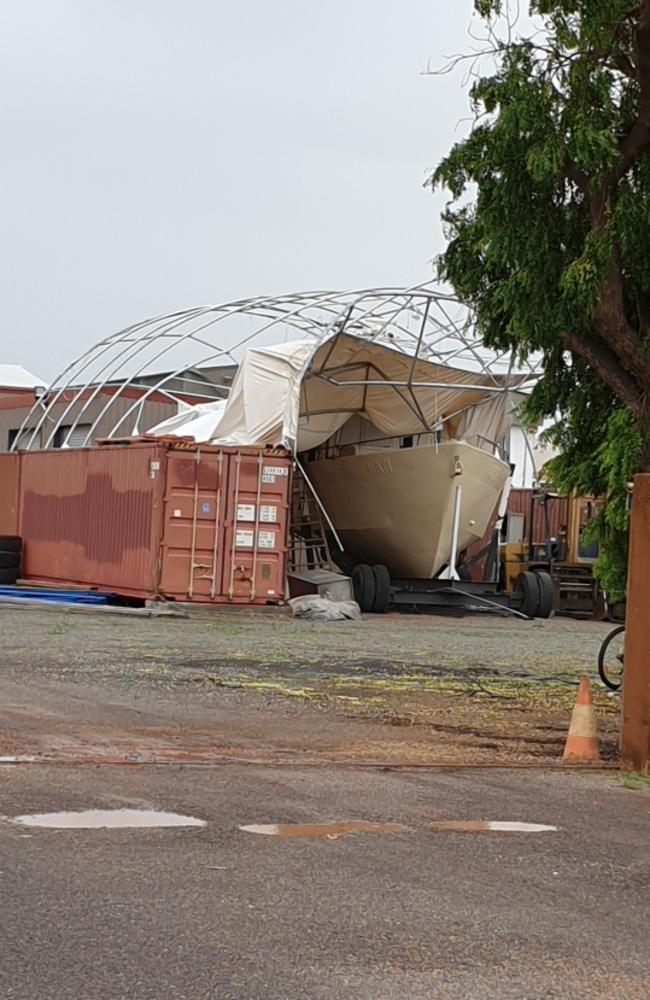
Roads have been cut and power is out in some far north communities where locals have woken to damage after a scary night.
The low is expected to continue moving east-southeastwards in the short term, taking it further inland today.
Longer term, the system is expected to track more slowly to the southeast towards the North Tropical and Herbert-Lower Burdekin coasts.
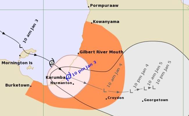
The storm system was upgraded to a Tropical Cyclone while in the Gulf of Carpentaria Sunday afternoon.
Tropical Cyclone Imogen crossed Queensland late Sunday night to the north of Karumba.
It was moving southeast at 18km/h at the time.
A tropical cyclone warning was updated by the Bureau of Meteorology at 10.56pm, with the warning zone being from Burketown to Kowanyama, extending inland to Croydon.
A severe weather warning is in place for areas from the far north to the lower Burdekin.
As of this morning, more than 260mm had fallen at Normanton since 9am yesterday, with falls of 192mm at Mornington Island and 75.6mm and 74mm at Burketown and Kowanyama.
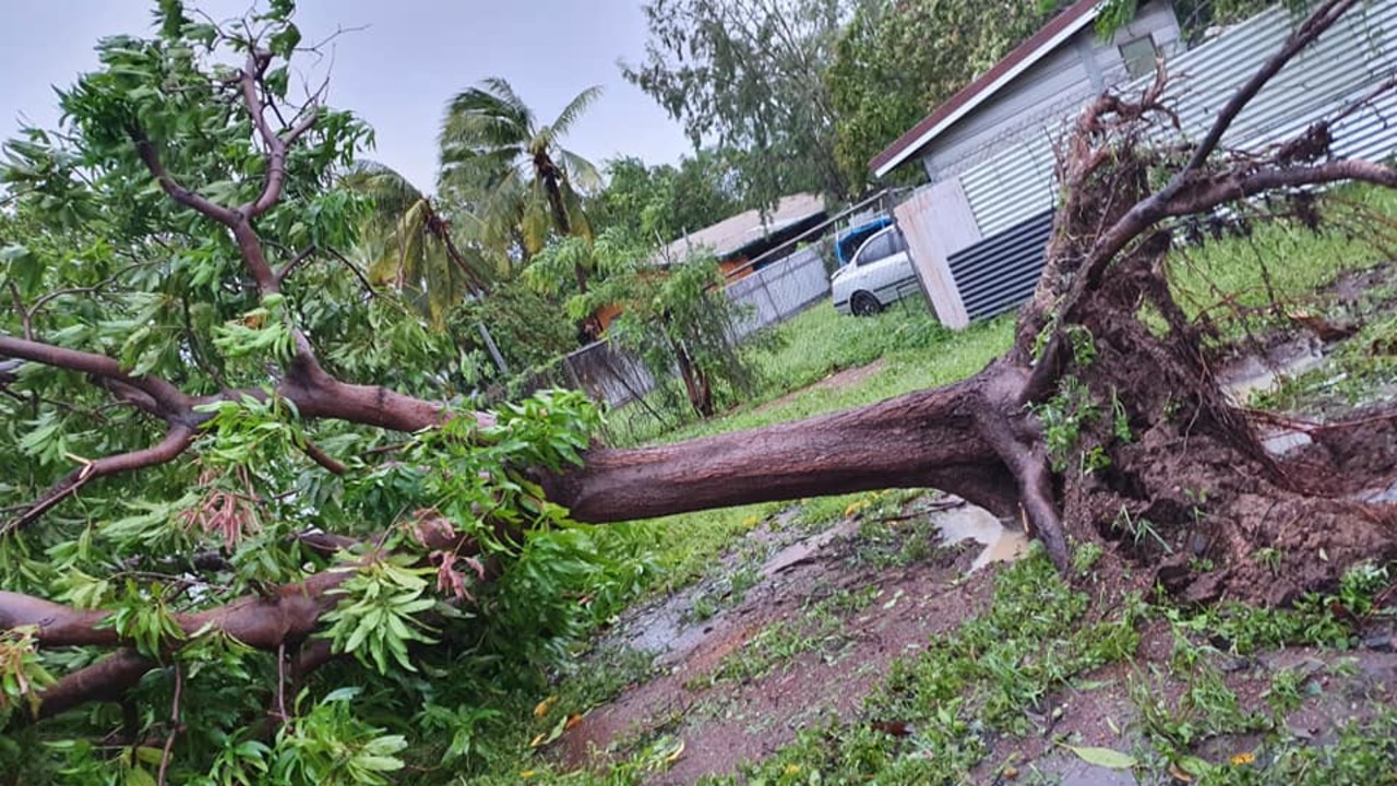
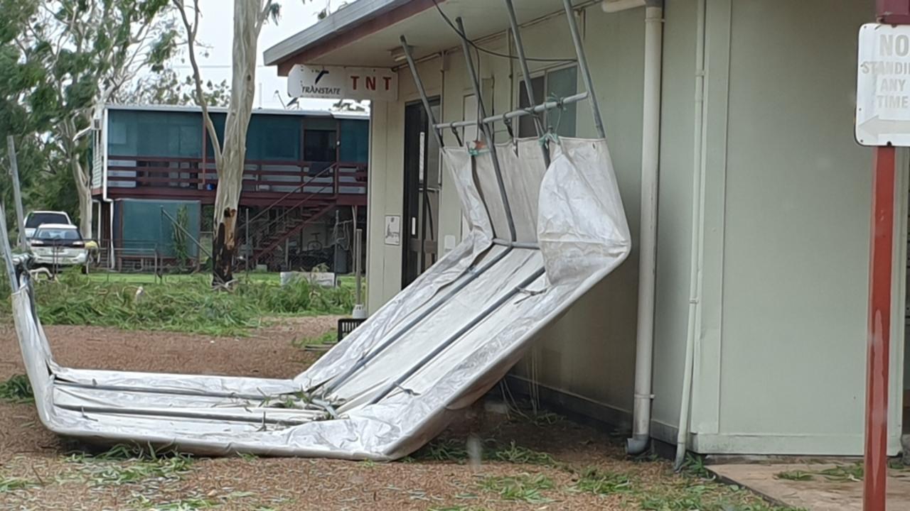
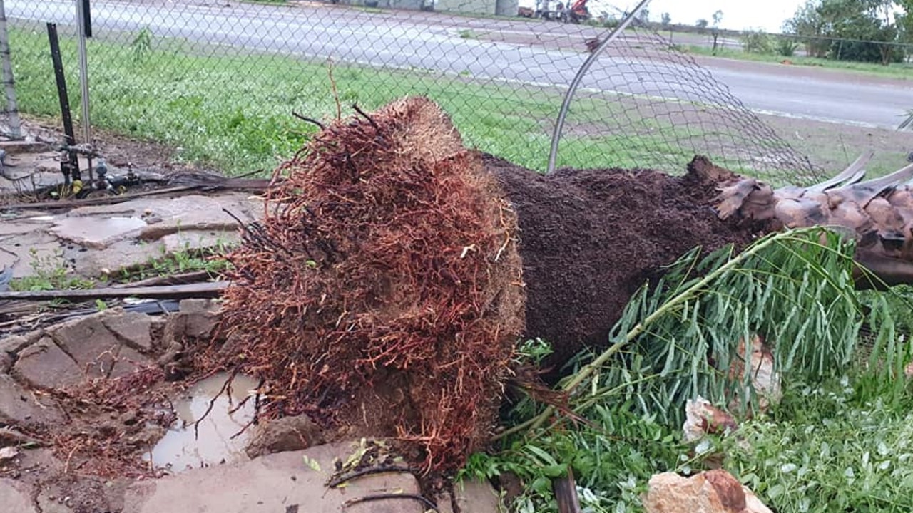
Karumba resident Rose Bouwens said she believed the cyclone should have been rated a category 2.
“I have never felt it like that, I think it should have been category 2, we have been through category 1 cyclones and they were nothing,” she said.
“It was terrible. I think we had over 200mm of rain. It was scary.
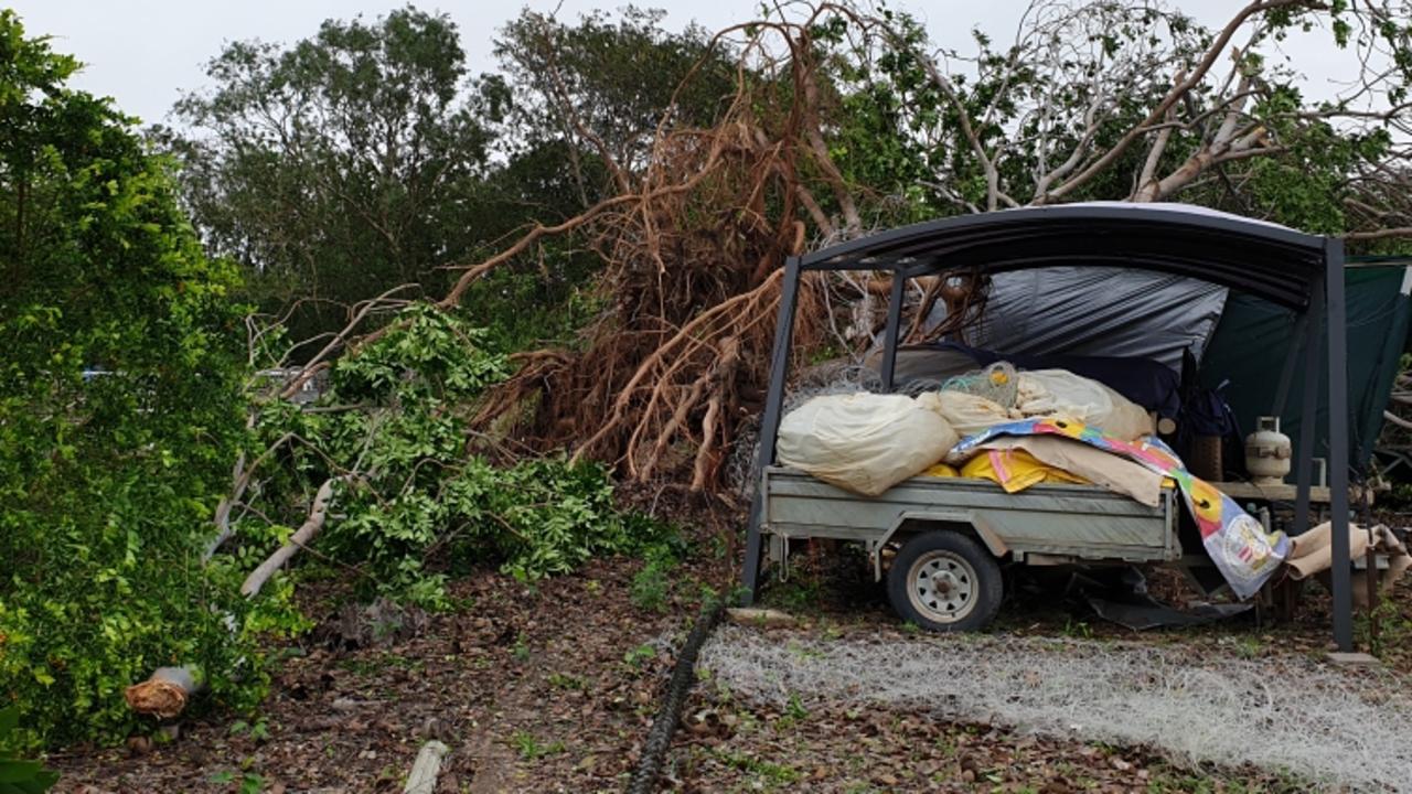
“Two boats got blown up from the river into the mangroves, there’s a lot of solid fences down, the canopy is off the kids playground and ripped to pieces, there’s an upside down carport near the post office, and a coconut palm on top of a house.
“The reason we lost so many trees is because we have already had rain and the ground was sodden,” she said.
There are 91 roads flooded across Qld, many as a result of ex-TC Imogen which has been downgraded to a tropical low. Never drive through flood waters. #TCImogen pic.twitter.com/P3SwXnkTmY
— RACQ (@RACQOfficial) January 4, 2021
The bureau warned that heavy rainfall that may lead to flash flooding would continue over the western Cape York Peninsula and will extend eastwards today.
“The heavy rainfall is set to increase, not decrease associated with that reclassification,” Bureau of Meteorology meteorologist Rosa Hoff said.
“We are expecting Tropical Cyclone Imogen to be reclassified today but It’s very important to remember that the impacts of that system will still remain quite significant.
“While we have had some observations of rainfall above 260mm at Normanton and wind gusts getting up to 100km/h we are likely to see much higher rainfall totals in the days ahead as the system continues to track out to the east.”
Ms Hoff said there is also a possibility of severe thunderstorm activity about the north and far northern parts of Queensland today, with a chance of heavy rainfall.
Many roads on the Cape are already cut, including all major roads to the north and south of Normanton.
Six hourly rainfall totals between 100mm to 150mm are likely near the low with localised intense falls up 200mm possible.
Heavy rain which may lead to flash flooding is also forecast to develop between Cooktown and Ingham, continuing into Tuesday, with six-hour rainfall of up to 200mm expected.
“Localised intense rainfall leading to life threatening flash flooding is also possible during this period, with six hourly totals of 250mm possible about the coast and ranges,” the Bureau warns.
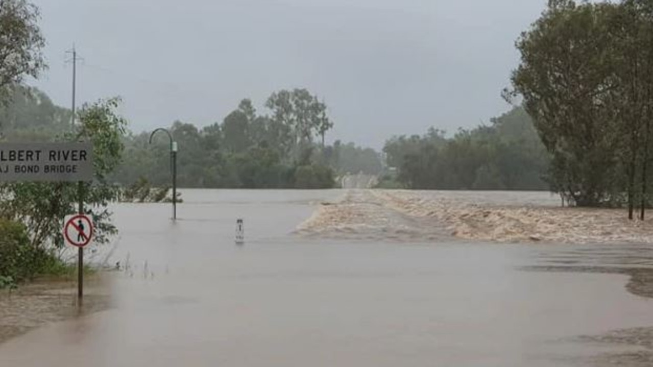
There are flooding warnings in place for the Belyando, Paroo, Bulloo, Thomson, Diamantina, Georgina, Lower Flinders, Norman and Gilbert Rivers.
There is a flood watch for parts of the top end, south to Ayr.
From Sunday afternoon and into the evening the cyclone had wind gusts up to 100kmh.
“Imogen is expected to continue moving east-southeastwards in the short term, taking it further inland tonight and Monday, and is expected to transition to a tropical low in the next few hours,” the warning said.
“Longer term, the system is expected to track more slowly to the southeast over the southern Cape York Peninsula as a deep tropical low.”
#CycloneImogen will continue moving SE as a Cat 1 tropical cyclone, & cross the Gulf coast near #Karumba tonight. The developing system passed over Mornington Island today, where damaging winds & ~200mm of rain has been recorded since 9am. Cyclone info: https://t.co/rLzz3RpdDe pic.twitter.com/06VYZklslS
— Bureau of Meteorology, Queensland (@BOM_Qld) January 3, 2021
People between Burketown and Kowanyama, including Burketown, were advised to remain indoors until the cyclone has passed.
The Bureau said the tropical low would impact the state’s far north for “the next few days”.
Residents have been warned to brace for gale force winds, abnormally high tides, large waves and heavy rainfall.
The conditions may lead to flash flooding, the Bureau of Meteorology warned.
âš ï¸ #SevereWeatherWarning issued for #Cairns & #FNQ âš ï¸#CycloneImogen will produce widespread heavy rain across the north over the next few days, with flash flooding possible. Damaging/locally destructive winds possible with storms. Warnings: https://t.co/ikpWy7UgEs pic.twitter.com/eTkMu9B3xG
— Bureau of Meteorology, Queensland (@BOM_Qld) January 3, 2021
When the system passed over Mornington Island on Sunday, damaging winds and 200mm of rain were recorded.
Forecaster Matt Marshall said the heavy downpours were expected Monday and Tuesday.
“Isolated falls of a few hundred millimetres are possible on each day in coastal areas,” he said.
âš ï¸ #SevereWeatherWarning issued for #Cairns & #FNQ âš ï¸#CycloneImogen will produce widespread heavy rain across the north over the next few days, with flash flooding possible. Damaging/locally destructive winds possible with storms. Warnings: https://t.co/ikpWy7UgEs pic.twitter.com/eTkMu9B3xG
— Bureau of Meteorology, Queensland (@BOM_Qld) January 3, 2021
“Heavy rainfall is also likely to lead to flooding in the flood watch area, which is the Gulf and north tropical coast, into the coming week.”
Mr Marshall said southeast Queensland could be hit by thunderstorms on Tuesday or Wednesday.

Mapped: Tropical cyclone likely within 24 hours
A tropical cyclone is likely to form off the Queensland coast by tomorrow morning, intensifying into a category two system. SEE THE TRACK MAP
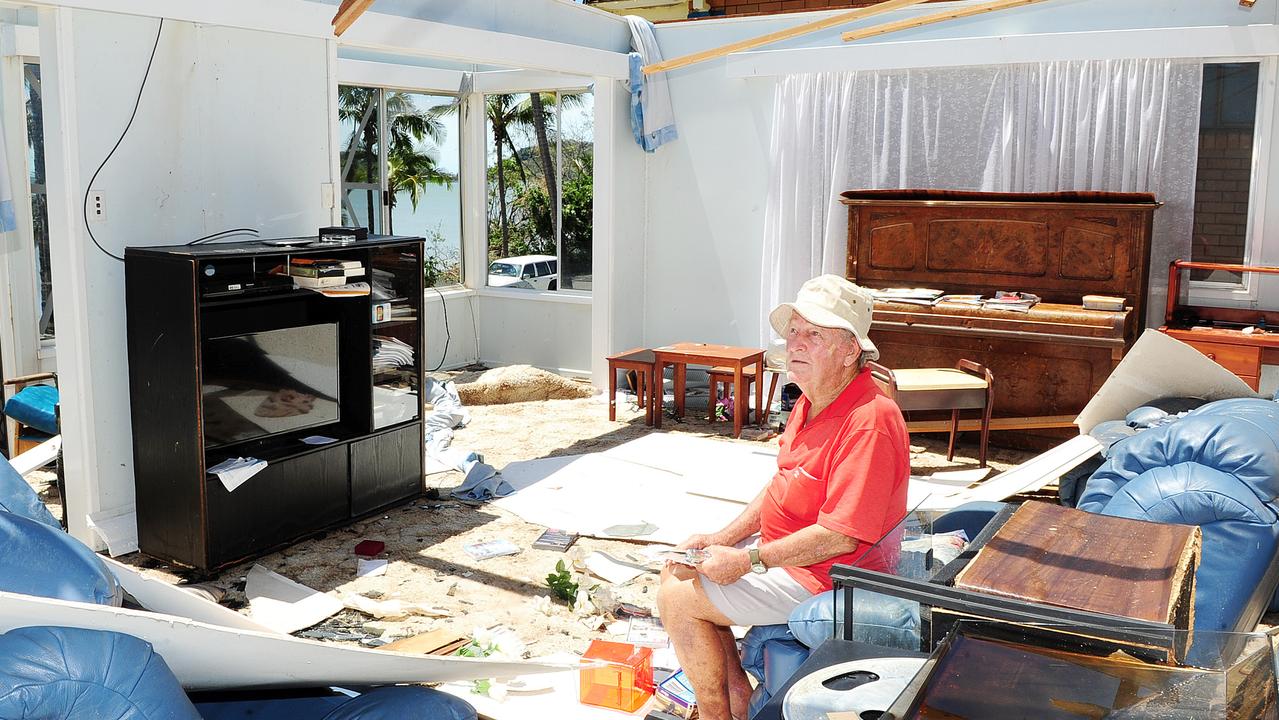
The day a monster named Marcia destroyed Qld homes
Ten years ago Severe Tropical Cyclone Marcia turned towards the Queensland coastline as a monster category 5 storm. What unfolded was truly terrifying for hundreds of residents. SEE THE PICTURES