
Tropical cyclone Imogen to cause extreme flash flooding in FNQ
Cassowary Coast residents have been urged to conserve water due to the heavy rainfall from ex-tropical cyclone Imogen creating water supply issues across the region.
Cairns
Don't miss out on the headlines from Cairns. Followed categories will be added to My News.
UPDATE 5.30PM: Cassowary Coast residents have been urged to conserve water due to the heavy rainfall from ex-tropical cyclone Imogen creating water supply issues across the region.
A Council spokesman said resident have been requested to keep water usage to a minimum until the weather improves.
“The new Bulgun Reservoir commissioned in late 2020 has already assisted Council in avoiding multiple boiled water events in the Tully supply system, however current high water consumption is placing that at risk,” he said.
“Heavy rainfall has increased the turbidity (“dirtiness”) of the water at our Tully intakes and they have been closed. The intakes for Cardwell and Nyleta are also closed. Council is now relying on water storages in our reservoirs to supply clean water.
“If the creek systems run dirty for an extended period there is a risk that our storages will be depleted before our intake creeks run clean again. This would force the implementation of widespread boil water alerts.
“The Innisfail water treatment plant is also being challenged by this weather event and our request to conserve water applies to all properties within the region.”
Residents can reduce their water usage by turning off sprinklers that are set on a timer, reduce the length of time spent in the shower, turning off the tap while you brush your teeth or shave, wait until your dishwasher or washing machine is fully loaded before turning it on and choose shorter, economy wash cycles.
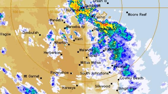
The Cassowary Coast has copped some of the highest falls in the region, with 261mm at the Tung Oil station west of Innisfail recording 261mm and Bulan Creek northwest of Tully recording 205mm since 9am today.
UPDATE TUESDAY: Cairns and the Tablelands are no longer included in a severe weather warning for the Far North, but large parts of the region, including the Cassowary Coast and Tablelands, remain on alert.
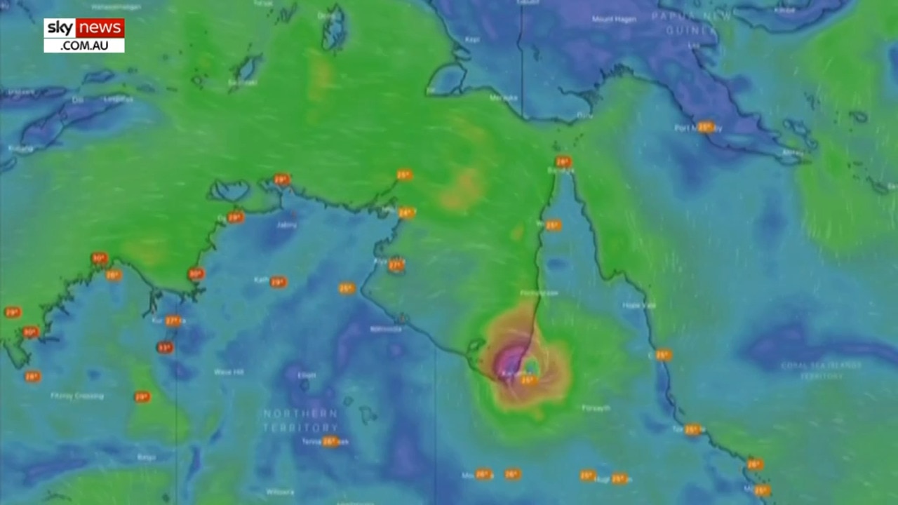
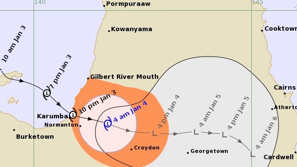
At 1pm, ex-tropical cyclone Imogen was about 120 kilometres east of Georgetown, and was slow-moving.
A coastal trough extends from ex-Imogen into the Coral Sea, and is triggering widespread rain areas, heavy showers and thunderstorms for the northeast tropics.
RELATED: Towns drenched as storm crosses Far North
Heavy rainfall is expected with six hourly rainfall totals between 150mm to 200mm.
Periods of localised intense rainfall leading to life-threatening flash flooding with six hourly totals of 250mm about the coast and ranges in the warning area are also possible.
Damaging wind gusts are possible with thunderstorms about coastal areas from Ingham to Ayr.
Severe weather warning: Heavy rainfall w. 6hr totals 150-200mm forecast between Tully & Ayr. Intense rainfall w. 6hr totals ~250mm may lead to life-threatening flash flooding about coast & ranges. Damaging winds possible with storms Ingham to Ayr. Warnings https://t.co/FBmpsInT9o pic.twitter.com/gg2C4iGdZO
— Bureau of Meteorology, Queensland (@BOM_Qld) January 5, 2021
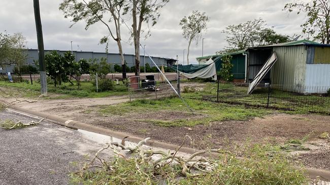
‘Pretty horrendous’: Residents recount scary night as cyclone hits
Areas north of Tully are no longer likely to experience widespread heavy rainfall, with heavy falls expected to be more isolated with thunderstorm activity later this afternoon and overnight into Wednesday.
Locations which may be affected include Townsville, Palm Island, Ingham, Ayr, Giru, Cardwell, Tully and Lucinda.
SANDBAGS
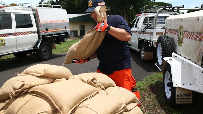
Free sandbags are available for Cairns region residents ahead of consistent heavy rain forecast across the coming week.
Local Disaster Management Group chairman Terry James said up to 300mm of rainfall was predicted over the next three days.
A Flood Watch is already in place for the Barron, Mulgrave and Russell Rivers.
Cr James said the Local Disaster Management Group was monitoring the weather patterns.
Bags will be made available for residents to fill with sand on site at the council’s waste transfer stations.
Scoops for filling will be provided. Sandbags are for residential use only and will be available until supplies run out. Limits will apply per person.
Sandbags and sand will be available from the following locations until supplies run out.
Portsmith Transfer Station 8.30am to 5.15pm
Smithfield Transfer Station 7am to 5.15pm
Gordonvale Transfer Station 8.30am to 5.15pm
Babinda Transfer Station 8.30am to 4.45pm (Monday, Wednesday, Thursday & Friday)
Originally published as Tropical cyclone Imogen to cause extreme flash flooding in FNQ

Watch the arrest: Depraved teen trio in vile knifepoint rape
Police have released dramatic footage of the arrest of a teenager wanted after a woman was allegedly raped at knifepoint in a sickening home invasion in Cairns.

Cairns home ownership challenges at centre of new tax reform
Cairns homebuyers Keely and Aidan Maxwell struggling to get a foothold on the property ladder say the axing of stamp duty would make their first home purchase easier on the hip pocket.