
Brisbane weather: SEQ still facing possible 100mm falls, flash flooding as rivers rise in west
Southern Queenslanders are being urged to reconsider weekend plans as rivers swell in the west and the South East still faces the risk of severe storms, 100mm rain and flash flooding.
QLD weather news
Don't miss out on the headlines from QLD weather news. Followed categories will be added to My News.
Residents across southern Queensland are being urged to reconsider weekend travel plans as rivers swell in the west and the South East still faces the risk of 100mm of rain and flash flooding.
Authorities on Friday issued an urgent warning to all residents and holiday-makers to stay put over the next 36 hours in anticipation of possible severe storms and life-threatening flash flooding.
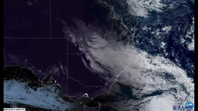
A large, slow moving trough, which has been sitting over the state’s southern interior for days is expected to dump at least 50-100mm of rainfall as tracks over the New South Wales border.
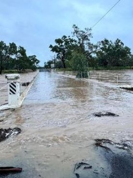
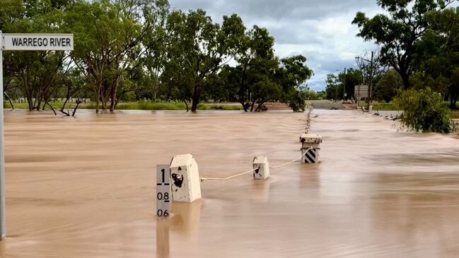
It comes as the Bureau of Meteorology issued a major flood warning for the Warrego River, with the waterway peaking at 6.7m at Charleville on Saturday.
Relentless rain has been smashing the region with warnings that further areas could become inundated overnight.
On Saturday the Bureau also issued a thunderstorm forecast for Sunday.
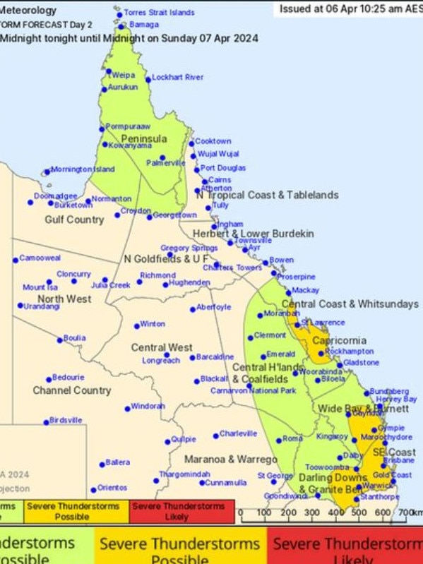
The alert stated that severe storms with heavy rainfall were possible for South East Queensland, including the Sunshine Coast, Brisbane and the Gold Coast on Sunday morning.
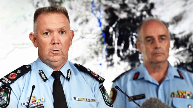
Queensland Police Deputy Commissioner Shane Chelepy on Friday said police had seen significant traffic accidents on the wet roads and people were still continuing to take risks by driving through flooded waterways.
“You really do need to reconsider your travel,” he said.
It comes after a deadly deluge earlier this week which saw a driver killed in floodwaters at Greenbank.
Senior meteorologist Harry Clark on Saturday said there was a fair bit of “cloud and shower activity across Southeast Queensland, today and tomorrow”.
“Most of the rain is actually a little bit further west … so across the Darling Downs, they’re seeing the most at the moment.”
But danger still exists for the southeast corner.
”As we go into tomorrow, the risk actually does shift a little bit further east and potentially includes Brisbane as well,” Mr Clark said.
“If we were to see that coastal trough forming, that could be anywhere in the order of 50 to 100 millimetres.”
This level of rainfall in already saturated areas could lead to flash flooding.
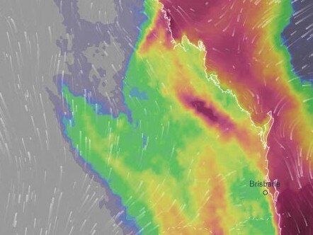
“The best case is to see under 50 millimetres for most areas, but there is a risk we see close to 100mm in isolated spots,” he added.
Mr Clark said there was ongoing flooding in southern inland Queensland.
“The most significant flooding is occurring on the Warrego River,” Mr Clark said.
The Warrego River at Charleville was expected to reach a peak near 6.7 metres.
Flood levee gates were activated in the town on Friday afternoon, with Mr Chelepy saying access roads would also likely soon be cut off.
“The levee has capacity to 7.9m,” he said, adding that there would be no evacuations unless the water reached 8.1m.”
State Emergency Service acting Assistant Commissioner Brian Cox said there had already been 59 calls for assistance across the state since Wednesday, most involving water inundation into homes.
He urged people to remain vigilant and those insisting on travel, to check the local government and transport and main roads website and to tell others where they were going.
“Flash flooding can occur in minutes, not hours or days,” he said.
“Please consider if you have to travel in those areas to at least warn people and friends and family about your travel arrangements so they are well aware if you do get into trouble.
Mr Clark said the weather would improve after the weekend.
“Things really do start to clear up from Monday, so mostly sunny Tuesday, and a sunny Wednesday and Thursday … So definitely some better school holiday weather coming up.”
Temperatures will also drop in the South East next week, with minimum temperatures as low as 16C in Brisbane and 13C in Ipswich.
More Coverage


Read related topics:Weather
Join the conversation
SEQ sunshine for Easter break as inland ocean inches toward border
Showers are clearing after a wet weekend in south east Queensland, with a forecast of sunny days ahead of the Easter break.
Read more
Outback dream wiped out by flood disaster as repair bill tops $1m
The owners of an outback motel face a $1m repair bill in the wake of the once-in-a-generation flood in Thargomindah.
Read more