
Brisbane weather: Severe storms likely in Brisbane, Sunshine Coast and Wide Bay regions
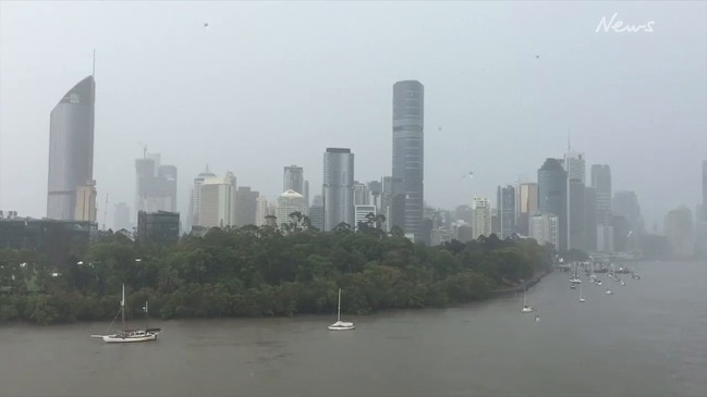
Residents, community groups and businesses are counting the costs of a wild storm that smashed into Brisbane this afternoon, delivering more than 75mm of rain to parts in less than half an hour.
QLD weather news
Don't miss out on the headlines from QLD weather news. Followed categories will be added to My News.
A WILD storm that slammed into Brisbane late this afternoon has left a path of destruction in its wake.
Some areas reported more than 60mm of rain falling in just 30 minutes, with the city’s northern suburbs hardest hit.
In Margate, resident Maris Bar recorded 65mm in 15 minutes. He said he was blown away by the storm’s “volume, speed and ferociousness”.
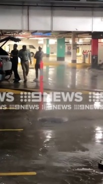
GREENSLOPES STORM CARNAGE: At least 6 cars flooded, residents say it came on in 10-20 minutes, water 1-1.5 metres high @7NewsBrisbane some people coming out of day surgery to find cars destroyed pic.twitter.com/VISYDTo3Zc
— Georgie Chumbley (@G_Chumbley) December 13, 2019
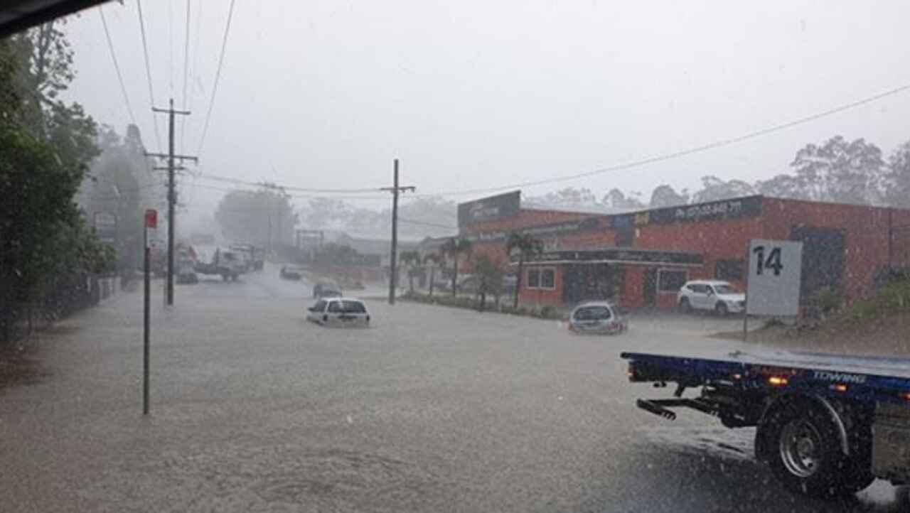
A Greenslopes street near Norman Creek was hit by a wall of water residents say was up to 1.5 metres high.
Parked cars were washed into one another, with at least six damaged and waterlogged, and six home suffered minor flooding.
Videos have emerged of huge trees fallen on suburban streets and powerlines down.

The roof of the Toombul Shopping Centre caved in under the weight of deluge, sending shoppers scurrying for cover. The shopping centre remained open and is expected to trade today.
Members of Redcliffe Little Athletics were last night mopping up after their clubhouse was inundated during the downfall.
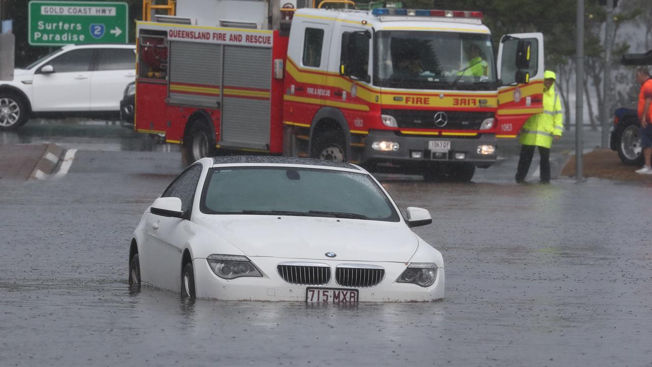
On the Gold Coast, authorities say the one-in-100-year storm produced falls of more than 130mm in just an hour.
At 4pm Energex reported more than 8600 customers were without power, with Gold Coast residents worst affected.
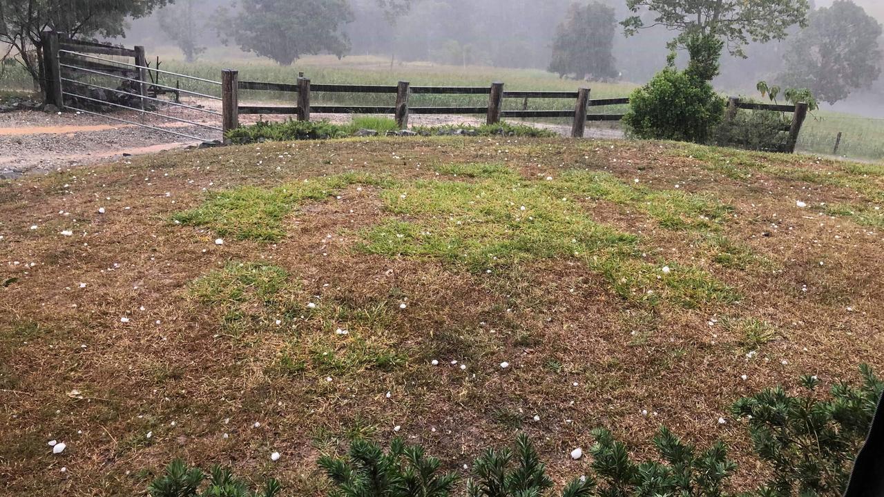
Further north, rural communities near Gympie were hit with massive hailstones, some measuring more than 10cm in diameter.
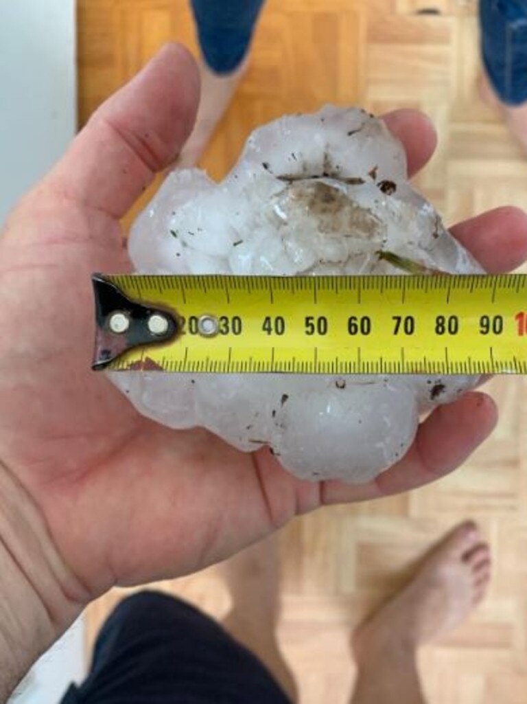
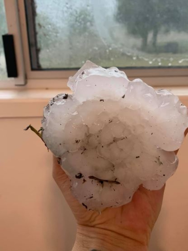
EARLIER: Hail stones larger than golf balls forced Gympie residents to take urgent cover this afternoon.
Bonny Dowling, who lives in Wilsons Pocket said “cricket balls from the sky” started following dangerous storm warnings and went for about half an hour.
“I knew a storm was coming but I was definitely not expecting all this plus hail,” Ms Dowling said.

EARLIER: A massive, slow-moving storm that caused flash flooding on the Gold Coast has smashed into Brisbane, delivering torrential rain.
The storm hit about 4.10pm with heavy falls already recorded in southern parts of the city.
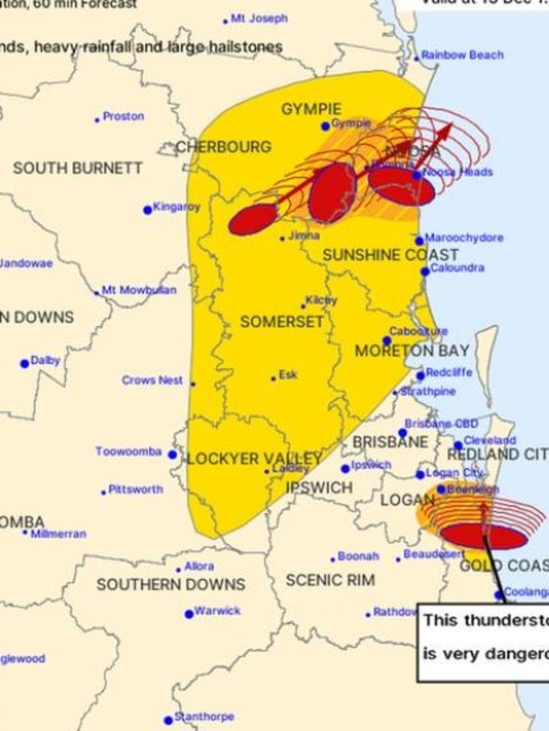
The Bureau of Meteorology is warning of damaging winds and heavy rainfall that may lead to flash flooding.
It was forecast to affect Nudgee, Aspley and Albany Creek by 4.40pm and Strathpine, Redcliffe and Kallangur by 5.10pm.
BRISBANE STORM | The storm that hit the Gold Coast earlier this afternoon is now moving across Brisbane.
— 10 News First Queensland (@10NewsFirstQLD) December 13, 2019
Video by @WeAreBrisbane pic.twitter.com/6lgwIPeq6Q
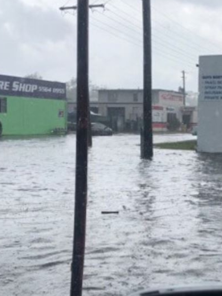
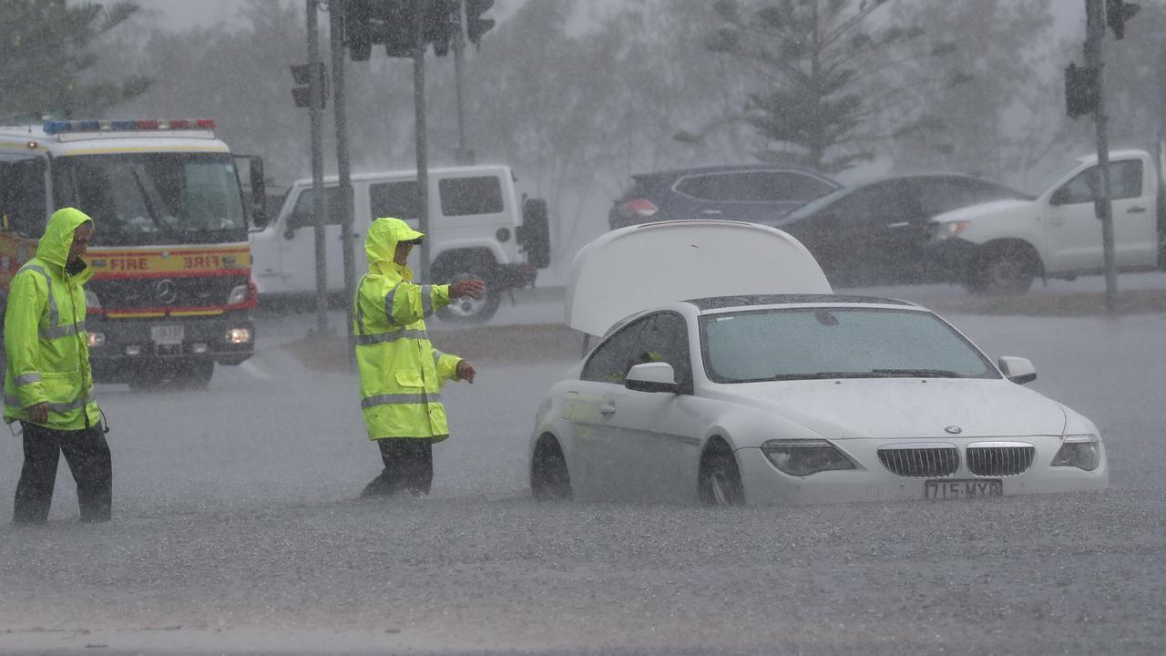
Earlier today, flash flooding hit parts of the Gold Coast as a slow-moving, very dangerous thunderstorm dumped torrential rain across the parched city.
Across the Southport area more than 120mm of rain an hour caused widespread flash flooding.
Slight delay here at Doomben @BrisRacingClub @RaceQLD pic.twitter.com/jEhnCw364Z
— Munce Racing (@munceracing) December 13, 2019
Authorities were warning of a second storm that was rolling towards the Gold Coast from the southwest.
It was located near Beaudesert and predicted to hit Southport and surrounding suburbs by 3.35pm.
Storms have also lashed Noosa and hail has pelted parts of Gympie.
The Bureau of Meteorology says the southeast should brace for further supercell storm activity with a general storm warning for the area between Hervey Bay and Brisbane still active.
Large hailstones fall in Kandanga near Gympie during this afternoon’s storm. A severe weather warning has been issued for the region. https://t.co/vKibZiiwXN #qldweather #7NEWS pic.twitter.com/1E5URoyEj7
— 7NEWS Wide Bay (@7NewsWideBay) December 13, 2019
More than 11,000 homes and businesses in Southport, Runaway Bay, Labrador, Surfers Paradise and Biggera Waters lost power as a result of the storm.
There is a severe thunderstorm warning for parts of the Gold Coast. Cars have been submerged in water on Enterprise Street at Molendinar, with more rain on the way. https://t.co/Ha2FcHTxZU #qldweather #7NEWS pic.twitter.com/YCwwVjXDpZ
— 7NEWS Brisbane (@7NewsBrisbane) December 13, 2019
Cars have been submerged in water on Enterprise Street at Molendinar, with more rain on the way.
The SES performed a swift water rescue to remove a person from their vehicle at traffic lights on Queen St at 1.10pm.
It was one of 46 requests for assistance received by the SES in suburbs including Southport, Ashmore and Arundel.
Crazy rain on the GC right now! Avoid driving if you can. Lots of flash flooding around Southport area. @9NewsGoldCoast pic.twitter.com/MlHQy6mpZ7
— Dominique Loudon (@dloudon9) December 13, 2019
On the Sunshine Coast, severe thunderstorms are forecast to affect the area south of Noosa Heads, the area southwest of Noosa Heads and Eumundi by 1.20pm and Noosa Heads, waters off Noosa Heads and Tewantin by 1.50pm.
Damaging winds, heavy rainfall that may lead to flash flooding and large hailstones are likely.
Earlier today, residents in Brisbane and southeast Queensland were being warned to expect severe thunderstorms today just two days after storms lashed the region, dumping 135 millimetres of rain in a matter of hours.
The Bureau of Meteorology has issued a storm forecast for Friday, saying severe thunderstorms are likely in a region stretching from Brisbane to Hervey Bay.
Brisbane weather: More storms on way after late-night deluge
Brisbane weather: Users take to social media to celebrate major storm
Severe thunderstorms are also possible on the Gold Coast and across the Darling Downs after both regions largely escaped Wednesday’s deluge.
ðŸŒ©ï¸ STORM FORECAST ðŸŒ©ï¸ severe storms likely (red) in #SEQ today, mostly northern #Brisbane and #SunshineCoast. As always we'll monitor storms and issue warnings as needed. Good day to keep the radar 📡 handy! https://t.co/bA4J4Y6qcF #QldStorm
— Bureau of Meteorology, Queensland (@BOM_Qld) December 13, 2019
1/ pic.twitter.com/ogW7pBdXep
The forecast will come as good news to former Queensland Premier Campbell Newman who was angry at the lack of notice for Wednesday’s storm, saying notifications only came out 15 minutes before it arrived.
The storm delivered more rain in a few hours than Brisbane had received in the previous six months, but did little to increase water levels in the region’s dams.
The Bureau says it will issue alerts and warnings as needed as the day progresses.
‘Too slow, no data’: Major BOM failures exposed in damning new report
Qld residents were forced to rely on amateur storm chasers instead of the weather bureau which failed to predict and alert the state during natural disasters, a new report has revealed.
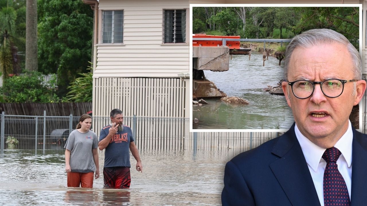
PM slams Bruce Hwy, as military might unleashed on flood clean-up
The Prime Minister hasn’t pulled any punches in his assessment of a critical part of the Bruce Highway as he visits flood-ragaved North Queensland, vowing to provide “whatever support is necessary”.