
Brisbane weather: Heavy rain, severe storms for Queen’s public holiday across South East Qld
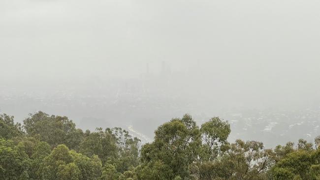
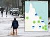
A severe thunderstorm warning has been issued for parts of Queensland with the Bureau of Meteorology warning conditions will deteriorate across the South East into tomorrow, with falls of up to 50mm.

QLD weather news
Don't miss out on the headlines from QLD weather news. Followed categories will be added to My News.
A severe thunderstorm warning has been issued for parts of Queensland, with damaging winds and large hailstones likely.
The storms are developing in the state’s southern interior with towns like Roma, St George, Mitchell and Surat in the firing line.
Storms are expected to move east with bad weather to continue over the next two days, with falls of up to 50mm.
“We’ve already seen quite a few storms in amongst that but they haven’t been anything crazy,” Bureau of Meteorology forecaster Helen Kirkup said.
The heaviest of forecast rain is expected overnight and into Thursday morning.
“We haven’t seen any significant rainfall yet, the totals will build throughout today and overnight, and closer to the coast, particularly down toward the Gold Coast there could be isolated falls tomorrow morning even up to 50mm.”
Earlier, forecaster Felim Hannify said the weather was “on a bit of a downhill trend”.
RELATED: Bureau of Meteorology declares third La Nina under way
“It’s a bit of a cloudy start and that is going to slowly thicken up as we go through the rest of the day with some patchy showers developing from about midafternoon and then becoming more consistent later in the day and overnight.”
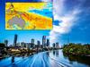
A low pressure system sitting in central New South Wales is being blamed for the wet weather onslaught, with its northern tip crossing the Queensland border and pushing the showers towards the coast.
As the trough continues to expand it will push the rain offshore.
Mr Hannify said the heaviest rain would fall Thursday morning.
“The morning particularly could see some thunderstorm activity rolling through as well, before it starts to brighten up in the afternoon, but we could still see storms then as well,” he said.
“It won’t be an ideal day for a public holiday.”

Mr Hannify said that while the Bureau had forecast between 10mm-20mm for much of the southeast, potential thunderstorm activity could see heavier isolated falls.
“There’s a low chance, but not no chance, of some localised severe activity as well and that will depend on how that cloud breaks.”
The Gold Coast will likely receive the heaviest rain, expecting between 15mm-30mm, while Brisbane and Ipswich will see between 8mm-20mm each.
But while the rain will be heavy, it will mostly be centralised around the Brisbane and Gold Coast areas. People further north on the Sunshine Coast can expect between 6mm-15mm, while areas inland like Toowoomba will see between 3mm-10mm.
The wet weather will clear quickly though, with clear skies with a possible rainfall of just 0.2mm and a maximum temperature of 27C forecast for Brisbane on Saturday.

Ice ice baby: Spectacular images of unseasonal frost as Qld freezes
Queensland’s overnight temperatures will increase to double digits in the coming days, following the coldest start to winter in 16 years, bringing frost and ice to many regions. SEE THE PHOTOS

City’s coldest June start in 16 years, feels like MINUS 9.8C out west
Southeast Queensland is shivering through its coldest morning in more than 15 years but feels-like temperatures have dropped to insane levels in the southern inland.