
45C: Temperatures set to climb across South East Queensland
Temperatures are set to hit the mid 30s in South East Queensland this week, with the mercury to climb even higher in the west. It comes after a record-breaking spring, on many levels. FULL DETAILS

QLD weather news
Don't miss out on the headlines from QLD weather news. Followed categories will be added to My News.
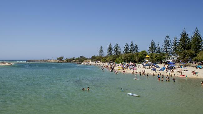
It may have been slow to get here but summer weather has finally arrived with a scorcher of a week in store for South East Queensland.
A RECORD-BREAKING SPRING: Scroll down to see why this year was the hottest, coolest and wettest across multiple regions
The Bureau of Meteorology warns there will be a noticeable jump up in temperatures from Tuesday.
“It’s been deliciously cool, which is very out of character for December. But tomorrow, the summer switch turns on very quickly,” Meteorologist Livio Regano said.
“Today’s the last mild day, tomorrow, suddenly Brisbane will get to a top of 35C.”
“Tomorrow looks like a sunny and hot day and it will stay hot and become more progressively stormy as we get into Thursday with temperatures in the mid 30s.”
Brisbane and the Gold and Sunshine Coasts are all expecting temperatures in the mid-30s, but some inland regions will see the thermostat climb well above the 40C mark.
Birdsville is forecast to reach a blistering 45C, Bedourie 45C, Quilpie 44C, Thargomindah 43C, Charleville 42C, Surat 40C, Roma 40C, Gatton 38C, Laidley 38C, Ipswich 38C, Chinchilla 38C, Beaudesert 37C, and Oakey 37C.
Mr Regano said the sudden hot change was unusual and thanks to a “blob” of cool air moving offshore.
“Normally it’s the other way around, you’d get a slow build-up of heat, and then you get a sudden, cool change,” Mr Regano said.
“What’s happening here is that for the last several days, our whether has been dominated by this low off the coast. But today is its last day, it’ll push away very, very quickly.”
“This blob of cool air that’s been sitting over Southeast Queensland all this time moves off and gets instantly displaced by a new blob of air coming from the north and it’s a much warmer one.”
Humidity will build through the week, with showers and storms more likely through the weekend.
“Storms arise generally just before a cool change … that’s what will be happening on Thursday night. That will take us into Friday which will be dropping back down to 26 degrees and leading us into a more showery weekend.”
“This coming weekend will be quite similar to the weekend we’ve just had, where it’s a little bit showery, a little bit cloudy, and back to the mid 20s,” Mr Regano said.
Record-breaking spring, for multiple reasons
Meanwhile, the Bureau’s wrap-up analysis of Spring weather across the state shows dozens of records were smashed, the season bringing above average temperatures in the north, below average in the south, and one of the wettest since records began in 1900.
WETTER
Spring rainfall for Queensland was 98.5 per cent above average, making it the ninth wettest in 122 years of record-keeping.
Many locations copped their highest ever total spring rainfall.
Comongin Station near Quilpie broke a 131-year record with 267.5mm over the season – more than four times its usual average.
Whynot Station, Cardbeign, Whyenbah, Trinidad, Gatton Vale, Coolmunda Dam, Cloncurry Airport, The Deep Crossing, Thargomindah Airport, and Julia Creek Airport also broke records for highest spring rainfall totals.
Springbrook station southeast of the Gold Coast was the wettest overall getting 700mm over the three months.
Nearby Wunburra station had the wettest day: being hit with an astonishing 348mm in a single day, September 23.
COOLER
Southern parts of the state shivered through a cooler than average season, Stanthorpe dropping to -1C on September 13.
Brisbane had its lowest spring mean temperature on record, with daily averages of 26C, while on September 7, a low of 4.4C was recorded.
Applethorpe was the coolest statewide with an average of 20C days and 8.7C nights, while Cunnamulla got the coldest day on September 2 reaching a maximum of just 12.9C, breaking a record set in 1958 for lowest spring maximum.
Weipa Aero, Thargomindah Airport, and Julia Creek Airport also set new records for lowest spring maximum temperature.
HOTTER
Up in northern parts of the state, temperatures soared through Spring – Julia Creek Airport, east of Mount Isa, reaching 43.9C on October 30.
Willis Island toppled a 92 year record for highest daily maximums with an average of 30C.
Cairns Aero, Lockhart River Airport, Cooktown Airport, Horn Island, Coconut Island, Weipa Aero, Burketown Airport and Kowanyama Airport also broke records – Kowanyama sweating through a sweltering 37.3C average.

Palmerville edged past a 113 year record for highest mean temperatures overall, with an average of 29C.
New highs for single day temperatures in Weipa Aero, 40.1C on October 29, and Coconut Island, 37.8C on November 20.
Brendan Mackey of Griffith University’s Climate Action Beacon said while La Nina explained much of the wetter and cooler weather, there was no doubt weather extremes were made worse by global warming.
“There is definitely an influence from climate change on these extreme weather events we’re experiencing this year,” Professor Mackey said.
“We’ve got to sort of take a step back and look at the weather systems that bring this to Australia – there’s La Nina, the Indian Ocean Dipole, tropical monsoon belts from the north.”
“These are all natural occurrences, of course, but with climate change it’s like climate on steroids. We get an increase in the frequency, duration and severity because of human caused global warming.”
Professor Mackey said Queensland was particularly vulnerable to extreme weather, and would be facing increasing clean-up bills in the coming decades.
“It’s extreme weather events which are really costly and deadly … we’re certainly going to see more of this in the years to come,” he said.
“That’s why mitigating global greenhouse emissions and moving away from fossil fuels is so important for Queensland.”

Feels like -5.3C: Icy blast sends temps plummeting again
South East Queensland has again shivered through a freezing start to the day, as a brutal cold front continues to blast the region with subzero temperatures, made worse by chilling winds.

Feels like MINUS 7.1C: Brutal cold front blasts southern Qld
A brutal cold front is blasting across southern Queensland with subzero temperatures and widespread frost.