
Warwick weather: Confirmed La Niña to drive summer of heavy rainfall, storms
Huge November rainfall totals have put the region on high alert for flooding and sent dam totals skyrocketing, but experts say it’s only the beginning, with things amping up this week. FULL OUTLOOK HERE:
Warwick
Don't miss out on the headlines from Warwick. Followed categories will be added to My News.
The humid and stormy conditions behind Warwick’s extremely wet November are set to ramp up throughout the summer, with a La Niña officially declared for the second year in a row.
Warwick and the wider region has already begun to see the impact of La Niña according to BOM meteorologist Helen Reid, who said several areas across the state were lining up whopping November rainfall totals.
“We’ll see it through the summer. Every event is different, but it’s the expectation for at least the next couple of months, give or take a few, that it will bring in all that moisture for the eastern part of Australia,” Dr Reid said.
“In general, we say La Niña helps rainfall right across the board, but I wouldn’t say everywhere gets the same rain.
“There are lots of individual aspects, such as whether the Dividing Range divides the rain coming in from the east, whether it’s one northwest cloud band after another, or whether it’s tropical cyclones coming from the west and north.”
It was an even greater difference for Stanthorpe residents, who have scored a huge 188.1mm of rain this month in comparison to an average of 74.1mm.
The month’s whopping rainfall totals have also sent dam levels skyrocketing, with Leslie Dam sitting at 70.42 per cent capacity, less than two years after it dropped to single digits in the devastating drought.
Storm King Dam and Connolly Dam both remain brimming at 100 per cent capacity.
Dr Reid said the massive numbers were set to increase yet again this week, with daily showers forecast and thunderstorms to bring an estimated widespread rainfall of 20mm – 45mm on Friday alone.
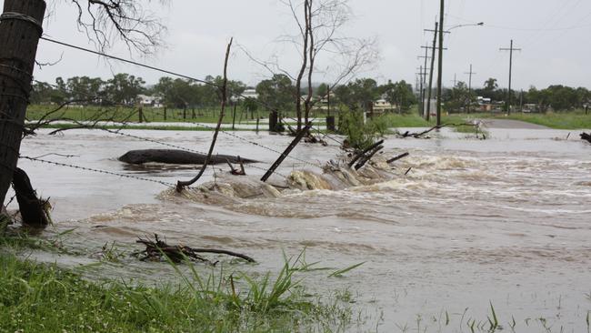
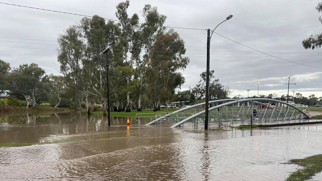
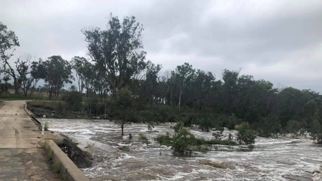
She said the Condamine River and its connected systems remained on flood watch due to the significant rainfall.
“All rivers are on high alert. The ground is still saturated, and it won’t take much more rainfall to see them go over minor flood warnings and even push it up to moderate,” Dr Reid said.
“(On Friday) you could quite easily be looking at 70mm if you’re right under a thunderstorm, and that’s all just going to feed into an area that is already very wet.”
No official thunderstorm or flood warnings have been issued at this stage, but residents are urged to check back regularly for updates.

Coroner to review jail cell death of McCulkin killer rapist
The final step before a coronial inquest into the death in custody of one of Queensland’s most notorious killers is in motion. DETAILS.

Watch: ‘I had a stroke in regional Qld – this new tech saved my life’
A Qld woman says she is alive because a new system, where strokes are diagnosed and “clot-busting” drugs given within minutes, is being piloted at her regional hospital. It comes ahead of a statewide rollout.