
Man’s body found in car in South Burnett as deadly storms hits
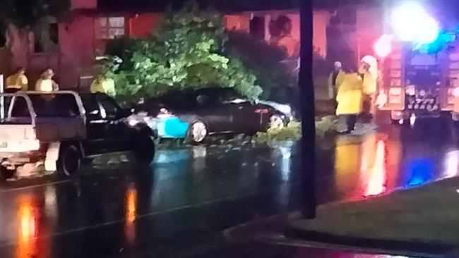
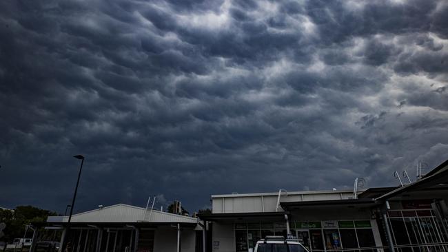
The body of a man has been found in his car in the South Burnett region after savage supercell storms lashed Noosa, Gympie, Bundaberg, Rockhampton, Brisbane and the Gold Coast overnight.
Sunshine Coast
Don't miss out on the headlines from Sunshine Coast. Followed categories will be added to My News.
The body of a man has been found in his car in the South Burnett region after savage supercell storms lashed Bundaberg, Rockhampton, Gympie, Brisbane and the Gold Coast on Sunday night.
The tragedy happened about 5pm on Mp Creek Rd in the Wondai region where swiftwater rescue crews rushed to the scene, saving a woman who had escaped the vehicle and was clinging to a tree amid rapidly rising floodwaters.
She was assessed by paramedics and taken to hospital with no physical injuries.
The submerged car was later found but crews could not safely access it until about 11.30pm, when the man’s body was recovered.
He was the 12th flood fatality in Queensland.
Another rescue was under way at Byee, also in the South Burnett, after another driver became trapped in rising floodwaters.
Queensland Fire and Emergency Services and police were able to make the vehicle safe and move the driver to higher ground.
Early reports indicate he was uninjured and will be taken to hospital for observation.
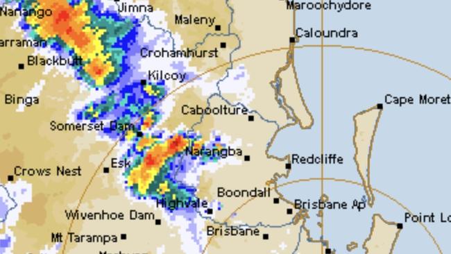
A Queensland Fire and Emergency spokeswoman said the SES had received 92 requests for assistance in the Gympie region, 17 call-outs for help on the Sunshine Coast and four requests in Noosa.
She said all requests to assist with storm damage.
More than 11,000 properties were without power, including 1000 in Noosa.
There were another 2150 in the Scenic Rim, 1800 in the Lockyer Valley and 3800 in Brisbane.
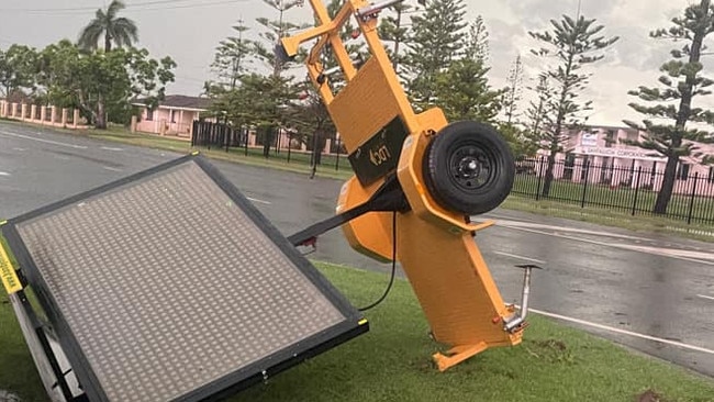
In Tanby, Central Queensland, a tornado caused minor damage. There were also reports of 140mm of rain at Keppel Sands, with extreme wind conditions.
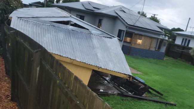
In Bundaberg, a car was hit by a tree, trees uprooted, trampolines sent skyward, traffic signs tossed over, while winds hit 83km an hour.
Meteorologist Peter Markworth said reports of a microburst, a strong downwards gust of destructive air, did not sound of character.
“It doesn’t look inconsistent given the cell that has passed over Bundaberg tonight,” he said.
Millbank woman Renee Ward said it was the “worst storm” she had seen in some time.
“Millbank still has power and it seems to have passed over, but the thunder still sounds like jets flying over,” she said. One lane of traffic near the Bundaberg Racecourse is believed to have been blocked by a downed tree.
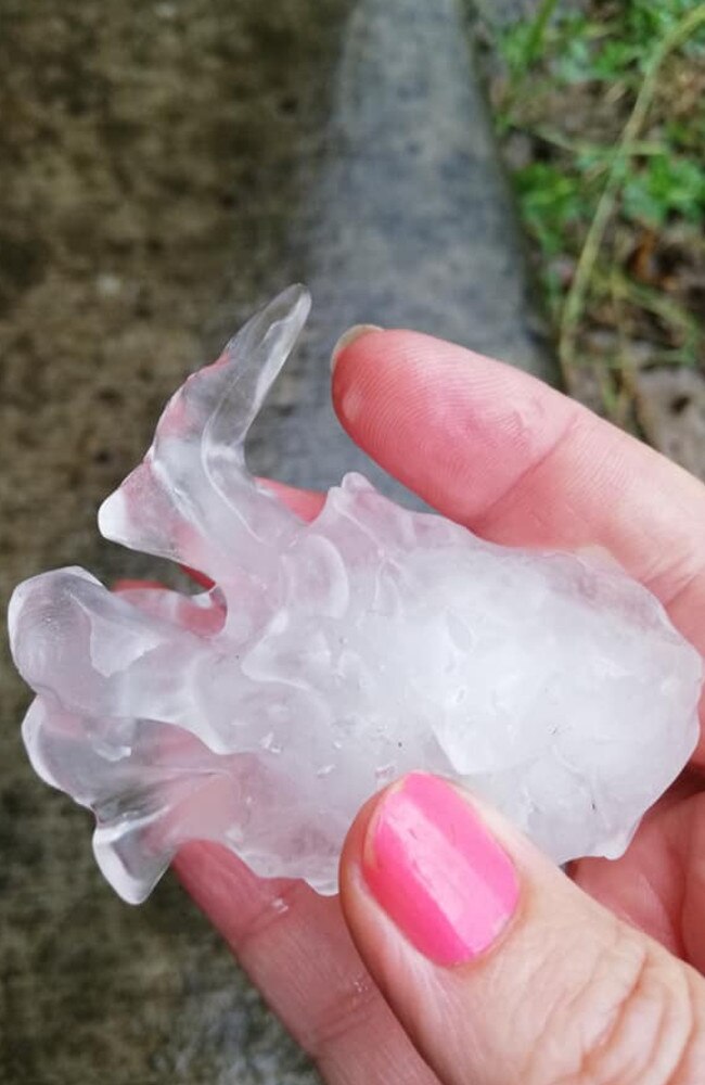
Hail of 8-9cm was reported at Beaudesert and Logan.
Higgins Storm Chasing shared video of what it said was a weak tornado at Tanby near Rockhampton. It also reported there was a microburst at Bundaberg.
The site posted pictures of a shredded trampoline near Hannah Road and damaged trees, along with a video which some said was more like a ‘whirly winds’ than a tornado.
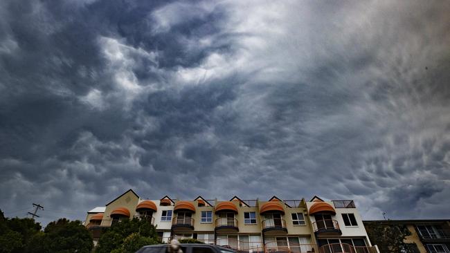
The savage storms were widely predicted by storm watching sites overnight.
The weather bureau says there is more to come with the Sunshine Coast and Gold Coast most in line for more storms, along with areas further north to Rockhampton.
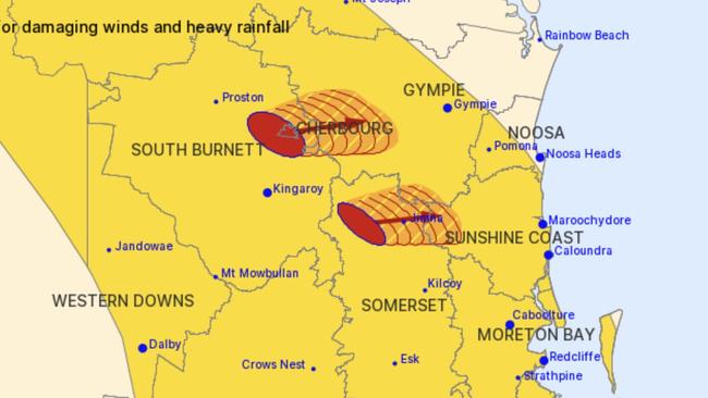
Just after 6pm, issued a warning of severe thunderstorms with damaging winds and heavy rainfall which may lead to flash flooding.
Locations which may be affected include Maroochydore, Gympie, Bundaberg, Rockhampton, Caboolture and Cleveland.
In the Wide Bay, the Fig Tree Alert recorded 99mm in 3 hours, while Holland Park recorded 51mm in 30 minutes.
Giant hail 8 to 9cm in diameter was observed from the very dangerous supercell near Beaudesert.
Flood warning issued for Burnett River
The weather bureau issued a warning for the Burnett River just after 11pm on Sunday, reporting widespread rainfall totals of 30-120 mm had been recorded across the lower Burnett catchment. There had been 124mm of rain observed at Fig Tree.
“Further showers and possible thunderstorms are forecast for Monday, which may lead to further small rises.”
Minor flooding is expected along the Burnett River downstream of Paradise Dam at Walla.
Minor flooding is occurring at Ned Churchward Weir.
The Burnett River at Walla was at 5.59m (below the minor flood level) and rising. It is expected to reach the minor flood level (6.00m) overnight Sunday into Monday. The river level may remain above the minor flood level into Monday morning.
The Burnett River at Bundaberg was at 1.77 metres (below the minor flood level) and falling with the tide. The Burnett River at Bundaberg is expected to remain below the minor flood level (3.50m) during Monday.
Mum shares terrifying hailstorm video as new super threat looms
A Sunshine Coast mum has shared a terrifying video of a hailstorm which destroyed four cars outside her home, including her partner’s brand new ute.
The minute long clip, taken a few days ago, shows the ferocity of super cell activity which is now again threatening from Gympie to the Gold Coast.
Weather and storm watching sites have forecast very dangerous storm activity with the possibility of hail of 5cm to 8cm in size.
Tammie Dobson, who has only recently moved to the Coast, said she had never experienced anything like what unfolded at her Landsborough home.
She said she was woken at 2.30am by what was ‘like a tornado’.
“All four cars need to be written off.’’
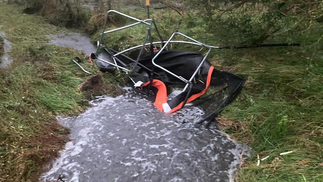
The family’s trampoline was a mangled mess down the street while the neighbour’s trampoline landed in their yard.
The family, who had only been recently trapped by floodwaters on the Coast, also lost power while trees were down everywhere in the estate.
The Bureau of Meteorology issued a warning for severe thunderstorms on Sunday afternoon.
At 2:45pm, severe thunderstorms were detected on the weather radar near Boonah and the area northwest of Jimna.
The storms are moving towards the east. They are forecast to affect the area between Boonah and Beaudesert, Borumba Dam and Imbil by 3:15pm and Beaudesert, Mapleton and Yandina by 3:45pm.
Damaging winds, large hailstones and heavy rainfall that may lead to flash flooding are likely.

Earlier the bureau issued a general warning, saying thunderstorms were likely to produce damaging winds at Warwick, Gold Coast, Toowoomba, Brisbane, Dalby, Maroochydore, Gympie, Ipswich, Kingaroy, Coolangatta, Stanthorpe, Caboolture, Cleveland, Gatton and Jimboomba.
Heavy rainfall increases the potential for landslides and debris across roads.
Ms Dobson said from what she could see there was not a lot of damage to the house.
“We were very lucky that it came from the direction it did, if it came the other way we would have had a lot more.”
“Our shed is hail damaged, we had water come in through windows and some lights.
“We are renovating and have already done a lot so we’re very lucky nothing we have done was damaged.’’
Trees along old Landsborough Road and Steve Irwin Way were left in a mess by the storm.
“There were power poles all leaning over down Old Landsborough Road with power lines across the roads and trees over the roads and in some houses.”


Five caravans, two cars ‘set on fire’ at rest stop
A man is in custody and firefighters are on the scene after an early morning blaze tore through a Sunshine Coast rest stop.
Read more

$420k tax debt forces prominent cafe to restructure
A corporate watchdog has revealed a popular Queensland hinterland cafe needs to overcome a six-figure tax debt.
Read more