Bundaberg region lashed by storms, BoM predicts more
A final flood warning has been issued for the Burnett River has been issued as waters recede following a night of heavy rain. But there’s more on the horizon, with the Bureau of Meteorology revealing the storms aren’t gone yet.

Bundaberg
Don't miss out on the headlines from Bundaberg. Followed categories will be added to My News.
A final flood warning has been issued for the Burnett River at Walla.
According to the Bureau of Meteorology, flooding is easing at Walla.
Flood levels are also easing downstream of Paradise Dam.
Minor flood warning issued on Monday morning
Minor flooding is expected into Walla during Monday, according to the Bureau of Meteorology.
The lower Burnett catchment area recorded between 30 and 120mm of rain due to Sunday’s storms, with 124mm observed at Fig Tree.
This has led to renewed river and creek level rises in the lower parts of the catchment, which remains wet and responsive after rainfall over the last week. Further showers and possible thunderstorms are forecast for Monday, which may lead to further small rises.
Minor flooding is expected along the Burnett River downstream of Paradise Dam at Walla. Minor flooding is occurring at Ned Churchward Weir.
As of Sunday night, the Burnett River at Walla was expected to reach the minor flood level of 6m overnight Sunday into Monday.
The river level may remain above the minor flood level into Monday morning.
The Burnett River at Bundaberg is currently at 1.77 metres (below the minor flood level) and falling with the tide. The Burnett River at Bundaberg is expected to remain below the minor flood level (3.50 m) during Monday.
Weather bureau says Bundy is in for more
Bureau of Meteorology meteorologist Livio Regano told the NewsMail that the region could expect more storms in the coming week.
Mr Regano said while today’s storm activity was starting to shift to Capricornia, the humidity and heat would remain.
“It isn’t going to be fine in Bundaberg for days,” he said.
There’s a chance of smaller storms in the next couple of days, but Mr Regano said Wednesday and Thursday would likely be “another two potent days coming up on the calendar” with a high chance of severe storms.
“We’re not going to see that holiday postcard sunshine,” he said.
Mr Regano said that with a typical storm peak in November and December, the current activity was unusual.
“It’s very untypical, the whole weather pattern is very untypical,” he said.
Overnight minimums that would normally sit around 19-20 degrees have instead been sitting at 25, and the usual south easterlies that would keep temperatures in check won’t arrive till around the end of the week.

From Sunday night
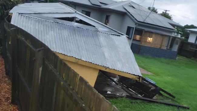
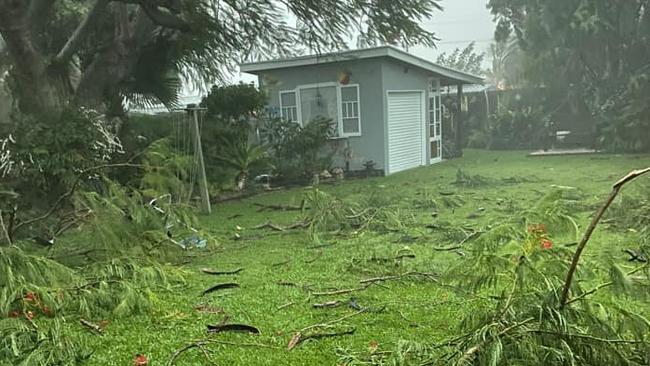
Bundaberg is tonight being lashed by wild weather following a severe thunderstorm warning from the Bureau of Meteorology today.
As of 7.30pm Sunday, Bureau of Meteorology meteorologist Peter Markworth said the region would be in for a second cell in the coming hours.
Mr Markworth said reports of a microburst, a strong downwards gust of destructive air, did not sound of character.
“It doesn’t look inconsistent given the cell that has passed over Bundaberg tonight,” he said.


At the time of reporting, Bundaberg had received 33mm of rain, while Gin Gin had received 65mm.
Fig Tree copped 99mm in three hours.
Winds in Bundaberg hit 83km an hour.
Mr Markworth said the second cell should stay north of Maryborough, but some of it could be felt in Hervey Bay.
From local accounts, the Walkervale and Parklands areas seem to have been hit heavily in tonight’s deluge.

Within a short time of the storm arriving, a tree had been uprooted and was across Sims Rd, while trampolines landed in trees on Boundary St.
Residents of the Branyan and Parklands area said they were receiving flash flooding as at 7pm, while Millbank woman Renee Ward said it was the “worst storm” she had seen in some time.
“Millbank still has power and it seems to have passed over, but the thunder still sounds like jets flying over,” she said.
One lane of traffic near the Bundaberg Racecourse is believed to have been blocked by a downed tree.
Natalie Collinson said that in the panic, her husband had broken a bone.

“Powerline across the road, trees down, branches everywhere, got the hail cover over the car just in time, but hubby fell over in the dark and broke his toe,” she said.
Emergency crews tended to the scene of one incident where a tree had fallen on a car. It is not yet known if anyone was affected.
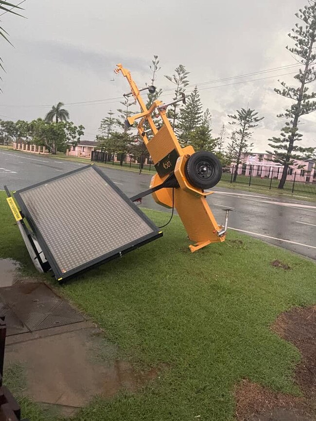
Clint Davis shared an image of a large road traffic sign, which he said flew 30m down the road.

Residents of areas including Sharon and Elliott Heads reported power outages.
At 7.30pm, the Bureau of Meteorology issued an updated severe thunderstorm warning for Bundaberg.
Locals have been warned to expect damaging winds and heavy rainfall.
If you have photos and video to share, join the conversation on Facebook.
More Coverage


