
Snow still possible as Qld prepares to shiver through fierce polar blast
A severe weather warning is in place in southern Queensland as the state braces for a polar blast that could produce a fierce winter storm bringing rain, destructive winds and the likelihood of snow on high peaks.
QLD News
Don't miss out on the headlines from QLD News. Followed categories will be added to My News.
Temperatures will plummet across southern Queensland today as a polar blast slams into the state, delivering rain, damaging winds and potential snow.
A severe weather warning for damaging winds is already in place in the southeast coast district, with strong westerly winds pushing a strong cold front to the ast.
The Bureau of Meteorology says damaging winds, with peak gusts of 90 to 110km/h, may be occur over a localised area near the Main Range area in the southern Darling Downs region.
Qld, the winter blast has arrived w/ daytime temps 3-8C below June averages today. Minima 4-10C below average. Granite Belt may see snow this afternoon. Warning for Sheep Graziers for parts. Damaging winds possible east of Main Range. #QLDweather warnings https://t.co/fxVSaG6NXlpic.twitter.com/2ZywfsfH4P
— Bureau of Meteorology, Queensland (@BOM_Qld) June 9, 2021
The eastern slopes of the range and nearby valleys within a few kilometres east of the base of the range will be the hardest hit until at least mid-morning.
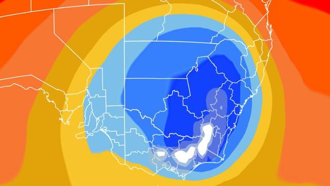
The bureau has said “20 million Australians are set to shiver” as a hefty chunk of polar air surges up from the Southern Ocean.
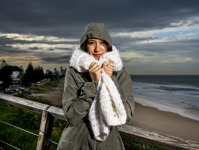
Parts of the Gold Coast and Tweed could receive a dusting of snow in coming days, according to the Bureau of Meteorology.
It’s thought a decent covering of snow was last recorded in the Gold Coast hinterland in July 1984, but Springbrook did receive light snow in 2005.
Forecasts show the hinterland could shiver through temperatures as low as 4C on Thursday.
BOM forecaster Melody Sturm said a cold front which started below Tasmania was due to make its way north as the week progresses.
She said snow was “very likely in areas above 900 metres near the coast and above 800m further inland”.
Springbrook has an elevation of 524m, but Mt Mumjin (Springbrook Mountain) reaches 1020m above sea level. Wollumbin (Mount Warning) just over the Queensland-New South Wales border in the Tweed reaches more than 1150m.
Ms Sturm said the weather would continue to cool through Wednesday and “inland areas will definitely take the brunt of this low pressure system.”
She said Thursday was expected to “be the coolest” and Ms Sturm added “we may get rain which will become snow above 900m”.
Snow also remains a possibility across the Granite Belt, but forecasters say a change in conditions may see Queensland miss out.
“It will be cold enough, but there’s not much moisture moving through at the right time,” Sky News Weather meteorologist Rob Sharpe said.
Stanthorpe is expected to drop to a freezing -2C on Thursday morning and only getting to a daytime maximum of 6C.
Subzero minimums will persist until at least Monday.
Brisbane residents have woken to 16C temperatures, but with strong winds already bloing in .
Up to 10mm of rain is possible today.
However, it will be much colder on Thursday morning with predictions of a 6C minimum and morning frost.
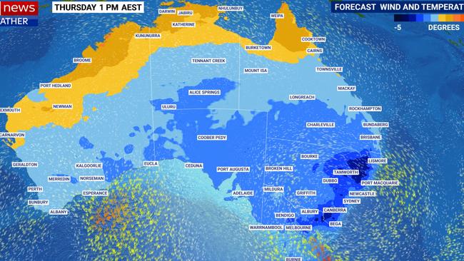
“Tropical Queensland will feel the cool change sweep through late on Wednesday,” said Mr Sharpe.
“By Thursday morning it will be much colder, particularly south from Townsville. Some areas will see nights more than 10 degrees colder than what will occur on Monday and Tuesday nights.”
Rockhampton’s minimum will sink from 16C early on Wednesday to 4C on Friday morning.
CURRENT TEMPS & 7—DAY FORECASTS

Father’s anguish, Minister’s silence: Second alleged sex assault as child-on-child attacks soar
A second father in a matter of days has told of his trauma after his daughter was allegedly sexually assaulted at a childcare centre, but Queensland’s Education Minister is bizarrely staying silent on the issue.
More Teals are coming: Here’s what they will demand
Three more climate-focused independents will be favourites to beat Coalition MPs. If they win, this is what they’ll push Anthony Albanese to do. SPECIAL REPORT