
Reprieve in sight as forecasters predict warm, sunny weekend after heavy rainfall across South West Queensland
Western Queensland’s hammering has continued overnight with flash flooding impacting rural communities. Here’s the latest forecast.
Roma
Don't miss out on the headlines from Roma. Followed categories will be added to My News.
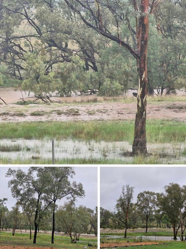
Heavy rainfall has caused a deluge in parts of South West Queensland with more than 150mm recorded in parts of the state.
An intensified trough system over the upper Warrego catchment saw flash flooding in Charleville and surrounding areas.
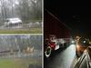
A number of roads between Roma and Surat, Inglestone, and in the wider Western Downs region have been impacted by the intensive falls.
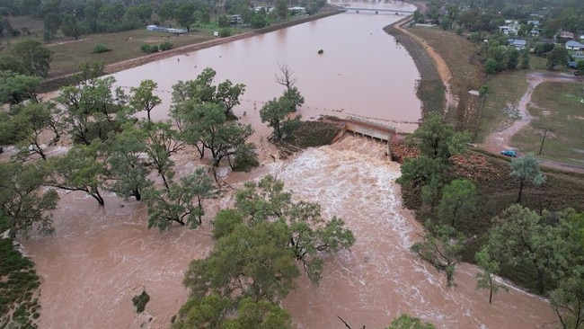
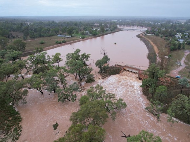
Flooding at Bradley’s Gully has been a major test for its diversion with the highest flow on recorded since it was constructed in 2013.
In a statement on social media from Murweh Shire Council chief executive Bruce Scott, council was monitoring automatic flood gauges in the Bradley’s Gully catchment.
“Council has also been in constant contact with our consultant senior hydrologist who has had extensive experience in the planning of the Bradley’s Gully Diversion and recent Flood Risk Assessments of Charleville and Augathella to ensure that we are making the most informed decisions on your behalf,” the statement said.
“Bradley’s Gully peaked at the Lower Bradley’s Gully gauge at 2.1m at 11.38pm last night, and we are now seeing the peak passing through just above Charleville down the Bradley’s Gully Diversion and across the Wellwater Road into the Warrego River.
“This is a major test for the Bradley’s Gully Diversion and the highest flow on record since construction, and council is very pleased to advise that the diversion is working perfectly and is keeping the Charleville community residents and infrastructure safe from flooding.”
Council acknowledged the heavy rainfall’s impact on the town drainage system and its inconvenience on affected residents.
“The town drainage system was never designed to manage an event of this magnitude which is considered by the Bureau of Meteorology as a probability of a 1 in 50-year event,” the statement said.
Thursday is predicted to be another wet day for much of Queensland, with showers and possible thunderstorms, patches of rain forecast across most districts.
South East Queensland residents were also lashed by overnight falls with Caboolture recording 97mm, Woody Point 87mm, Rothwell 84mm, Deception Bay 77mm, and Redcliffe with 66mm.
In the Western Downs region Tara recorded the highest overnight rainfall of 54mm, while Dalby recorded 40mm and Condamine 49mm.
Between Roma and Surat the ongoing rainfall has caused Yalebone Creek to rise, with flash flooding reported across parts of Seventeen Mile Lane.
On Tuesday, Warwick was hammered with 91mm in just over an hour, while overnight recording around 22mm.
Bureau of Meteorology senior meteorologist Dean Narramore said most of the wider Darling Downs saw overnight falls between 20-40mm.
“Less rainfall was recorded around Toowoomba and down towards the NSW border around Applethorpe and Goondiwindi who saw between 10-20mm (over the past 24-hours),” he said.
“More widespread showers will continue for most of today, there could be some ponding in areas but we’re not expecting any major flooding.”
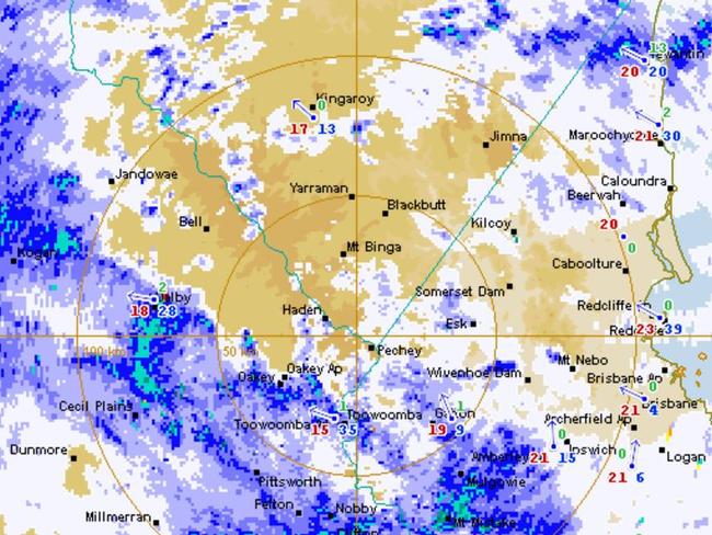
The forecaster said there’s likely to be an ease from the rain this evening, with isolated showers expected into tomorrow.
While parts of the region have recorded unusually low temperatures of 6-10C cooler, Friday is expected to bring a warm and sunny weekend.
More Coverage

Originally published as Reprieve in sight as forecasters predict warm, sunny weekend after heavy rainfall across South West Queensland

Moment of truth for Premier’s key election promise
Premier David Crisafulli’s flagship election policy to reduce the number of victims of crime will be put to the test today with the release of critical data.

$888m lost: Qld’s worst pokie hotspots revealed
Queenslanders are losing more than $888 million as the state’s worst pokie hotspots can be revealed. Search our interactive table and see how your suburb compares.