Queensland weather: Heavy rain forecast for Brisbane, totals up to 80mm
Brisbane is expected to cop more rain across the rest of the week, following Tuesday’s large, slow-moving deluge.

QLD weather news
Don't miss out on the headlines from QLD weather news. Followed categories will be added to My News.
Brisbane is expected to cop more rain across the rest of the week, following Tuesday’s large, slow-moving deluge.
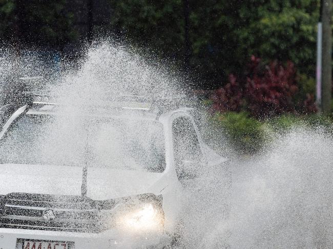
On Tuesday heavy rainfall in the Brisbane CBD caused flash flooding along Coronation Drive at Milton, before Cribb St, with all lanes affected outbound towards Toowong.
The flash flooding caused delays, with traffic banked up on the Riverside Expressway, the Department of Transport and Main Roads reported.
Flash flooding was also impacting the Margaret St off ramp along the Riverside Expressway, with all lanes affected.
Meteorologist Pieter Claassen said light showers were expected for the rest of the week, with the peak of rainfall activity seen across Tuesday.
“We could continue to see mostly light rain, maybe at times more moderate rainfall across the Brisbane region (on Wednesday) – about 5 to 25mm of rain possible for (Wednesday),” he said.
“Looking at the rest of the week, it is quite a cloudy week ahead for southeast Queensland and a relatively wet week.
“Although (Tuesday) was likely the peak of that shower and rain activity.
“So it’s on an easing trend over the next few days, and by the weekend we are likely to see a bit of sunshine around southeastern Queensland.”
Mr Claassen said while the rain was tipped to ease over the week, there was still a slight risk of flooding in southeast Queensland river systems.
“There are some slight risks as we have had reports of some very isolated flash flooding in parts of the southeast,” he explained.

Earlier on Tuesday Warwick was hammered with 91mm in just over an hour.
Inala (30mm), Springfield Lakes (33mm), Coolangatta (34mm), Palm Beach (47mm), Adams Bridge (49mm) and Torridon (50mm) were also hit hard.
It comes after 150mm of rain flooded suburban streets in Brisbane on the weekend.
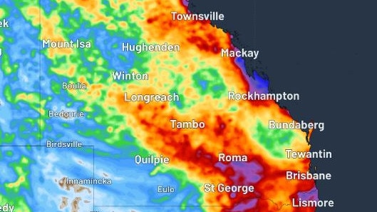
Weatherzone’s Ben Domensino said a low pressure system could form near the central coast of Queensland about Thursday, which would further enhance the risk of heavy rain and flooding.
“Rain will increase over Qld from the middle of this week as moisture-laden easterly winds feed into a deepening coastal trough,” he said.
“This rain will start on Wednesday and could increase on Thursday as the coastal trough deepens.”
Mr Domensino said there was the potential for more than 200mm of rain along parts of Queensland’s central coastline.
“While there is still some uncertainty regarding this week’s rain in central Queensland, there is potential for heavy rain and flooding in the state’s central coastal districts around Thursday,” he said.

The bureau on Monday predicted isolated showers, with possible thunderstorms and a day of persistent rain on Tuesday.
Senior meteorologist Steve Hadley said there will be storms from inland west and will land on Scenic Rim region and the Granite Belt at anytime on Monday.
“It will be very late for Brisbane and the Gold Coast,” he said.
Showers and thunderstorms will continue across the week.
The Bureau of Meteorology recorded 150mm of rainfall at Leslie Harrison Dam and 138mm in Burbank in Brisbane on Saturday, with Queensland State Emergency Service responding to 50 call-outs in a day.


