Interactive maps show true extent of Brisbane’s February 2022 floods
New flood maps have been released revealing the full impact of the 2022 flood disaster on Brisbane suburbs. SEE THE MAPS
QLD News
Don't miss out on the headlines from QLD News. Followed categories will be added to My News.
Brisbane City Council has released a new interactive flood map to show residents the devastating reality of the February floods and how the looming La Nina season could again impact them.
After conducting more than a thousand surveys, council has updated its online flood hub to include current and historic flood mapping so residents can see the flood risks connected to their home or workplace, and better prepare.
Residents can search individual addresses to see what type of flooding is likely to occur (rivers, creeks, storm tide), risk of overflow flooding and any existing flood waters, with modelling updated as live weather events occur.
New features allow users to select different map layers which show them the visual impacts of Brisbane’s major flood events in February 2022, January 2011 and January 1974.
SCROLL DOWN TO SEE THE NEW FLOOD MAPS
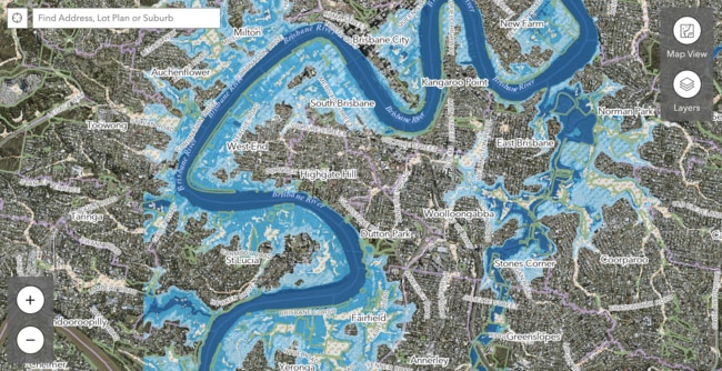
Lord Mayor Adrian Schrinner said the interactive map gave residents both historical and up to date flood information specific to their area, with the website now more user friendly.
“The online hub gives residents the latest flood information in a new-look interactive way so it is easier for people to visually understand flooding and how it may affect where they live or work,” Cr Schrinner said.
“To generate the new maps there were nearly 1100 on the ground surveys completed, alongside 21 hydrology models and 21 hydraulic models.
“The online tool also includes a new historic flood layer displaying the extent of the February 2022 flood with mapping for both river and creek flooding included.
“We can never stop severe weather, but we can be better prepared and these new flood maps will help residents have a better understanding and be better prepared,”
The online flood hub also includes an updated Floodwise Property Report to show residents how floods could affect their property for building and development -a tool Cr Schrinner said would be warmly welcomed.
“More than 540,000 residents downloaded property reports between January and May this year so we know this update will be a popular feature for residents wanting to be better prepared,” Cr Schrinner said.
MAPS REVEAL FEBRUARY AND MARCH FLOOD REALITY:
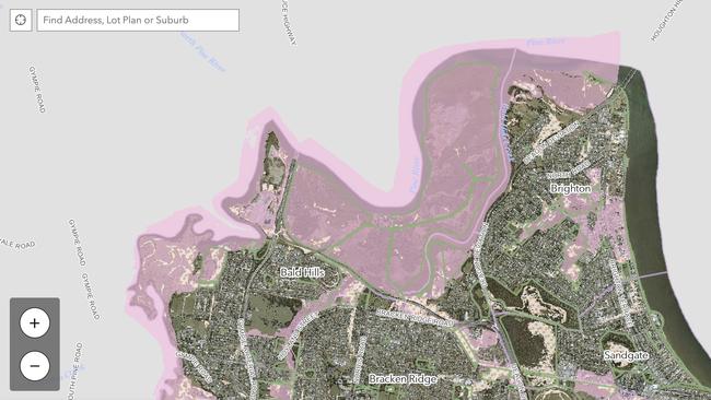
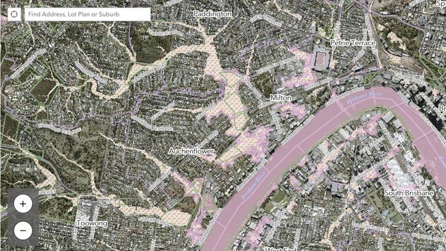
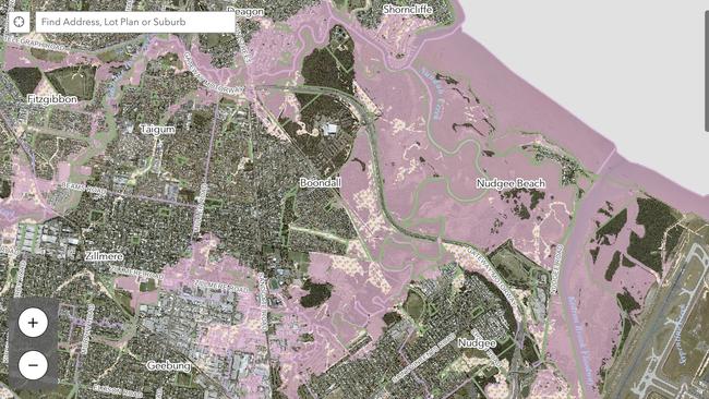
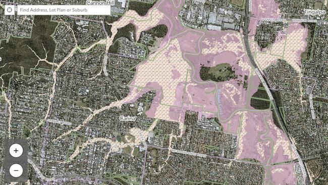
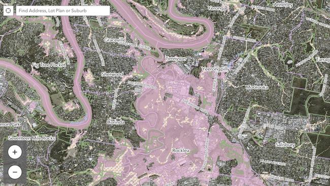
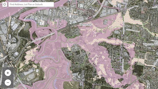
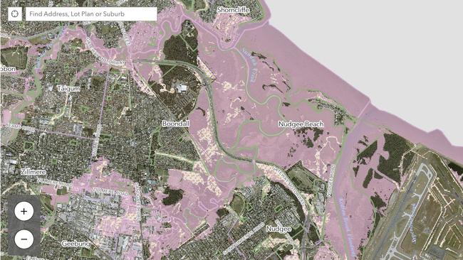
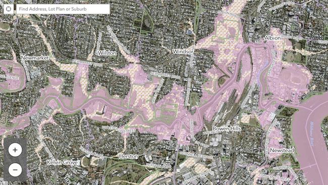
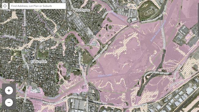
Council will update the maps annually prior to the summer storm season however, the flood information online hub may be updated outside of the usual schedule to reflect significant data source changes.
In the event the flood mapping is updated prior to October 2023, council will advertise the change or in cases of significant updates, may write to individual property owners.
The Lord Mayor reminded anyone who had not yet signed up to Brisbane Council’s free flood alert system, to register their interest now ahead of the severe wet season, with council offering incentive prizes -including a family trip to Tangalooma- to those who register before December 1.
“More than 11,750 residents have signed up for the free alerts since the February flood event, but it remains important if you’re not registered to sign up so you can be prepared,” he said.
For the latest Brisbane City Council flood information visit www.brisbane.qld.gov.au and search ‘Flood Information’ or call Council on (07) 3403 8888.
How council created the flood maps:
- Flood levels surveyed at more than 550 locations
- Gauges inspected at more than 450 locations
- Debris markings surveyed at more than 90 locations
- 21 hydrology models
- 21 hydraulic models


