
IN PICTURES: Looking back on floods that hit Maryborough
Maryborough has been hit by two floods in as many months but it’s far from the first time the city has faced the might of the swollen Mary River. Here we look back on the major floods. PHOTOS.
Fraser Coast
Don't miss out on the headlines from Fraser Coast. Followed categories will be added to My News.
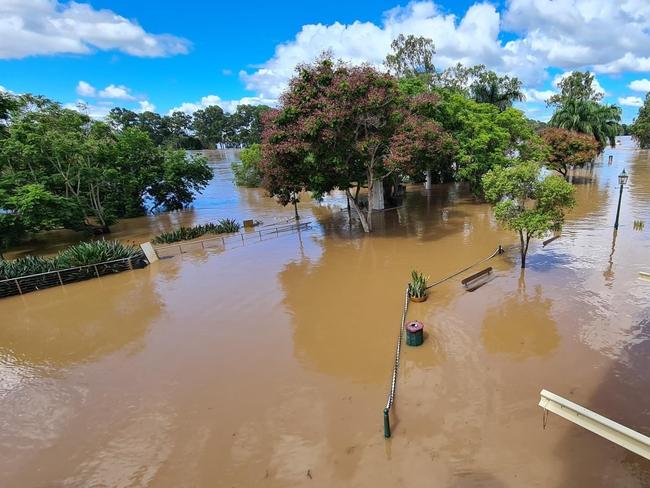
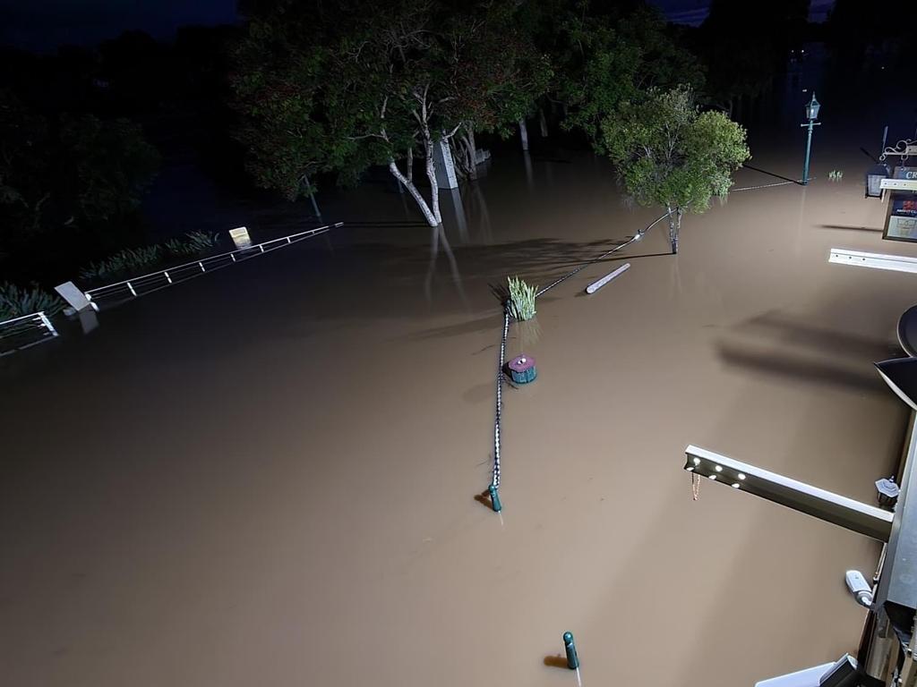
Maryborough has now survived two devastating floods in as many months – but it’s far from the first time the city has gone under.
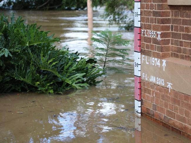
In the Wharf precinct, on the side of the city’s Bond Street store, a measure of metres tells the story of the floods that have hit the city, the biggest on record happening in 1893 when the Mary River peaked at more than 13m.
Before that, Butchulla legend told of an even bigger flood, according to Fraser Coast tourism identity Greig Bolderrow.

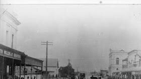
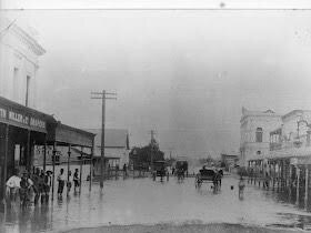
As the story goes, men were sitting on the veranda of the old Grand Hotel in March Street to watch the water rise, but soon it was lapping at their feet.
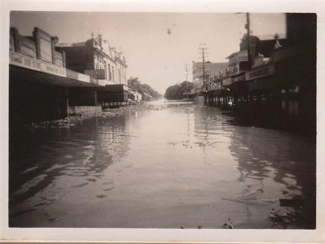
In 1955, bridges across the region went under, along with the city’s police station.
Residents were also left stranded, much like this week, in suburbs such as Granville and Tinana.
- 1857 – Above 9m
- 1864 – Above 9m
- 1870 – Above 9m
- 1875 – Above 9m
- 1887 – Above 9m
- 1890 – Above 9m
- 1893 February – 13m+
- 1893 second flood – 9.89m
- 1898 – Above 9m
- 1955 – 11.24m
- 1968 – Above 9m
- 1974 – Above 10.8m
- 1992 – 9.48m

- 1992 second flood – Below 9m
- 1998 – 6.64m
- 2013 27th to 30th January – 10.7m
- 2022 – 10m
- 2022 second flood -10.3m
Fraser Coast Mayor George Seymour said it was clear floods had been an ongoing theme throughout Maryborough’s history.
But he said it was also true that the community had come together each time to overcome the challenges it faced in the wake of the natural disasters.
MORE FLOOD COVERAGE
- ‘Enormous task’: Flooded city’s freshly fixed pool a muddy mess
- ‘Start from scratch’: Family’s valiant effort to save home fails
- ‘Felt a big crack’: Flood legend breaks leg saving stranger’s home
Cr Seymour said Maryborough’s location had been chosen because of the river when settlers first came to Queensland in the 1800s.
Even the city’s homes were a reflection of the climate, he said, with Queenslanders built both because of the heat and the flood threat.

The Bond Store, with the height of the various floods marked on its wall, was a tangible representation of what other generations had experienced, Cr Seymour said.
Residents today had many advantages over the previous generations that had lived on the river, he said.
That included social media, via which information was able to be spread quickly, as well as other modern forms of communication.
Predictions from the Bureau of Meteorology meant communities had prior notice, Cr Seymour said, something which would have been lacking when the city was hit by the big flood in 1893.

Cr Seymour said it would have been “shocking” for the residents of Maryborough who would have been unaware of the approaching floodwaters.
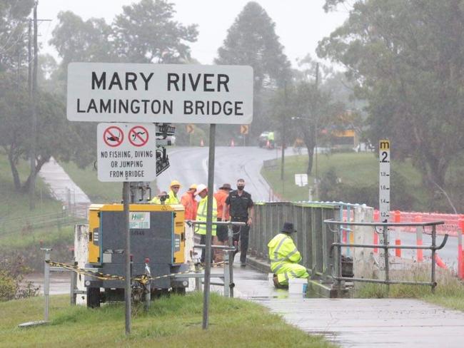
The levee, which protected the CBD from this week’s floods, had also signified another step forward.
What hadn’t changed was the city’s resilience, Cr Seymour said.

“I’m very, very proud of how our community has reacted,” he said.
While communities down south were falling victim to looters, Cr Seymour said the idea of that was unthinkable in Maryborough.
“I’ve never heard of that happening in Maryborough,” he said.
“I’ve had plenty of people asking how they can help.”
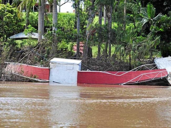
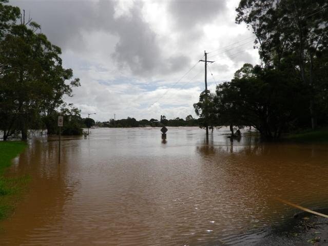
This week, the clean-up began for a second time across Maryborough.
In January, the flood peaked at 10m.
The second flood peaked at 10.3m, short of the 10.7m what was the worst-case scenario predicted by the Bureau of Meteorology.

WATCH: Council Community Hub reaches major milestone
The Fraser Coast Regional Council’s Community Hub is halfway done with construction as Mayor George Seymour takes a tour through the current site. VIDEO

‘Boomerang’ apartments planned in Esplanade shake-up
An application for apartments shaped like boomerangs on Hervey Bay’s Esplanade has been lodged to council, with the developers hoping to offer options for permanent residents and tourists.