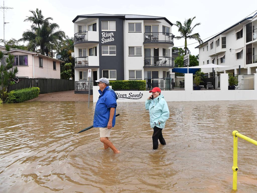
‘Unrelenting rain bomb’: Schools closed, public transport cancelled, work from home order issued
Brisbane City Council has sent out an emergency alert via text advising that major flooding is likely on the Brisbane River, with levels expected to peak at 3.7m on Monday morning.
Brisbane City Council has sent out an emergency alert via text advising that “major flooding” is likely on the Brisbane River.
The text was sent just after 8pm as the Bureau of Meteorology advised that major flood levels of 3.7m are possible at Brisbane City with the high tide on Monday morning.
“Major flooding likely on the Brisbane River,” the text read.
“Evacuate if required. Stay out of flood water. Check roads and plan your journey if evacuating.”
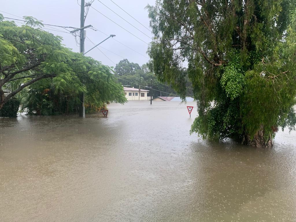
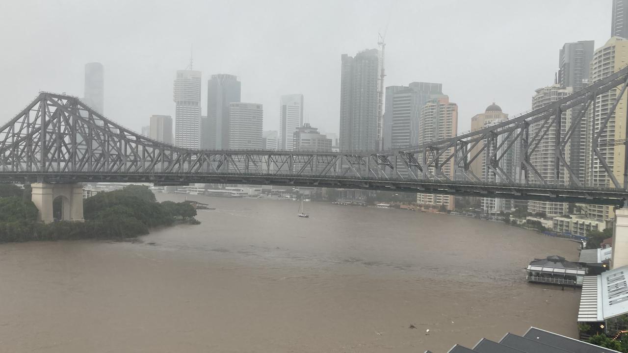
The Brisbane River is still rising and has reached 3.41m at the Sunday evening high tide mark.
Authorities are predicting a peak of 3.7m during Monday morning high tide, 76cm shy of the 2011 flood peak of 4.46m.
Authorities had earlier predicted the river to peak at 3.1m on Monday morning but later revised the forecast after hours of relentless rain.
Bureau of Meteorology forecaster Rosa Hoff said the Brisbane River should peak about 8am on Monday.
“Depending on a range of factors, the Brisbane River could peak at 3.7m,” Ms Hoff said.
“The Brisbane River could stay in that peak for a while, it’s unlikely to drop below the moderate level for a couple of days.”
Ms Hoff said the Brisbane River reached 3.017m at 6.15pm on Sunday.
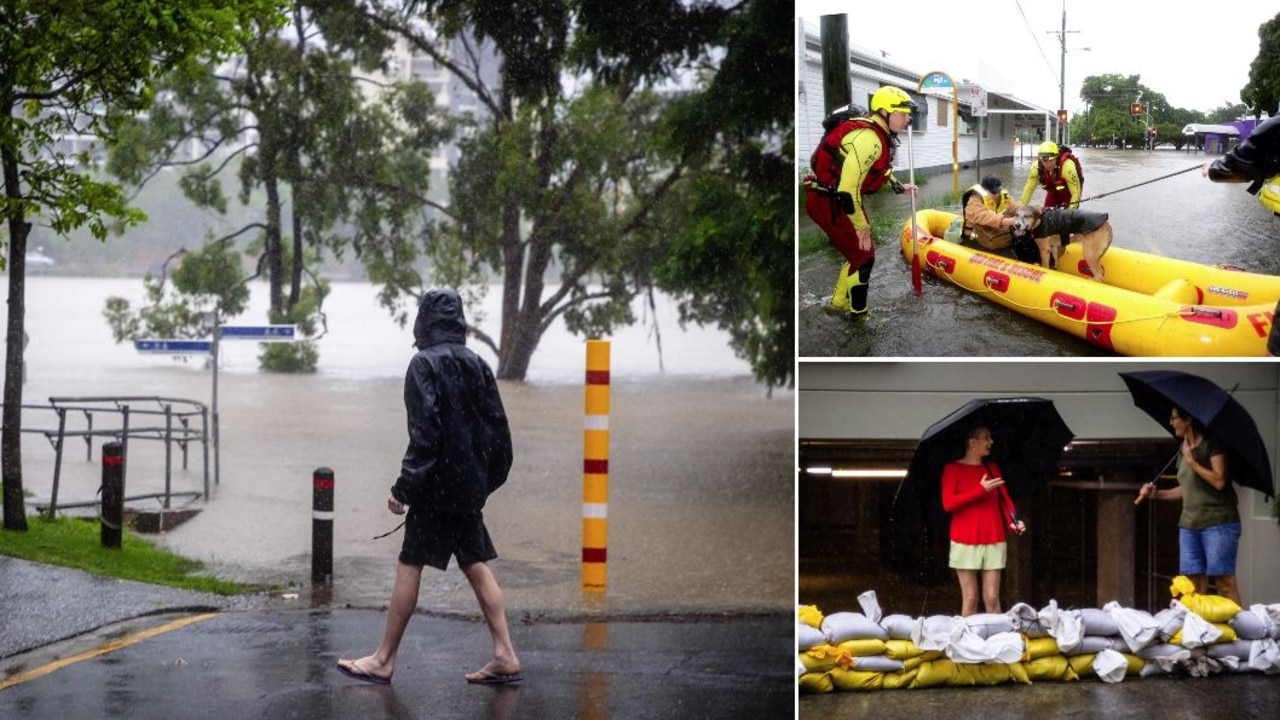
Schools in parts of Queensland will be closed on Monday and people requested to work from home as catastrophic flooding continues in the southeast.
The Royal Brisbane and Women’s Hospital has also suspended appointments and planned care for the next 24 hours as a result of the ongoing weather, which has left some roads around it under water.
FULL LIST OF SCHOOL CLOSURES HERE
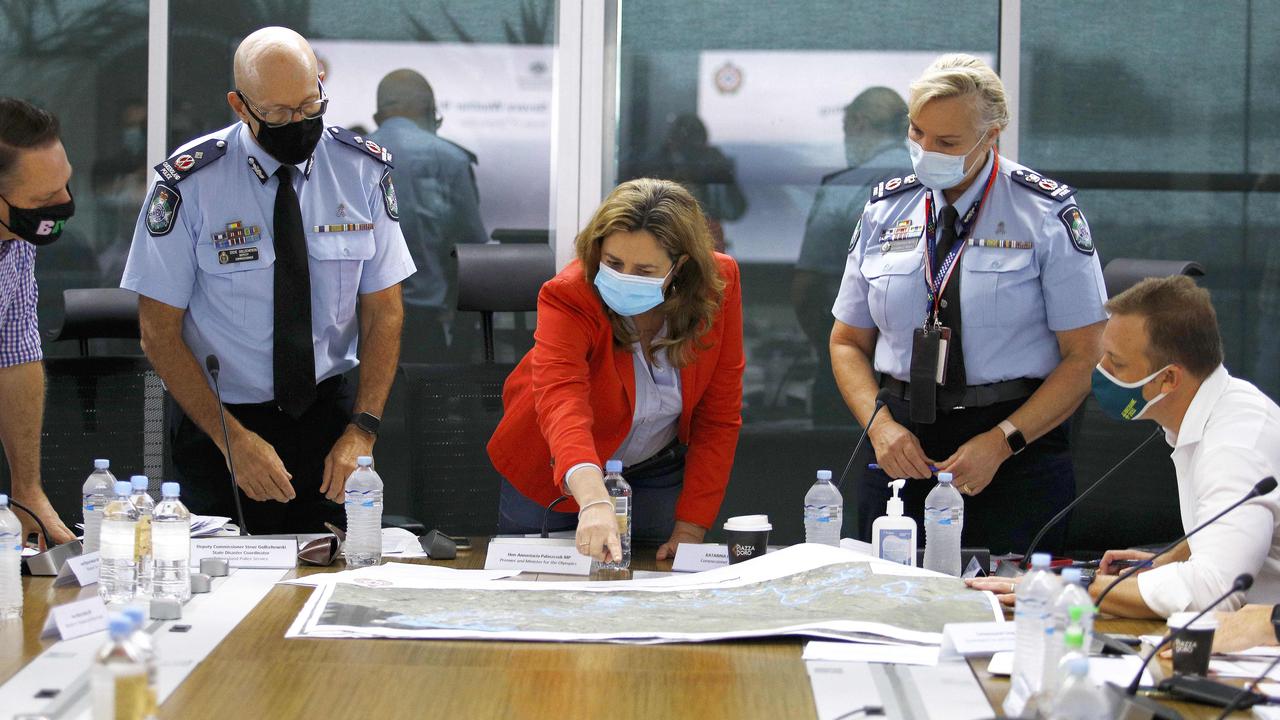
Premier Annastacia Palaszczuk says “now is the time to think about your safety plan”, urging residents in flood-prone areas to consider evacuating.
“We never expected this rain,” she said.
“This rain bomb is unrelenting.”
Prime Minister Scott Morrison on Sunday afternoon reiterated warnings for people to stay at home and said planning for recovery had begun.
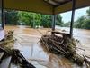
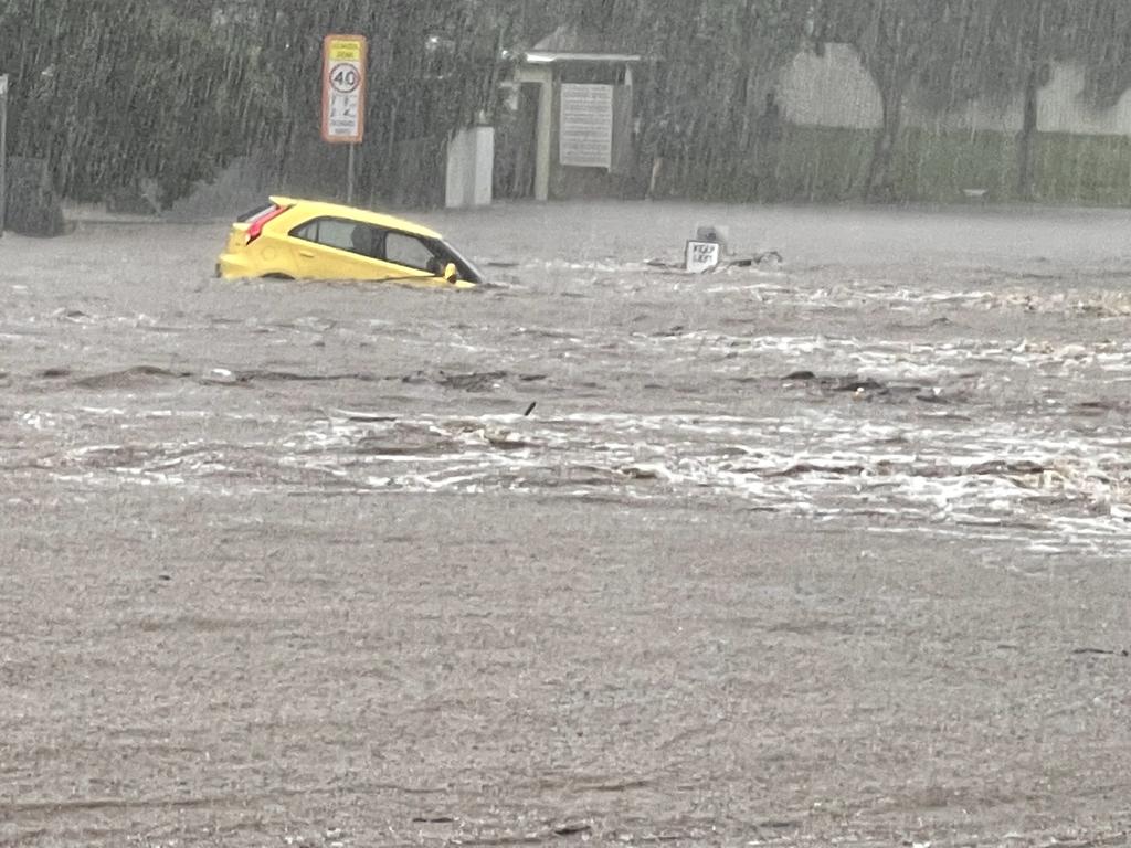
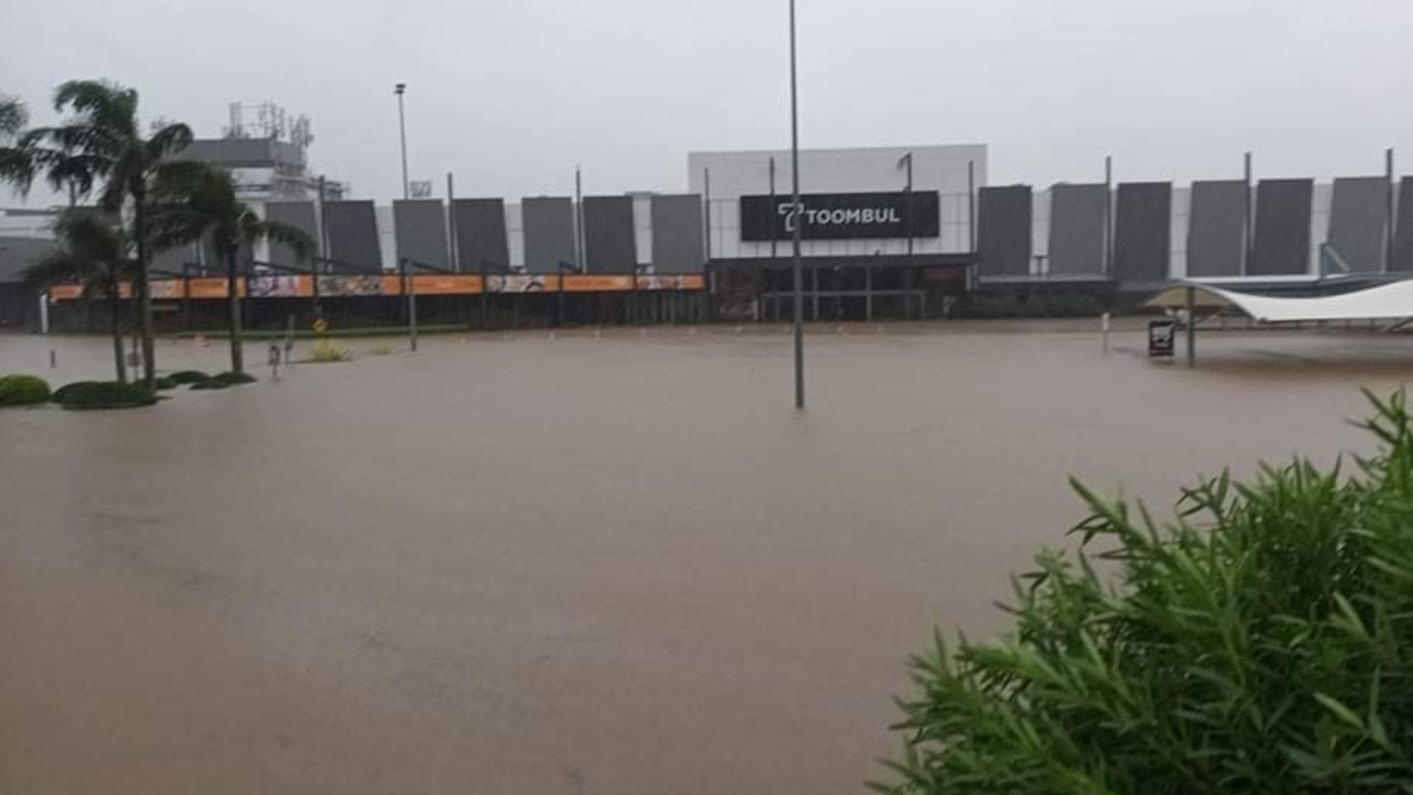
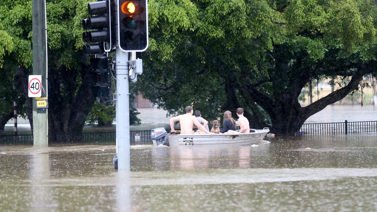
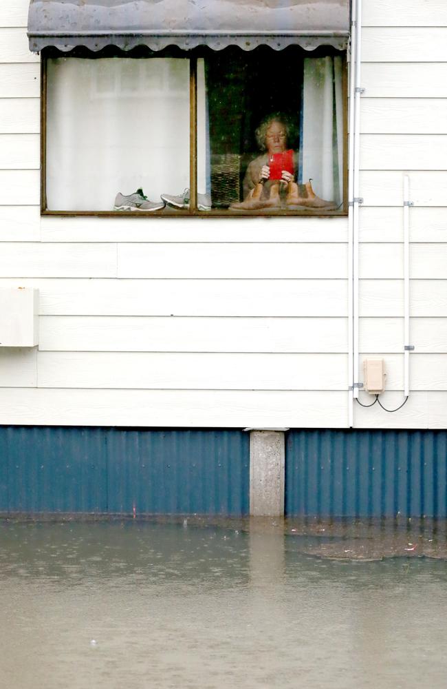
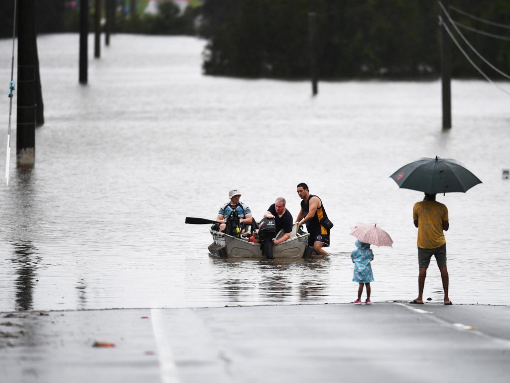
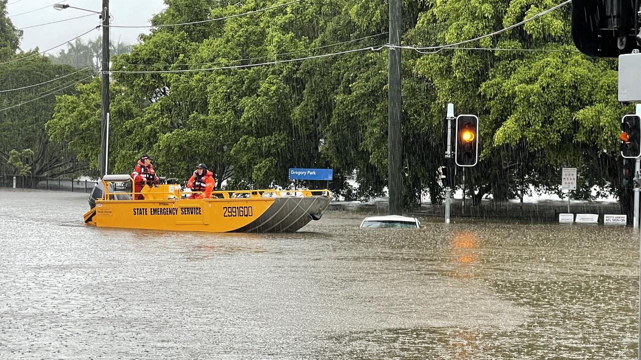
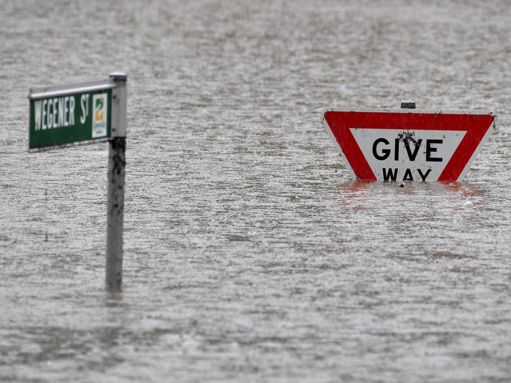
Thousands of homes have been flooded, untethered boats and pontoons have caused carnage on the swollen Brisbane river, power is cut for days and authorities warn there’s 24 more hours of danger as the 1000mm+ rain bomb continues to strike southeast Queensland.
The Bureau of Meteorology has issued another warning for very dangerous thunderstorms in the Brisbane City and Moreton Bay council areas this evening.
“At 5.55pm, very dangerous thunderstorms were detected on the weather radar near Brisbane CBD and Strathpine,” it said.
These thunderstorms are slow moving. Very dangerous thunderstorms are forecast to affect Kallangur by 6:25pm and Enoggera Reservoir by 6:55pm.Intense rainfall that may lead to dangerous and life-threatening flash flooding is likely.
Emergency alerts have been issued for two Gold Coast Hinterland towns and Beaudesert with catchments in the areas reaching major flood levels.
The Scenic Rim Regional Council issued an alert for Tamborine at 5.50pm, stating the Albert River was at major flood levels.
Meanwhile an emergency alert was issued for Canungra at 6.10pm.
Council has advised that Canungra Creek is flooding.
At 6.10pm an alert was issued for Beaudesert where the Logan River has exceeded major flood levels.
Residents in low-lying areas across the three locations have been urged to prepare to leave and warn neighbours.
And an emergency alert was issued on Sunday afternoon for the Metro North Hospital and Health Service amid flooding and road closures, including on Bowen Bridge Rd, where the RBWH is located.
“Due to the significant impacts as a result of the current weather event, Metro North has called a Code Brown,” the service said in a statement after issuing an emergency alert.
“As a result of these impacts and to reduce the number of people travelling to our hospitals, Metro North Health has made the decision to reschedule all planned care for the next 24 hours where it is clinically safe to do so.
Emergency and critical care will continue in collaboration with the Queensland Ambulance Service and SES to reduce any unnecessary movement to minimise risks.
The emergency alert will be revisited on Monday, and there is no current requirement to evacuate staff or patients.
Rail authorities have cancelled all rail transport operations across South East Queensland and Brisbane buses were cancelled from 4pm due to the severe weather.
The last services will leave Brisbane City at 4pm and customers requiring the services are being urged to ensure they depart by that time.
No further services travelling towards or away from Brisbane City will happen after this time.
The Airtrain is among services cut.
More than 60 flights into Brisbane’s airport have been cancelled today, but the facility is open.
Thirty arriving flights and 34 departing flights were cancelled on Sunday across a number of carriers including Qantas, Virgin and Jetstar.
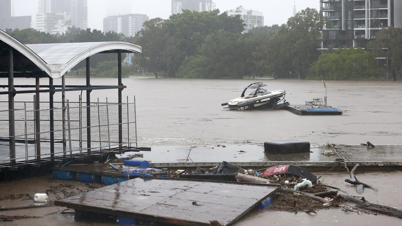
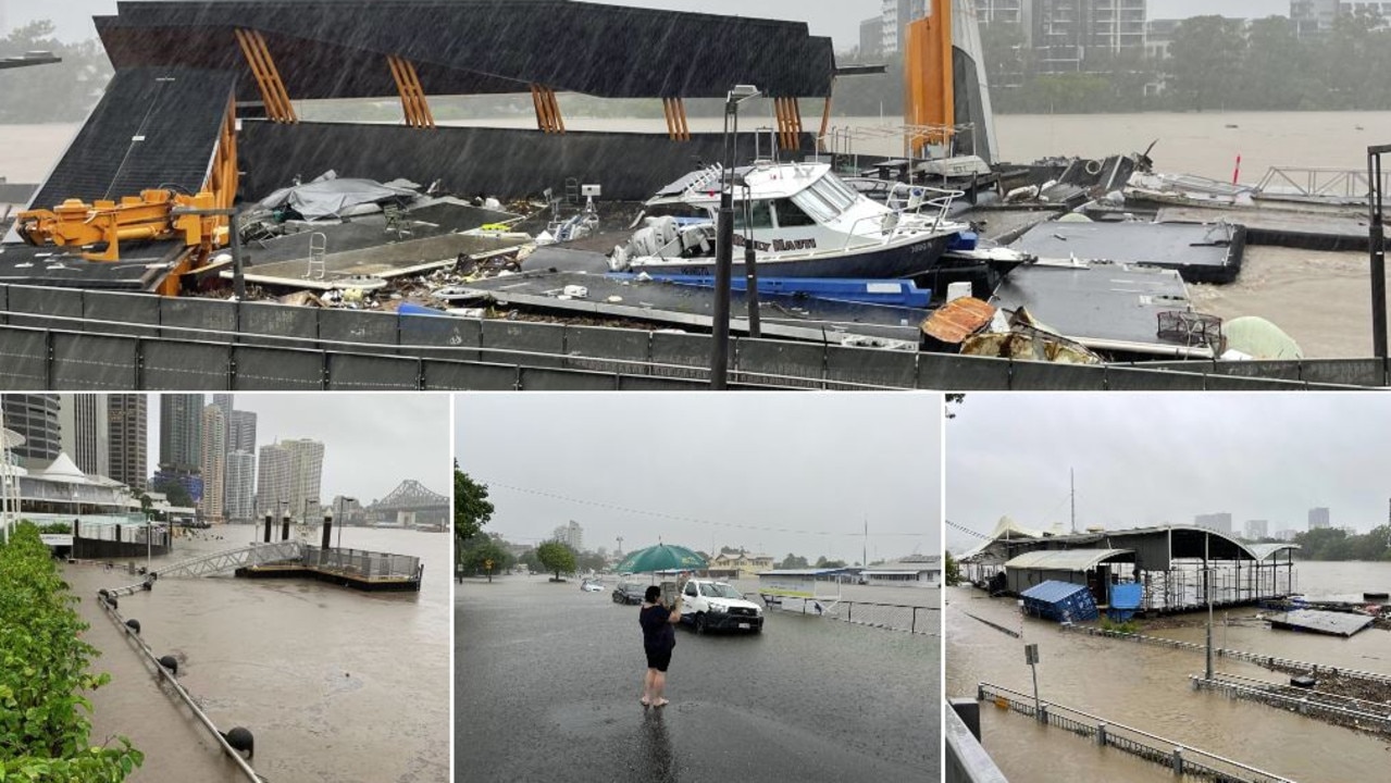
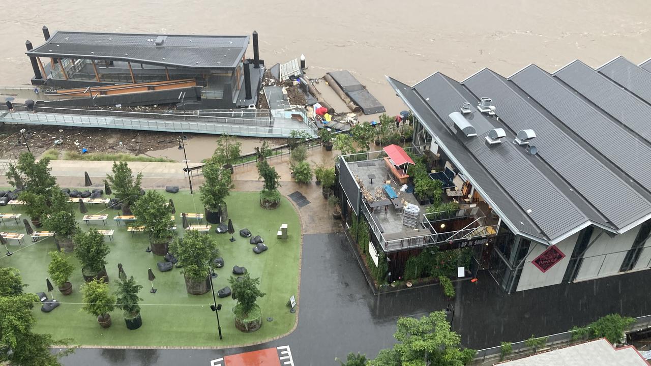
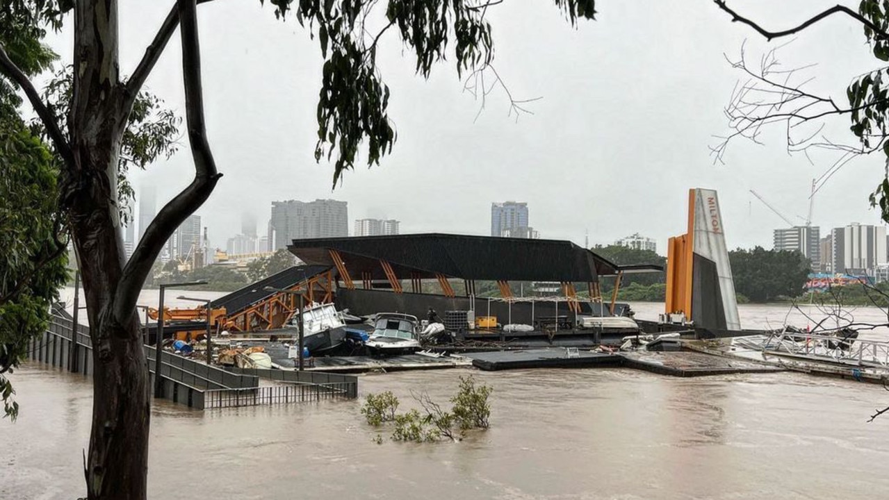
Multiple ferry terminals on the Brisbane River have been smashed by floating debris, with Hawthorne, Milton and QUT Gardens all taking a pounding.
Milton CityCat Terminal on the Brisbane River #QueenslandFloodspic.twitter.com/ONeHERSIsw
— Joe O'Brien (@JoeDoesNews) February 27, 2022
Hawthorne Ferry Terminal. #brisbane#floodspic.twitter.com/t5RgSgAnyf
— Oscar Green 🇦🇺🇺🇦 (@oscardjgreen) February 27, 2022
Dozens of Queensland courts will be closed to the public on Monday, with only urgent domestic and family violence applications going ahead.
The arrangements apply to courts at Beaudesert, Beenleigh, Brisbane, Caboolture, Caloundra, Cleveland, Coolangatta, Gatton, Gympie, Holland Park, Ipswich, Maroochydore, Maryborough, Murgon, Nambour, Noosa, Pine Rivers, Redcliffe, Richlands, Sandgate, Southport and Wynnum.
The electricity is cut off at Maryborough’s courthouse, with matters to be mentioned in Hervey Bay court and adjourned.
Weather bureau senior meteorologist Jackson Browne said the wet weather on Sunday afternoon was compounded by thunderstorm activity embedded within that rainfall band which provided an “additional punch to the rainfall intensity”.
“Some of these storms were quite slow moving,” he told The Courier-Mail.
“So when you have a storm parked over a location for an extended period of time, the accumulations shoot up in a very short amount of time.”
In just over seven hours from 9am, nearly 350mm fell at Murrumba Downs, 344mm and 331mm fell in Lawnton and Bracken Ridge respectively while Everton Hills in Brisbane’s north collected 285mm.
“It’s quite a lot of rainfall there and it’s a pattern that has been repeated since about Wednesday, where we’ve had this background of that heavy rainfall with these embedded cells within them,” he said.
Ms Palaszczuk compared the relentless rainfall to an “unpredictable cyclone”.
“But we are seeing once again incredible levels into our catchment system,” she said.”
“There’s a lot more capacity there and hopefully with the easing those controlled water releases, you’ll hear from the dam experts and that’s what’s really important.
“I want Queenslanders, especially in southeast, to understand how that’s operating.”
The Bureau of Meteorology said the southeast will continue to experience heavy rainfall this evening with easing conditions on Monday.
“So while we are seeing a contraction of this weather event further south, and the focus still remains on Brisbane and Gold Coast, we have seen some isolated shower and storm activity about the Sunshine Coast,” they said.
“Our catchments are so saturated, they will be responding very quickly to any rainfall.”
The bureau said there had been “pockets of incredibly intense rainfall” on Sunday.
Seqwater was pressed by reporters about why authorities hadn’t made precautionary releases of water from the dam network, given the expected rainfall, to avoid similar impacts of the 2011 drought, which inundated the city.
“To release water from a dam, particularly if you make a decision to release large volumes of water from a dam, you can’t get it back,” SEQ Water’s Mike Foster said.
“Once you release the water, it’s gone. So if you’ve got forecasts that are telling you that there is a massive amount of water coming in, say the forecast doesn’t eventuate, we have put large amounts of water into the mid Brisbane River, what we’re doing is exacerbating the flooding.”
When the water management authority was asked about the comparisons to the devastating flooding in 2011, Mr Foster said “I’m not going to get into a compare and contrast because we are managing the event as we speak”.
He said he was confident, based on the forecasting, that the release plan was working.
“We are able to continue to use the flood compartment as we have and we will continue to fill that flood compartment,” he said.
“We have the luxury of a very large flood compartment that allows us to better manage the size of the flows we are required to make downstream.”
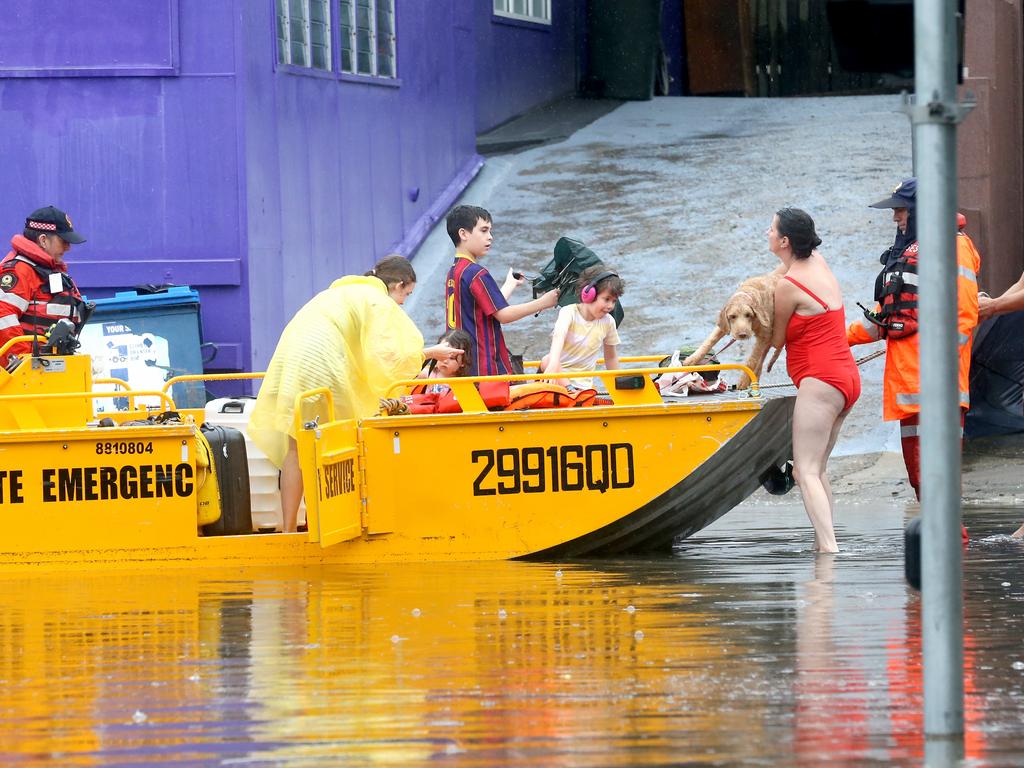
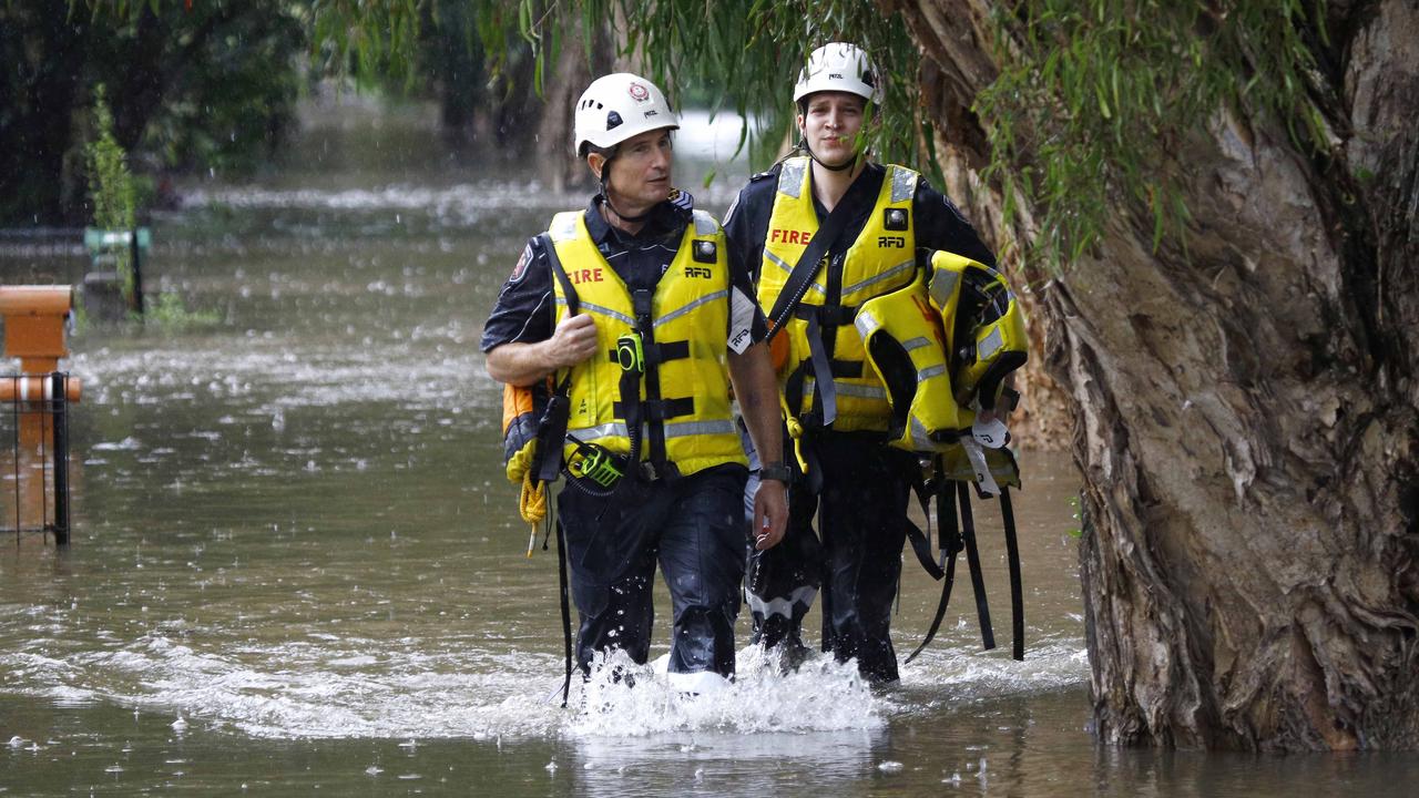
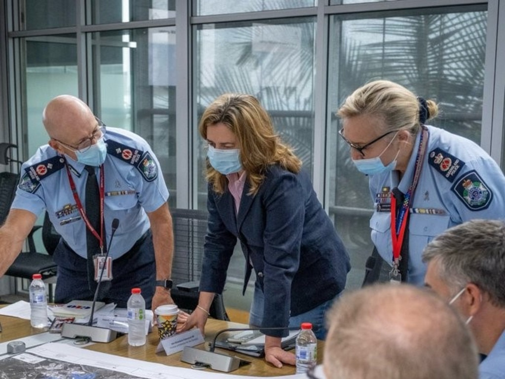
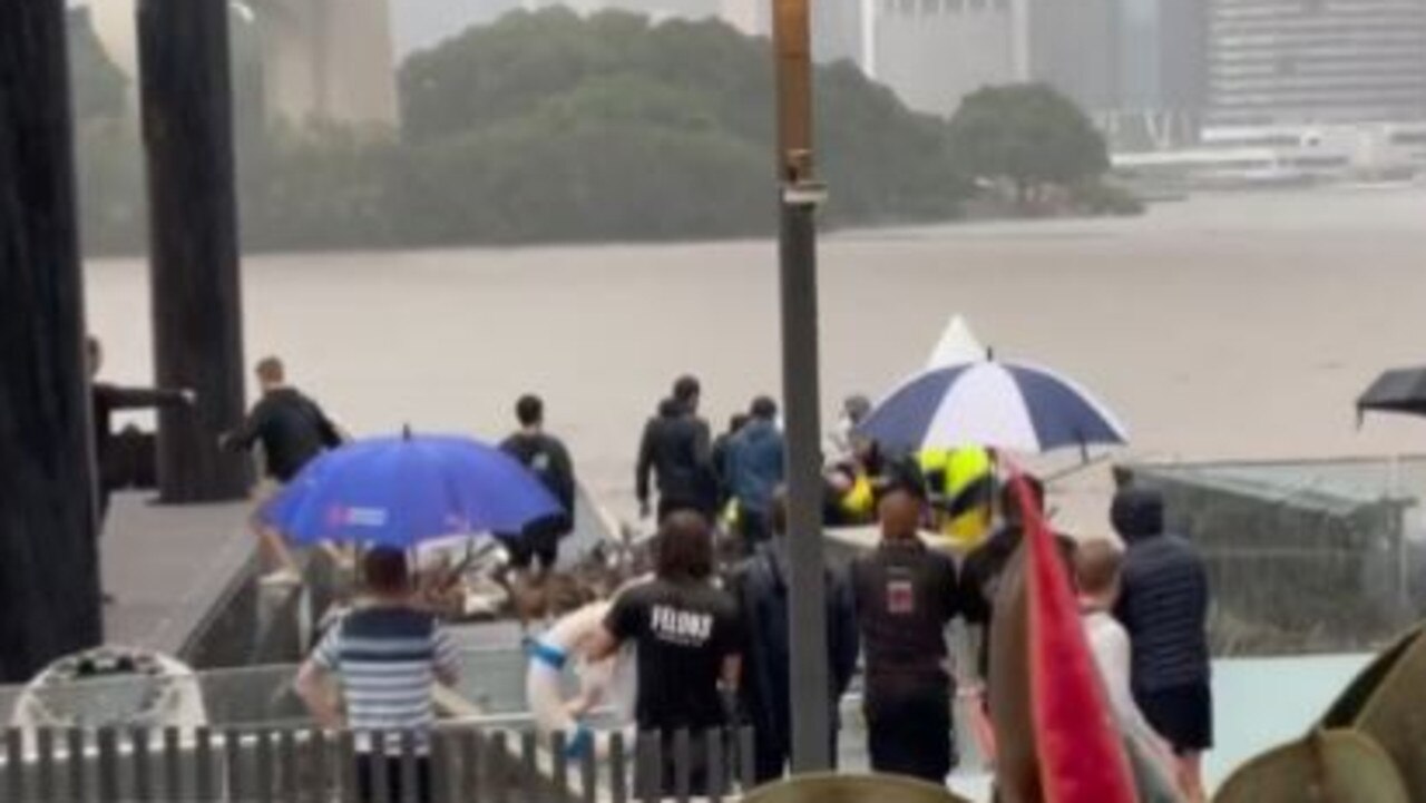
Police Commissioner Katarina Carroll said there were no more fatalities reported on Sunday afternoon, with the death toll from the weather event remaining at six.
But the top cop was furious with the reckless behaviour of those playing in floodwater, urging parents to make sure their children weren’t playing in water.
“The issue here is the you aren’t just putting your own life at risk and other members of the public, because even the members of the public are going out to conduct rescues, but you are also risking emergency services,” she said.
Emergency calls had responded to 6000 jobs in the past two days, the commissioner said.
State disaster co-ordinator Steve Gollschewski said the current focus of the emergency response was Brisbane following the intense rainfall that lashed the southeast on Sunday afternoon. He said there were a significant number of road closures across the city as flash flooding surges, with added concerns about the high tide due to arrive in the coming hours.
Katrina Murphy, whose own house is flooding, was one of many to put out a desperate call for someone with a boat to help her stranded friends in Victoria St, Windsor.
“It’s pretty life threatening for her now,” she told The Courier-Mail.
Ms Murphy said her friend Iryna and her husband are both from the Ukraine and have barely slept worrying about their families in the war-torn nation.
But now they are perched on top of a table with water through their house.
“She and her husband and a dog are trapped in the house,” she said.
“They called for a rescue but were told to sit tight because the water wasn’t flowing.
“She’s got no power and barely any battery left on her their phones. What’s left they are conserving for when they need to call police.
“I have accommodation for her. I just need to get her out.”
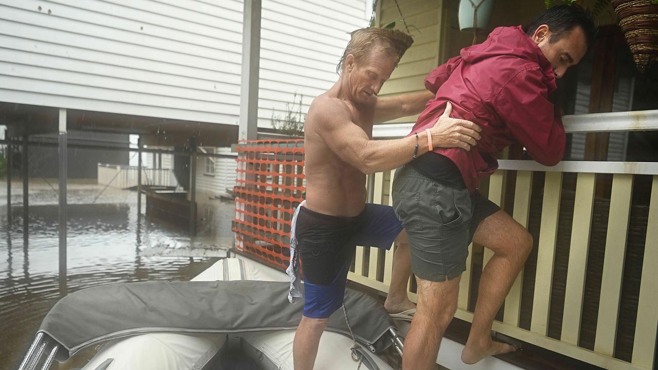
The SES have since arrived to assist the couple. Eliza van Amstel, who lives near Downey Park In Windsor, said she is packing up to leave but her house is surrounded by water.
She said neighbours have been using inflatable mattresses and stand-up paddle boards to evacuate people, pets and possessions.
“We would like to leave now, because we have two dogs here as well. But we aren’t really keen to get in the water.”
She said the water would need to rise about another 40 or 50cm before it inundates her house.
Ms Palaszczuk earlier issued a warning for people to stay indoors on Sunday afternoon as the heavy rain shows no sign of easing.
“This is an extraordinary weather event and it should be treated very seriously. I urge everyone to stay home if safe to do so, and call for help if you need it,” Ms Palaszczuk said.
The Bureau of Meteorology has warned very dangerous and slow-moving thunderstorms were detected on the weather radar near Brisbane CBD and Strathpine.
It said intense rainfall would likely lead to more dangerous and life-threatening flash flooding.
There is also the thread of landslides and debris across roads.
Kippa-Ring recorded 117mm in one hour to 11am while 71mm was recorded at Woody Point.
Queensland Fire and Emergency Services says people should never enter floodwaters, seek shelter indoors and never under trees.
Earlier Ms Palaszczuk said the ‘rain bomb is sitting over SEQ’ and it was ‘completely unforeseen it would stay for so long’. But authorities hope it will move south out of Queensland in the next 24 hours.
Meanwhile, the Brisbane Airport is still operating from one runway but warned ongoing flight delays were expected.
Social media reports had circulated that the airport had shut. However a spokesman said the airport was continuing to operate, but only using one of the two runways.
“Despite social media reports to the contrary, the airport is still open,” an airport spokesman said.
Anyone scheduled to fly out of Brisbane Airport is being urged to check flight schedules and road closures and to allow plenty of extra time for travel and check in.
Energex has warned it will be a “marathon not a sprint” to restore power to the thousands of Queensland homes that have already lost power during the severe weather event.
Power has been cut to more than 37,000 properties, including 19,000 across Brisbane, 5700 in Gympie, 5200 in the Moreton Bay region.
Outages are also impacting thousands of homes on the Sunshine Coast, Greenbank and Ipswich areas.
Brisbane Lord Mayor Adrian Schrinner says the council is working 24-7 to make sure there are enough sandbags for residents experiencing flooding.
He said sandbags were available for collection at Darra, Morningside and Zillmere.
But he said the Newmarket depot was closed due to localised flooding.
Evacuations are currently underway in nearby Windsor.
Cr Schrinner said another update would be provided when the Newmarket depot was up and running again.

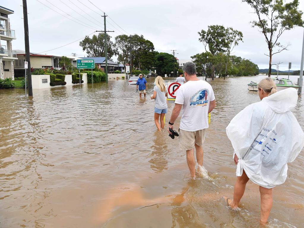
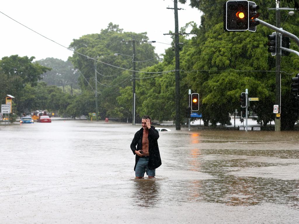
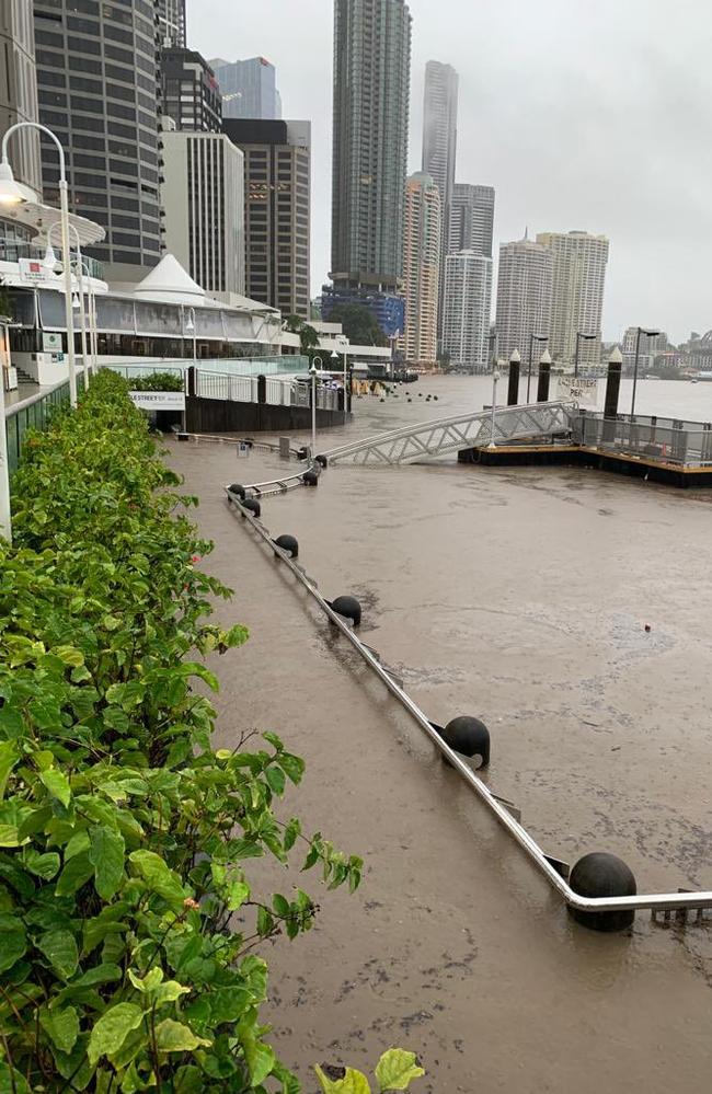
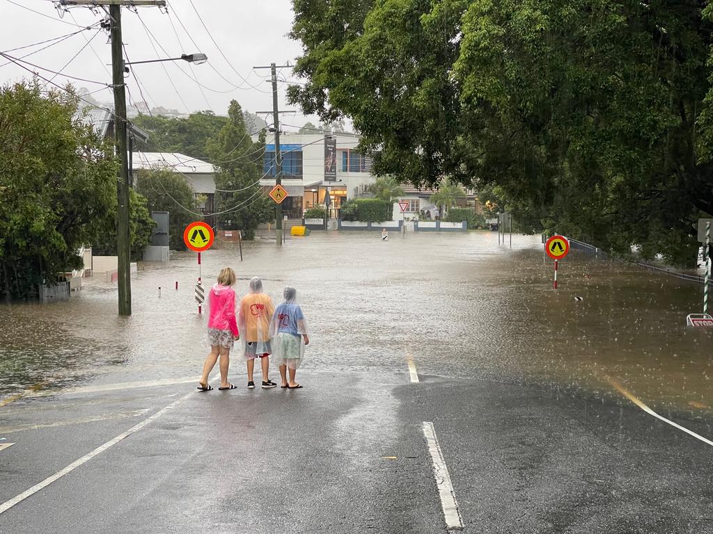
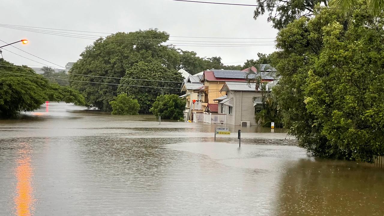
Residents in nearly 100 suburbs on Brisbane’s southside have been scrambling in the early hours of the morning as rising water puts homes under threat, with the 7.30am high tide delivering a “perfect storm” of conditions.
The Brisbane River reached 3.1m this morning with 1,430 homes in Brisbane impacted above the floorboards by flooding.
Authorities have warned river levels across the southeast will continue to peak with Maryborough expected to experience worse inundation than the January floods and Beaudesert set for major flooding.
SCROLL DOWN FOR THE LATEST ALERTS
The flood-swollen, rapidly rising Brisbane River reached 3.1m and moderate flood level but the situation is ‘rapidly evolving’ and unpredictable' with residents urged to stay on alert.
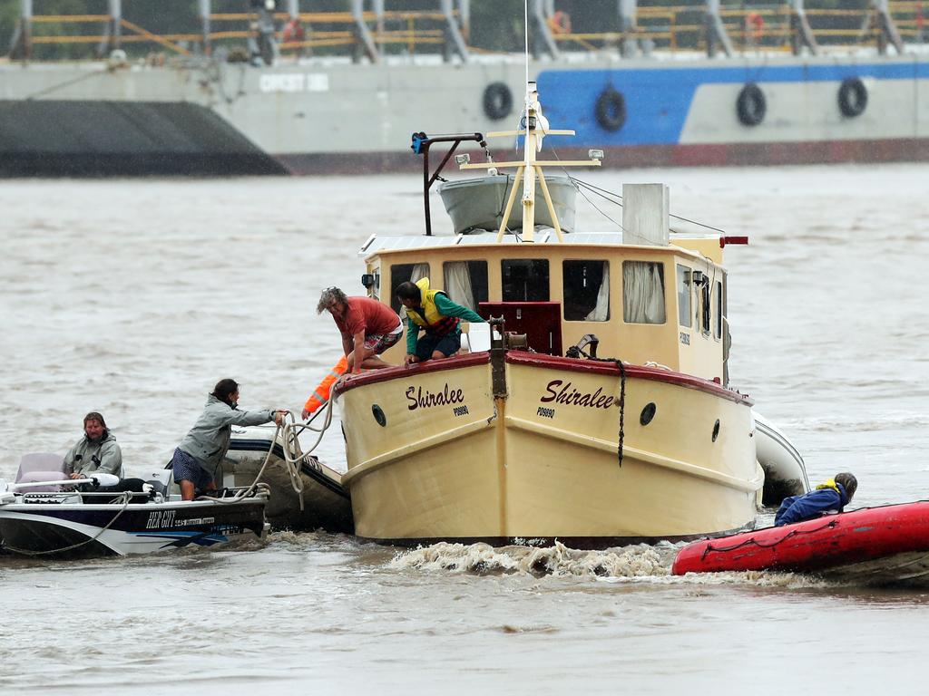
It has caused carnage with boats and debris slamming into the Milton ferry terminal and pontoons that had been washed away seen floating down the Brisbane River.
The Holman Street ferry terminal at Kangaroo Point has also been broken apart, after it was hit by floating debris.
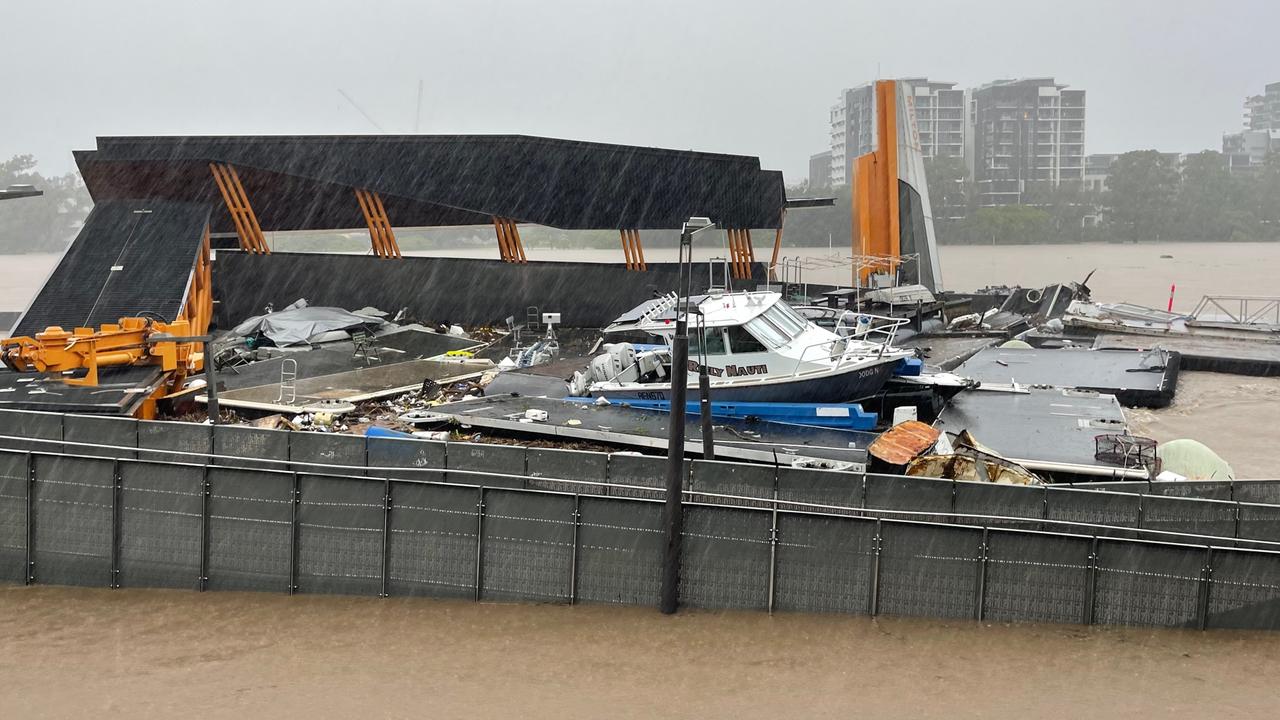
The ferry terminal had also been hit by a boat earlier in the day with man reportedly needing to be rescued after the incident.
The man was reportedly the sole occupant onboard the vessel which sunk immediately after hitting the Holman St terminal.
Boats floating down the Brisbane River have also caused significant damage to the ferry terminals at both Milton and Hawthorne.
Footage emerged earlier today of boats colliding with the Milton ferry stop at the city end of Coronation Drive.
Videos on social media have also provided updates on the Hawthorne terminal which also appears to have been badly impacted by the floods.
The QUT ferry terminal also appears to have been damaged by the intense rainfall that has impacted Brisbane today.
As the high tide hit shortly after 7.30am, streets that an hour before were not under water were inundated.
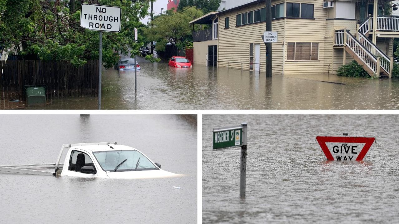
Residents in Graceville said it was getting “serious” and issued calls for help, while there were reports of evacuations at Corella St in Rocklea.
In Yeronga, residents on Astolat St moved belongings to higher levels, while a resident of Central Ave in Sherwood said his property was “almost two to three metres submerged”.
In Albion on Sunday afternoon Sue Cox was trapped in her home where she runs a clothing manufacturing and alterations business.
“I went through Cyclone Yasi and this is just 100 times worse – knowing I can’t get in or out.”
She said her business, including seven industrial sewing machines, has been completely destroyed by water.
“I did rescue my brides’ wedding gowns though – I have five bridal gowns upstairs that I managed to save,” she said.
“I’d rebuilt my business by working my butt off for the last two years. It’s just been such a fight for two years. And now it’s gone.”
Ms Cox said the water this morning was waist deep, with the high tide reaching 2.7m.
“I think 7pm is the next tide and they are expecting 3.2m. Plus the water they are releasing from the dams,” she said.
Ms Cox said she is trapped in the house alone with water all around her and only one power point that works.
“The SES said it could be 72 hours before there is any assistance. They were great though. They called me to make sure I had enough supplies for 72 hours.
Meanwhile, the Wivenhoe Dam went from 80 per capacity on Friday to 160 per cent capacity today, which has required extensive releases which will be felt in the catchment downstream in coming days.
At 1.30pm RACQ had already received more than 1000 insurance claims in the South East as waters continue to rise.
There are now more than 760 road closures across the state and motorists have again been urged not to make unnecessary journeys.
Transport and Main Roads says there are reports of people knocking down and driving around road closure signs across the state.
“They’re there for a reason,” a TMR spokesman said.
Meanwhile, the Prime Minister’s address to the Queensland Media Club due to take place on Monday has been postponed due to the severe weather event.
SEE A FULL LIST OF ROAD CLOSURES HERE
A man has died after a car was found in floodwaters in Indooroopilly about 2.45am on Sunday.
Reports suggest the man tried to swim to safety from his vehicle on Witton Road but failed to surface.
Emergency services located the body of the 34-year-old Moorooka man a short time after.
It means six people are now confirmed to have died in the flooding disaster so far, including an SES volunteer swept away going to the aid of stranded residents in the Lockyer Valley while men also perished in floodwaters in the heart of Brisbane and outside Gympie.
Emergency Services are scouring the shores of the Brisbane River this morning as a search resumes for a yachtsman who fell overboard just before 5pm on Saturday near the mouth of Breakfast Creek.
The search was suspended last night due to dangerous weather and debris within the river.
A police spokesman said the man was yet to be found this morning after a search resumed at first light.
Police have also been alerted to a possible missing person in Maryborough after receiving reports of screams from an upturned tinnie.
Emergency services received calls about the tinnie in Queen’s Park about 7pm, but they are yet to have confirmation of a missing person.
In the hours from 9am Saturday to 5am Sunday, a staggering 430mm fell at Mount Glorious, with other huge totals centring around the Caboolture and southern Sunshine Coast area.
Elimbah received 371mm, there was 306mm at Rose Ck Road, 302mm at Mount Mee, 288mm at Beerburrum, 295mm at Wamuran and 283mm at Delaneys Ck.
Flights into Brisbane have been delayed and cancelled as wild weather lashes the city, with one plane turning back to Sydney as it was about to land.
According to Brisbane Airport’s website, at least three flights from Sydney and Melbourne this morning have already been cancelled.
Flights from Darwin, Townsville and Uluru scheduled for later in the day have also been cancelled.
About a dozen other flights are also listed as delayed.
The Courier-Mail understands a flight from Sydney was about to land in Brisbane this morning, but was turned back to Sydney.
24 MORE HOURS OF DANGER AS AUTHORITIES REVEAL WHAT’S UNFOLDED:
Authorities are nervously watching the intense, slow-moving weather system, expecting it will finally move away from the region in the next 24hrs but warning the danger was not yet over.
Premier Annastacia Palaszczuk said Queensland has not experienced this much rain in such a short period of time before.
“It is literally a rain bomb over the entire SEQ,” she said, comparing it to Cyclone Debbie.
“It was completely unforeseen that this (rain bomb) would stay here for so long,” she said.
“We don’t control nature – this is beyond our control.”
She said on Friday Wivenhoe Dam was at 80 per cent capacity and now it sits at 160 per cent.
The Brisbane River has reached 3.1m this morning with 1430 homes in Brisbane impacted by flooding above the floorboards.

Wivenhoe Dam releases have occurred, but they have not impacted downstream areas yet.
“We have also done some releases from the dam – that does take about 24 hours to come down,” Ms Palaszczuk said.
“That is not impacting at the moment but with the rain easing hopefully over the next 24 hours we then do expect to see high levels of water in our river system for at least the next 3 to 5 days.
“The system is easing on the Sunshine Coast but there are roads closed including the Bruce Hwy.”
Maryborough is expected to “peak tonight and exceed the January event”.
“We do expect major flooding at Beaudesert that may exceed the bridge on Sunday morning, major flooding is possible downstream later Sunday” she said.
Hundreds of roads have been cut and the Shorncliffe and Ferny Grove train lines have been impacted causing delays of up to 60 minutes across the network.
Ms Palaszczuk said the weather is moving to the Gold Coast and “we are monitoring the Logan and Albert rivers.”
She said there was “a lot of water around”.
If you do not have to be on the roads please do not be on the roads,” she said.
“There’s a lot of water that has been coming up quite suddenly.
“This water is unrelenting.
“I don’t want to see any more deaths.”
Ms Palaszczuk said the weather is expected to ease into Monday when it started to move south.
“We have this big rain event right across the southeast...we have a lot of rain coming right across the southeast catchment zone into Wivenhoe,” she said.
“This is a very extreme weather event that we have at the moment.”
Ms Palaszczuk has asked people to conserve water amid problems with the Mount Crosby treatment plant, which includes Brisbane, Moreton Bay, Logan, Ipswich and the Lockyer Valley areas.
The flood peak may have been reached at 21m in Goodna.
There are 550 people in the Goodna evacuation centre and 1040 across the state.
She said there have been calls for assistance in Goodna, Oxley, Auchenflower, St Lucia, Yeronga, Beachmere, Caboolture and Redcliffe.
Ms Palaszczuk said SES calls have been received from some areas of the Gold Coast hinterland.
“There will be some schools impacted and of course it may be hard to get to some schools as well,” she said.
“In Gympie we think we may have reached the peak but the Mayor says it still might go a little bit higher – in excess of 21 metres,” she said.
Ms Palaszczuk said the system was moving south and Beaudesert could experience major flooding on Monday.
The Fraser and Sunshine Coasts are no longer seeing prolonged rainfall but more showers could fall, according to the Bureau of Meteorology.
About 70mm of rain has already been recorded at Bribie Island today.
Brisbane River is tipped to reach a moderate flood level, but the Bureau said it was an “evolving” situation.
In Ipswich, the Bremer River is expected to reach a major flood level.
While it will not be as high as 2011, the level has been compared to TC Oswald in 2013.
State Disaster Coordinator Steve Gollschewski said this is still a “very dangerous situation” and “rapidly changing environment.”
“Please stay safe – you do not need to be out in this environment,” he said.
“If you do not go into the water you can’t drown.”
He said there is “a lot of water around Southbank, going into buildings.”
“As the high tides come in we see inundations start to happen,” he said.
There are 21,000 people without power, largely in the Gympie, Brisbane and Moreton regions.
Mr Gollschewski said people were going to South Bank, where a lot of water is flowing.
Commissioner Katarina Carroll said six deaths had occurred and one person was still missing.
The deaths occurred in Sunshine Coast, Gympie, Stones Corner, Ipswich, and last night in Indooroopilly.
One person “fell into the Brisbane River” two days ago at Bulimba and has still not been found, Ms Carroll said.
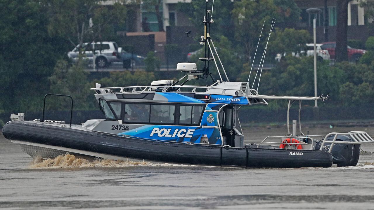
Specialist water police have been deployed across the southeast.
“We are in a very dangerous and life threatening situation,” she said.
QFES Commissioner Greg Leach said authorities needed people to stay home.
“If you’re thinking about doing some sightseeing to look at flooded areas, don’t,” he said, adding we have ‘at least 24 more hours of danger’.
There has been more than 850 requests for service from the SES in the past 24 hours.
The Bureau of Meteorology has issued a severe weather warning for southeast Queensland.
Heavy rain is expected to continue throughout Sunday and into Monday.
A BOM spokeswoman said there has been a “clearance in northern areas – Sunshine Coast and Fraser Coast” but “these areas are not out of the woods yet.”
“The focus now remains on Brisbane and the Gold Coast where we are seeing a lot of widespread rainfall, some really high rainfall totals and some really intense rainfall and it’s that intense rainfall that can lead to flash flooding especially considering that our rivers and catchments are incredibly saturated and responding incredibly quickly,” she said.
“We have already seen 70mm fall within an hour at Bribie Island – just one example of how quickly this rain is falling.
“The relief will come in the early hours of Monday morning but we can expect this rain event to continue today and well into tonight.
“We are also expecting a lot of activity in our rivers and catchments.”
She said although the Brisbane River is currently at a moderate level, “this is an evolving situation.”
QFES Commissioner Greg Leach said it is important for people to stay home.
“Our crews have received over 5000 requests for assistance since this event began,” he said.
He said calls have started to increase for the Gold Coast, hinterland, Logan and Beaudesert.
“There is a backlog of jobs for the SES,” he said.
“We will get to you, we appreciate your patience.”
Lord Mayor Adrian Schrinner said “this is a unique event” and there was a natural curiosity for people to look at floodwaters but ‘curiosity is a killer in these types of circumstances’.
“It is different to 2011 – in 2011 we saw the rain had stopped while the rivers continued to rise but right now the rain is bucketing down,” he said.
He said the three levels of government are “working exceptionally well together.”
“We have been through natural disasters before, Queensland and Brisbane have some of the best disaster management procedures and processes in the world. This is bread and butter for our emergency services.”
“We will get through this but now is not the time to be out and about – now is not the time to start cleaning up,” he said.
Mr Schrinner said the council was in the process of assessing the damage across the city.
An evacuation centre has been established at the Sleeman Centre at Chandler and another could be established.
The southeast water grid currently stands at 98 per cent – an increase of 10 per cent in the last 24 hours.
LATEST ALERTS
The Bureau of Meteorology has issued another warning for very dangerous thunderstorms in the Brisbane City and Moreton Bay council areas this evening.
“At 5:55pm, very dangerous thunderstorms were detected on the weather radar near Brisbane CBD and Strathpine,” it said.
These thunderstorms are slow moving. Very dangerous thunderstorms are forecast to affect Kallangur by 6:25pm and Enoggera Reservoir by 6:55pm.Intense rainfall that may lead to dangerous and life-threatening flash flooding is likely.
A more general 10am alert issued on Sunday warned a low pressure system has developed and is embedded within the surface trough that has been causing havoc over the past few days.
“This low is expected to track southward along the Southeast Queensland coast and into northeastern New South Wales today producing further heavy to locally intense rainfall with embedded thunderstorms,” the Bureau said.
“As this low tracks southward heavy rainfall is expected to contract towards the NSW border during today.
“Heavy rainfall which may lead to flash flooding is forecast to continue over parts of southeast Queensland today.
Six-hourly rainfall totals between 60mm and 120mm are likely to continue, reaching up to 150mm over areas southeast of Caloundra to Warwick and contracting south to the NSW border today.
“Locally intense rainfall leading to dangerous and life-threatening flash flooding is possible with thunderstorms during this period, particularly over coastal areas south of Caloundra and the Gold Coast hinterland.
Six-hourly rainfall totals in excess of 200mm are possible. A separate Severe Thunderstorm Warning will be issued if very dangerous thunderstorms with intense rainfall are detected.
“Heavy rainfall increases the potential for landslides and debris across roads.”
In a rare piece of positive news, severe weather is no longer occurring in the Wide Bay and Burnett district, and the warning for the region has been cancelled.
THE THREAT OF BRISBANE RIVER INUNDATION:
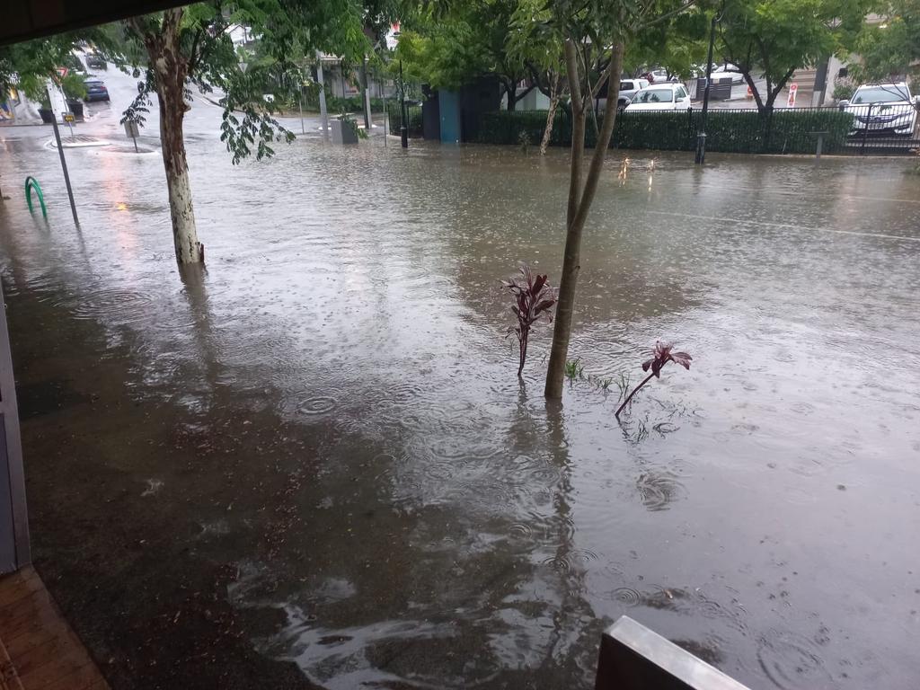
Almost 100 suburbs faced the threat of inundation on Sunday with a potentially catastrophic combination of an early high tide and millions of megalitres of rain hurtling down creeks and rivers.
Council modelling suggested a threat of flooding in 87 locales from north of Brisbane towards Ipswich and Logan.
Lord Mayor Adrian Schrinner said thousands of properties could be affected.
“For many Brisbane residents, this terrible rain event will be reviving memories of the 2011 floods,” he said.
“Our latest modelling shows flows from the catchments and the potential for further Wivenhoe Dam releases into the Brisbane River may combine with (Sunday) morning’s high tide (and) this could impact thousands of residential properties.
“Households in low-lying areas should make sure they’re prepared.
“Stock up on sandbags at our depots, ensuring you have essentials and know when it’s time to leave.”
IMPACT OF SATURDAY’S DELUGE FELT ACROSS THE REGION
More than 1000 roads have been cut with some 500 people taking refuge in evacuation centres as a slow-moving weather system compared to cyclones Debbie and Oswald wreaks havoc across a region the size of Tasmania.
Gympie and the Sunshine Coast are facing the worst flooding in 30 years while the community of Cherbourg is likely to be cut off for several days as rescue authorities plan supply drops for the area.
Almost 2000 calls for help were made to rescue authorities, with 132 swift-water rescues performed in the 24 hours until late Saturday.
Officials are confident Wivenhoe Dam will stand firm against its greatest threat since the 2011 disaster.
Mt Glorious has now copped more than 1m of rain in less than two days.
The death toll rose by three on Saturday with Lowood SES volunteer Merryl Dray killed when a vehicle carrying four SES personnel was swept away at Coolana. The 62-year-old was praised as an “orange angel”.
Premier Annastacia Palaszczuk and Police Minister Mark Ryan paid tribute to the volunteer, who had been with the SES for almost five years.
“This is a terrible tragedy for everyone concerned,” Mr Ryan said.
“Our SES volunteers are remarkable people, who selflessly give of themselves to help others.
Tragically, this volunteer has made the ultimate sacrifice as she went to the assistance of her fellow Queenslanders.”
Early Saturday, the body of a Camp Hill man, 55, was found in waters at Stones Corner, while a 40m chunk of concrete pontoon was ripped from its moorings at Albion.
Two boats were dragged along by the strong current as good Samaritans in tow boats and tinnies worked hard to pull them to shore.
Queensland Police and Maritime Safety Queensland secured the pontoon near the base of the Gateway Bridge.
The body of a Goomboorian man, 37, who disappeared near Gympie on Friday night was found late on Saturday.
Against fears of a repeat of the 2011 floods that devastated southeast Queensland, officials have insisted Wivenhoe Dam would withstand the onslaught, with enough capacity to safely store another two million megalitres.
However, Graham Fraine, director-general of the department of water, said the storage capacity of Wivenhoe meant there was no threat of a repeat of that disaster, despite the grid’s main dam jumping from about 60 per cent to 100 per cent of capacity in days.
“There were some releases from Wivenhoe during the course of last evening and they were done at the time to do some strategic releases in order to manage water flow levels between the various parts of the SEQ network,” he said. “Future releases will be looked at through the lens of the flood manuals that SEQ Water operates by and through the lens of when rain and water levels subside.”
SEQ Water chief operating officer Stuart Cassie said modelling showed Wivenhoe should be able to cope with the extra floodwaters without posing a risk to communities.
“The current modelling that we’re using in conjunction with the BOM is not predicting that capacity will be filled up,” he said.
“We’re playing a balancing act in terms of making sure that we’re not increasing the flows downstream unnecessarily so we will wait for the rains to subside and the flows in the rivers to subside and that’s the point that we will release water in accordance with the flood manuals.”
Prime Minister Scott Morrison will visit on Sunday, while Ms Palaszczuk implored people to stay home.
Senior Bureau of Meteorology meteorologist Jackson Browne said there was another day of drama ahead before the wet heads slowly south towards northern NSW.
“There’s still a long game ahead of us and we might see another extraordinary 24 hours,” he said. “And even when the rain stops, people shouldn’t become complacent because the flood threat will still be there.”
There are major flood warnings for the Mary and Mooloolah rivers, Maroochy and Noosa rivers, Upper Brisbane and Stanley rivers and the Bremer River, along with Laidley, Lockyer and Warrill creeks. Mr Browne said a further 150-250mm would fall across already soaked areas of south Queensland before the region gains a reprieve Sunday night, courtesy of a new low pressure system that will push south towards NSW.
Train lines north and west of Brisbane are likely to be offline for days, while ferries have also stopped services.
Highways linking Brisbane to Toowoomba and the Sunshine Coast have also been cut in multiple places, leaving motorists stranded between bursting creeks and rivers.
LOGAN ON EMERGENCY ALERT
Logan residents are being warned not to leave their homes unless it’s necessary as the city south of Brisbane was placed under an “emergency alert” on Saturday afternoon as flooding continues.
The city’s catchments had varying levels of rainfall over the past 24 hours – from 40mm to more than 200mm.
Logan Mayor Darren Power urged residents to be prepared for the possibility of becoming isolated due to flooding and to stock up on essentials in the event some areas of the city became cut off.
“Schmidts Rd at Logan Reserve is already isolated, and other areas could also become affected by rising waterways,” Mr Power said.
“We need our community to be aware and alert of how they might be impacted and also be sensible about how they handle the conditions.
“Now is the time to be prepared – make sure you have essential food and medication, and that your family and pets are safe.”
Communities that could be impacted by floodwaters include Logan Village and Buccan around Dairy Creek, Ooah Creek and Quinzeh Creek, Jimboomba and Glenlogan, around Henderson Creek and the Logan River.
BRISBANE SUBURBS AT RISK ON SUNDAY
ACACIA RIDGE
ALBION
ANSTEAD
ARCHERFIELD
AUCHENFLOWER
BALMORAL
BELLBOWRIE
BOWEN HILLS
BRISBANE AIRPORT
BRISBANE CITY
BROOKFIELD
BULIMBA
CANNON HILL
CARINA
CARINDALE
CHAPEL HILL
CHELMER
CHUWAR
COORPAROO
CORINDA
DARRA
DOOLANDELLA
DUTTON PARK
EAGLE FARM
EAST BRISBANE
FAIRFIELD
FIG TREE POCKET
FORTITUDE VALLEY
GRACEVILLE
GREENSLOPES
HAMILTON
HAWTHORNE
HEMMANT
HERSTON
HIGHGATE HILL
INDOOROOPILLY
JAMBOREE HEIGHTS
JINDALEE
KANGAROO POINT
KARANA DOWNS
KELVIN GROVE
KENMORE
KHOLO
LAKE MANCHESTER
LYTTON
MIDDLE PARK
MILTON
MOGGILL
MOOROOKA
MORNINGSIDE
MOUNT CROSBY
MOUNT OMMANEY
MURARRIE
NEW FARM
NEWMARKET
NEWSTEAD
NORMAN PARK
OXLEY
PADDINGTON
PINJARRA HILLS
PINKENBA
PORT OF BRISBANE
PULLENVALE
RED HILL
RIVERHILLS
ROCKLEA
SEVENTEEN MILE ROCKS
SHERWOOD
SINNAMON PARK
SOUTH BRISBANE
ST LUCIA
SUMNER
TARINGA
TENERIFFE
TENNYSON
TINGALPA
TOOWONG
WACOL
WEST END
WESTLAKE
WILLAWONG
WILSTON
WINDSOR
WOOLLOONGABBA
WYNNUM WEST
YEERONGPILLY
YERONGA
More Coverage