
Gympie, Sunshine Coast, Moreton Bay flood latest
Hundreds of Gympie locals have been urged to flee their properties as the Mary River reaches a century high.
QLD News
Don't miss out on the headlines from QLD News. Followed categories will be added to My News.
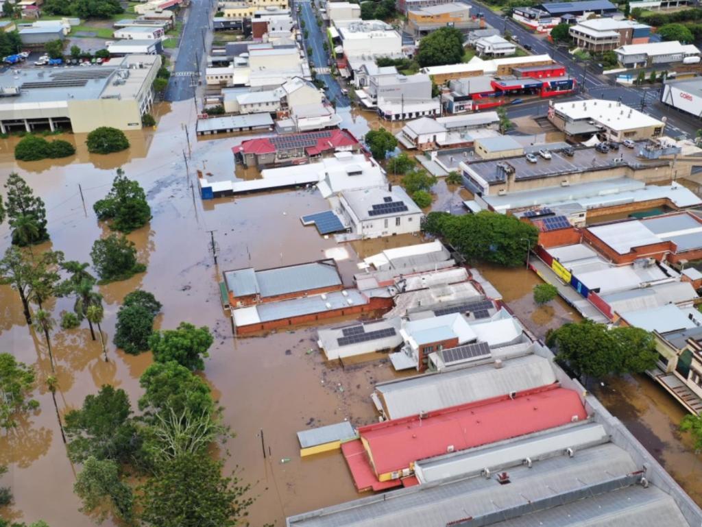
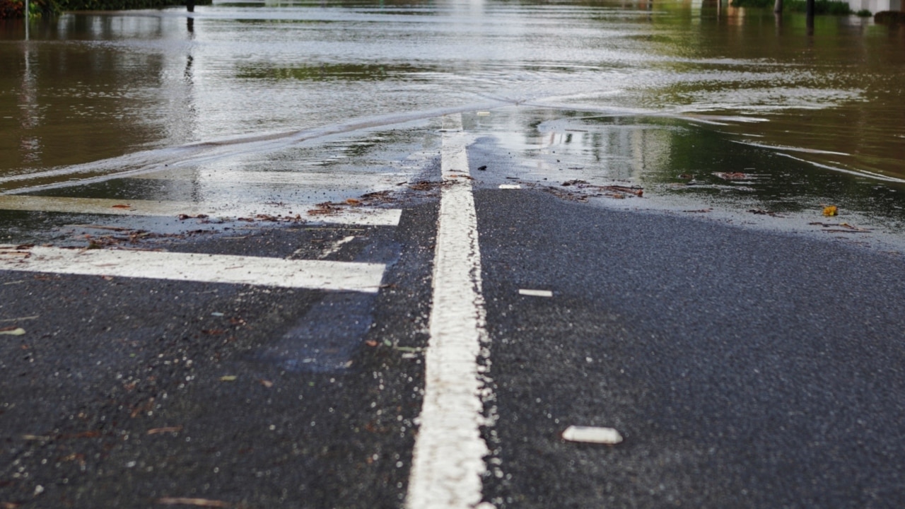
Gympie was last night ground zero of Queensland’s flood crisis, with about 700 locals urged to flee their properties as the Mary River reached its highest level in over a century.
A man swept away in floodwaters at Goomboorian was found dead, while the town’s CBD and a number of homes were under water.
Storms on the Sunshine Coast cut the Bruce Highway in both directions from Caboolture to Caloundra and towards Gympie, with cars left stranded in chaotic scenes.
Gympie Regional Council issued an alert on Saturday afternoon for city and southside residents potentially impacted by rising flood water to “evacuate now” as the Mary River reached 21.96m by 5pm yesterday, making it the worst flood in a more than century.
The 1999 flood was 21.95m, which was the third highest flood on record while the second highest was in 1898.
“Gympie council advises major flooding is occurring in Gympie area,” the alert read.
“If you live at Southside and are in an impacted area, you need to evacuate now and seek shelter with friends or family on higher ground. If you live on the hospital side of the river and are in an impacted area you need to evacuate now and seek shelter with friends or family on higher ground. Take essential medication and secure your property.”
The Bureau of Meteorology could not say at what height the river would peak and when but confirmed major flooding would continue into next week.
Multiple rescues and search operations were carried out, including a land and air search at Goomboorian for a 37-year-old man found dead in floodwaters after being swept away long Tin Can Bay Rd about 10pm on Friday.
The man was last night named as popular local meat worker and father of three Phil Sugg.
Gympie’s lowest-lying businesses were well under water on Saturday.
All major bridges, including the Normanby and Kidd Bridges to the southside, Pengelly’s, Inglewood on the Bruce Highway and Bells Bridge on the Wide Bay Highway were cut late Saturday.
The council set up evacuation centres at the Gympie Civic Centre in Mellor Street and at the Pavilion at the Gympie Showgrounds.
Mary Street’s lower end was strewn with shipping containers, trucks and 4WDs as shop owners worked to clear items out of the path of the flood.
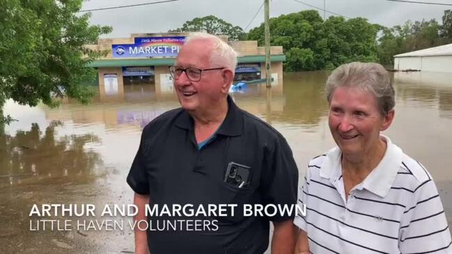
Charity Little Haven Palliative Care lost thousands of dollars of stock as dozens of businesses across Gympie went underwater.
Staff and volunteers spent most of Friday clearing stock from the Brisbane Rd shop ahead of the floods, but were unable to prevent significant losses as the store became submerged by the rising waters.
It was one of several businesses and a dozen houses around the One Mile Ovals to be inundated by flood waters from Deep Creek.
Volunteers Arthur and Margaret Brown said the floods would have a lasting impact on Little Haven.
“We won’t be open for... quite some weeks,” Mr Brown said.
“We won’t be taking donations for a few weeks.”
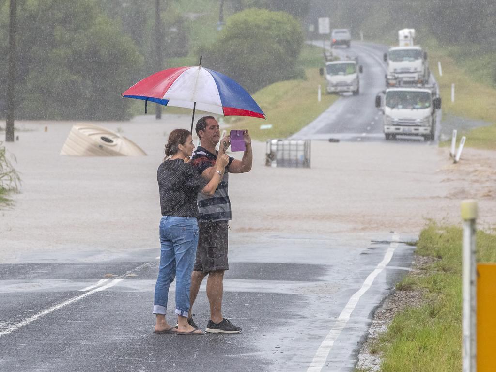
Authorities were forced to issue a stern warning to motorists to stay off the roads as hundreds of cars were stranded on the flooded Bruce Highway on both directions from Caboolture to Caloundra on Saturday afternoon.
The Department of Transport and Main Roads took to social media with a simple message: “We can’t be any clearer – now is *not* the time to be on the roads.”
The call came as the Sunshine Coast copped a drenching cutting off several sections of the Bruce Highway between Brisbane and Gympie with reports hundreds of motorists being trapped near Beerburrum.
The Department of Transport and Main Roads closed the Bruce Highway in both directions from Caboolture to Caloundra with water covering several sections of the main artery. Queensland Police said the major road closures would be in place for a “lengthy period”.
Vast parts of the Sunshine Coast were under water throughout Saturday as the weather bureau warned major flood levels for the Maroochy and Noosa rivers could soon exceed those experienced back in 1992.
The bureau said Tewantin may exceed 1.81m, Dunethin Rock the 1992 major flood level of 4.40m and Picnic Point at Maroochydore 1.91m.
A family of three were counting their blessings after being rescued from metre-high floodwaters in the Sunshine Coast on Saturday.
Nicolette Stewart, Rachel Thompson and their son Noah, climbed into a QFES rescue boat and said goodbye to their underwater Glasshouse Mountains home.
Emergency crews responded to several other rescues including two people stuck on a roof at Yandina.
Meanwhile, Moreton Bay Regional Council Mayor Peter Flannery has pleaded with residents to stay at home until life-threatening flood conditions pass.
It comes as the region prepares for another 150mm of rainfall and flash flooding in the area over the next 24 hours.
Mayor Flannery said “far to many” swift water rescues have already been conducted, with 130 people now housed in evacuation centres.
“This wet weather event is already one of the biggest we’ve seen in decades, so I’m urging everyone to please be patient and stay at home until conditions have passed,” Cr Flannery said.
“QFES has performed far too many swift water rescues across our region in the last 24 hours and required assistance from additional teams from the Brisbane region to maintain safety.
“Our local disaster co-ordination centre has responded to 134 registered incidents across the day, and we’ve had at least 300 properties suffer some level of impact from this weather event that we know of at this time. We’ve made significant efforts to move people from these areas into evacuation centres.”
Moreton Bay Regional Council has now set up several emergency evacuation centres in Woodford Memorial Hall, Dayboro Community Hall, Watson Park Convention Centre Dakabin, Bribie Island Recreation Hall and Beachmere Hub however the Caboolture centre has already reached capacity.

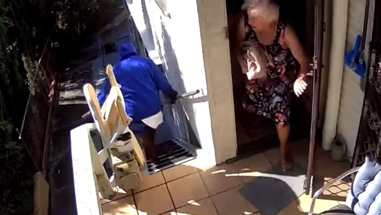
Brisbane’s crime crisis reaches new low as woman, 91, forced to defend home
A 91-year-old woman has been forced to chase away an intruder outside her home in Brisbane’s south after he broke in during broad daylight. WATCH THE VIDEO

From table hand to death row: I interview women serial killers
Sitting in a cold grey interview room on death row, across from some of the United States’ most prolific women serial killers, former Queensland criminologist Dr Kathryn Whiteley wants to know what leads them to crime.