
NSW weather warnings: State on high alert as warnings issued for coastal towns and cities
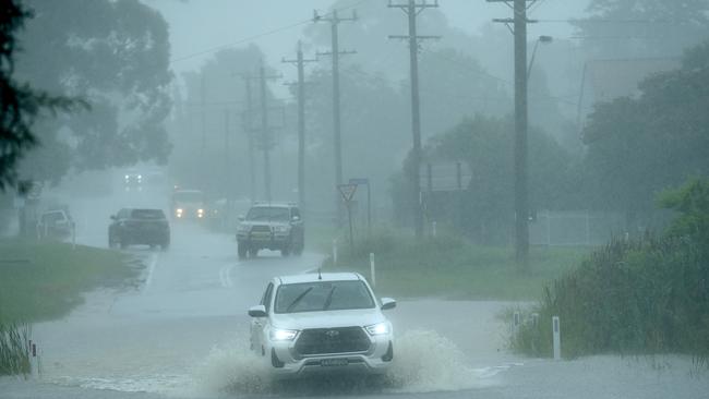
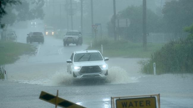
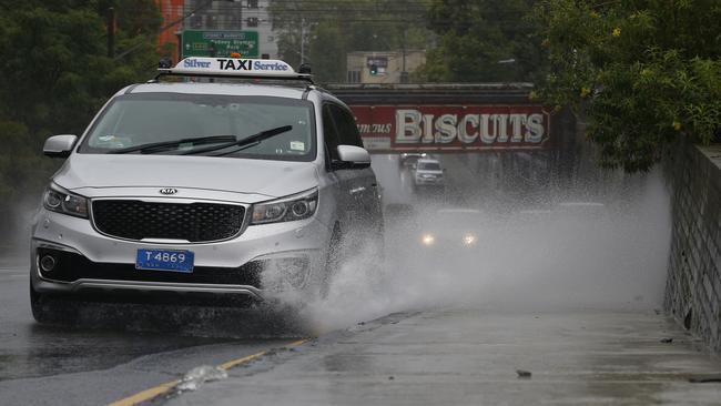
Large parts of NSW are being warned to prepare for torrential rain and flooding, as multiple Sydney suburbs are being told to immediately evacuate.
NSW
Don't miss out on the headlines from NSW. Followed categories will be added to My News.
An evacuation order has been made for residents and businesses in parts of a Hawkesbury town.
The State Emergency Service has directed residents of Ebenezer who live along Hendrens Rd and 114-136 and 113-161 Ebenezers Wharf Rd, as well as those on Coromandel Rd bordering the Hawkesbury River to evacuate by 11pm.
It follows alerts from the SES in which multiple riverside towns in Sydney’s southwest have been warned to evacuate before it is too late as flooding becomes an imminent, immediate threat.
Residents and businesses between Bligh Park and South Windsor along Berger Rd and Fairey Rd between the sewerage treatment plant and Penruddock St must leave by 11pm.
People are advised to evacuate along Berger Rd to South Windsor, then George St and Richmond Rd before following flood evacuation signs.
Once floodwaters reach 10m at Windsor, the area will be completely cut off.
Residents and business in parts of Camden, in Sydney’s southwest, have been ordered to evacuate immediately.
The areas impacted are Sheathers Lane, Kirkham Lane, Menangle Rd (near Racecourse Rd), Poplar Caravan Park, Cawdor Rd (between Barsden St and Murray St) and Peter Ave (between Onslow Ave and Belgenny Ave).
SES made the evacuation order as once floodwater reaches 8.5m at the Camden Weir, the area would be isolated and it may be too dangerous for rescues to be performed.
Parts of Chipping Norton and Lansvale have been directed by the SES to evacuate by 3am Thursday.
Those areas in Chipping Norton are: southern side of Newbridge Rd (between Davey Robinson Dr and Miperra Bridge), northern side of Newbridge Rd (between Rickard Rd and Riverside Rd), eastern side of Henry Lawson Dr (between Milperra Rd and Auld Av), Epsom Rd (between Westbury St and Governor Macquarie Dr) and Riverside Rd (between Newbridge Rd and Alfred Rd).
In Lansvale, the areas are: Knight St (between Day St and Hollywood Dr), Lower Day St, Erna Av, Lucy Av, Mena Av, Willis St, Hollywood Drive (between Knight St and Willis St).
Beatty Parade, Georges Hall and The Warwick Farm Racecourse have also been directed to evacuate.
An evacuation centre has been established Cabra-Vale Diggers, 1 Bartley Street, Canley Vale.
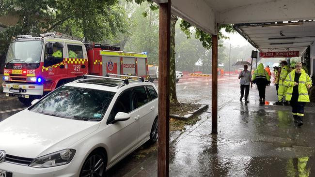
The NSW State Emergency Service has issued a flood evacuation warning for Picton CBD, while the Bureau of Meteorology has released a major flood warning for the Upper Nepean.
But the situation is now urgent for residents in low-lying areas around the Georges River, specifically Lansvale, Milperra and Chipping Norton.
Those suburbs are now subject to an evacuation warning and should prepare to leave if the situation changes imminently.
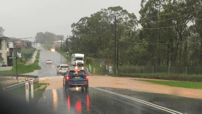
Floodwaters also continue to rise as the Nepean River is transformed into rapids at Penrith – threatening to inundate homes as rain continues to pelt down across Sydney’s west.
At 6pm the SES issued a raft of alerts for parts of Emu Plains, Cattai, Ebenezer, Sackville, Cumberland Reach, Agnes Banks, Pitt Town and parts of Penrith.
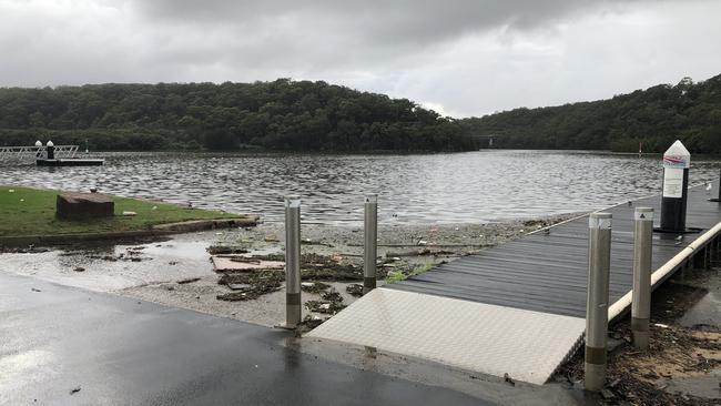
Earlier residents in Emu Plains and Regentville gathered on the swollen banks of the river on Wednesday afternoon as the river swallowed up the newly completed boat ramp, as well as low-lying pathways.
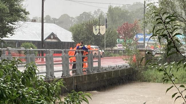
As a result of rising flood waters, residents within the Picton CBD are being asked to prepare to evacuate and a statement from the SES said once waters begin to rise in Stonequarry Creek, there will be flooding of roads and sewage and power lines may be lost.
“If you remain in the area, you may become trapped and it may be too dangerous for NSW SES to rescue you,” the statement said.
Picton CBD residents are asked to identify a safe place they can go, stay up to date with information, life belongings above the predicted flood height, place electrical items on top, take pets and essential items including clothes, medicine and important documents with them.
Both Picton and nearby Wilton in the Wollondilly region were devastated by major floods in June 2016 when severe storms saw Stonequarry Creek break its banks.
It is just one ominous sign of all that Sydney must expect as conditions worsen across the suburbs, the Illawarra, the south coast, Central Coast and Hunter in particular.
Communities on the Georges River remain on high alert.
“Please review your evacuation plan and be prepared to evacuate,” the NSW SES Liverpool unit said on Facebook.
“The flood gate at Arthur St and Riverside Dr is now open for residents of Rickard Rd to evacuate through.”
Bureau of Meteorology (BOM) senior forecaster Jonathon How said heavy rain had been moving away from the north eastern parts of the state with Sydney, Newcastle, Illawarra and the south coast now in the firing line.
Mr How said the build-up of heavy rainfall over the past weeks and months had made catchments “very, very sodden” and had increased the risk of landslides.
“As well as heavy rainfall, damaging, destructive winds are possible but it all depends on where this low does move,” Mr How said.
“We are really advising people to stay in touch with the warnings and forecast, because these east coast lows can provide quite a punch across these coastal areas,” he said.
Mr How said the bleak conditions could be expected to continue into the weekend.
The Warragamba Dam has now breached its banks, with the Woronora River, Georges River, Nepean River and Hawkesbury River among those being closely watched as heavy rains persist.
“A separate Severe Weather Warning for Damaging Surf and Abnormally High Tides is current for coastal areas south of Forster,” the BOM stated earlier on Tuesday.
“A Flood Watch and multiple Flood Warnings are current for parts of NSW.”
Locations which may be affected include Gosford, Sydney, Penrith, Parramatta, Wollongong, Nowra, Bowral, Campbelltown, Batemans Bay, Braidwood, Bega and Moruya Heads.
The State Emergency Service is warning residents in low lying areas around some of Sydney’s major waterways to start preparing for heavy flooding as rain starts to intensify across the city.
BREAKDOWN BY LGA:
Here is the total rainfall recorded so far by Local Government Area.
RIVERS TO SWELL
On Tuesday the BOM said the following rivers were expected to be impacted by potentially dangerous floodwaters:
• Upper Nepean River — Moderate to Major Flooding
• Georges and Woronora Rivers — Minor to major flooding
• Hawkesbury and Lower Nepean Rivers — Minor to moderate flooding
• Colo River — Minor tomoderate flooding
• Cooks River — Minor Flooding
• Upper Coxs River (local flooding)
• Macdonald River (local flooding)
• Northern Sydney (local flooding)
• Southern Sydney (local flooding)
• Parramatta River (local flooding)
Western Sydney:
The Penrith NSW State Emergency Service (SES) are urging residents along the Hawkesbury and Georges Rivers to review their evacuation kits and brainstorm evacuation routes.
The flood warning has been extended for people who live in the low lying areas of the Penrith local government area.
All properties within the area of the area of Emu Plains north of Emu Plains Train Station, boundedby the train line, Russell Street and the Nepean River should prepare to evacuate.
All properties along Tench Ave, Blaikie Rd and Jaminson Rd (from Tench Ave to Anakai Drive) should also be prepared to evacuate.
The region is bracing for a rain deluge and potential flooding with minor and moderate flood warnings issued for the Nepean, Hawkesbury and Colo rivers.
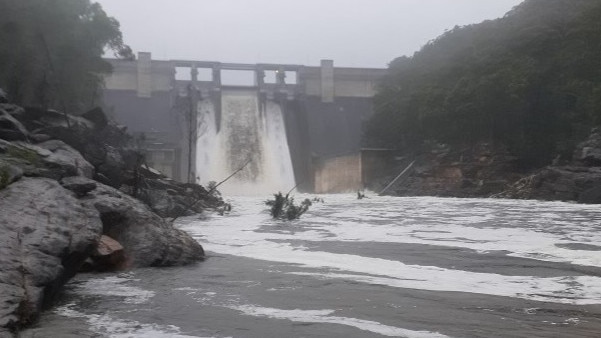
About 3am Warragamba Dam reached capacity and started spilling though its crest gates, which may continue for up to two weeks according to WaterNSW.
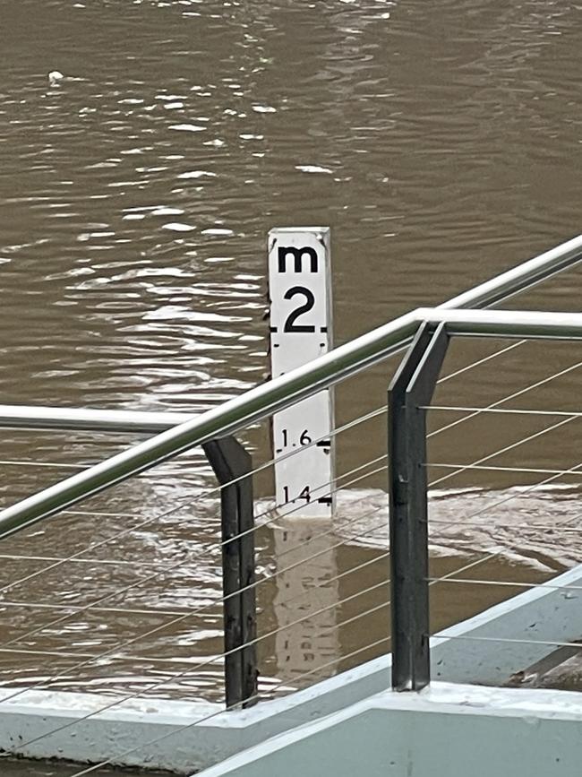
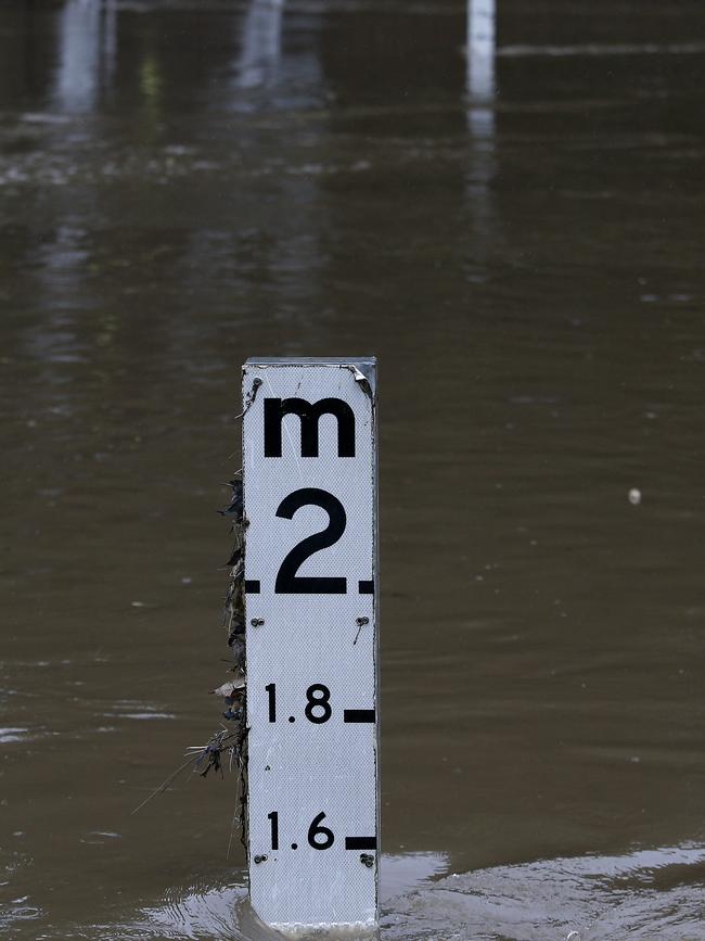
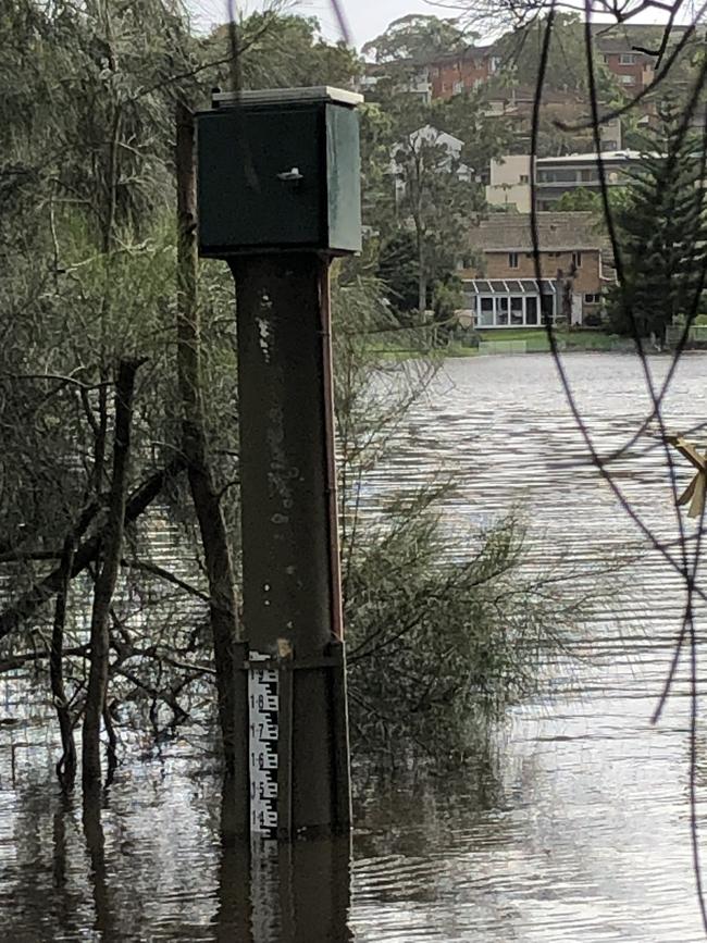
The Bureau of Meteorology (BOM) predicted the Hawkesbury River would reach a height of 7.9m at North Richmond this afternoon which would bring it 50cm below deck height, potentially leading to the closure of the bridge.
The river at Windsor is predicted to reach 7m by this evening which should allow the bridge to stay open, as long as roads to either side of it are not flooded.
Yarramundi River is currently steady at 4.32 metres, which is roughly 1m below bridge height, but given the low-lying nature of the bridge the Yarramundi Bridge may close later today.
According to BOM, minor flooding has already occurred along the Hawkesbury River at North Richmond.
In the Hawkesbury, a sixth flood warning has been issued by the Bureau of Meteorology for the Hawkesbury/Nepean River.
The volunteer Hawkesbury Flood Statistics Unit’s gauges show a minor flood level has been detected in North Richmond, with reports the rate of water rising continued to slow on Wednesday morning.
Water levels are expected to reach 7.9m in the at North Richmond by Wednesday afternoon.
Meanwhile, in Windsor, water levels will reportedly reach 7 metres, with the flood statistics unit confirming the flood levels would allow for the Windsor Bridge to remain open today.
Parts of North Richmond are being told to evacuate immediately with fears Redbank Dam will fail and cause flooding to properties below the dam.
Residents in parts of Pitt Town are being warned to prepare to evacuate, with the SES issuing an alert at 6pm that “all properties in the Pitt Town Bottoms suburb along Pitt Town Bottoms Rd” should evacuate in the next few hours”.
The SES also said people should prepare to evacuate in for parts of Cattai including Riverside Caravan park and non-residential farmland in Agnes Banks.
Parts of Ebenezer – all properties from 2 and 47 to 59 Port Erringhi Rd, the eastern end of Sirius Crescent and 22 to 32 Shallow Reach Place.
All properties in Cumberland Reach in the following streets should prepare to evacuate: 560 to 600 and 501 Laws Farm Rd and 450 to 480 Laws Farm Road
High danger areas named by NSW SES include:
• Southern Cross Drive
• Spitfire Way
• Grainger Place
• Bradley Road
• Tyne Crescent
• Campbell Street
• Yvonne Place
• Michael Street north west of Gregory Street
• Northern side of Gregory Street
• Stephen Street north west of Arnold Street
• Pecks Road between Mokari Street and Bradley Road
• Elizabeth Street north west of Campbell Street
• Trent Place
• William Street north west of Charles Street
“Recent rainfall over the Nepean and Hawkesbury River catchments and a deepening East Coast Low is bringing heavy rainfall from Wednesday and has the potential to cause minor to major flooding along the Nepean and Hawkesbury Rivers,” the spokeswoman said.
“Minor flooding is occurring along the Hawkesbury River at North Richmond.
“Moderate flooding is possible from Wednesday afternoon with further rises to the major flood level possible with forecast rainfall in the next 24 hours.
“Minor flooding is occurring along the Colo River at Putty Rd.”
Warragamba Dam started spilling at around 6am on Wednesday morning.
The spill, as well as heavy rainfall, is expected to cause havoc for residents in Yarramundi, with reports Yarramundi Bridge could be forced close as floodwaters continue to rise.
A SES spokesman said there was particular concern for Hawkesbury — with Richmond Bridge anticipated to close.
“For residents in the low-lying parts of Hawkesbury … we are urging them to prepare to evacuate and have a plan — know your routes in and out,” he said.
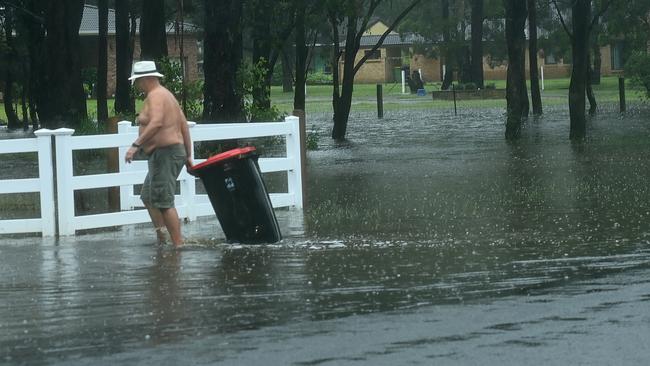
Londonderry resident Skye Dickinson said floodwaters threatening her family’s property had risen more than 30cm in the hour to 2pm.
I grew up here and I can’t remember a year where we haven’t faced some kind of flood,” she said. “ But floodwaters have never been this fast.”
Ms Dickinson likened the floods to the March 2021 disasters that saw hundreds of homes in the rural Western Sydney suburb inundated.

One resident in Torkington Rd, Londonderry blamed an increase in development and “fill” being dumped on rural properties for the increased threat of floodwaters on homes. “We are seeing water diverting into homes like never before,” she said.
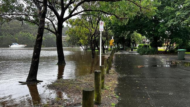
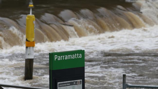
At Parramatta, wild weather lashed Parramatta River where the weir overflowed, rubbish travelled downstream and park benches became submerged as water steadily rose through the day.
At 11am, the water gauge near Parramatta Wharf had passed the 1.3m mark but had leapt towards 1.5m by 11.40am.
Parramatta SES deputy controller David Henry said the unit had responded to two jobs — a leaking rook at North Rocks and a fallen tree branch that fell on to a house at Carlingford — on Wednesday morning.
But it is bracing for severe weather and being extra vigilant around flood zones along the banks of the Parramatta River, A’Beckett St at Granville and Kay St at Rosehill.
“At this point in time we’ve been pretty lucky,’’ he said.
“We’re preparing teams for the worst that hopefully doesn’t eventuate today and into tomorrow but our plan is to have around-the-clock coverage for today and tomorrow.
“One big thing is the fact the roads are starting to get a lot of water and puddles so slow down on the roads.
“Maintain distance and speed from other vehicles.’’
A man in a wheelchair has been rescued in a dramatic operation in Riverstone after they became trapped in their house, while residents of Kerry Road, Schofields are evacuated.
Blacktown SES unit volunteers rescued the man, who was in the his Crown St home with two carers, on Wednesday morning.
Police, Fire and Rescue crews and Rural Fire Service volunteers descended on the property where they were forced to remove fence panels in the backyard to evacuate the man and his carers.
“The quick response, that’s what we’re here for and getting there and making sure the person is OK regardless of how serious or not it may be,’’ Blacktown SES media co-ordinator Aloka Holland said.
About 3.30pm, rescue teams were deployed to Kerry Rd, Schofields, to evacuate residents whose homes were flooded.
“At the moment we’re seeing multiple flooded roads in low-lying areas of Schofields and Riverstone’’ Miss Holland said.
“They’re always hot spots for flooding so we monitor that closely.’’
Road closures at Schofields include Carnarvon Rd, Grange Ave and Kerry Rd while Riverstone Rd (near Clarke St) and Clifton Rd have shut at Riverstone.
Other road closures are Stoney Creek Rd and Eighth Ave at Shanes Park, Palmerstone Rd at Rooty Hill, Vardys Rd at Kings Langley, Jasmine Rd at Quakers Hill, Bandon Ave at Vineyard, Durham Rd at Mt Druitt and Knox Rd Doonside.
Ms Holland said Blacktown SES had been inundated with calls for help.
That comprised five flood rescues including at Vardys Rd when four cars stuck in flood waters and police removed the motorists and passengers while crews were kept busy with torrential rain flooding Breakfast Rd, Marayong, where childcare centres had to be evacuated.
Residents of Kerry Rd, Schofields have also been evacuated as roads into Schofields are currently being closed.
Sydney’s southwest
Southwest Sydney residents are urged to be on alert as the region readies for a deluge of rain that could cause “life-threatening” flash flooding.
The Bureau of Meteorology issued a warning for an expected “six-hourly rainfall totals between 80 and 120mm”, which could also impact the Central and Southern Tablelands.
Locally intense rainfall leading to dangerous and “life-threatening” flash flooding is possible with thunderstorms with six-hourly rainfall totals up to 200mm possible.
The Georges River is expected to flood today, reaching two metres in the afternoon.
The most dangerous floodwaters are expected at Cambridge Ave, and Glenfield between Moorebank Ave and Canterbury Rd.
However, other low-lying areas may also be affected.
Rural towns in Sydney’s southwest are being urged to prepare for the worst as the Bureau of Meteorology (BOM) predicted heavy rainfall for the state’s south.
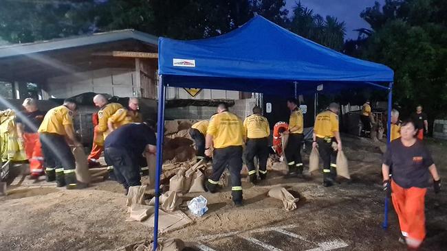
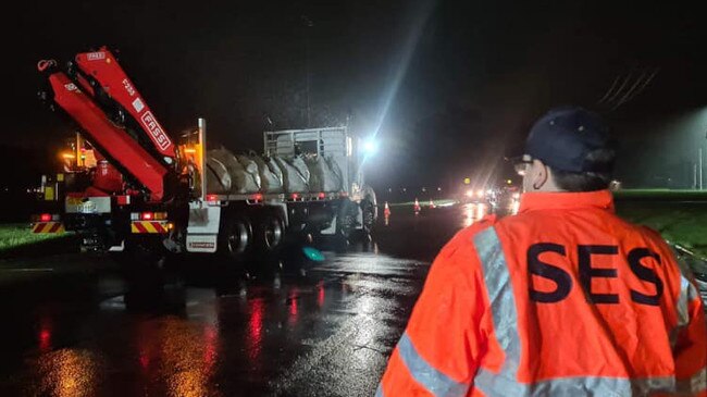
Fairfield City Council mayor Frank Carbone posted to Facebook that the NSW SES in Liverpool had been supplied with material for sandbags as part of the council’s emergency service response.
“If anyone needs sandbags it’s important you call SES, they are ready,” Mr Carbone said.
“What we don’t want is to give away sandbags to people that don’t need them when you have 65000 homes – it would mean those that need them in an emergency would miss out.”
Wollondilly Mayor Matt Gould used social media to advise constituents the flood watch rating had been upgraded from moderate to major. He reminded residents a flood warning would be issued if flooding becomes more likely.
The change comes after BOM issued a severe weather warning for large areas of south east NSW, including the Macarthur region.
Mayor Gould said the warning indicated “potential locally intense rainfall leading to dangerous and life-threatening flash flooding, with six-hourly rainfall totals up to 200mm possible.”
Damaging winds of up to 90km/hr are also expected and residents should take care to avoid the possibility of falling trees, according to Mayor Gould.
He said council had mobilised their crews, as well as contractors, to conduct emergency repairs but warned residents to drive sensibly.
Mayor Gould said residents living near rivers would be at the most risk, so they should keep an eye on the rainfall and watch for signs of flooding.
Water NSW is closely monitoring the dams in the Wollondilly area as Warragamba Dam is currently at 99 per cent capacity. A statement from the department warned the heavy rain forecast is likely to cause the dam to spill over in the next few days.
“The spill rate will ultimately be determined by the intensity of the rainfall and the inflow generated,” the statement said.
However, Water NSW noted the predicted spill peak is well below the level experienced during the 2021 floods.
As many locals will remember, Picton was evacuated in March last year after the flash flooding after the Warragamba Dam spilt over for the first time since 2016.
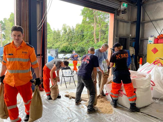
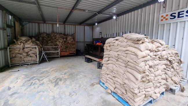
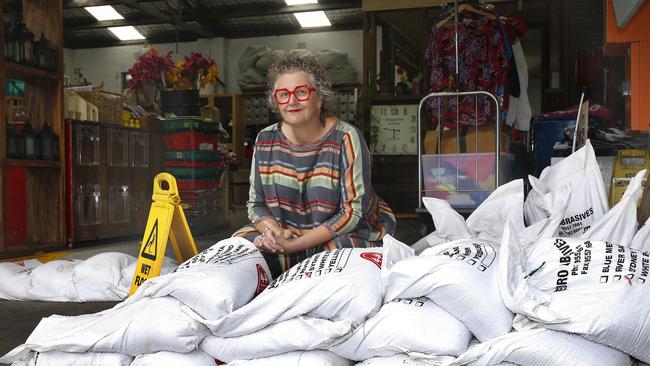
On Tuesday afternoon, the Wollondilly SES Unit in Picton announced they are providing pre-filled sandbags on a first come, first served basis to help locals prepare their properties for the onslaught of heavy rain.
Central Coast
Central Coast Council has warned that the BOM’s moderate flood warning for the region could blow out.
Council has stated that its engineers have identified the potential for the “moderate” 1.3m flood level to be exceeded overnight and into tomorrow when the east coast low is expected to hit.
At 11.15am today, Tuggerah Lake was recorded at 0.75m following a 1.97m high tide.
“Council crews and machinery were at The Entrance Channel again today to conduct further precautionary work establishing a pilot channel, which supports the channel widening and sand berm lowering undertaken by Council crews yesterday,” a council spokeswoman stated.
“The pilot channel may not necessarily present an immediate and obvious water flow, however is designed to assist water flow if flood conditions eventuate over the coming days as the east coast low approaches.”
An increasing east-north-east swell of 4.5m is forecast for the rest of the day, with dangerous surf conditions and strong gusty winds. Beach closures include Lakes, Soldiers, North Entrance, The Entrance, Shelly, Wamberal, Terrigal, North Avoca, Avoca, Copacabana, Macmasters, Killcare and Umina. The ferry at Wisemans Ferry has also been closed.

Northern beaches

On Sydney’s northern beaches, residents have been warned about potentially hazardous weather over the next three days.
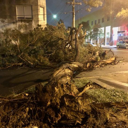
Damage caused by wind and heavy rain has been reported on the northern beaches — even before the worst of the devastating weather that is expected to hit on Wednesday night.
A car was crushed by a falling tree on Myoora Rd at Terrey Hills at about 11am, close to the Forest Coach Lines Depot.
No one was injured.
Between 9am and 12.30pm on Wednesday, close to 16mm had already been collected in the rain guage and winds were recorded gusting to 50km/h.
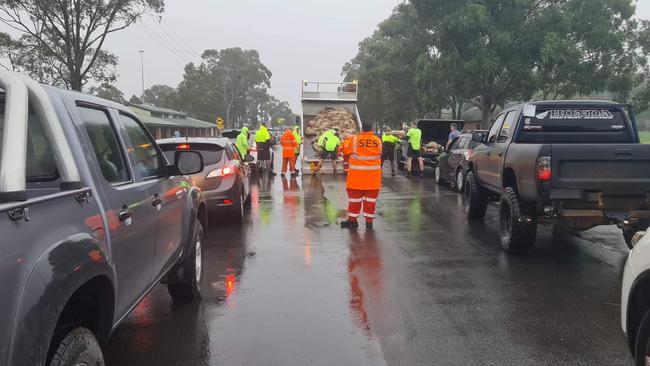
SES units on the northern beaches this morning dropped off free sand and sandbags at two locations – North Narrabeen and Curl Curl – so locals could protect their homes.

Mona Vale couple Pawel and Magda were at the car park next to North Narrabeen Surf Club on Wednesday morning filling bags to place at the top of the driveway of their new home in Golf Ave.
“We haven’t even moved in yet,’ Magda said. “We picked up the keys yesterday and move in on Saturday.
“This shovel is the first thing we’ve bought for the new place.”
Pawel said they were worried that stormwater drains near Mona Vale Golf Course might back up with all the rain and flood into their property, which is below the level of the road.
“We’re following the SES advice to be prepared, just in case.”.
Authorities are already releasing water from Manly Dam to increase flood storage ahead of local downpours of up to 50mm a day.
Northern Beaches Council already has crews clearing drainage networks on local roads to help prevent flooding. It is also closely monitoring weather conditions and has its special emergency Incident Management Team on standby.
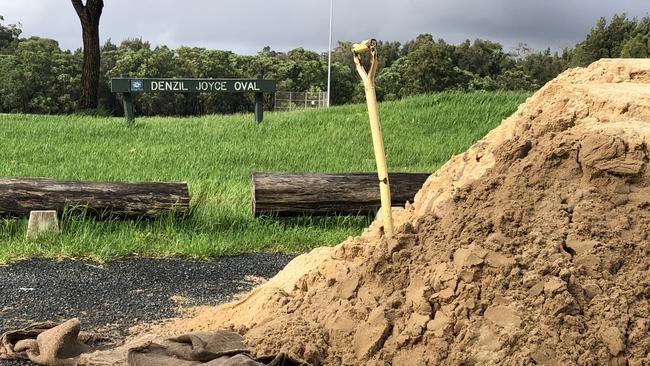
On Tuesday and Wednesday the Warringah/Pittwater SES unit placed tonnes of sand at two locations for locals to fill sandbags with in preparation for the East Coast Low — North Narrabeen Surf Club Carpark the Denzil Joyce Carpark at Curl Curl, just off Abbott Rd.
Sandbags were set to be dropped at the locations early on Tuesday this evening, but people can also fill shopping bags as an alternative.
A group of SES volunteers from the Manly unit filled up sand bags at its depot in Quirk Rd, Balgowlah.
Meanwhile Volleyball Australia has made an early call to can the 2022 Australian tour event at Manly Beach this weekend – just days after NSW surf life saving officials were also forced to cut youth events at the state titles short on the northern beaches due to the weather and a gastro outbreak.
Forecasted torrential rain and wild surf conditions and high tides were behind the decision.
“The safety of competitors continues to be our utmost priority, and the effect of the approaching weather pattern and surf conditions will make the beach dangerous and unplayable,’’ said Volleyball Australia CEO Andrew Dee.
“We would like to thank our community for their understanding, and our thoughts are with all those affected by the current flooding emergency in Queensland and New South Wales.”
The Southern Highlands
Heavy rainfall is wreaking havoc in the Southern Highlands and Tablelands, causing road and school closures, overflowing dams, and daily disruption.
The Southern Highlands and Tablelands are being lashed by heavy rainfall this week as a deepening low pressure system batters south eastern NSW.
Roads and schools have been closed throughout the region as emergency services warn residents to stay home and stay safe.
The NSW SES Wingecarribee Unit has been urging residents to prepare for potential flooding with helpful advice and a number of sandbag stations across the Wingecarribee Shire.
Sandbags in the Southern Tablelands are being provided at the NSW SES Goulburn headquarters at 4 Lanigan Ln. The headquarters have handed out more than 500 sandbags since Tuesday night as people prepare for the onslaught.
According to the SES team, approximately four sandbags are required per door to secure a residence.
NSW SES Goulburn Unit volunteer and duty officer Bonnie Wilson said the line for sandbags was so long on Tuesday night that it wrapped around the perimeter of the headquarters.
Ms Wilson was pleased with the community response to the recent SES warnings and said that “people seem to be preparing more than last time.” She noted the improvement since January, when locals impacted by natural disasters were asking for sandbags after they affected.
NSW SES Goulburn Unit Commander, Daryl Skinner, said the unit has only received two or three calls on Wednesday for the region.
However, he mentioned that most emergency calls occur after work hours, and that the team of 50 – 56 volunteers will be prepared if any incidents arise.
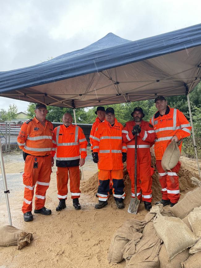
If you require sandbags to protect your property from being damaged in the storms, head to one of the self-fill stations being run by the local SES team:
Wingecarribee SES local headquarters at 16 Bessemer St, Mittagong
Moss Vale Saleyards at 205 Berrima Rd, Moss Vale
Robertson RFS at 1 Wallangunda St, Robertson
Locals will remember a number of Wingecarribee roads became impassable during last year’s downpour, which led to long delays for many and temporary isolation for some.
To help locals navigate that tricky issue, the SES Wingecarribee Unit has disclosed some of the worst offending roads to avoid if the rivers rise.
Local roads to avoid during flooding include:
• The intersection of Bessemer St and Bowral Rd, Mittagong
• Opposite the pool on Mittagong Rd, Bowral
• Rose St, Bowral
• Argyle St near the railway bridge in Moss Vale
• Old South Rd at the intersection of Bowral St and Merrigang St
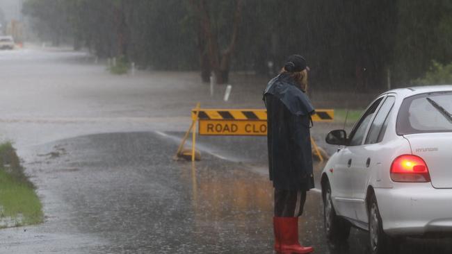
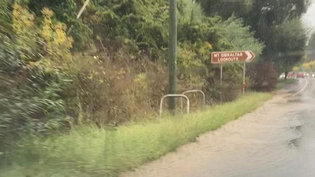
At the moment, Transport for NSW advises Macquarie Pass on the Illawarra Highway is closed due to flooding. Motorists are advised to take either Picton Rd or the Princes Highway as alternative routes.
Transport for NSW has also advised Moss Vale Rd near Cambewarra Lookout Road has been reduced to single lane traffic after a landslide occurred between two hairpin bends. Traffic lights have been set up to assist motorists navigate the difficult area.
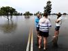
Motorists are reminded to never drive through floodwaters.
The Riverina
In the Riverina region, the BOM has issued severe thunderstorm warnings for Tuesday afternoon with heavy rainfall expected.
The warnings cover the towns of Condobolin, Deniliquin, Griffith, Narrandera, Jerilderie and Darlington Point.
People are advised to stay clear of creeks and storm drains, not travel through flood water and if trapped by flood water, seek refuge in the highest available place and ring triple-0.
The Mid North Coast
Port Macquarie is not subject to any flood risk at the moment but residents on the Macleay River remain alert for minor flooding as communities to the north battle with the ongoing flood fallout.
On Wednesday morning, Kempsey Shire Council said the Macleay River at Kempsey peaked at 4.92m at around 8pm on Tuesday with minor flooding, and at 3.43m around 9pm at Smithtown.
“Upstream of Kempsey, Bellbrook peaked below the minor flood level of 6.5m overnight Tuesday into Wednesday,” the council stated.
“Many river crossings remain closed and the council’s flood mitigation infrastructure is closed.”
The Big Hill floodgates are being inspected for opening on Wednesday.
Sydney’s inner west
The deluge anticipated today across the inner west has yet to materialise, but there’s more rain expected and Council and the SES unit in the area have been preparing hot spots and tending to damage trees.
A spokesman for the SES said that at the moment the inner west wasn’t experiencing the flooding that some other areas had.
“At this current moment in time, the inner west isn’t a main concern,” he said.
“There has been some flood rescue and some road closures around the Liverpool and Bankstown area, but in terms of the inner west at the moment, there’s nothing really happening outside of some road closures.
The spokesman did say that Burwood Rd was a concern for the local unit.
“We’ve got some concerns about that road, because of some recent works on the road,” he said.
While the inner west braces itself, the suspected flash foods have yet to materialise, to the relief of emergency workers and businesses.
But a blocked drain couldn’t stand the volume of water in Stanmore, bursting at the seams onto the intersection of Stanmore Rd and Liberty St. Queues of traffic formed while crews tried to clear the water from the busy inner west street.
And although the area has been one of the lesser hit spots today, the downpour hasn’t bypassed the inner west with Street Festival 2140 – a 12-day festival starting this Friday in Homebush – postponed by the Strathfield Council until March 11.
South Coast
The Illawarra and South Coast have so far escaped the wrath of record-breaking storms that have left large swathes of the state underwater, only a year after wild weather wrecked local homes and businesses.
Parts of the Illawarra have continued to cop heavy downpours with Albion Park being hit with more than 100mm of rain to 9am on Wednesday.
The wild weather has made for dangerous conditions on the roads with a number of routes closed on Wednesday.
A number of schools across the Illawarra have also been closed.
The Department of Education has advised Bulli High School, Woonona High School and Dapto High School are all shut due to adverse weather conditions. Catholic Schools NSW also confirmed St Mary’s Star of the Sea at Wollongong and St Anthony’s Catholic Primary School in Picton are both non-operational due to predicted flooding.
For Ulladulla, Batemans Bay and Moruya, that system brought with it warnings of possible severe storms and dumplings of more than 200mm of rain.
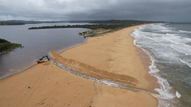
In preparation, the Eurobodalla and Shoalhaven City Councils have begun mechanically opening heads across the region, with others opening naturally.
For Ulladulla, Batemans Bay and Moruya, that system brought with it warnings of possible severe storms and dumplings of more than 200mm of rain.
A large number of roads have been closed due to dangerous conditions.
Sutherland Shire
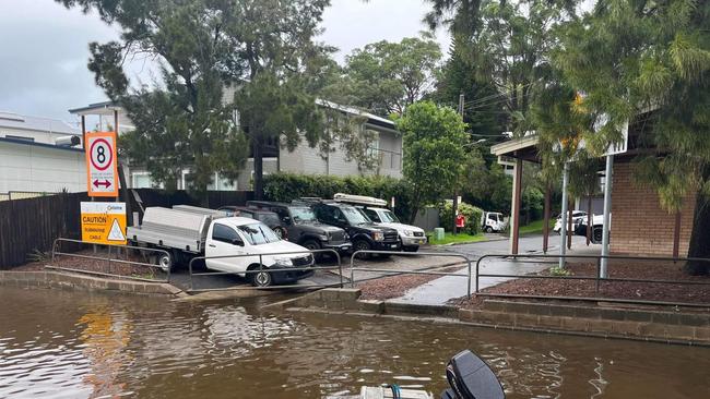
Emergency services have warned the Woronora Dam has started to overflow and that would contribute to an increased volume of water in the Woronora River system.
Woronora Bush Fire brigade said on social media that the scale of impact was not yet known and would depend on how much rain will fall.
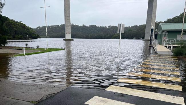
“A flood watch remains in place with potential for minor to major flooding, but no warnings have yet been issued,” a post read.
“We ask all residents to monitor conditions closely, particularly into this evening and overnight, with the next high tide expected to peak at 10:10pm.”
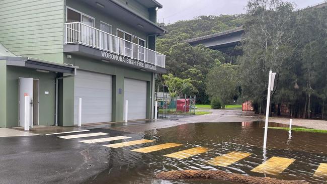
Meanwhile, 18 Rural Fire Service volunteers from Sutherland and Illawarra left for Coffs Harbour on a five-day deployment to assist in the flood clean up on the North Coast.
Crews from Illawong, Loftus, Bulli and Maianbar were driving north Wednesday afternoon, according to Woronora Bush Fire Brigade.
Eastern suburbs
The eastern suburbs is bracing for a deluge with intense rainfall expected today and tonight.
In the past week to 9am this morning (Wednesday March 2) the Bureau of Meteorology’s Sydney Airport station received 300mm, Randwick St at Randwick recorded 343.2mm, Rose Bay’s Royal Sydney Golf Club got 305.5mm, Centennial Park experienced 346mm and Dover Heights at Portland St has had 278.2mm.
In the 24 hours to 9am, falls were relatively light in the east with all official gauges measuring under 30mm.
A Waverley Council spokeswoman said a large eucalypt tree on the corner of Ebley and Lawson streets in Bondi Junction fell overnight causing homes to lose power.
The spokeswoman said Ausgrid was in the process of restoring power.
“Contractors are engaged for the removal and clean up,” the spokeswoman said.
The BOM’s forecast for Bondi today (Wednesday) is for heavy falls becoming heaviest in the evening and possible gusty winds.
Waverley Council’s Lifeguard Services Manager, Matt du Plessis, asked people to watch the warnings and always follow instructions from lifeguards.
“As a general precaution, swimming at ocean beaches should be avoided for up to one day after heavy rainfall or for as long as stormwater is present,” Mr du Plessis said.
“If you witness an in-water emergency, please inform our council lifeguards, or if it is after hours, dial triple-0 (000) and ask for the police.”
Councils were already responding to the dangerous conditions, with Coogee Beach and Maroubra Beach closed on Wednesday due to large and dangerous surf as well as wild weather.
Hills Shire and Hornsby
The Hills Shire is bracing for heavy rains and flash floods as a ‘rain bomb’ is predicted to hit Sydney.
With wet weather expected to hit Sydney hard today, suburbs are preparing for the worst.
Councils are urging people to take precautions, not drive through flooded streets and play it safe.
Due to the flood risk, Castle Hill Showground was opened to evacuated horses, livestock and domestic animals last night.
Those who are relocating their animals to the showground need to bring identification as well as adequate food and water. They must also remain onsite with their animals at all times.
In a Facebook post, Mayor Peter Gangemi encouraged residents in flood prone Hills suburbs to be prepared.
“I encourage residents, especially those located in our northern regions … to begin actioning their flood plans, including moving machinery to higher ground and relocating livestock,” Mayor Gangemi wrote.
The Hills Shire Council have closed a new set of roads in response to the rain bomb hitting this region.
These roads include: Wisemans Ferry Rd at Cattai Creek in Cattai, Cattai Ridge Rd at Cattai Creek in Maraylya, Terry Rd between Byerley St and Hedgewood Drive in Box Hill, Boundary Rd at Killarney Chain of Ponds in Box Hill, and Boundary Rd between Old Pitt Town Rd and Maguires Rd in Gables.
Bara Way Reserve, right near the Rouse Hill Town Centre, has also been hit hard by flash floods.
In response to today’s flooding, the Hills SES Unit has set up locations for flood-affected residents to pick up sandbags.
These locations are: 84 Watkins Rd, Baulkham Hills; 142A Old Pitt Town Road, Box Hill; 2654 Old Northern Road, Glenorie.
MORE TO COME
More Coverage
Originally published as NSW weather warnings: State on high alert as warnings issued for coastal towns and cities
Join the conversation

Man found with head injury after suspected road rage incident
A 55-year-old man was found injured on the side of the road in Sydney’s southwest. Police believe he may be the victim of a road rage incident.
Read more

AI chatbots flick switch to predator-companions
AI-companion chatbots are dangerously promoting harmful personas including sexualised underage characters that encourage pedophilia and other sickening behaviours.
Read more