Storm watch: Illawarra South Coast braces for record storms
Train services on the Illawarra and south coast were shuttered on Thursday, with a number of roads and schools remaining closed as wild weather continues to move across the state.
The South Coast News
Don't miss out on the headlines from The South Coast News. Followed categories will be added to My News.
The Illawarra and South Coast are bracing for record-breaking storms that have left large swathes of the state underwater, only a year after wild weather wrecked local homes and businesses.
A weather system currently travelling down the coast was forecast by BOM to reach parts of the Illawarra and South Coast regions on Tuesday night, before becoming more severe on Wednesday.
Illawarra
Parts of the Illawarra have continued to cop heavy downpours with Albion Park being hit with more than 100mm of rain to 9am on Wednesday.
The wild weather has made for dangerous conditions on the roads with a number of routes closed as of 6pm Wednesday.
Trains between Waterfall and Bomaderry have also been halted due to water over the tracks. Buses are operating between Waterfall and Thirroul, and Wollongong and Kiama.
The word is you’re not meant to drive through floodwaters.
— Dylan Arvela (@dylanarvela) March 2, 2022
BMW driver caught short on Calderwood Road, Albion Park. pic.twitter.com/OMvmiEQTRu
Road closures
As of 6pm March 2, some roads in the Illawarra remain closed.
- Macquarie Pass - Flooding between Tullimbar and Mount Murray on the Illawarra Hwy.
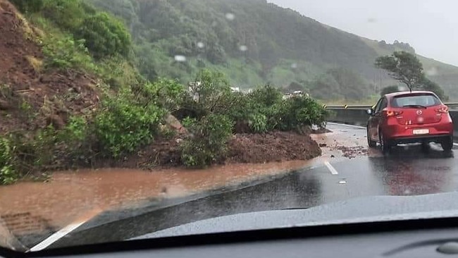
- Kiama bends - A landslide just after 9am caused the temporary closure both northbound lanes. One northbound lane has since reopened.
School closures
A number of schools across the Illawarra have been closed.
The Department of Education has advised Bulli High School, Woonona High School and Dapto High School are all shut due to adverse weather conditions.
Catholic Schools NSW also confirmed St Mary’s Star of the Sea at Wollongong and St Anthony’s Catholic Primary School in Picton are both non-operational due to predicted flooding.
Many other schools had notified family throughout the day to collect students Oak Flats High School, Tullimbar Public School and Warilla North Public School.
South Coast
Additional excavation at Shoalhaven Heads deemed unsafe: Council
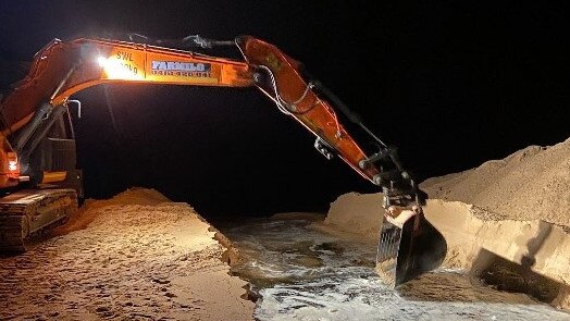
The Shoalhaven City Council has deemed it unsafe to artificially open the Shoalhaven Heads further after bulldozers were brought in yesterday to partially open the area to the sea amid community criticism.
In a statement on Thursday, the council said staff had visited the site of the entrance.
Fierce waves that triggered region-wide warnings from NSW SES were deemed too great a risk to staff and machinery needed to widen the opening.
That decision faced backlash from community members who had been calling on the council to open the heads for days.
Kathryn Hartigan said on Facebook: “Why wait to the last minute when we knew this weather was coming?”
“Should have been done days ago.”
In a statement on Wednesday, independent Kiama MP Gareth Ward urged the council to open the heads pre-emptively, despite local government regulation that sighted the water levels as being well below the 2m trigger.
“Shoalhaven Heads must be opened to the ocean to protect at-risk homes,” Mr Ward said.
“Life and property come first.”
Mr Ward said he had been in contact with the Minister for Emergency Services and their office, as well as Shoalhaven City Council CEO Stephen Dunshea, to secure approval for an early opening.
For some in the community, the difficult decision was met with praise.
Phil Guy said on Facebook: “I thank everyone who worked together to obtain special approval from the Minister of Planning, Industry and Environment to allow an early opening of the Heads.
“It is known that every flood or flood watch or warning is different and this time was a new scenario being rain for a long period and then a potential deluge from a east coast low.
“It is my opinion that this procedure of early preparation should be adopted as the normal and be included within an update of the Heads Entrance Management plan and the soon to be formed Coastal Management Plan.”
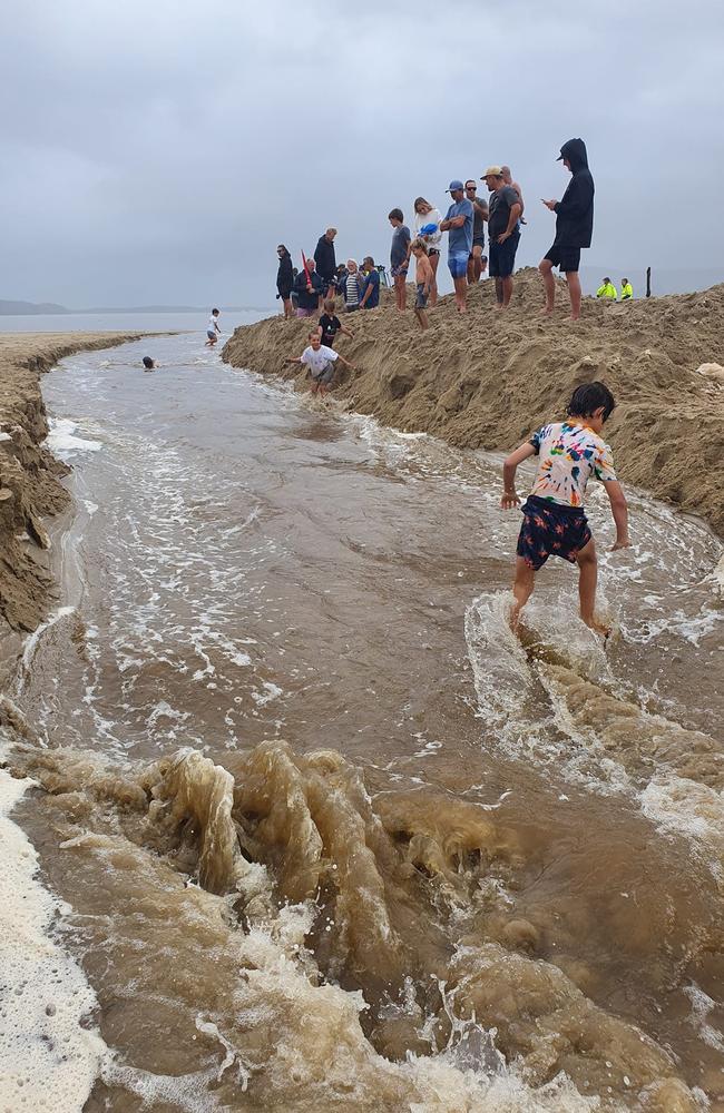
By 3pm on March 3, reports the heads had opened first appeared online.
Jess Zealand posted an image of the heads on Facebook, writing: “It’s open.”
Eurbodalla passes flood peak, roads remain closed
A number of roads in the Shoalhaven area remained closed late on Thursday, as the neighbouring Eurobodalla Shire Council announced it had passed the flood peak, with less rain expected in coming days – though some roads would remain closed.
In Shoalhaven, the roads still closed included:
- Moss Vale Road & Nowra Rd between Barfield Rd and Myra Vale Rd
- Cambewarra Lookout Rd and Carrington Road
- Tannery Rd
- Coolangatta Rd
- Browns Mountain Rd
- Bugong Rd
- Hockeys Lane
- Shoalhaven Heads Rd
- Bolong Road
- Back Forest Rd
- Scenic Drive, Paringa Park
- Wharf Rd, Nowra
- Terrara Rd
- Comerong Island Rd
- Greenwell Point Rd
- Adelaide St
- Albert Ave
- Greens Rd
- Jindy Andy Lane
- Millbank Rd
- Quinns Lane
- Yalwal Yalwal Rd
- Forest Rd
- Woollamia Rd
- Lighthouse Rd
In the Bega Valley area, the following roads are also closed:
- Benny Gowings Rd at Murrah River Bridge, Murrah is closed
- Wandella Rd at Wandella Creek Causeway is closed.
- Big Jack Mountain Rd between Mt Darragh Rd and national park rest area, Rocky Hall is closed (Big Jack Mountain has experienced a landslip and is closed in both directions until further assessment)
- Carp Stat Kisses Lagoon, Bega is closed (alternate routes in place)
- East St at the racecourse causeway, Bega is closed
- Angledale Rd at Jaunceys Bridge
- Murrays Flat Rd, Tarraganda
- Forest Ln at the causeway, Millingandi
- Millingandi Rd at the causeway, Millingandi
- Millingandi Shortcut Rd at the creek crossing, Millingandi
- Orchard Rd at the causeway, Rocky Hall
- Pericoe Rd at Towamba River Bridge, Towamba
- Tarlingtons Lane at Tantawangalo Creek causeway, Tantawangalo
- Tathra Bermagui Rd at the Wapengo causeway, Wapengo
- Big Jack Mountain Rd at Reedy Creek causeway, Burragate
- Church Ln at Tantawangalo River causeway, Tantawangalo
- Poplar Avenue at Carp Street and Kirkland Avenue, Bega
- Angledale Rd at Doctors Creek, Angledale
- Parrabel St at the intersection with Angledale Rd, Angledale
- Tathra Rd between East Street and Howard Ave
- Buckajo Rd between Grosses Creek Rd and Ridge Street (North Bega), Buckajo
- Jacksonia Grove at the causeway
- Yankees Gap Rd at Greens crossing Bemboka River, Bemboka is closed
- Bega Street at Bega Recreation Ground
- Towamba Rd at Jingo Creek and Stoney Creek causeways, Towamba to Burragate - water over road
- Nullica Shortcut Rd at the causeway, Nullica - water over road
In the Eurobodalla region, the roads that remain closed are:
Eurobodalla Rd, at the turf farm
Cheese Factory Bridge, Eurobodalla Rd
Tyrone Bridge, Eurobodalla Rd
Shore St, Moruya - closed from Thomas Street to River St
Dwyers Creek Rd, Moruya - at the causeway
Old Bolaro Rd, Nelligen – at the causeway
Silo Farm bridge, Bodalla
Sunnyside Rd, Mystery Bay - at the causeway
Kiora Bridge, Araluen Rd
River Rd, Nelligen - at the causeway
GALLERY: Heavy rains and rough surf batter the south coast
Severe weather conditions continued for a second day on Thursday, as residents across the south coast wait to find out if devastating flood events felt elsewhere in the state will be repeated.
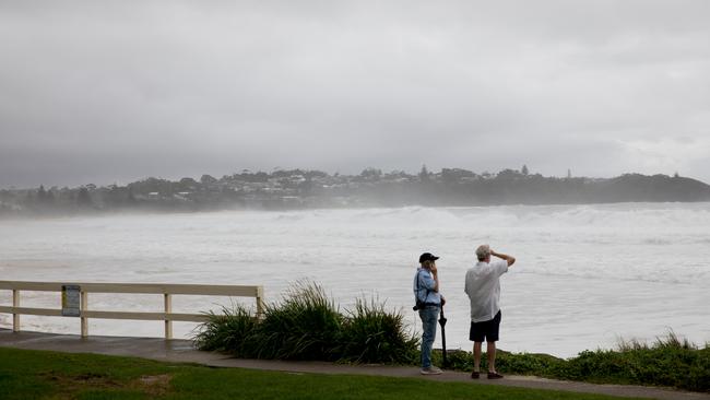
In the popular beach town of Mollymook, roads, paths, and beaches were mostly abandoned.
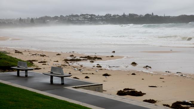
The usually popular restaurants and businesses nearby to Mollymook beach were either shut completely, or mostly empty.
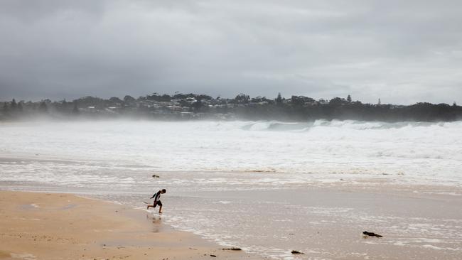
Still, the mid-tide waves that were regularly smashing against the grass hill at the very end of the beach weren’t enough to deter everyone.
Onlookers snapped photos and videos of the rough surf, while one family braved the dangerous beach.
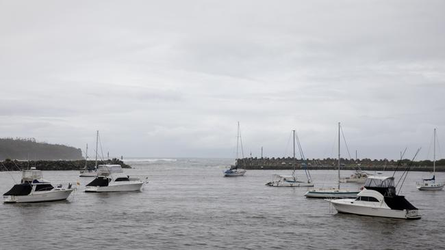
In nearby Ulladulla, the usually busy harbour was brimming with boats, dinghies, and trawlers.
NSW SES warned fisherman and businesses that marine conditions were severe on Thursday, and urged people to avoid the open water.
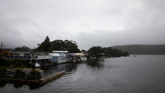
At Burrill Lake, lakeside homes and piers stared down rising water levels.
Pontoons with seats usually occupied by tourists were mostly underwater on Thursday.
At the popular campervan and tourist spot of Lake Tabourie, rising water levels had inundated local farms and businesses.
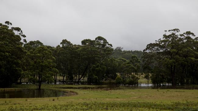
A childcare centre in the area was caught with waters lapping at its edge.
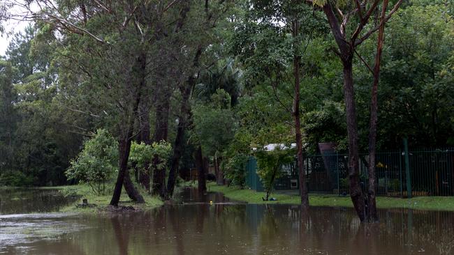
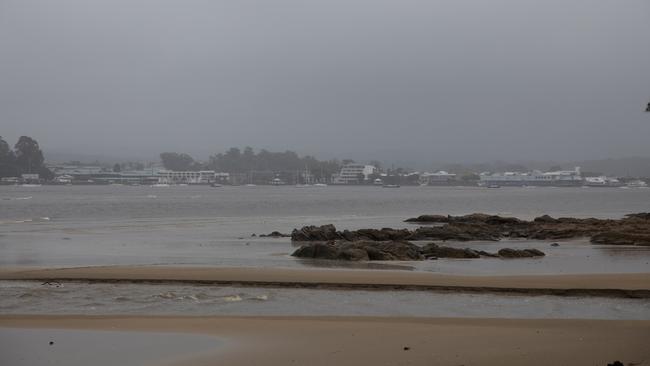
In Batemans Bay, wild weather partly concealed the popular bay-side town.
The new Batemans Bay bridge was being battered with strong winds and heavy rains on Thursday.
Trains shuttered, roads closed - but Moruya might be in the clear
The second day of record weather on the south coast has halted bus and train services across the region, and brought with it more road closures.
Train lines connecting Bomaderry, Kiama and Wollongong were shuttered on Thursday, due to heavy rain, according to NSW TrainLink South.
Services between Thirroul and Waterfull were also closed because of flooding on the tracks at various locations.
A shuttle train service is operating in both directions between Thirroul and Port Kembla only to make uop for the transport defecit.
A limited bus service will also replace trains between Waterfall and Thirroul, as well as Wollongong, Kiama, and Bomaderry.
In areas further south, flood warnings were being reduced on Thursday.
The Moruya river was listed as a major flood threat on Wednesday morning by BOM.
The Moruya CBD faced minor flooding as a result, but was likely to be downgraded on Thursday, according to the Eurobodalla Shire Council.
The council said their assessment of usual trouble spots, including Casey’s Beach, had not resulted in any further actions as predictions of extreme high tides loomed.
River levels will remain high over the next week, according to the council.
Currently, 11 roads are closed in the shire, seven of which were added since yesterday.
They are:
Cheese Factory Bridge, Eurobodalla Rd
Wamban Bridge 1, Wamban Rd, Moruya
Tyrone Bridge, Eurobodalla Rd
Shore St, Moruya - closed from Thomas Street to River St
Kings Highway – Minor slip on Clyde Mountain. Council staff onsite to clean up. Traffic control in place, motorists can expect minor delays.
Dwyers Creek Rd, Moruya - at the causeway
Old Bolaro Rd, Nelligen – at the causeway
Silo Farm bridge, Bodalla
Sunnyside Rd, Mystery Bay - at the causeway
Kiora Bridge, Araluen Rd
River Rd, Nelligen - at the causeway
NSW SES have warned of possible minor flood in Bega from late Thursday morning as warnings of heavy rains and dangerous surf persist throughout the south coast.
The agency said heavy rainfall had accumulated in the Bega catchment on Wednesday, and was only expected to rise as rain continued into Thursday.
According to BOM, the areas predicted to be impacted by flood waters are:
Roads and low lying areas in Angledale, North Bega and Bega Jellat Jellat, Kalaru, Rocky Hall, Tathra, Tarraganda, and Tanja
Bega Bowling Club
Princes Hwy
The Bega Valley Council has also advised the following roads in the shire have either been closed or are being effects currently by floodwaters.
East Stat the Racecourse causeway, Bega
Angledale Rd at Jaunceys Bridge, Angledale
Murrays Flat Rd, Tarraganda
Forest Lane at the causeway, Millingandi
Millingandi Rd at the causeway, Millingandi
Millingandi Shortcut Rd at creek crossing, Millingandi
Orchard Rd at the causeway, Rocky Hall
Pericoe Rd at Towamba River Bridge, Towamba
Big Jack Mountain Rd at Reedy Creek causeway, Burragate
Tarlintons Lane at Tantawangalo Creek causeway, Tantawangalo
Tathra Bermagui Rd at Wapengo Causeway, Wapengo
Church Lane at Tantawangalo River causeway, Tantawangalo
Poplar Ave at Carp St and Kirkland Ave, Bega
Angledale Rd at Doctors Creek, Angledale
Parrabel St at intersection with Angledale Road, Angledale
Tathra Rd between East St and Howard Avenue, Bega
Buckajo Rd between Grosses Creek Rd and Ridge Street (North Bega), Buckajo
Jacksonia Grove at the causeway, Bega
Yankees Gap Rd at Greens Crossing at Bemboka River, Bemboka
Towamba Rd at Jingo Creek and Stoney Creek causeways, Towamba to Burragate - Water over road
Nullica Shortcut Rd at the causeway, Nullica - Water over road

In the Shoalhaven area, images of Porters Creek Dam released by NSW SES on Wednesday evening show the amount of water still pouring into the region.
The dam, which is located near to Milton, was 79mm above normal height, according to the agency.
NSW SES also warned of minor flooding at Sussex Inlet resulting from abnormally high tides on Thursday.
The inlet was expected to reach a minor flood level of 0.90m at 10am on March 3.
BOM expects the following areas may be impacted by rising floodwaters:
- Fairview Crescent
- River Rd
- Ellmoos Ave
- Poole Ave
- Nielson Ave
- Wunda Lane
- Low lying areas along the Inlet
A similar warning was issued late on Wednesday for the Shoalhaven River at Nowra.
“Minor flooding is occurring along the Shoalhaven River at Nowra and Terara,” NSW SES Nowra Unit said in a statement.
“Heavy rainfall over the past 24 hours has caused river level rises across the Shoalhaven River catchment.
“The Tallowa Dam is spilling, with further heavy rainfall is forecast for tonight into Thursday, combined with abnormally high tides could cause renewed river level rises.”
The Shoalhaven River at Nowra peaked at 3.21m at around 2am Thursday, and is currently at 3.10 metres and falling, though renewed rises to the moderate flood level are possible on Thursday afternoon.
The Shoalhaven River at Terara peaked at 3.12m at around 3am Thursday and is currently at 2.95m and falling.
Renewed rises to the moderate flood level are also possible on Thursday afternoon.
Based on the prediction provided by BOM, it is expected the following areas will be impacted by dangerous floodwaters:
Shoalhaven Heads, Greenwell Point, Culburra- Orient Point
Bolong Road to Broughton Ck Bridge and Burrier Rd
Shoalhaven Ski Park and Coolendel Camping Reserve and Caravan Park
Elsewhere in the Shoalhaven area, the following roads remain closed:
Forest Rd, from Princes Highway to Callala Bay
Bolong Rd, Shoalhaven Heads
Kangaroo Valley Rd, Berry
Woodhill Mt Rd, Berry
Prince Alfred Rd, Berry
Coolangatta Rd, Berry
Hockeys Lane, North Nowra
Tannery Rd, North Nowra
Browns Mountain Rd, North Nowra
Bugong Rd, Moollattoo
Wharf Rd, Nowra
Terarra Rd, Nowra
Millbank Rd / South St / Comerong Island Rd intersection, Terara Terara Rd Millbank Rd, Nowra
Millbank Rd, Nowra
Lighthouse Rd, Callala Bay
Woollamia Rd, Tomerong
RESTRICTED: Lake Conjola Milham St
HAZARD: Cambewarra to Fitzroy Falls between Moss Vale Road & Nowra Road cross Barfield Road and Myra Vale Road - trees fallen, rock slides
Gerringong Creek rescue
A woman in her 50s was rescued by emergency services after getting caught in floodwaters in Gerringong Creek near Kangaroo Valley on Wednesday.
NSW Police with water rescue, NSW Ambulance and NSW State Emergency Service personnel attended the scene around 10am on Wednesday with a staging area established on Gerringong Creek Rd.
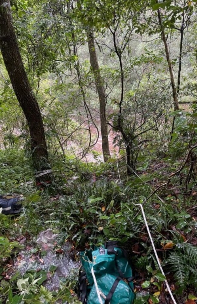
Special operations paramedics abseiled down a steep embankment to get the woman to safety.
NSW Ambulance Inspector Irwin Burbage says she was lucky to escape serious injury and grateful to be inside a warm ambulance.
“This is a timely reminder to all about the dangers of water, especially during this wild weather event,” he said.
“We urge the community to please avoid bodies of water as the rain continues across the state.”
Milton show postponed as storms continues, river watch downgraded
The majority of acts due to perform this weekend at the popular Milton Show have been postponed due to worsening weather conditions, according to a statement by the Milton Show Society.
“For the safety of our wonderful community and our livestock, we will reschedule,” the statement reads.
“A new date will be announced shortly… This was not an easy decision, but we are confident it is the right one.”
The move comes as wild weather continues to impact the south coast.
Traffic along Moss Vale Rd between Barfield and Kangaroo Valley Rd, connecting Cambewarra and the Kangaroo Valley, is currently being impacted by fallen trees and rockslides.
Parts of the Macquarie Pass along the Illawarra Highway are also currently affected by flood waters.
Further south in the Eurobodalla and Bega Valley Shire areas, roads remain mostly open, but businesses have been impacted.
In Ulladulla, the Native Cafe announced it would close just after midday today due to weather impacting the harborside business.
In the Eurobodalla, three roads remain closed, including the Silo Farm Bridge near Bodalla, the Sunnyside Rd at Mystery Bay, and the Kiora Bridge near Araluen Rd.
The Bureau of Meteorology has warned minor flooding is possible along the Deua River at Wamban, near Moruya.
The river is expected to reach a flood level of 4.4m early Wednesday evening.
The Moruya River is currently at 1.01m.
The Bega River has been downgraded to a minor flood warning.
Tourist town a ghost town
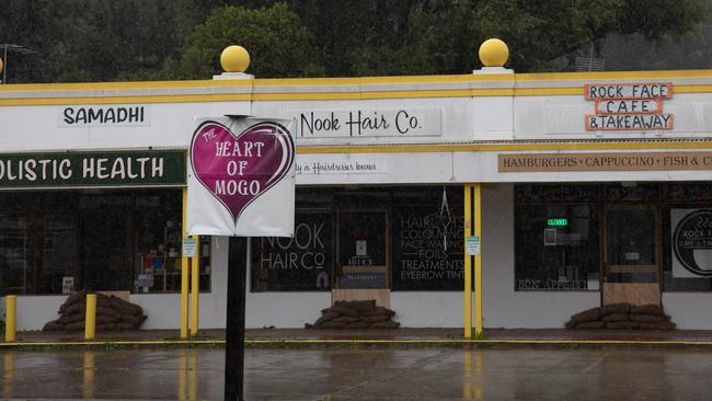
The popular tourist town of Mogo has been nearly completely abandoned by business owners today, as fears for a second flood event in as a few months loom large.
Only the service station was still open by mid-afternoon on March 2.
Local businesses were closed with sandbags placed in front of the doors, where usually tourists would be streaming in and out.
The few remaining workers still sandbagging their businesses told The South Coast News they were not interested in talking to the media, but did say they felt they had to prepare for the worst.
One local shopkeeper told The South Coast News they were caught unprepared by flood events in the past, and did not want a repeat of that event.
In December, Mogo homes and businesses were severely damaged by rapidly rising floodwaters.
That damage came less than two years after the town was devastated by the Black Summer fires.
Opening the heads
In preparation, the Eurobodalla and Shoalhaven City Councils have begun mechanically opening heads across the region, with others opening naturally.
The Eurobodalla Shire Council announced on Tuesday evening it had opened Coila Lake to the sea at Tuross Head after the lake had reached the 2m trigger point.
Little Lake near Surf Beach also opened naturally yesterday.
Shoalhaven residents have had their calls answered after the council moved to open heads throughout the popular seaside region on Wednesday.
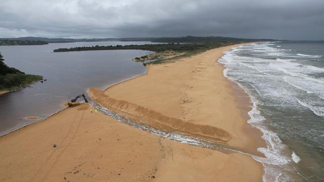
The Shoalhaven Heads is likely to be opened on Wednesday after community calls for the lake to be opened to the sea.
In a statement, the council said the heads could not be opened until they had reached the requisite height, but preparation was underway for the opening.
“Preparatory works are being undertaken now as hazardous surf conditions are forecast for the time the trigger level is predicted to be reached, making works unsafe,” the council said.
Tabourie Lake also required “pre-emptive” mechanical opening on Tuesday, according to the council.
A major flood warning has been issued for the Moruya, Deua, and Bega rivers.
Moderate to major flooding is also forecast for the Shoalhaven River and the St George Basin.
In Mogo, which faced devastation only a year ago from wild storm weather, sandbags were being made available by the council at the SES shed and Mogo Day Surgery.
Sandbags are also available in Narooma at the Council Depot.


