Storm forecast cancelled in Far North as temperature heats up in Cairns
A severe storm warning has been cancelled after it was issued for parts of the North Tropical Coast and Tablelands this afternoon. It comes after the “feels like” temperature in Cairns hit 33.7C by 11am.
Cairns
Don't miss out on the headlines from Cairns. Followed categories will be added to My News.
THE Bureau of Meteorology has cancelled severe thunderstorm warnings for the Peninsula, Gulf Country, North Tropical Coast and Tablelands after earlier warnings.
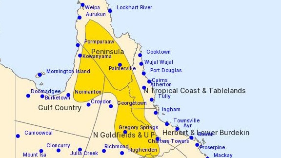
EARLIER: THE Bureau of Meteorology has expanded a severe thunderstorm warning for the Far North this afternoon.
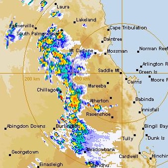
According to the BOM’s 4.14pm update, severe thunderstorms are likely to produce damaging winds and heavy rainfall that may lead to flash flooding over the next several hours in parts of the Peninsula, Gulf Country and North Tropical Coast and Tablelands.

Locations which may be affected include Pentland, Palmerville, Musgrave, Einasleigh, Chillagoe and Mount Garnet.
The Bureau’s initial warning earlier this afternoon only covered a small section of the region around Mt Garnet.
It comes as wild storms hit the southeast corner of the state, with 101mm of rain bucketing down in one hour at Brisbane Airport.
A weak tornado also occurred in the area, the BOM has confirmed.

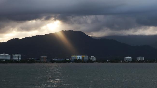
Friday is shaping up as a steamy day in the Far North as Queensland braces for another day of thunderstorms.
The “feels like” apparent temperature in Cairns hit 33.3C by 8.30am, though the official temperature was 29.2C.
At 11am the apparent temperature was 33.7C and the actual temperature 30.9C.
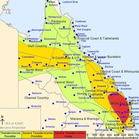
Widespread thunderstorms are possible across the state today, with central Queensland and north-west Queensland facing the prospect of severe weather.
Wild conditions are already impacting the southeast corner, where a severe storm has lashed Brisbane Airport.
There are reports of a tornado or water spout at the Port of Brisbane and more than 38mm of rain was dumped in 15 minutes.
“The airport precinct is currently experiencing severe storm activity. The impact is being assessed,” the airport advised in a statement.
“Flight delays are anticipated. Check with your airline for updates.”

In the Far North, the Bureau of Meteorology says the best chance of thunderstorms today is slightly inland and through parts of Cape York including Weipa.
“A trough extends from northwestern Queensland to the southeastern interior, and will linger for a few days,” the BOM said.
“Another trough moving into the far southwest will move slowly across the state over the weekend, approaching the southeast coast late in the weekend.”
The Far North has had several severe storm warnings over the past week, and hail fell at multiple locations including Malanda and El Arish.

Malanda State School principal Mark Allen said he saw a massive hailstorm on his way home from work last Friday.
“It was bigger than pea-size hail, you definitely noticed it hitting the car. The whole storm went for a half an hour, just before 5pm,” Mr Allen said.
“There was a lot of wind. It was one of those storms when rain just blows in every window.”
“I saw quite a lot of tree branches and debris blowing around the place. I was trying to get home so I parked under the tree until it subsided. Lots of people also pulled over the side of the road.”
He said the kids were also in the car and found it pretty exciting watching the hail.
“It was definitely the heaviest rain we’ve seen in a long time,” Mr Allen said.
“My windscreen and wiper blades were going as fast as it could and I still couldn’t see.”
Some Queensland towns resembled winter wonderlands on Wednesday after storms dumped large amounts of hail over them.
More Coverage
Originally published as Storm forecast cancelled in Far North as temperature heats up in Cairns


