
Severe heatwave issued for Cairns and parts of Far North
The ‘feels like’ gauge is expected to skyrocket across Cairns and the Far North in the coming days with a soaring heatwave predicted.
Cairns
Don't miss out on the headlines from Cairns. Followed categories will be added to My News.
UPDATE THE ‘feels like’ gauge is expected to skyrocket across Cairns and the Far North in the coming days with a soaring heatwave predicted.
Bursts of rain will give way to hot and humid conditions until the middle of next week with the mercury consistently hovering around 36 degrees, or about five degrees above average for March.
Cairns recorded a top of 36C on Wednesday which “felt like 41” and the Bureau of Meteorology has forecasted more of the same with only moderate rain.

“You are looking at maximum temperatures of 35C and 36C even along the coastal areas,” BOM senior forecaster Felim Hanniffy said.
“You are looking at very warm and very hot day time temperatures, but overnight will be very, very warm as well.
“It’s pretty unusual for this time of the year and it is pretty long lived as well.
“There will be very little reprieve.”
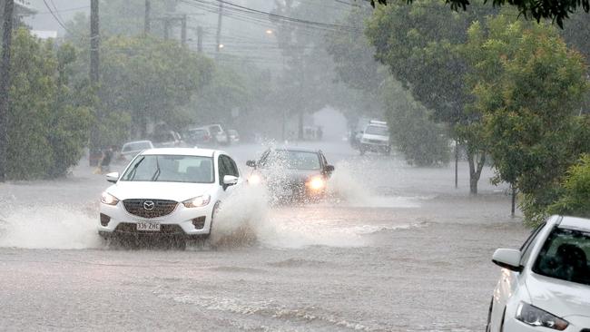
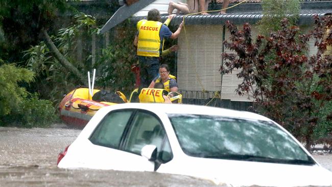
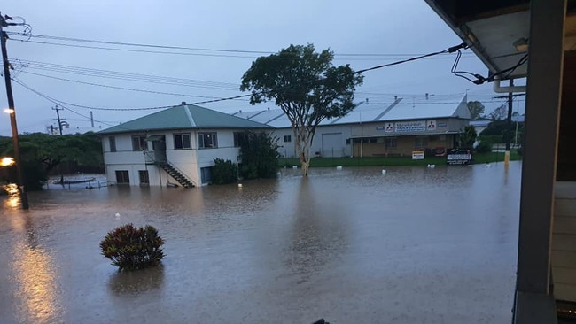
It comes as the south east of the state and northern New South Wales battle unprecedented rainfall and flooding.
Gordonvale resident Karina Nerot said she would gladly take some of their rain “in order to cool down.”

“This is our fourth year in Cairns after moving from Broome and this has been ridiculous, it is so hot,” she said.
“It’s not like I’m not used to humidity, but it has just been crazy.
“It feels like 46C.”
Mr Hanniffy said BOM was predicting tops of 36C, 35C, 35C, 36C, 36C, and 35C over the next six days with less than a millimetre of rain predicted on any given day.
“The monsoon activity is taking somewhat of a break and you still have got that stagnate air mass along the north tropical coast,” he said.
“There is nothing really to flush it out for the time being.
“There will be no real reprieve until may be Wednesday next week.”
TUESDAY: STORM activity hit Cairns on Tuesday at roughly 4pm today but is expected to die off within the next few hours as it makes its way north, according to the Bureau of Meteorology.
BOM meteorologist Shane Kennedy said the region can expect similar weather over the next few days as the Far North falls into a “rinse and repeat” cycle of warm mornings and hot afternoons with the occasional thunderstorm.
“These storms are more likely to hang around the Tablelands through the week, already 45mm has fallen just south of Gordonvale, but it’s very hit and miss for other suburbs,” he said.
“If you do end up under one of these random storms you could certainly see anywhere from 20 to 50mm of rain in a day.”
Mr Kennedy said the region cooled right down as the rain came through, dropping from 34C to 27C and similar patterns are expected through the week.
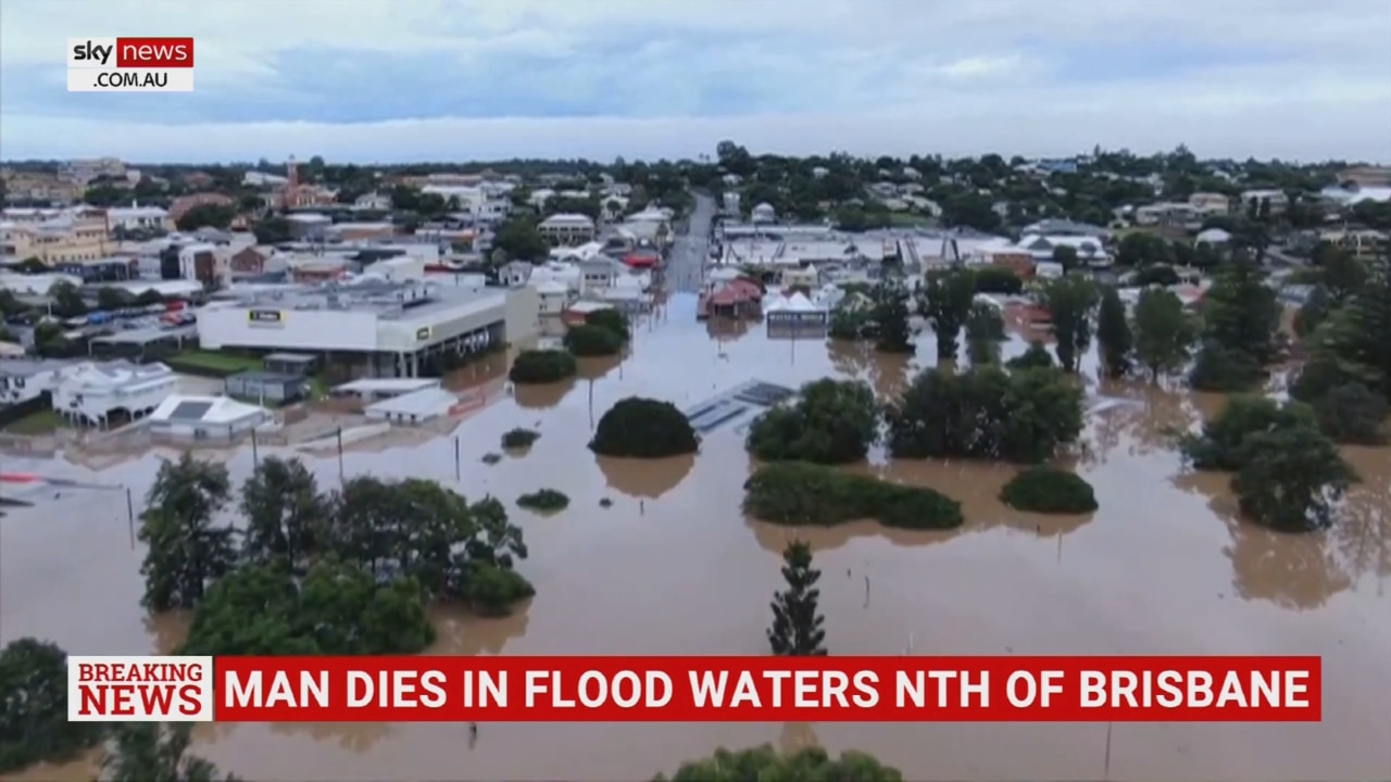
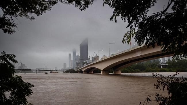
Brisbane is in a state of emergency with flood alerts issued for 140 suburbs, one man confirmed dead and 49,000 homes without power.
The horrific scene is reminiscent of the devastating 2011 floods which pummelled the southeast corner and seemed to herald the arrival of Cyclone Yasi within a matter of weeks.
That latter meteorological disaster is seared into the minds of all Far North Queenslanders – so a certain sense of trepidation is understandable as current events unfold down south.
Ominous faraway lightning and thunderstorms overnight will not have helped ease the tension.
But while cyclones are notoriously difficult to predict, there is some good news on the immediate horizon.
Bureau of Meteorology forecaster Helen Reid said Cairns and Far North Queensland looked like missing out on the powerful weather system currently wreaking havoc to the south.
“It’s not moving north,” she said.
“It’s actually moving south and Northern NSW is now bearing the brunt of it.
“As far as South East Queensland is concerned, there’s an easing trend in rainfall but major floods are going to be problematic for a few days.
“But Cairns should just get regular showers and storms.”
A tropical low was located over open waters in the eastern Coral Sea between Cairns and Vanuatu at 10am on Sunday, moving east-southeast at 15 km/h.
“The system is expected to move east and out of the region tonight and there is a very low risk of it being a tropical cyclone,” BOM said.
However, the bureau has previously warned the Cairns region had “all the ingredients” for a cyclone this La Nina season.
“La Nina does increase the likely number of cyclones and we have not had them impact the land area,” meteorologist Helen Kirkup said.
“Statistically you get slightly higher numbers of cyclones during La Nina years.
“February and March is the peak cyclone time for FNQ, but will a TC form soon and then cross the Cairns coast is not out of the question and you should be prepared.”
While the region looks like missing the downpours this time, it will likely still feel some pain – if only at the checkout.
Flooded highways and a train derailment at Gympie will mean key northern transport routes are cut and will likely remain so for some time.
Woolworths state general manager Danny Baldwin said those two factors had delayed deliveries into North Queensland stores.
“Deliveries continue to arrive at our stores daily and contingency planning ensures we have additional stock available, particularly essential items,” Mr Baldwin told the Townsville Bulletin.
“We are working closely with local authorities and continue to monitor the situation closely.”
More Coverage


Originally published as Severe heatwave issued for Cairns and parts of Far North
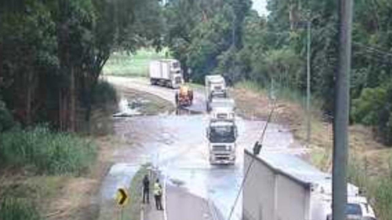
Trucks incoming as flood waters recede on Bruce Hwy
Hapless shoppers were once again greeted with empty shelves on Friday morning despite the Government’s “laser like focus”, but relief is on the way as waters over the Bruce recede.

Rider busted with gun and cash after prang and alleged attempted car rip-off
A man who broke his leg after crashing into a car while on the run from police with a backpack full of cash and a gun then attempted to steal the damaged vehicle before being arrested, police allege.