
Severe weather warning for Adelaide and South Australia Tuesday
More severe weather will hit Adelaide today, and the bureau is warning more rain events will lash the state.

SA News
Don't miss out on the headlines from SA News. Followed categories will be added to My News.
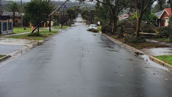
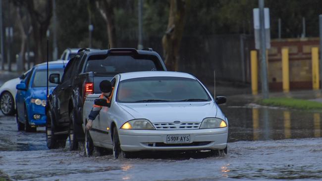
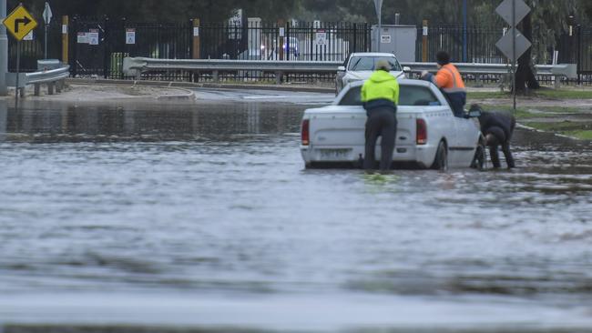
A severe weather warning remains in place for most of the state today as residents recover from a tornado that struck in Adelaide’s north and wild weather overnight.
Strong wind gusts of up to 90km/h are forecast in the Mt Lofty Ranges, Adelaide, Yorke Peninsula, Mid North, Murraylands and Upper South East areas on Tuesday.
In the early hours of the morning local wind gusts of 72km/h were recorded at Adelaide Airport and 59km/h at West Tce.
“There are still showers around today, it won’t be certainly not as wet as it was yesterday but there will be showers around from time to time today,” Bureau of Meteorology senior forecaster Tom Boeck said.
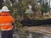
The State Emergency Service advised people should move vehicles from trees, secures loose items around properties and stay indoors away from windows.
A marine wind warning is in place for South Australia on Tuesday as well as a warning to sheep graziers in most of the state.
Severe Weather Warning for damaging winds has been updated. Keep up to date with latest warnings at https://t.co/j900D2pnDYpic.twitter.com/pYPrYpZ6Ui
— Bureau of Meteorology, South Australia (@BOM_SA) May 30, 2022
Conditions will remain cool in Adelaide on Tuesday, forecast to reach a maximum 14C, with up to 4mm of rain expected in the city.
Temperatures will stay below 16C for the rest of the week and showers will persistently increase by the weekend when another weather front reaches Adelaide.
Mr Boeck said there would be a “significant easing” of rain on Wednesday, but more heavy showers are expected on the weekend.
“We do have another front coming through on Friday and also another one on the weekend as well, that’ll keep showers going and there will be increasing showers and rainfall for Friday and the weekend in Adelaide,” Mr Boeck said.
He said the weather was not expected to be as severe over the weekend as it was on Monday.
“It’s not quite the same sort of system, we had an intense low pressure system which caused the weather yesterday but winter time fronts essentially is what we’re looking at on Friday and the weekend, so they can still produce moderate to heavy rainfall totals,” he said.
The high falls combined with recent falls from Queensland have flooded the Diamantina River, in the far North between Birdsville and the Goyder Lagoon.
The river, which flows from Queensland, has closed access to the Birdsville township and may cut roads and access tracks.
The tornado hit the northern suburbs in the early hours of Monday morning, bringing down powerlines, flooding roads and causing damage to homes.
The SES responded to more than 200 calls for help due to the weather damage at about 5am Monday.
Parts of the Yorke Peninsula were thrashed with rain on Monday, with 53mm recorded in Maitland since 9am Monday, and 49mm at Warooka in the same time frame.
Other areas which saw high falls included Mt Lofty and Nuriootpa, which both copped 18mm, and Victor Harbor recording 17mm.

Popular cafe set to close for good this weekend
The Grange cafe made the shock announcement on social media after 16 years in business.

Car thief didn’t mean to steal backseat baby too, court hears
A Salisbury North man’s lawyer says the Clearview incident has been a big wake up call.