
Fire cover up: Premier Daniel Andrews hides fuel load maps
Maps showing the risks Victorians face this summer from millions of tonnes of highly combustible forest fuels remain hidden by the Andrews Government.
PREMIER Daniel Andrews’ bid to keep Victorians in the dark on millions of tonnes of bushfire fuel laying at their doorsteps has been dealt a major blow.
Opposition MPs successfully gained the support of Parliament’s Upper House for a motion demanding the premier and his Government release crucial fuel loads maps by December 11, detailing how many tonnes of fine fuels had accumulated across the state since Black Saturday.
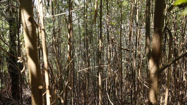
These fine fuels stand ready to explode into flame during a catastrophic bushfire, creating massive quantities of burning bark and embers that researchers have found can spot new fires up to 35km away.
The Opposition motion follows repeated refusals from the Department of Environment, Land, Water and Planning to release the fuel load maps to The Weekly Times.
In August last year Department of Environment, Land, Water and Planning staff stated: “The fuel load data is only published to Business Level Data (an internal system)”.
After repeated delays, emails and calls departmental officers came back almost 12 months later stating: “This information is not something that DELWP typically provides and the department has some concerns with this information being made publicly accessible”.
Ultimately The Weekly Times lodged a Freedom of Information request for five years of data for the whole state, but cut back the request to one map after DELWP demanded $1294.80 to process the request.
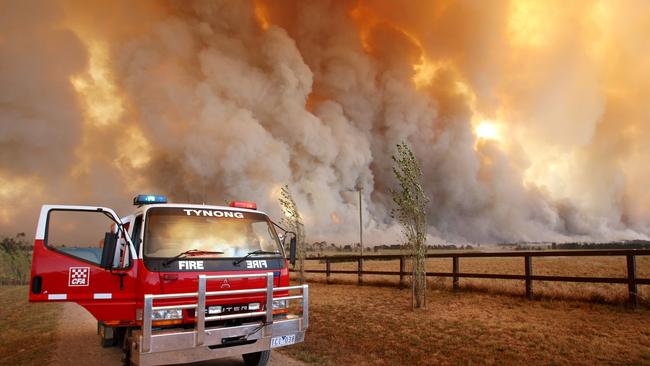
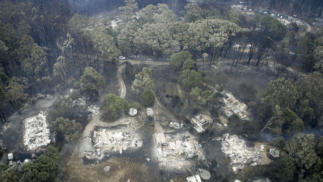
That one map of Victoria’s highest risk and most populous East Central fire zone, showed fine fuel loads had reached extreme levels, of at least 34 tonnes per hectare, in the rapidly drying eucalypt forests north of Kinglake and Healesville.
It was in this fire zone that on February 2009 the Kilmore East and Murrindindi fires merged to burn out 169,542ha, killing 119 people and destroying 1242 homes.
FUEL LOADS HIT NEW EXTREME ACROSS AUSTRALIA’S HIGHEST FIRE-RISK ZONE
When The Weekly Times asked DELWP and Emergency Services Minister Lisa Neville’s office to supply the full complement of maps for the state’s seven bushfire zones last week, DELWP spokeswoman Bethany Tyler said: “We act on the advice of fire experts who’ve advised the map shouldn’t be released at this time”.
Opposition Upper House leader David Davis said it was totally unacceptable that “Daniel Andrews and his Government sought to continue their cover up”.
“The community is entitled to see the facts,” Mr Davis said.
‘No one knew it was coming’: Tongala cow abattoir shuts
The livestock industry and local community have reacted to Greenham’s closure of its Tongala cow processing plant.

Victorians want to feel guilt-free about eating meat
Research – to guide a Victorian Government-funded pro-agriculture campaign – has revealed how consumers feel about the state’s farmers and what issues need to be addressed.